

ArcGIS StoryMaps
@ArcGISStoryMaps
Followers
30,933
Following
964
Media
3,703
Statuses
11,080
ArcGIS StoryMaps helps you tell remarkable stories with custom maps that inform and inspire. Join our growing storytelling community.
Joined June 2012
Don't wanna be here?
Send us removal request.
Explore trending content on Musk Viewer
México
• 655616 Tweets
Janones
• 187925 Tweets
Star Wars
• 81273 Tweets
Uruguay
• 45395 Tweets
Byron Donalds
• 39190 Tweets
FOT FOT 800K LOVE🩷
• 37634 Tweets
Copa América
• 34671 Tweets
#AEWDynamite
• 33138 Tweets
Omega
• 30487 Tweets
COY SOMOS TU FAMILIA FURIOSA
• 30153 Tweets
A'ja Wilson
• 21130 Tweets
悪魔の日
• 16840 Tweets
Vance
• 16172 Tweets
Darwin
• 15715 Tweets
Hannity
• 14987 Tweets
#6ล้านจนขึ้นใจ
• 13330 Tweets
Evidence Tampering
• 13312 Tweets
Court Orders
• 13099 Tweets
#DesafioXX
• 10767 Tweets
#あなたに贈りマスカット
• 10356 Tweets
Tala
• 10171 Tweets
Alejo
• 10153 Tweets


Calling all
#StoryMappers
! The 2019 contest is open - ENTER NOW to win $5,000 for your community!
Details here >>

29
413
1K
🎉 It's finally here 🎉
#StoryMapsBeta
has officially arrived and we're eager to hear what you think. Discover the new features that have us so excited, try it out yourself, and let us know how we can keep improving this next-generation storytelling tool:
6
86
190
On stage at
#EsriUC
,
@Jbellmaps
highlights new
#storymaps
features used to build Everest, a
#natgeoextremes
expedition story by
@insidenatgeo
Geographer
@taitmaps
.
See
@Esri
's storytelling platform bring science to life:
4
73
184
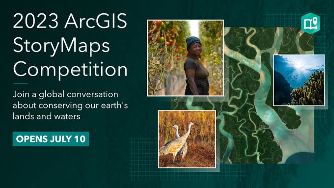
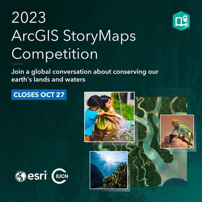
The 2023 ArcGIS
#StoryMaps
Competition is here, storytellers!
Build a story + save the planet. 🌍💚
#EarthWeek
@Esri
invites you to create stories about—
-
#conservation
-Sustainable agriculture
-Science & indigenous knowledge
-Parks
+more
Get started:
2
65
144
Do you follow the hashtag
#mappymeme
? Share sightings of
#mapsinthewild
on social?
Then this year’s ArcGIS
#StoryMaps
Competition may be the one for you.
#EsriUC
Get the details from
@John_M_Nelson
,
@Esri
map +
#dataviz
expert 🔊
3
31
115
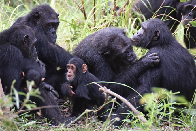
Meet the men and women who parachute into roadless and rugged terrain to protect US lands, resources and people from
#wildfire
.
The
@forestservice
Missoula
#smokejumpers
take us behind-the-scenes.
#NotYourOrdinaryJob
0
36
116
Happy
#GISDay
! Celebrate by testing your geo-knowledge with 5 map-based treasure hunts. Don't forget to claim your prize at the end!
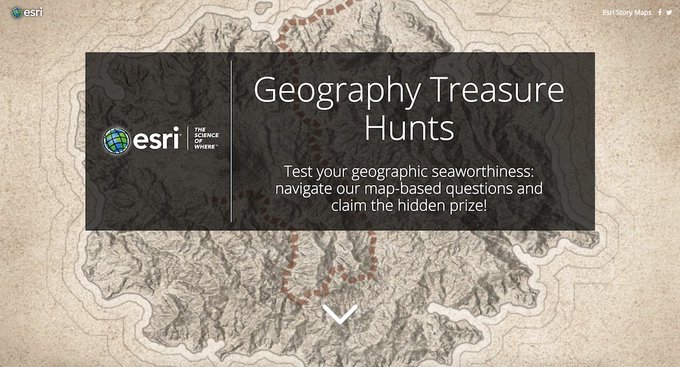
1
48
105
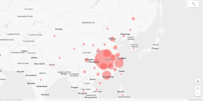
.
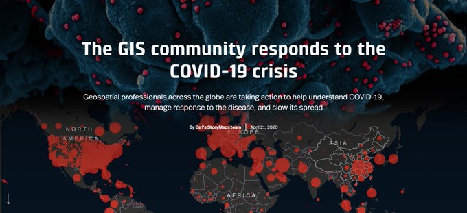
@Esri
's
#storymaps
team is tracking the Wuhan
#Coronavirus
with
#maps
& graphics—populated in real time, from multiple data sources—all housed in one story map.
Read the story as a visual snapshot of the outbreak. Come back for live updates globally.
1
65
92
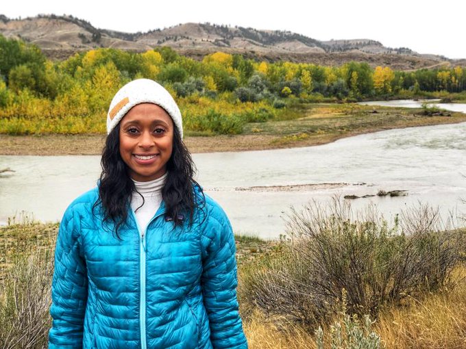
Meet
#EsriUC
plenary cohost
@RaeWynnGrant
,
@NatGeo
fellow & large carnivore ecologist.
Learn how she uses field-based data collection, statistical tools +
@Esri
mapping to study the return of grizzly bears in & around the
@AmericanPrairie
. Read the story:
2
20
95
Congratulations to all the winners of our 2018
#StoryMapsContest
! Your work really blew us away this year—judging was no easy task.
See the winners for all 5 categories here:
#EsriUC
1
36
96
Celebrate
#GISDay
with the 2022
@Esri
Storytellers of the Year!
Meet the winners & runners up of the 2022 ArcGIS
#StoryMaps
Challenge for
#dataviz
.
+Check out special award winners in best map choreography, visual language & storytelling with data 🏆
1
30
90
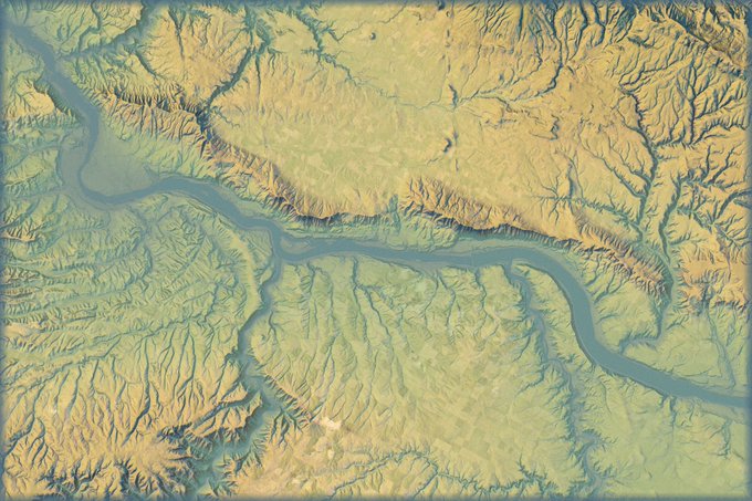
Landsat, the longest-running earth-observing satellite 🛰️ program in history, turned fifty this weekend!
#Landsat50
See how
@USGS
&
@NASA
Landsat images provide a visual record of Earth’s changing landscapes.
📷: Colorado River Basin from 1998 to 2022
1
37
87
We've been hard at work on something we think is going to be a game changer for
#storytelling
with
#maps
—and we're almost ready to let you take it for a test drive. Stay tuned...
#StoryMapsBeta

6
17
87
Today we launched a new
@ArcGISHub
site to recognize
#WorldOceansDay
+
@deepseadawn
's dive to Challenger Deep.
It combines multiple
@Esri
products to share a geospatial approach to ocean science. Dive in 🌊
🗺️ by
@InfiniteCoop
3
33
89
#EsriUC
shines a spotlight on the work accomplished by our storytelling community!
See how
@audubonsociety
combined
#StoryMaps
,
@ArcGISOnline
&
@esriSurvey123
to create
#Birdability
— an app that crowdsources
#accessibility
info for outdoor locations.
1
20
74
Custom separators. Fonts and colors. Animated illustrations.
Gustavo Cardenas, graphic designer for the
#StoryMaps
team, shares simple design choices that make a big difference to your audience.
Read the interview:
1
21
82
Congratulations to the 2023 ArcGIS
#StoryMaps
Competition finalists. 🏆
This year
@Esri
&
@IUCN
challenged storytellers globally to create stories about conserving our planet. 💚🌎🌊
Explore the stories that really stood out to us:
#GISDay2023
4
23
77
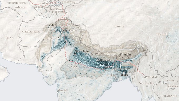
#India
, like no other country, "is shaped physically, culturally, and spiritually" by its river systems, says
@PaulSalopek
of
@outofedenwalk
.
See what he learned over the 17 months he spent traversing the country with his latest
#StoryMaps
piece:
1
27
74
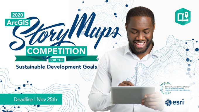
The 2020 ArcGIS
#StoryMaps
Competition for the
#SDGs
is now open!
Every day, leaders use
#GIS
+ storytelling to solve global challenges.
@Esri
and
@UNSDSN
invite you to contribute your skills + ideas for change. Learn how to get started on
#yourSDGstory
:
1
49
78
.
@Esri
+
@IUCN
Announcement! 📢
The 2023 ArcGIS
#StoryMaps
Competition is now OPEN.
Who? Storytellers globally
What? Build stories about conserving our planet
When? June 10 - Oct 27
Where?
Why? 💚🌎🌊
#EsriUC2023

2
31
72
New ArcGIS
#StoryMaps
features released today! You can now...
📍Add audio to your stories
📍Compare maps using the new swipe block
📍Change sidecar panel size
📍Drag & drop immersives
Plus check out mapping enhancements & more in
@OwenGeo
's blog post:
2
25
72
Happy
#EarthDay
from the
@EsriStoryMaps
team!
Once you drop & pin your favorite outdoor place in our
#earthday2019
map - - explore the Living in the Age of Humans
#storymap
series about the planet-wide impacts of human activities
0
31
70
ArcGIS StoryMaps has launched & we've got a new handle! Follow us
@ArcGISStoryMaps
.
This is an exciting chapter in the history of
@Esri
’s storytelling tools. We look forward to your continued support & feedback as you try the new
#StoryMaps
.
1
21
71
A year ago,
@Esri
launched ArcGIS
#StoryMaps
— our next-gen storytelling tool built with your feedback.
Thank you, storytellers, for the collaboration & your beautiful stories that inspire us every day. Take a look back at the past year with
@jbellmaps
.
2
12
68
🚨 12 Hot Numbers to Know 🚨
We've updated our popular Hot Numbers story with new
#climate
info from
@KHayhoe
—
@TTUClimate
director &
@UN
Champion of the Earth.
#climateaction
#SDGs
Learn about human impacts on our changing planet & action you can take:
4
38
70
🏆And the
#EsriUC
Map Gallery "Best in Show" goes to...
Southern Journey: The Migrations of the American South, 1790–2020 made with ArcGIS
#StoryMaps
! 👀
Congratulations to Justin Madron, Nathaniel Ayers & Ed Ayers at
@urichmond
for your stellar work.
1
20
62
From
#LotR
to
#WinnieThePooh
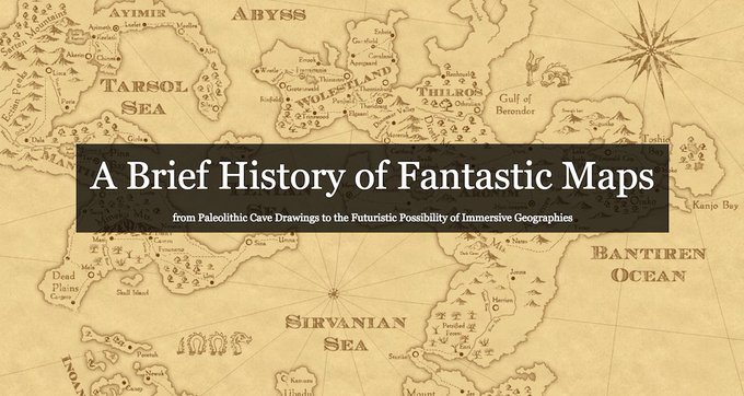
, settle in for a delightful introduction to the
#maps
of humanity's wildest imaginations:
#cartography

0
43
63
Want to add more
#dataviz
components to your
#StoryMaps
, but need inspiration? Check out this great resource:
1
47
65
Swipe right for a powerful storytelling tool!
Learn how & when to use the new Swipe media block in ArcGIS
#StoryMaps
— a great tool for simultaneously comparing two
#maps
side-by-side using an interactive slider.
1
16
62
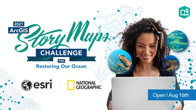
And the finalists are... 🥁
Meet the 18 finalists for the 2021 ArcGIS
#StoryMaps
Challenge for Restoring Our Ocean, hosted by
@Esri
and
@NatGeoEducation
.
+Cast a vote for your favorite finalist in our first-ever People's Choice Award! 📽️🍿🏆
1
26
63
Why are
#maps
so interesting? "We have no choice but to think and see spatially," explains
@AllenCarroll
. "Maps make sense of things."
Here's more on why these visualizations are so appealing to both sides of the human brain:
#dataviz
1
36
63
Animated maps can be a powerful tool for driving the narrative of your story and showcasing movement.
Learn how
@WarrenDz
created migration animations for the
@Esri
+
@audubonsociety
story of Diego the Swainson’s Hawk:
0
14
61
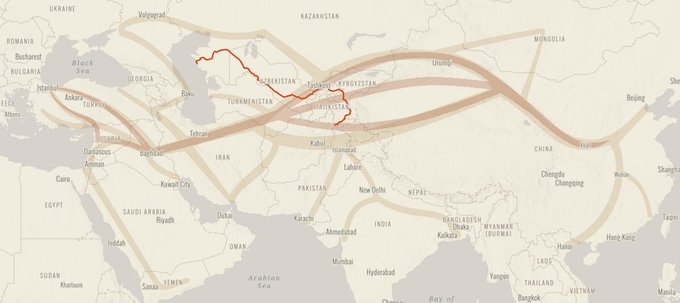
The Silk Road was a complex web of trading routes linking far-flung civilizations 2,000 years ago. During his
@outofedenwalk
, Nat Geo Fellow
@PaulSalopek
has retraced some of these ancient paths. "I often felt like a passing ghost," he writes:
#EdenWalk
0
26
60
It's
#WorldOceansDay
& we're celebrating with Hope Spots.
What are Hope Spots? Special places critical to
#ocean
health + championed by local conservationists. Explore Hope Spots around the globe in
@MissionBlue
's
#StoryMaps
collection:
2
26
59
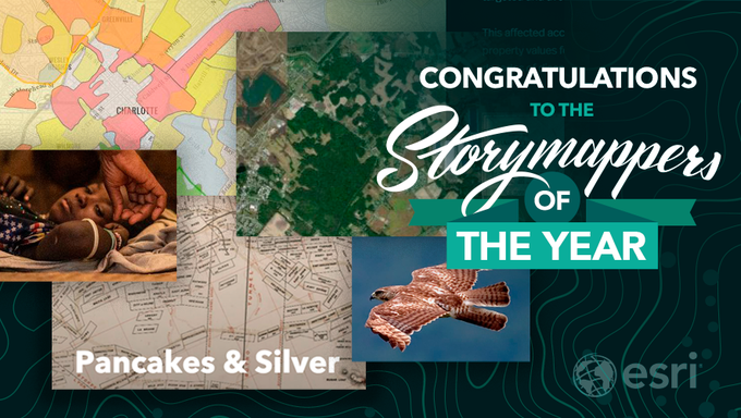
And the grand prize winner is...Pancakes and Silver by
@StanfordLibs
! Meet your 2019 ArcGIS
#StoryMapper
of the Year contest winner and finalists in the article by
@AllenCarroll
.
A heartfelt thanks to the entire community for your
#storymaps
submissions.
2
32
60
From
#LotR
to
#WinnieThePooh
, settle in for a delightful introduction to the
#maps
of humanity's wildest imaginations:
#cartography
2
28
58
🔥 Big news storytellers 🔥
The theme currently defines the colors, fonts, and block styles used in your story. Now create your own theme with the all-new ArcGIS
#StoryMaps
theme builder.
1/5
4
12
57
Ready to try the new
#StoryMapsBeta
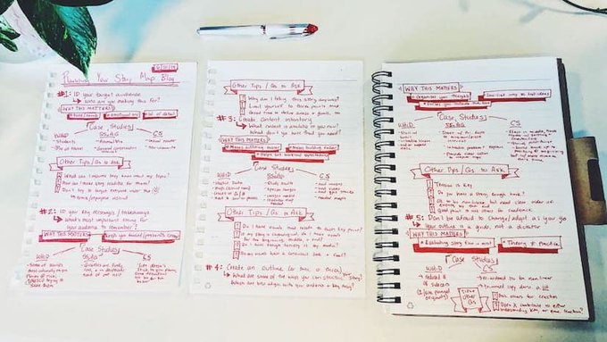
but aren't sure where to start? We've got you covered.
Read our new Planning and Outlining Your Story Map blog post and set yourself up for success.
1
15
55
We’re atwitter for
#BirdabilityWeek
! All week, join
@audubonsociety
& other birders for online events that celebrate accessibility in birding.
Find events, resources & contribute to the crowdsourced
#map
through the updated
#Birdability
app!
#storymaps
🐦
0
15
51
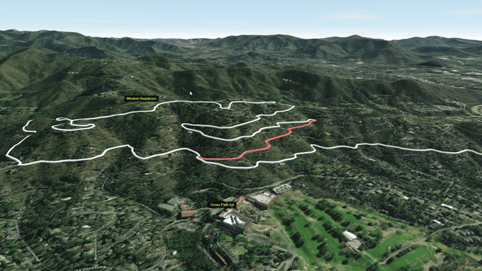
Do you live by your GPS watch? Use that data to create a 3D depiction of your favorite epic adventure. 🧗🏽🚵🥾
Follow these five simple steps from the
#StoryMaps
team:
0
17
56
How much of the
#ocean
do we need to protect? Which areas should we protect first?
#EsriUC
For answers,
@Enric_Sala
& scientists focused on biodiversity protection, food production + carbon storage.
Learn about these marine
#conservation
priorities:
0
26
55
Ready to join the rebellion against the limits of human knowledge?
Embark on a journey to galaxies far, far away with this interactive exploration of images captured by the James Webb Space Telescope.
#MayThe4thBeWithYou
🛰️📷:
@NASAWebb
3
14
53
How did they make that map?
This 360 VR Experience shows what sea level rise could look like in Norfolk, Virginia in 2100.
Get the story — and data — behind the
#map
from
@ODU
's George McLeod & the
#StoryMaps
team:
📹
@ODUGIS
@nearmap
0
10
56
It's known as “the last perfect place” in
#California
by conservationists; eight miles of unmarred coastline and a last-of-its-kind coastal wilderness. And now, thanks to two philanthropists, its future is safe:
#nature
#conservation
@nature_org
1
12
50
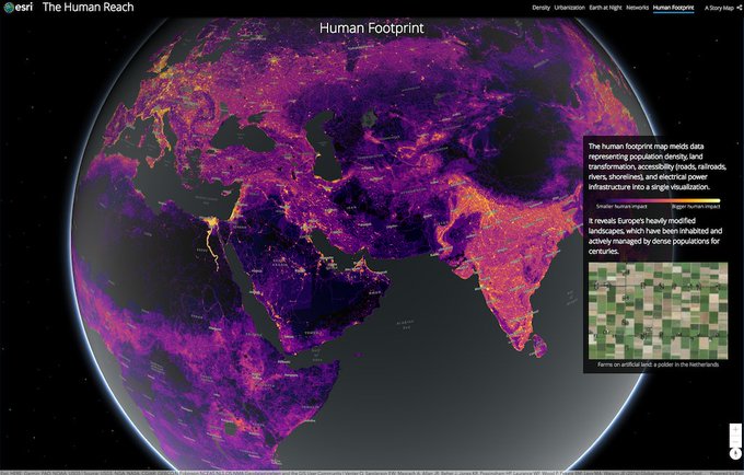
What does the collective impact of 7 billion people look like, mapped? (And how different might those maps look for 9.7 billion people?) Take a look at the extent of the human reach around the globe in our new series,
#AgeOfHumans
:
#dataviz
#datajournalism
0
30
51
Get inspired! Climb
#mountains
& protect natural habitats for
#wildlife
in our featured reads by
@JaneGoodallInst
@blueraster
@RossDonihue
&
@khemesphere
:
Then find new webinars & tutorials to enhance your
#storytelling
skills:
0
20
52
Learn about Alexander Von Humboldt in this Cascade story map
@andrea_wulf
keynote at
#EsriUC
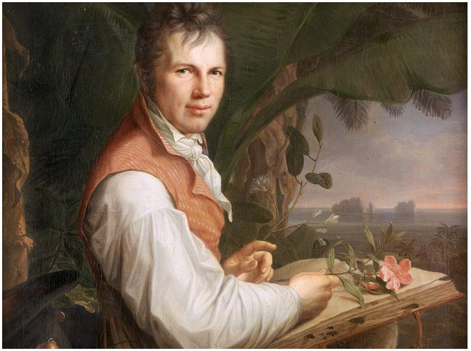
3
49
53
Make your photos shine in ArcGIS
#StoryMaps
! 📷✨
Check out the new guide by
@WilberIsBananas
and Mark Harrower. It includes simple rules + tips for file types, resolution, image sizes and more.
3
18
54
Exciting news for all story authors…UNDO IS HERE! 🎉
Try out this game changer & other new ArcGIS
#StoryMaps
features like—
-Map tour progress lines
-Photo editor tools
-Scale bar
+Use a web map as your theme basemap. Get the details:
3
12
51
ArcGIS
#StoryMaps
updates released last night! You can now...
📍Embed your story in a website
📍Add attribution to images & videos
📍Add a logo + more items to a collection
📍Create a story with a quick-start template
Get the details in
@OwenGeo
's post:
0
20
52
Take on the
#StoryMaps
Ocean Challenge! 🌊
Join
#GenGeo
storytellers globally for the 2021 ArcGIS StoryMaps Challenge for Restoring Our
#Ocean
.
Build a story + save the planet in the new challenge co-hosted by
@Esri
&
@NatGeoEducation
.
#WorldOceansDay
0
22
52
Save the date 📅
On April 22, celebrate
#EarthDay
with
@Esri
's StoryMaps team.
Get a sneak peek at the 2023 ArcGIS
#StoryMaps
competition & learn how your story can contribute to a sustainable world. 🌏
#conservation
📷: from Okavango Explore by
@BlueWaterGIS
1/2
2
17
53
Inspiring presentations by amazing women during the
#EsriUC
Women and GIS SIG! 👉
@womeningis
@geospatialwomen
@BlackGirlsMapp
@WiGISKe
@africwomeningis
Check out the Women and GIS story to learn more about the presenters and how you can get involved.

0
21
50
ArcGIS StoryMaps briefings (beta) is available in ArcGIS Online!
You can use ArcGIS
#StoryMaps
to create a story, a collection, and now—a horizontal presentation style called briefings.
Get the details + test out the initial capabilities:
1
10
49
Congrats
@John_M_Nelson
on your
@sgk_swisscarto
Prix Carto 2019 Award!🏆
John would not want you to view his winning Mountain Mapping
#storymap
() but might want you to steal his Imhof-Like topography style ()
1
9
47
Explore the ocean, dig into
#history
, conserve
#wildlife
habitat + more with 50 stories by
@InsideNatGeo
Explorers—including
@SylviaEarle
@JaneGoodallInst
@PaulSalopek
@taitmaps
&
@RaeWynnGrant
.
View the
#StoryMaps
collection:
📷:
@JimRichardsonNG

0
18
47
ArcGIS
#StoryMaps
turns 4 y/o next week—just in time for
#EsriUC2023
. 🥳🎂
We're celebrating with a new digital magazine featuring you, our global storytelling community.
Explore
#StoryScape
. Read innovative stories, meet storytellers & learn together.
2
14
48
Happy
#GISDay
, storytellers!
Share your mappi-ness with our animated
@gisday
postcards available on the
#GISFilmFestival
hub:
See you at 1:00 pm (ET) HERE as
@Esri
&
@NatGeoEducation
reveal the finalists for the 2021 ArcGIS
#StoryMaps
Ocean Challenge. 🌊
0
11
48
How can GIS help address
#climatechange
?
#worldwaterday
Learn how leading organizations like
@natureserve
@NOAA
+
@USDA
use
#GIS
in their work.
1
23
46
🚨 Release alert—it’s a BIG one! 🚨
-Choose theme fonts from Google Fonts
-Select link styles in theme builder
-Create a map tour from ArcGIS data
-Build an image gallery 😍
+Much more
Get the details in
@OwenGeo
's latest
#StoryMaps
post:
4
18
47
#GIS
professionals around the globe help organizations track and communicate
#COVID19
cases, identify our most vulnerable populations, and make sound policy decisions based on local capacity.
Explore this
#storymaps
snapshot of their impactful work:
2
29
47
News for storytellers who use the classic
@Esri
storytelling templates!
Your classic
#storymaps
will be around for a long time & we've updated the transition timeline to help put your mind even more at ease. Get the details:

2
10
47
Explore the ocean, dig into
#history
, conserve
#wildlife
habitat + more with 50 stories by
@InsideNatGeo
Explorers—including
@SylviaEarle
@JaneGoodallInst
@PaulSalopek
@taitmaps
&
@RaeWynnGrant
.
View the
#StoryMaps
collection:
📷:
@JimRichardsonNG
0
22
46
Over ½ of the world’s population will live in cities by 2050.
Learn how 4 cities are using a geographic approach and
@Esri
tools to address
#climate
challenges and create resilient, sustainable communities.
Explore the
#GrowingGreenCities
collection 🏙️
1
24
50
47 countries, 74 schools + 151 organizations were represented in the 2020 ArcGIS
#StoryMaps
Competition for the
#SDGs
.
After much deliberation,
@UNSDSN
and
@Esri
are excited to announce our winners + celebrate all of the entries we received. Congrats! ✨
0
18
49
Only one month left!
The 2023 ArcGIS
#StoryMaps
Competition closes on Oct 27th. Enter to become our Storyteller of the Year.
Add a little polish to your story with our Meet the Judges webinar recap for submission tips, resources + the webinar video.
3
22
48
Nearly a third of our planet is covered by trees. But that's just a fraction of the number found on Earth centuries ago. Learn more about how the world's
#forests
are changing, and see what we can do about it:
#AgeOfHumans
1
33
49
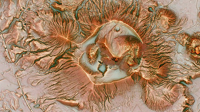
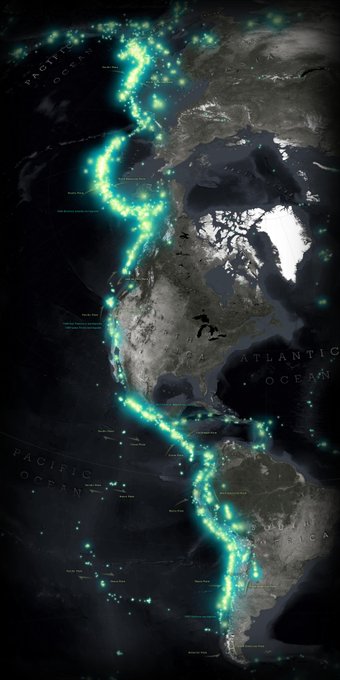
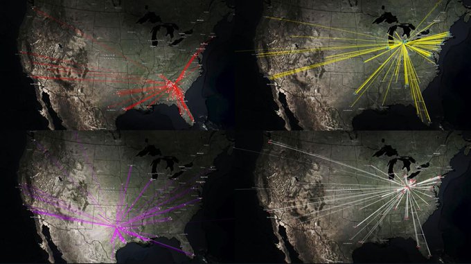
One earthquake, while locally impactful, is a blip in geologic time. But thousands of earthquakes over time illuminate planetary processes at work.
See the
#dataviz
in the Seismic Illumination story by
@John_M_Nelson
🌎
Data
@USGS
& 🛰️ imagery
@NASA
1
11
46
Today is the 50th anniversary of
#EarthDay
! Celebrate digitally with
@Esri
,
@EarthDayNetwork
& our partners.
For
#EarthDay2020
, download 10 nature-inspired videos,
#maps
& photos from our
#storymaps
as virtual backgrounds for your next meeting or meetup.
0
22
47
Thank you, storytellers, for inspiring us! You published 450,000+ stories in 2020 alone—some tackled critical causes & others offered refuge.
In the annual
#StoryMaps
wrap up, see our 10 Favorite Community Stories + 10 Favorite
@Esri
Stories of 2020!

0
17
46
We just added a lot of great new features to Story Maps, including:
• A new layout for Map Tour
• Story Actions in Map Series
• The ability to edit
#maps
from within your Cascade story
And more! Get the details here:
#tech
#digitalstorytelling
3
20
46
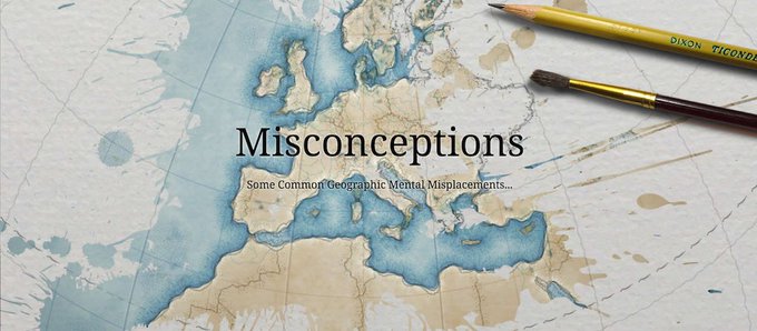
Is your mental world map as accurate as you think it is? Test yourself against these 4 common geographic misconceptions:
1
35
41
Turn story actions into eye-catching buttons with the new
#HTML
editor in our Map Series template. Here's all you need to make it happen:
#interactive
#maps
1
17
45
Want to learn how to design beautiful maps? Then this free, six-week
#MOOC
is for you. "Cartography." starts April 18, but registration is open until May 2. Details here 👉
2
24
45
Just in time for
#DarkSkyWeek
, there's a new ArcGIS
#StoryMaps
remake of the
@John_M_Nelson
classic—
🔵Lights on 🔴Lights off
See how satellite
#maps
can illuminate patterns in land use change & human activity.
#EarthWeek
💡
0
10
44
Are you our 2023 Storyteller of the Year?
Enter the 2023 ArcGIS
#StoryMaps
Competition to protect the planet. 🌎 Get tips for building a winning story:
📹 via Esri_Maps TikTok
0
16
45
Share your 💙 for the ocean! 🌊
Join
@Esri
,
@NatGeoEducation
& storytellers globally in a conversation about ocean
#conservation
!
#GenGeo
Simply share your favorite photos of the ocean & local waterways through the
#myoceanstory
crowdsourced map.
1
22
44
What does the collective impact of 7 billion people look like, mapped? Take a look at the extent of the human reach around the globe🌎
#science
#climate
#climatechange
#climateaction
#storymaps
@Esri
@UNEnvironment
@Esri_Nonprofit
@deepseadawn
@SDGoals
1
28
41
Ready for
#GeoWeek
? Get started with the
@Esri
+
@NatGeoEducation
#GISFilmFestival
.
Conduct black bear research, up close, with
@InsideNatGeo
Explorer
@RaeWynnGrant
. 🐻
And learn how
#ExploringWithGIS
helps Rae protect
#wildlife
& local communities.
0
12
44
Storytellers, thank you for another year of inspiring stories.
This year you explored the ocean, traveled to space + connected for a more just & sustainable planet.
Explore our favorite
@Esri
stories + ArcGIS
#StoryMaps
community stories from 2021.
0
16
45
The new media layer in Map Viewer opens up fun, innovative approaches for storytellers!
Use images as your maps in ArcGIS
#StoryMaps
with:
🚗Image tours
🔀Image choreography
🏃♀️Image actions
Check out examples + get tips and tricks for your own stories:
1
5
43
In the November
#StoryScape
—
Cartographic wizard
@John_M_Nelson
🧙🏼♂️🏈 takes a deep geographic dive into college football recruiting patterns.
And then shows us how it's done 📽️
1
8
45
New ArcGIS
#StoryMaps
features released today! These are the updates you've been asking for...
📍Story navigation
📍Sidecar floating panel layout
📍Duplicate stories
+Collection enhancements and much more. Get the details in
@OwenGeo
's new blog:
1
21
44
Lidar technology uses light pulses to collect 3D information. In the State of Washington, geologists are using it to study volcanoes, glaciers, rivers, and more.
@waDNR
explains with this beautiful story:
#StoryMapsWow
1
18
45
GIS Day is just two weeks away — November 15th.
And the theme this year is Celebrating the GIS Professional.
Celebrate
#GIS
and the people behind the maps with
@Esri
’s featured storytellers 🥳
#StoryScape
#GISDay2023
1
16
43
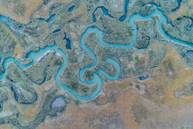
This
#WorldWaterDay
—
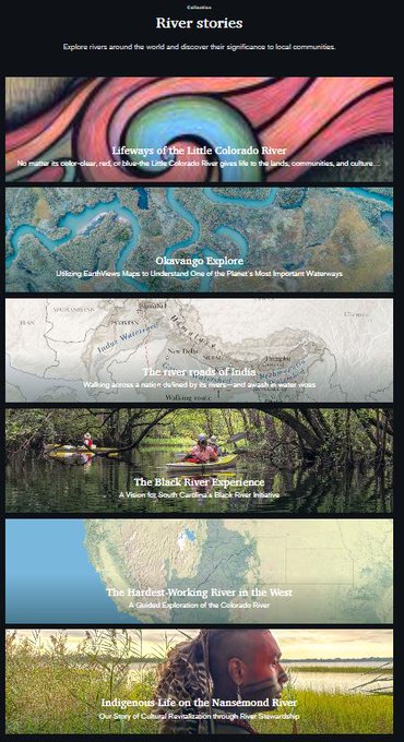
Explore rivers around the world and discover their significance to local communities. 💦
1
13
42
The 120th
@audubonsociety
Christmas Bird Count starts today! NEW—share photos of your
#AudubonCBC
experience with friends, family & other birders through the "CBC Live"
#storymap
.
Explore the
#map
👉 .

0
21
43
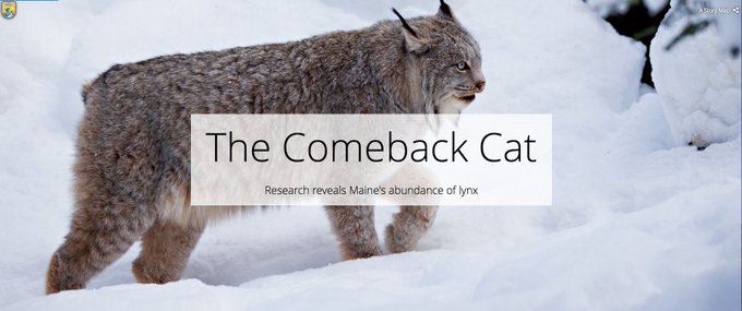
The lynx is well on its way to becoming America’s latest
#conservation
success.
This month,
@USFWS
found that the protection for these cats in the lower 48 states is strong enough that lynx may no longer need to be considered threatened:
0
14
45
Maps that move can be a powerful star of the story, but knowing when to deploy them is key.
Get the most out of animated maps with a few quick questions:
📷
@John_M_Nelson
0
5
44
If you compressed Earth’s history into 24 hours, humans would arrive with just a couple seconds left on the clock. In that short time, we’ve come to dominate the planet. See this dominance mapped (in
#3D
!), in our newest series,
#AgeOfHumans
:

2
20
43
Take a curated tour of the
#EsriUC
Virtual Map Gallery with three
@Esri
cartographers.
In this story,
@sarahbellmaps
@John_M_Nelson
& Heather Smith share a few of their favorites from the 2020 submissions with short video clips about each map.
#StoryMaps
0
13
43
Experiment with the first ArcGIS
#StoryMaps
updates of 2024! 🥳
Enjoy streamlined workflows for selecting text size, media, map tour layouts, and more.
⬇️ 1/3
1
10
44
Learn how to choreograph your
#maps
with ArcGIS
#storymaps
in the latest blog post by
@InfiniteCoop
:
#dataviz
#gis
0
18
44
Why are maps so interesting? Because, "we have no choice but to think and see spatially," explains
@AllenCarroll
. "Maps make sense of things." Here's more on why these visualizations are so appealing to both sides of the human brain:
1
21
44
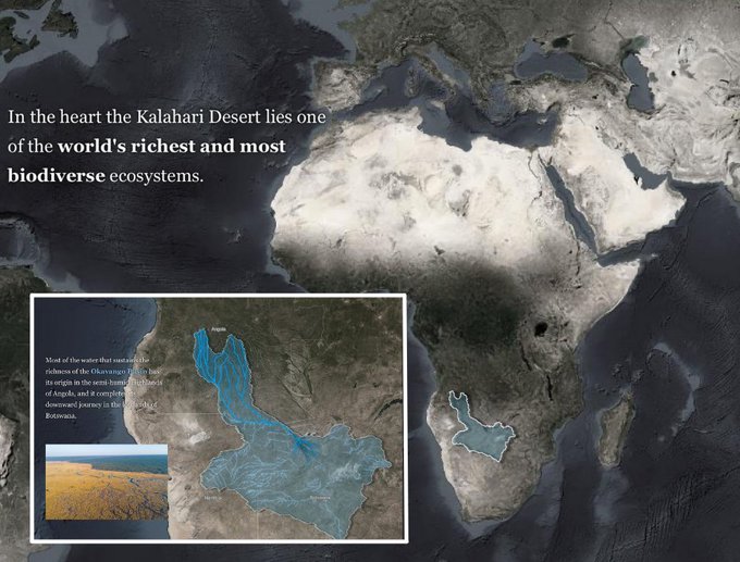
Thank you
@drsteveboyes
for sharing the Okavango with us at
#EsriUC2023
.
Storytellers, learn more through—
-A NEW
@Esri
&
@InsideNatGeo
Okavango story
-Okavango Explore, our 2022 ArcGIS
#StoryMaps
Competition winner
-A 360° canoe ride down the Okavango
1
15
40
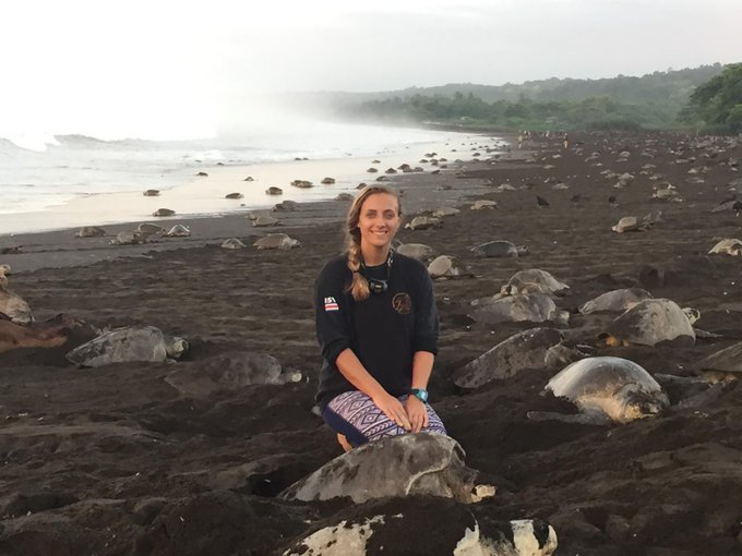
Meet sea turtle biologist &
@NatGeoExplorers
Dr. Vanessa Bézy! 🐢🐢🐢
Check out her new Sea Turtle
#Science
series—a
#StoryMaps
collection—to learn all about sea turtles and her amazing work.
#education
👉
1
12
41
Thanks for following our countdown to
#GISDay
with the 17
@UN
Sustainable Development Goals.
#SDGs
Today, read inspiring stories by The
@CarterCenter
,
@Refugees
&
@John_M_Nelson
about peace, justice + strong institutions around the world.
#SDG16
0
11
42
When viewed in aggregate, these earthquakes reveal something so large it's barely visible otherwise 👀
#StoryMapsWow
0
22
43
#TuesdayTip
: Supercharge your stories with map actions—configurable toggle buttons for sidecar slides with web
#maps
or scenes.
@InfiniteCoop
's article gives the ins and outs of map actions + examples like our Wuhan
#coronavirus
& Urban Africa stories.
1
11
42
Hunt for sunken ships. Track whales. And visualize piracy on the open seas.
The August 2023 Issue of
#StoryScape
magazine examines the growing footprint of nautical travel and ways to visualize the impact.
Dive in 🌊
#StoryMaps
#dataviz
2
10
41