
Mitchell Lyons
@mitchest
Followers
569
Following
1K
Media
75
Statuses
711
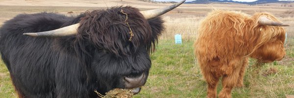
Scientist & farmer. Ecology, remote sensing, modelling, fencing, gardening, chasing bulls, talking to cows (order of importance varies)
Ngarigo Country
Joined October 2009
Deep into a Google Earth Engine coding session 🌐 @EarthOutreach @googleearth.

☁ Highlight from day 1 of Global Dialogue: using cloud-based spatial frameworks for #OceanAccounting. During training, participants were introduced used cloud-based remote sensing and GIS tools to map and account for coastal ecosystems. #GlobalOceanDialogue2024 #OceanAccounts

0
0
3
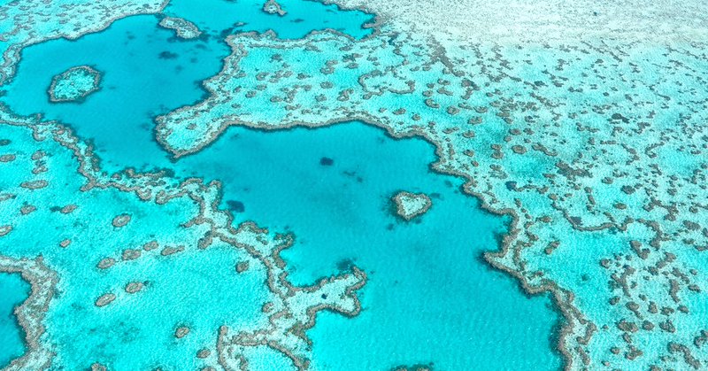
RT @ConversationEDU: Our new maps show coral reefs are more extensive than we thought, write @mitchest + @stuartphinn (@UQ_news). https:/….
theconversation.com
Our new maps show coral reefs are more extensive than we thought.
0
2
0

RT @CellPressNews: "New global area estimates for coral reefs from high-resolution mapping" @mitchest. Read more in @CellRepSustain https:/….
cell.com
Lyons et al. present statistics and trends derived from globally consistent, high-resolution maps of shallow coral reefs. They revise the global area of shallow corals reefs to 348,361 km², including...
0
2
0
RT @remotelysense: Finally the main @AllenCoralAtlas paper is out! The paper acts as a scientific reference and summary of the ACA, includi….
0
37
0
RT @RemoteSens_MDPI: #editorchoice.Automated Global #ShallowWaterBathymetry Mapping Using #GoogleEarthEngine by Jiwei Li, David E. Knapp, M….
0
5
0
RT @remotelysense: Just published: coastTrain is a free training library designed to support efforts to map and conserve coastal ecosystems….
0
59
0
RT @ChrisRoelfsema: Coral cover is high at Heron, 20 Years anniversary of #geolocated #photoquadrat benthic surveys for Heron Reef with hel….
0
13
0
RT @LewisPughFDN: The first wave of our #CoralChampions list is here! Read up on the 16 inspiring people and teams working hard to protect,….
0
25
0
RT @ChrisRoelfsema: Check this @AllenCoralAtlas maps created by the @RSRC_UQ are on the list below @stuartphinn @mitchest @GBRFoundation @U….
0
1
0
RT @terrifreemantle: @mitchest discusses the methods behind the development of the @AllenCoralAtlas including the fact that the team used o….
0
2
0
RT @rohan_connolly: As you might have gathered, I'm a little fired up about the Essendon FC situation right now. Here's a few more thoughts….
0
22
0
RT @TropWATER: Researchers analysed more than one-million satellite images to find 4,000km2 of tidal #wetlands have been lost globally over….
0
4
0
RT @remotelysense: New paper out today in @ScienceMagazine: we developed an EO monitoring system to detect the type and timing losses and g….
0
60
0
RT @Briggs: NEWS: White Australian Male who has a regular column in massive Newspaper and on TV every other night feels unheard. https://t.….
0
197
0
RT @RonniSalt: Ahem . After some requests, I wrote some more words for @shot_au including the invention of a new term for Scott Morris….

theshot.net.au
Australia is smaller for having been led by this man
0
1K
0
RT @ChrisRoelfsema: Which outline describing #CoralReefs extent of the #GreatBarrierReef? The choise will impact #modelling, #monitoring #m….
0
2
0
RT @tjmcdgeo: Congrats to @AllenCoralAtlas team! @Jiwei_Li_JL @ChrisRoelfsema @stuartphinn @mitchest @remotelysense @asnerlab @greg_asner….
0
5
0
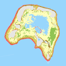
RT @Exopixelist: First coral reef dataset in the Earth Engine catalog: .Geomorphic Zonation and Benthic Habitat from @AllenCoralAtlas. Data….
developers.google.com
The Allen Coral Atlas dataset maps the geomorphic zonation and benthic habitat for the world's shallow coral reefs at 5m pixel resolution. The underlying satellite image data are temporal composites...
0
11
0