

Matthew Colenbrander
@mcol_
Followers
71
Following
382
Media
6
Statuses
71
Creator of the subway-style trail map for Toronto. Check out the trail navigation site and app: https://t.co/03ZA4yOn9K
Joined January 2021
My subway-style Toronto trail map has been transformed into a fully interactive app by @esricanada! → https://t.co/6i0UOMwARi The app is made possible by community collaboration and the amazing work of @MapEnglish. #DonValley (1/2)
6
26
67
This looks exciting!

Millwood Rd is a vital connection between Thorncliffe Park, Flemingdon Park, Leaside neighbourhoods and Downtown. The proposed improvements include protected and connected bikeways, reduced speed limits, widened sidewalks and improved traffic operations at intersections. (2/3)
0
0
0
Definitely going to come back with snowshoes/xc skis once the conditions are right.
0
0
2
I love transit accessible green space! Don Valley Golf Course is now open to rolling, walking, cycling (and more) all winter, just steps from York Mills Station.
1
1
3
Wow. Great work from @JeffAllenMaps. Incredible how much the ravines have changed.

Cool slider:
0
0
0
Learned a lot at the Toronto Island Park Master Plan open house yesterday. Indigenous placekeeping, accessibility, and ecological protection are central to the plan for an even better (year-round!) park. @TorontoPFR #TorontoIslands
https://t.co/NdC1R4MgHu
toronto.ca
Toronto Island Park has long been a place of cultural and ecological significance. For thousands of years, it has been a site of healing, ceremony and gathering for the Mississaugas of the Credit...
0
1
1

Experience winter in Toronto. From skating at outdoor rinks, snowshoeing through parks and more, there is snow shortage of winter activities. Welcome TO Winter, Toronto! Visit https://t.co/oxBrSBElub
#welcomeTOwinter #winter
0
4
8
Scarborough has incredible potential. Very excited about this project.

Scarborough presents a remarkable opportunity for an off-road greenway netowrk #ScarboroughGreenway
0
0
0
This map shows #TransitFrequency for TTC, MiWay, YRT & Brampton Transit. #GIS data are from a new #OpenSource tool I helped create with @calebsdiehl & @ibigroup. It uses #Python to merge overlapping #GTFS route segments to show headways between stop pairs. https://t.co/Nlc62AxCaF
3
10
22
This account is getting less smug by the day
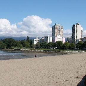
It's a tiny bit warmer in Vancouver right now (13C) than in Iqaluit (11C).
0
0
0

The Tour de Thorncliffe supports kids with autism ensuring kids with all abilities get a good summer camp experience. Great community support including from @bowman_dvw @rchernoslin and friends from @TPS55Div
0
5
14
Hey, that's me! There is a web app now for GPS navigation of the map: https://t.co/BxnZ8WWvTw
@MapEnglish @esricanada

Someone made a TTC style map of trails in Toronto's Don Valley https://t.co/tDOU8avVZg
#Toronto #TTC #DonValley
0
0
3
The fog in Vancouver is intense right now. Foghorns are sounding off every 15 seconds, sounds like the 2010 World Cup
1
0
5
Great video made by my very own sister Kate Colenbrander! Scarborough has the foundation and potential to build the best bike network in the GTA, if it were a priority.

#ScarbTO cycling experiences: joy, health, utility, cost savings, fear, danger, lack of safety, and the knowledge that Scarborough roads take lives. Every single person said: Bike lanes would make Scarborough roads safer & better for people. Full video: https://t.co/WI5hkbQTMN
0
0
2
Had a great ride up the trails all the way from Pottery Road to Steeles yesterday. Was much cooler down in the valley!

If you're tired of melting under the summer sun, these five trails will cool you off and lift your spirits.
0
0
1
This route will help connect the network and make cycling a viable option for everyone. It would a be a huge waste to see it blocked. Side note, there are some really good multi-use trails in Mississauga if anyone hasn't checked them out yet!
Please help save this safe cycling route in Mississauga Hydro Corridor blocked because people didn’t want other people cycling behind their homes. Email the councillor today and voice your support! @insauga #visionzeropeel #bikesauga
0
0
1

sweeeeet..... #LoveTheRavines
My subway-style Toronto trail map has been transformed into a fully interactive app by @esricanada! → https://t.co/6i0UOMwARi The app is made possible by community collaboration and the amazing work of @MapEnglish. #DonValley (1/2)
0
2
4

This subway-style Toronto trail interactive map cooked w @ArcGISPro TraceNetworks and NetworkDiagrams. Brought to life w @ArcGISJSAPI. Inspired by @mcol_ Data from @Open_TO #DonValley
https://t.co/J4nIpdYou2
0
3
10
Pic above is just a small preview. All of the trail data is open source and looks even better zoomed-in, so check out the app and go hit the trails. → https://t.co/6i0UOMwARi Be sure to press the "Switch Map" button at the top to toggle the satellite view! (2/2)
3
1
1