Explore tweets tagged as #MapProjections


Day 19 - Projections For GIS Day I mapped the world using a cubic projection, an unusual way to reveal how dramatically our planet’s shapes and areas change depending on the projection we choose. #30DayMapChallenge #Day19 #Projections #Cartography #ArcGISPRO #MapProjections
0
4
14

Rebuilt the Arctic Fox journey in @ArcGISPro ahead of #EsriUC demos next week to explore the issue of #mapprojections. For this map, Polar Stereographic is tough to beat.
5
35
138
We'll be talking #Lego and #mapprojections with our special guest @BojanSavric when we 'ask a cartographer' during today's ##EsriUC #MappyHour. Join us at 4pm PDT.
1
6
25
40 world map clementines in under 2 hrs. Shout out to my mom for being my back up cartographer. 🌎 🍊#mapprojections
4
3
26

0
2
7

#30DayMapChallenge 🗺️ (Day 26: #MapProjections) Perth, Western Australia, is often referred to as the world's most isolated major city. This map visualises the international flights departing from Perth. This map uses an #AzimuthalEquidistantProjection with Perth as the origin.
0
2
8

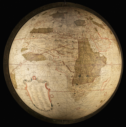
Happy GIS Day! Here I am showing Jack Dangermond how I teach map projections with my illuminated globe... #MapProjections #GISDay
0
1
23

0
1
2
📣A new version of #ProjectionWizard v2.1 🗺️🌐🪄 is now live as of this morning. Visit https://t.co/d1cm80oNt1
#mapprojection #mapprojections #webMercator #endMercator #mapprojectionsarehard #projectionsarehard #gischat #geospatial
1
13
61
ما الفرق بين #إسقاط_الخرائط #MapProjections وأنظمة #الإحداثيات #CoordinateSystems؟ #إسقاط_الخرائط عبارة عن طرق تستخدم لتحويل السطح الكروي للأرض إلى مستوى ثنائي الأبعاد من المعلوم أن شكل سطح الأرض منحني وعندما يتم تمثيله على خريطة مسطحه ستحدث بعض التشوهات لذلك فإن الغرض الأساسي
0
10
37

A map projection necessarily distorts *something* -- it is a 2-dimensional representation of a 3-dimensional reality. Different projections distort different things (& get other things right) 🌍📷-- https://t.co/UTgu2gkqHw -- #MercatorProjection #MapProjections #Cartography
0
0
1

They say travel expands your horizons … pleased to have encountered the rarely used Equal Caffeination Opera-Sanremo Projection at @Zibettoespresso, just blocks from Carnegie Hall. #creativeCarto #mapProjections
0
2
8
Fantastic example of an @ArcGISStoryMaps by Josef Münzberger, with non-#webmercator #map. Oh, yes! It can be done. #ICC2023 #mapprojection #mapprojections #mapprojectionsarehard
https://t.co/Zr1WlNMn7N
1
6
30

STREEEETCH!!!!! What happens when you flatten a globe into a map??? Uh oh!!! I see distortions! Applying our spatial perspective skills! #MapProjections #LearnersToday #LeadersTomorrow @BrenhamHS
0
1
8
And today I learned about the 5 May 1953 Nancy projection. Envious that Nancy doesn't seem to have the orange peel problems everyone else runs into. #creativeCarto #mapProjections
2
2
16
Everyone did well on yesterday's projection. Today's contribution from @harvartmuseums is a less standard projection though—Agnes Denes' Cube projection from 1986. #maps #mapprojections
0
1
8

#Y6 students learning about #mapprojections by modelling #3D globe templates. It was an interesting journey learning about the accuracy of shape and size on #worldmaps @NatGeo @imanacad #thatsgeography #edutwitter #geography #curiosity #eduLK
0
0
5