Explore tweets tagged as #DogsFire


#DogsFire Aircraft Assisting. Air Attack 658, 1 Lead. Air Tankers 12, 16, 74, 75, 76, 78, 79, 121, 137. Copter 9WL, Helitanker 0HX, 6HT, 95B. Pretty visible burn scar showing up on Satellite, Cal Fire has the Fire at 3,000 acres.
0
1
8
The #DogsFire is now 200 acres with a continued moderate rate of spread.

With no official updates in the past hour, here is an update on the #DogsFire. The fire remains 120 acres since the latest mapping and remains very active on nearby @ALERTCalifornia cameras. Aircraft assisting: 5 helicopters 7 Type One Air Tankers
0
1
4

With no official updates in the past hour, here is an update on the #DogsFire. The fire remains 120 acres since the latest mapping and remains very active on nearby @ALERTCalifornia cameras. Aircraft assisting: 5 helicopters 7 Type One Air Tankers
1
2
3
OES Intel 24 has Mapped the #DogsFire at 4,406 acres, no longer 8,500 acres, the Fire remains Northwest of Poso Creek and Granite Road.
0
0
7
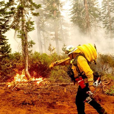
#DogsFire The Fire is 8,500 acres from IC, Aircraft and Ground crews are making good progress and the Fire is beginning to hold. The Fire has Reached S Granite Road/Poso Creek.
1
2
9

🚨Red Cross Evacuation Shelter Opening 🚨 A @RedCross shelter is open for wildfire evacuees affected by the #DogsFire in #KernCounty. All those in need of a safe place can find us at: 📍North High School 300 Galaxy Ave. Bakersfield, CA 93308
1
4
6
Wildfires: Colusa County: #FordFire 14 acres 80% contained Fresno County: #FirestoneFire 482.6 acres 42% contained Kern County: #HudsonFire 624 acres 76% contained #DogsFire 8,500 acres 5% contained Modoc County: #WillowFire 18 acres 90% contained
3
2
1

Details for #DogsFire at Famoso Rd, California, USA. Size: 3,000 acres, Containment: 0%. Stay informed!
0
0
1
#DogsFire is now 8,500 acres and holding per IC.
0
2
0
#DogsFire: Kern County Animal Services will assist with sheltering companion animals at the center. If you have any physical limitations and require evacuation assistance, call the Aging & Adult Services hotline at 1 (855) 264-6565. 🗺️ Evacuation map: https://t.co/1We5pEP5BJ
1
0
0
0
0
0

#DogsFire #VegetationFire The #DogsFire is now 85% contained. This will be the final update on this fire unless there are any further threats that the public needs to be advised of.
0
1
12
0
0
0
0
0
0