California Wildfire Tracking
@CaliFireTracker
Followers
15K
Following
5K
Media
1K
Statuses
4K
Follow for the most reliable and accurate information. Buy us a coffee at the link below! For inquiries, please email us at [email protected]
California
Joined July 2024
The team at @CaliFireTracker is looking for passionate volunteers to help deliver reliable, real-time wildfire information. I’m headed into a very busy part of my life and will need some extra support to ensure operations are not affected. If you’re interested in joining the.
4
15
29
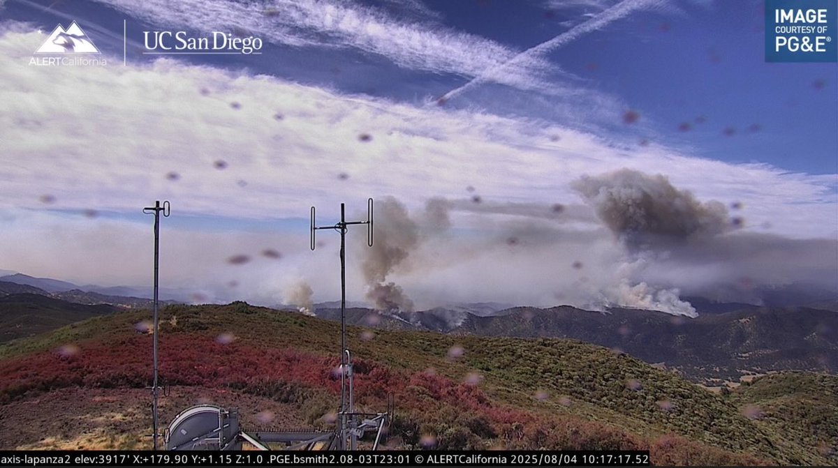
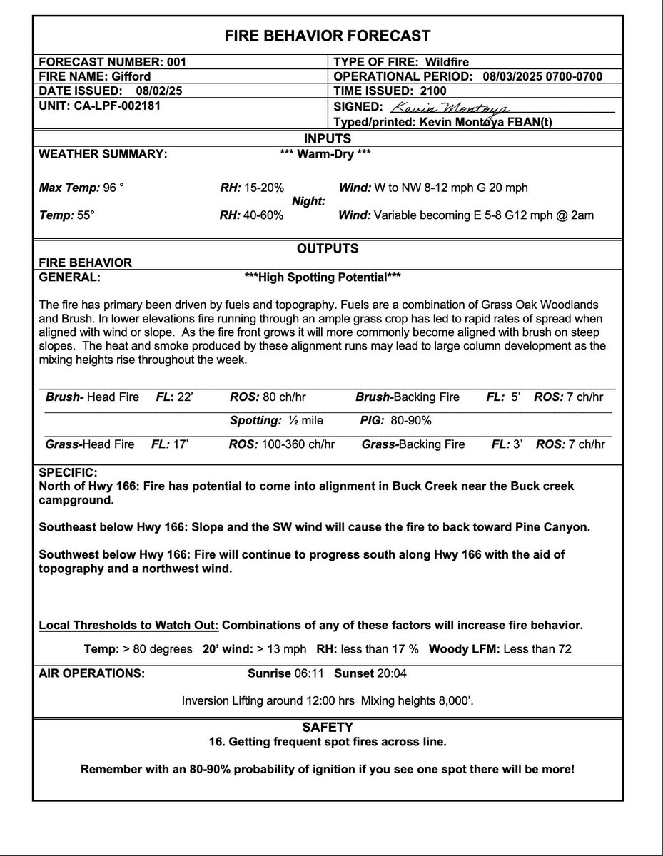
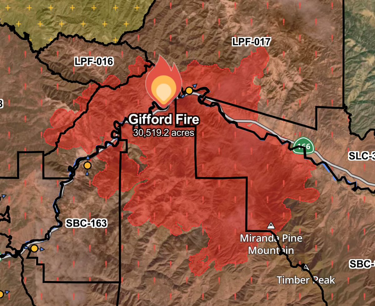
.The #GiffordFire is starting to stand up a little this morning. Conditions today are expected to be similar to Sundays with increasing temps and worsening fire weather later in the week. This one has a real possibility of going 100k acres +. Just gotta wait and see.
1
1
8
Looking like the #GiffordFire could have a very active week ahead. These rates of spread are quite impressive. One chain = 66 feet. This fire is running up to 360 chains an hour!
2
9
23
Gabe is one of the most knowledgeable guys out there when it comes to fires, if you haven’t seen his film yet, do yourself a favor and give it a watch. Give him a follow while you’re at it.
0
3
10
Factually incorrect, this fire started on state managed land adjacent to Highway 166.CA Governor spreading false information on X yet again.

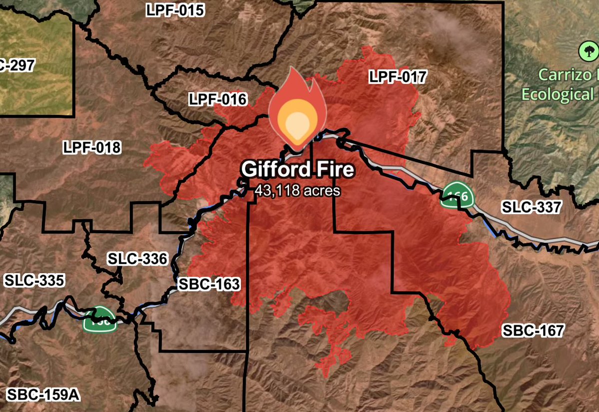
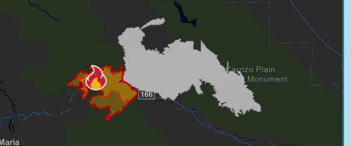
The #GiffordFire — which began on federally managed land — has now burned nearly 50,000 acres, prompting evacuations in Santa Barbara and SLO counties. Over 1,000 personnel are on the ground fighting this fire, as well as aerial assets.
6
17
91
RT @CaliFireTracker: 🚨BREAKING🚨.If you are under the smoke plume of the #GiffordFire, head outside and check out the moon. The moon is abso….
0
5
0
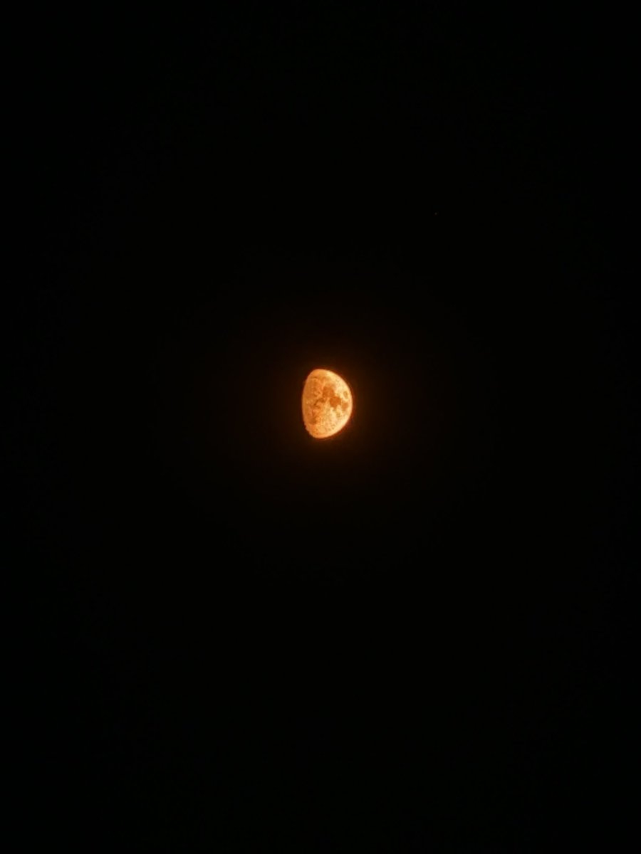
🚨BREAKING🚨.If you are under the smoke plume of the #GiffordFire, head outside and check out the moon. The moon is absolutely stunning tonight.
2
5
26
This is truly some exceptional fire behavior. Sundowner wind gradients are currently tightening with critical thresholds nearing. Expect the #GiffordFire to continue this monumental run.
2
27
72
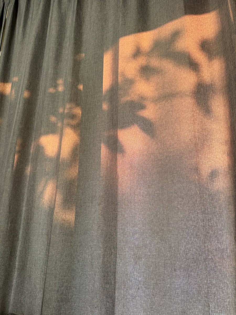
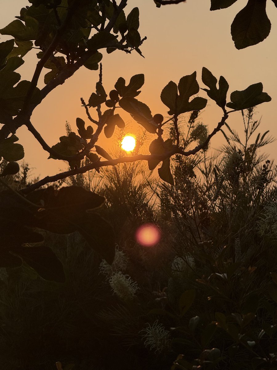
Sun is blocked by smoke and everything is orange. Ash is falling. Welcome to California in the summer. #GiffordFire
1
3
15
Would you rather .A. Have a wildfire nuke your neighborhood ($200 billion in damages).Or.B. Do some fuel mitigation work and deal with a little smoke from Rx burns ($0). I know which one I’m picking.

Fuck it. Sorry guys, we need to accept our houses getting nuked with our pets and grandparents burning alive inside, $200bn in damages, year after year because it’s just…too hard to do fire mitigation work.
1
1
12
Hey @RichIMET, it’s real Smokey over here in South Santa Barbara County. You got a forecast for smoke impacts from the #GiffordFire?

2
0
11
RT @CaliFireTracker: 🚨BREAKING🚨.In the past month alone over 100k acres have burned within the highway 166 corridor. Why this is such a hot….
0
10
0
🚨BREAKING🚨.In the past month alone over 100k acres have burned within the highway 166 corridor. Why this is such a hot spot for fires? Because the state of California (CALTRANS) does not fulfill their duties and properly clear the brush off of the side of their highways. The
7
10
47
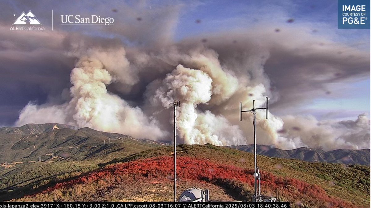
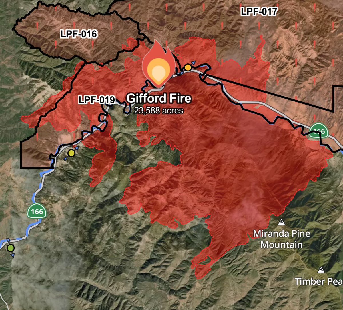
🚨BREAKING🚨.The #GiffordFire has been mapped at 23,588 acres by Intel Aircraft. Map via Watch Duty
1
22
85
RT @CaliFireTracker: 🚨BREAKING🚨.On this day, exactly one year ago, California Wildfire Tracking was started. From reporting on the Bridge a….
0
4
0
If you would like to help further support California Wildfire Tracking, you may do so at the link below! .
buymeacoffee.com
Wildfires can devastate communities; with a team of reporters, we ensure all stories are told urgently and accurately.By buying us a coffee, you are doing your part to ensure your community stays well
0
0
1
🚨BREAKING🚨.On this day, exactly one year ago, California Wildfire Tracking was started. From reporting on the Bridge and Line Fires to the infamous Los Angeles Fire siege, it has been a wild ride but I would like to thank you all for the tremendous support. I never expected
4
4
20