

DataUrbana
@Data_Urbana
Followers
1K
Following
769
Media
149
Statuses
796
Promoviendo las Ciudades y Sociedades Data-Driven a partir de la Educación, la Ciencia de Datos y la Digitalización
Barcelona
Joined June 2020


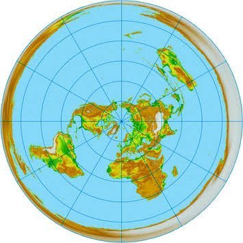
#30DayMapChallenge Day 2: Lines Reducing the number of lines needed to draw France (about 20 times)
3
8
134

#30DayMapChallenge Day 3: Polygons. Let's use basin boundaries instead of country boundaries. Made with #qgis. #opendata from #HydroSHEDS.
2
14
66

The scale of the fires currently burning across northern Australia is pretty unfathomable. This animation visualises just the last two months of fire captured by #DEAHotspots - for context, the map covers an area larger than France, Spain and Germany combined...
184
3K
6K

Kindergarten proximity in and around Vienna 🇦🇹 through Voronoi tessellation. Day 1: Points #30DayMapChallenge
#OpenStreetMap #rstats #Vienna
0
6
39

🌃 How bright is your night sky? I used satellite data to create this map of average nightlight pollution in Europe for 2022. The darker the color, the less light pollution there is. 🌑 Can you spot the darkest area on the map? Spoiler alert: It’s in Ukraine! 🇺🇦🥹
3
9
65

📢 Delighted to share the cover of my book Spatial Statistics for Data Science: Theory and Practice with R 😍😍😍 🔗 https://t.co/vrvMufKrEM Thanks so much to my editor @lara_crc & all the team at @CRC_MathStats! The book will be available soon! #rstats #stats #datascience
29
380
2K

Day 2 of the #30daymapchallenge - Lines! This map shows journeys to work in England & Wales where more than 10 people make that trip. Thanks to @ONSgeography for releasing the data just in time! Designed in #QGIS with #CARTO & #bigquery doing the heavy lifting 💪
1
29
317

Accurately predict travel time ETAs for a given day of the week or time of day, with the 'depart_at' functionality in the Mapbox Isochrones API. 💡 See how: https://t.co/ET4LaFdrBV
#geospatial #mapping #gischat
0
2
15

On a daily basis, our #Copernicus Sentinel5-P monitors a wide range of atmospheric gases, such as Nitrogen Dioxide #NO2, Sulphur Dioxide #SO2 or Methane #CH4 More at https://t.co/4QWUwk2nbV
#Sentinel5P average values for the tropospheric concentration of NO₂ for Aug.-Sept. 2023
41
170
461
My new map compares the levels of nightlight pollution in India in 2013 vs. 2022 to reveal the astonishing growth that took place in just 10 years 😮😮😮 #nightlight #satelliteimagery #india #science #education #RStats #DataScience #datavisualization #dataviz #visualization
3
20
64
Tradicionalmente hemos asociado el alto nivel de movilidad de una sociedad a su prosperidad y riqueza. Pero, probablemente, a partir de ahora, las sociedades prósperas serán aquellas que sepan contener la movilidad.
3
19
47
Podemos afirmar que la movilidad en el territorio también apoya la movilidad social y que si reducimos esta movilidad en el territorio entonces puede crecer la estratificación social, la desigualdad y por último lastrar también el progreso social de todo el país.
1
7
19
Hoy compartimos un nuevo mapa realizado a partir de datos abiertos. #MartesDeMapping Mapa de #buffers de 100m, 400m y 800m en torno a edificios que generan urbanidad en el centro de #braga #Portugal Fuente: OSM Instagram: dataurbana #DataUrbana #python #dataviz #italy #retail
0
0
0
Hoy compartimos un nuevo mapa realizado a partir de datos abiertos #MartesDeMappingMapa de usos y actividades en el centro de #kualalumpurl #Malasia Fuente: OSM Instagram: dataurbana #DataUrbana #python #dataviz #map #maps #landuse #leisure #transport #commercial #touristic
0
0
1

The railroads of the world! This map was made with #Python using #matplotlib and #pandas. #DataScience #Data #DataVisualization #infrastructure
6
27
152


I love how on maps like this one the shipping routes show up clearly. This carbon monoxide emissions was created by the marvelous @pythonmaps.
3
22
95