
T☈EY FULB☈IGHT
@CF3_Weather
Followers
3K
Following
21K
Media
13K
Statuses
27K
Christian | Meteorologist | BS @iowastateu | Graduate student @MSStateGrads | Former NWS FWD Intern| Storm chaser, outdoorsman, cooking, & music!
Pennsylvania, USA
Joined October 2014
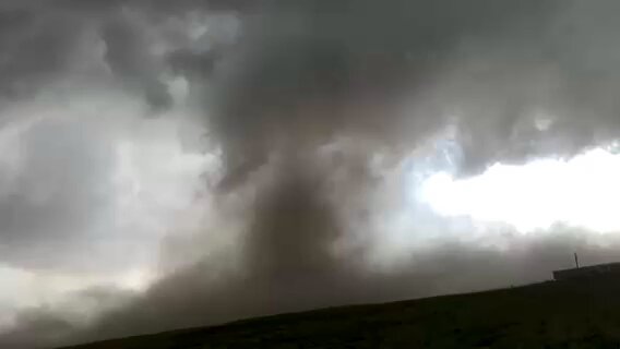
This is my close range view of the Minden, IA tornado at 5:43PM yesterday. We were on 360th a few miles east of town. Incredible violent motion at the base with debris being thrown out. Watch the collar cloud work its way down. Common characteristic of violent tornadoes. #iawx
0
8
132
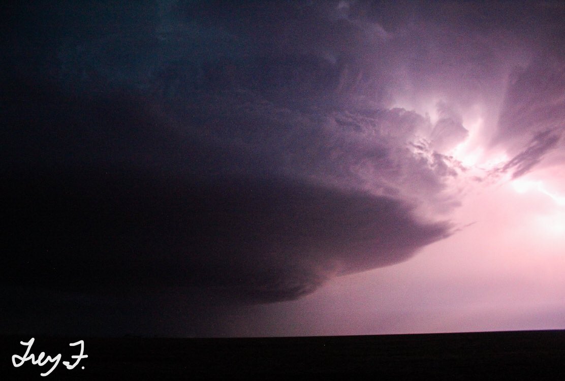
Wedge and rope out phase of a tornado we witnessed on a warm front riding supercell in North-Central #kswx near Galatia in May 2021.
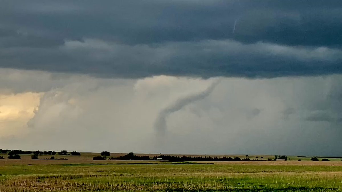
0
0
2
I remember being outside trying to save the car battery in that map on the right….

If you can’t You don’t .handle me deserve me at .at my worst my other worst


0
0
2


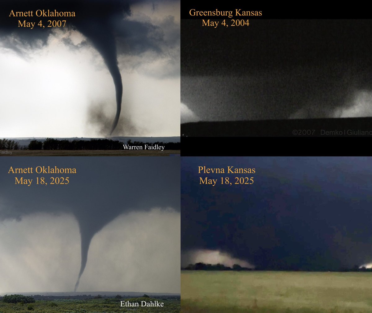
I’d give almost anything to go on this particular chase, Pilger 2014, and Columbus, NE 1998!.

This video was my first ever Dakota mega wedge #tornado setup - the Manchester F4 on June 24, 2003. This was when I first realized the unstable warm frontal / outflow boundary zones during summer produce the largest, most violent tornadoes. They are often very slow moving, if not
0
0
2
RT @RARohde: In most of the world day-to-day weather variations are still much larger than long-term global warming. As a result, both dai….
0
302
0
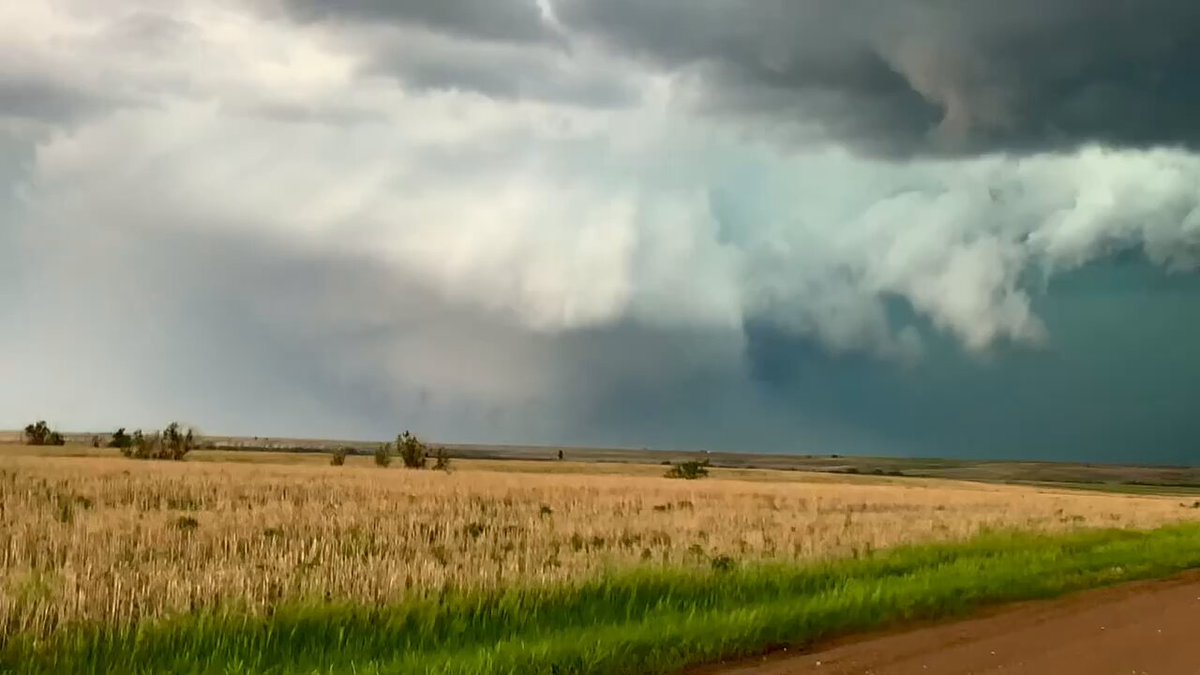
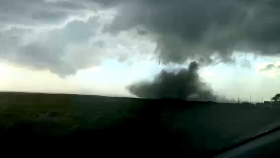
A tornado forms directly in front us while chasing near Akron, CO, on May 23, 2025. Ready to get back out there, I need more of this! #stormchase
1
3
8
RT @Discovery: New season. New disasters. Same fight for survival. #InTheEyeOfTheStorm returns this Sunday at 10p.
0
13
0
It’s only “big news” and treated aggressively if it happens M-F during legacy prime news hours and in the core of a metro area or “targeted ZIP”. Rural area? May or may not get covered thoroughly depending on the situation.

Is TV dead? The D.C. viewing area just saw a flash flood EMERGENCY in its core viewing area — Montgomery County. Three of the four network-affiliated stations don’t have a stitch of coverage on their social media feeds. Only ABC7 retweeted its weekend PM meteorologist. Yikes.


0
1
2
The four horsemen of summertime weather alerts: extreme heat, severe storm, flooding and air quality. #uswx

2
1
7
RT @webberweather: This is supported by fig 7. from DeMaria et al (2001) (link below) (left) & the C3S ensemble mean SSTa forecast via @cyc….
0
1
0
RT @webberweather: The weak instability & developing La Niña later in the fall also both point to a backloaded season, because La Niña favo….
0
1
0
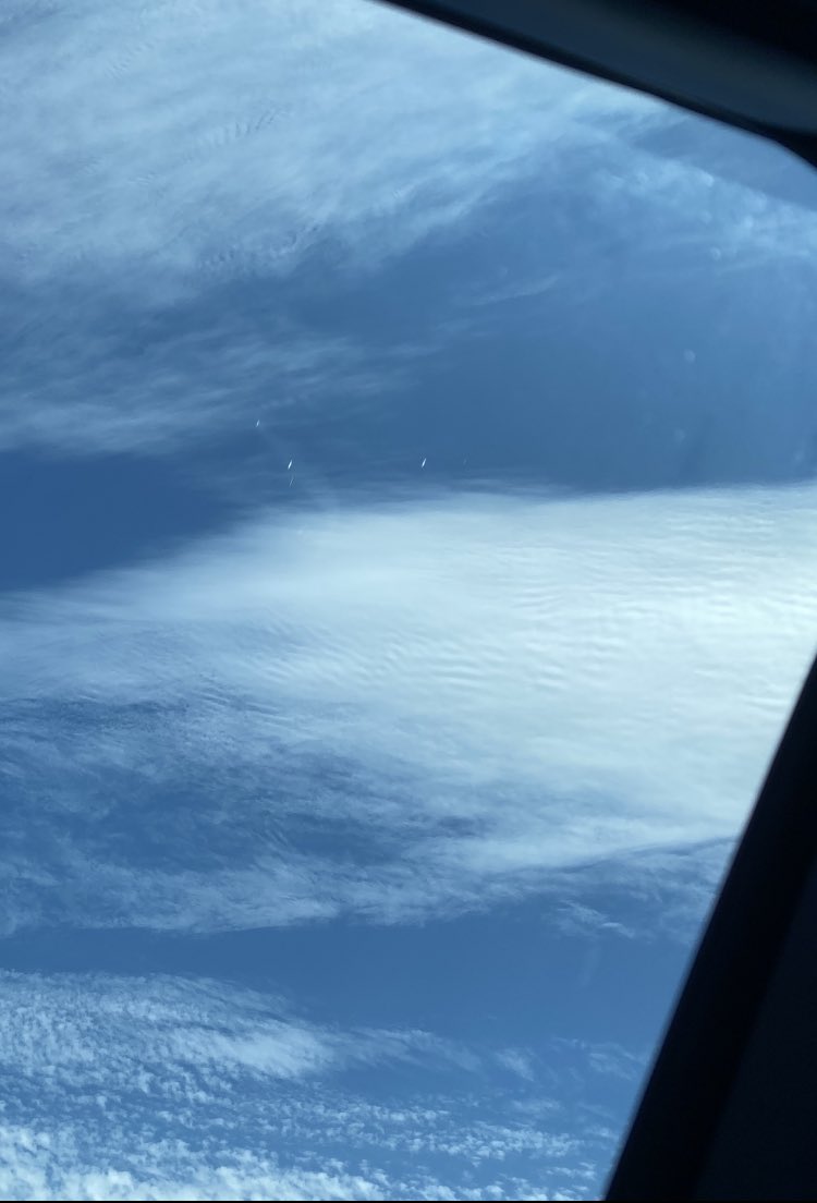
I guess she’s never heard of cloud subcategories 😂.

No these are not normal cirrus clouds. Trying to show you these weird ripples like vibration waves.
0
0
0
0
70
0

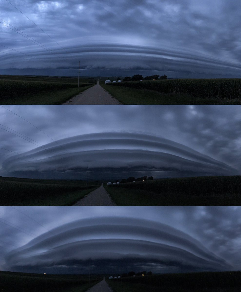
RT @adler_hanson: Early morning wake up call in West Union, IA at 5:09 AM CDT as storms roll through. #iawx
0
1
0
Classic case of possible QLCS mesovort generation near the Ames and Gilbert areas this morning thanks to differences in horizontal shear. Northwesterly wind direction from cold pool moving in from the northwest meets up with a due westerly wind from cold moving east. #iawx
2
7
26
Yes!.
1
0
6
Warmer than normal oceans allow for faster & greater amounts of evaporation leading to higher amounts of moisture in the air. When favorable steering currents & a synoptic scale pattern setup like we’ve seen the last several weeks, a supercharged atmosphere is ready to unload.

There have been varying meteorological forces behind recent extreme rainfall events, but they are all connected by very unusual amounts of moisture pulsing above the United States. Precipitable water, a measure of the total amount of water in the atmosphere, has been above the

0
0
3
RT @MatthewCappucci: This might be the best 26 seconds of TV I have ever seen 😂😂😂. Florida government — I’m still happy to do a science cra….
0
154
0