
Reed Timmer, PhD
@ReedTimmerUSA
Followers
734,644
Following
25,415
Media
25,836
Statuses
101,874
Extreme meteorologist, inventor and storm chaser intercepting the most powerful storms on the planet. I'm driven to push the science and its education forward.
Golden, CO
Joined February 2009
Don't wanna be here?
Send us removal request.
Explore trending content on Musk Viewer
Eigen
• 879812 Tweets
Wasit
• 268611 Tweets
Scotland
• 132130 Tweets
Uzbek
• 102983 Tweets
#HappyBirthdayRohit
• 99212 Tweets
Mufasa
• 67497 Tweets
Jerome
• 65101 Tweets
#محمد_بن_سلمان
• 63747 Tweets
billie
• 46276 Tweets
Madonna
• 43372 Tweets
ARMY ARE FOREVER BEHIND BTS
• 43276 Tweets
Rock in Rio
• 30600 Tweets
Seinfeld
• 29287 Tweets
Nadal
• 25816 Tweets
HBD PP KRIT 25th
• 21231 Tweets
Medina
• 20484 Tweets
gracie
• 17427 Tweets
Tekno
• 14208 Tweets
Jake Paul
• 13839 Tweets
Fermin
• 12960 Tweets


Pinned Tweet

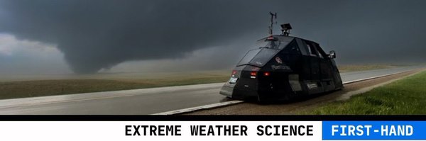
Going LIVE for another INTENSE day ahead at 3pm CT. Today's SPC Risk if HIGHER than yesterday. LINK -
35
185
997
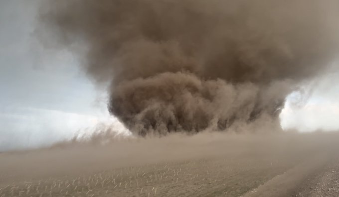
Highest-res drone footage of the Andover, KS
#tornado
which has received a preliminary rating of EF3. Note how the tornado propagates via vortex dynamics and likely terrain. Incredibly, no lives were lost by this tornado
742
10K
35K
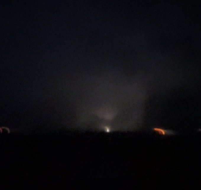
Destructive tornado tearing through Andover KS minutes ago
809
6K
22K
Measured 50” snowfall at 630 pm in Hamburg, NY outside the gas station along I90. Found a unimpeded flat area with wind coming from right side of this image. There are areas with more but I could not burrow far enough to reach those locations.
@accuweather
@NWSBUFFALO
@JLAngeline
308
2K
13K
More extreme close-range footage of destructive
#tornado
going through Andover Ks. Had bird in the air, attempted to deploy pressure and tornado was on top of me. Went from 10 to 300 mph in seconds
342
3K
12K
It is incredible how this explosion de-condensed the condensation funnel of the
#tornado
. The explosion changed the thermodynamic gradients dramatically within the vortex and blew up the Clausius-Clapeyron equation
601
2K
12K
Intense large
#tornado
Cole, Oklahoma. Deployed subsonic sensor for infrasound. 4 homes damaged
603
3K
12K
Powerful storm surge southern tip Pine Island FL eye wall Hurricane Ian
@accuweather
@ChrisFLTornado
487
4K
12K
Major storm surge in Cedar Key, FL from Hurricane Idalia
268
2K
8K
Going through this 4K drone footage reveals complex vortex structure with multiple vortex breakdowns and quick formation of jet like vortices below reservoir of negative pressure perturbation. Sadly, immense damage was caused by this compact tornado
240
2K
8K
RIP my best friend and storm chasing partner, Joel Taylor. I am shocked and absolutely devastated by the loss of my incredible, caring friend. We chased so many intense storms, and I wish we could have just one more storm chase. I'll miss you forever, Joel. We lost a legend


1K
2K
7K
Hey
@Discovery
let’s bring back Storm Chasers. There are a lot of knock off series out there. Only Team Dominator can do this right. Let’s do this.
455
663
7K
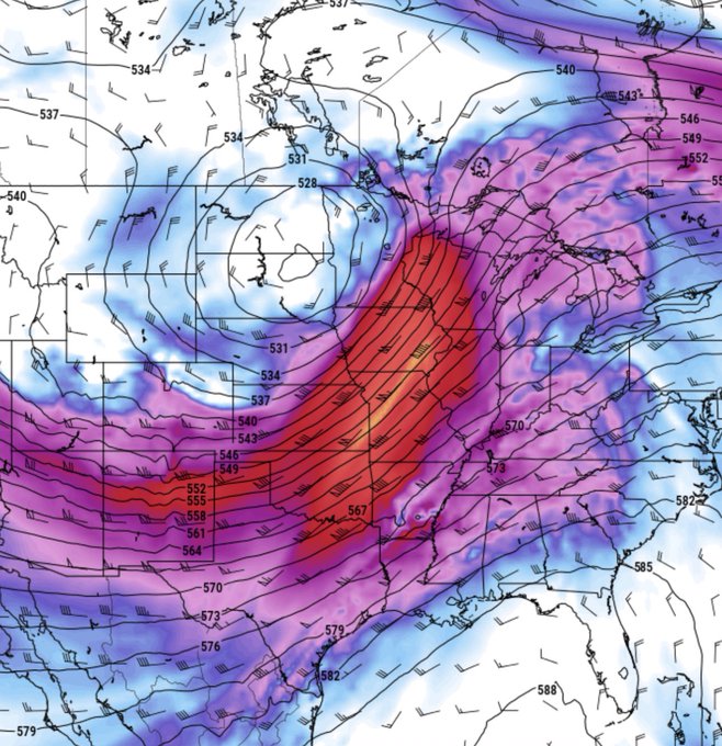
I am very concerned about the overall pattern for tornado outbreaks this early spring as we finish March and into April. Long-range models show a pattern we see every 10 years or so - massive high amplitude storm system after storm system. Time is now to mentally and physically…
336
2K
7K
One year ago today, the beautiful but tragic Andover, KS EF3
#tornado
happened. Here are the Dominator drone and ground perspectives captured on this solo chase. My FB live stream is what caused the tornado sirens to be activated just prior to the tornado warning being issued.…
192
1K
7K
BREAkING! Buildings gutted in Lake Charles LA in powerful eye wall of
#HurricaneLaura
@RadarOmega_WX
@ChasinSpin
204
3K
6K
Storm surge causing structural damage and blowing out the doors of condo complex in Cedar Key, FL from Hurricane Idalia
@accuweather
160
2K
6K
First
#tornado
of the year 2024 confirmed ripping through Fort Lauderdale, FL as the supercell passed into the Atlantic Ocean
109
1K
6K
POWERFUL
#tornado
just southeast of Loco, OK inside tornado with Dominator 3. We are live. Time is 637 pm
@NWSNorman
@accuweather
170
1K
6K
Peak
#blizzard
Downtown Buffalo as lake effect plume has solidified again. Bigtime winds. Deadly conditions
201
1K
6K
Heartbreaking loss of 3 OU students in an accident on the way back from chasing. These students are close to my heart and a shining light in the weather community. Words cannot describe the sadness. My thoughts and prayers go out to their families and friends. RIP my friends
191
585
6K
More footage of the Madison TN area
#tornado
when crossing I65. Severe damage through Hendersonville and the south loop of GALLATIN, TN
134
1K
6K
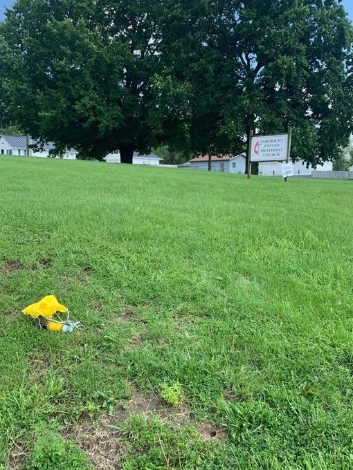
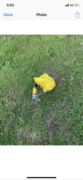
BREAKING NEWS!!! I just got off the phone with Matthew DuBois, Jerry Belk who found the ROCKET sensor with parachute just short of KC Airport! This is huge. Due to this miracle we will now have 10 Hz data for the entire flight inside EF4 tornado and 3D animation of its flight!

257
771
5K
MAJOR storm surge Pine Island, Florida Dominator Fore Hurricane Ian eye wall
174
1K
5K
True blizzard conditions near the crest at Mammoth Mountain, California!
80
735
5K
Destructive
#tornado
near I65 earlier near Nashville. You can see smoke from an explosion in the vertical winds. Terrible scenes of damage emerging
120
1K
5K
I an so blessed to meet my godson for the first time yesterday in OKC before the storm chase

152
94
5K

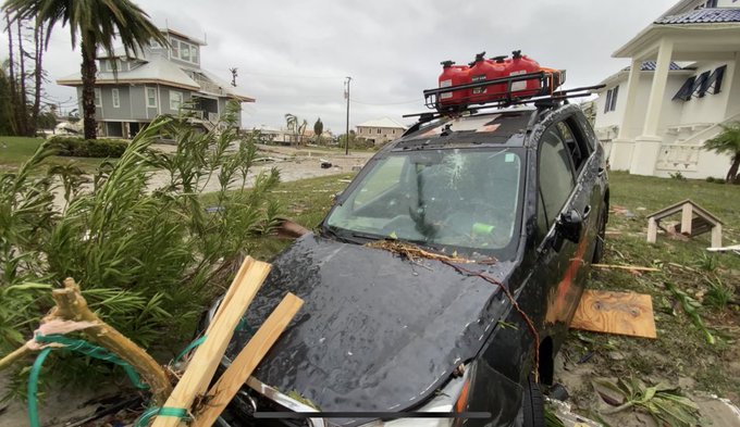
Abandoned dominator fore. Salvaged science bag. Retreated to shelter. Very intense
@ChrisFLTornado
@accuweather
257
631
5K
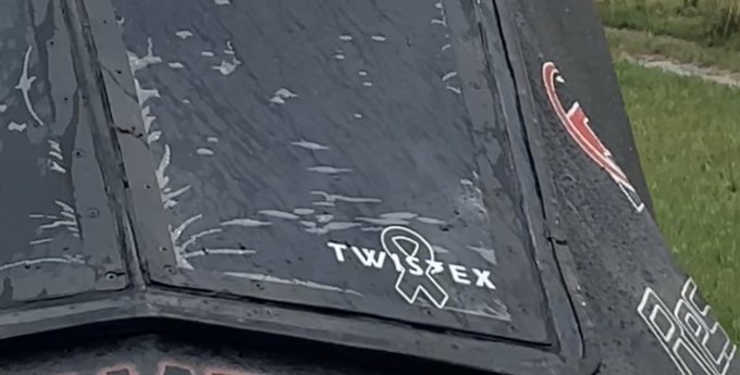
RIP Twistex. Today we chase in memory of the Twistex Team, Tim and Paul Samaras and Carl Young. Never stop chasing
90
568
5K
EXTREME close-range intercept of strong
#tornado
outside of Crockett Texas. Deployed graviton sensors and took a direct hit. We could hear the tornado several minutes before impact
232
1K
5K
Check out the RFD spraying snow in the mountains behind the tornado. The tornado cyclone is just east of the mountains. This is an example of straightline winds on the mountains rather than closed rotation with the tornado cyclone. The tornado is just in front of the mountains.…

A tornado over the Rockies here in Montana, about 20 miles from where I live. 🏔🌪 So crazy. What a trip.
492
2K
9K
87
829
5K
Heading to Vicksburg hospital with injured residents of Rolling Fork MS they need emergency personnel NOw
164
1K
5K
This dog has been to all Lower 48 states and 3 Canadian provinces. She has been inside a tornado and a category 5 Hurricane. She has been to Zion National Park, Grand Canyon, Lake Louise. She has chased debris flows in Utah. Cancer survivor: 200+ tornadoes. Summited one 14er.…
166
265
5K
Hearing reports of causalities from the powerful tornadoes in northwestern Ohio
117
1K
5K
BIG-TIME flash flood in Catamarca, Argentina in the northwest corner of the Pampas. This looks to be off a wildfire burn scar with its dark color and debris
104
952
5K
Winds gusting over 100 mph in Houma, LA. This is nothing compared to eye wall. Hunker down. This is going to be really bad
@RadarOmega
129
1K
4K
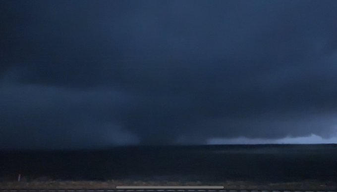
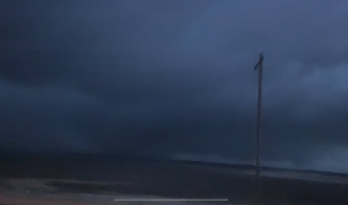
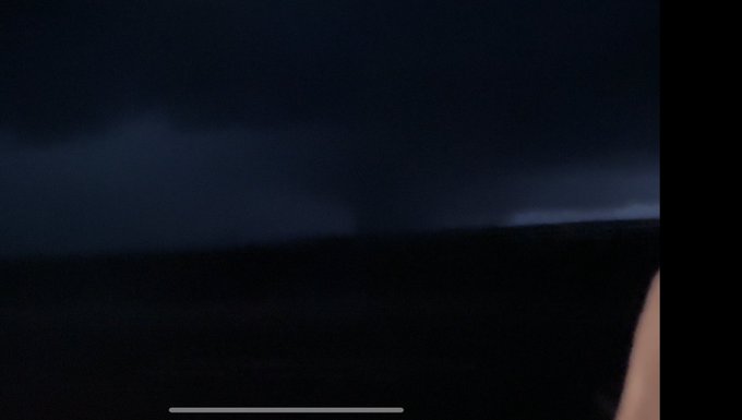
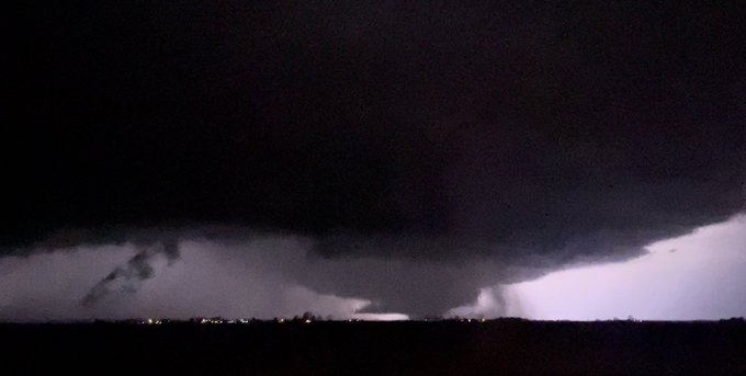
TORNADO wedge intercept near Linneus, MO in Dominator 3 intercept
102
805
4K
I miss Joel deeply. We should be chasing this. Miss his balance. Friendship. RIP Joel Taylor
129
156
4K
A record-breaking storm chasing dog is shown in this photo. She has been inside a tornado and also the eye wall of a category 5 Hurricane Michael. She has chased blizzards, debris flows and more across 48 states and two Canada provinces. Her name is Gizmo
145
246
4K
LOL can’t argue with this

this is the most accurate description i have ever seen of storm chasers💀
22
161
2K
62
185
4K
On this day, 24 years ago, one of the most powerful tornadoes in recorded history happened in central Oklahoma. Tragically, 46 people lost their lives on this day with 74 tornadoes confirmed in a single day. Here is the F5 from southwest of Moore. This was just prior to the…
95
712
4K
EXTREME intercept of the rare total solar eclipse by JET PLANE with master pilot
@MatthewMmov23
@accuweather
132
586
4K
TORNADO INTERCEPT in Dominator 3 with drones in the air!! Tornado intensified to the north then roped out
@SeanSchofer
@breakingweather
@accuweather
@skyforcex
343
1K
4K
It appears the Dominator Drone captured a descending vortex breakdown bubble burst over Andover KS. Sadly this tornado was responsible for immense damage
59
503
4K
This is an accidental
#tornado
intercept folks. However, I agree that a vast majority of storm chaser tornado intercepts are accidental these days. This motorist just panicked, likely becoming disoriented by the rotational motion of the debris
109
685
4K
Good heavens me

I just captured the most insane strike of lightning I’ve ever caught on camera.. 😳😱⚡️
@weatherchannel
@KSNNews
@KWCH12
@KAKEnews
@JimCantore
2K
18K
79K
141
675
4K
Tornado close-range near Wray, Colorado on May 7, 2016! Textbook hook slice maneuver to achieve this angle. 2016 began an active period for the high plains that lasted for 3 years. The last two have been locked in drought
97
698
4K
Gizmo needs your thoughts and prayers. I believe she has a severe case of pancreatitis. Heading to the emergency vet. Fluids and rest, and lots of love is needed.
385
122
4K
Decimated corn crops by hail as far as the eye can see north of Denver International Airport from round-after-round of severe storms
192
1K
4K
HUGE FLASH FLOOD / debris flow front wall down Whitewater Canyon, California as flash flood quadrupled in size! Burn scar flash flood.
77
833
4K
Apparently a plane almost crashed on me while driving on I26 in Asheville, NC
161
471
4K
Like a beacon of light
@Whataburger
is boarded up but OPEN and surving burgers in the outer bands of Hurricane Hanna
@RadarOmega_WX
#HurricaneHanna
194
519
4K
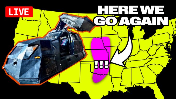
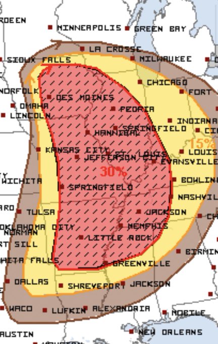
The Storm Prediction Center has issued a massive enhanced risk with 30% hatch area for significant severe weather on FRIDAY stretching from northern Louisiana through Iowa. It has been a few years since we have witnessed an tornado event this widespread. Stay tuned
143
1K
4K
Icelandic Coast Guard nearly zero metering the eruption north of Grindavik, Iceland! I wonder how warm it feels in that chopper
62
659
4K
SNOW falling on the honky tonks of Nashville with snow plows on the party busses on Broadway Street!
37
418
4K
Horrifying reports of loss of life from possible 220+ mile track tornado last night from AR through MO, NW TN and KY. I am so sorry for all of this damage and loss. Will figure out ways to help in recovery. Damage survey along entire path of this historic, tragic tornado today
81
685
4K
Here are some frame captures of the destructive
#tornado
as a wedge on approach to Rolling Fork, MS. We are heading back to assist in transport
77
961
4K
UPDATE: Conditions deteriorating rapidly in Lake Charles with winds gusting over 70 mph. DEPLOYED infrasound sensor of
@ChasinSpin
to measure the heartbeat of
#HurricaneLaura
109
1K
3K
Winding around massive snow piles in the middle of the road near Orchard Park, NY
92
493
4K
I bet this
#tornado
in southern Wisconsin was strong. Full condensation to ground beneath a base that is not terrible low, requires one hell of a pressure deficit to the ground. Compact structure, compact tornado
12
597
4K
Dangerous storm surge continues in Cedar Key, FL with strong westerlies on the backside of Hurricane Idalia. Here is the peak storm surge:
93
901
4K
WOW!!! Jaw-dropping
#HABOOB
crippling traffic along I-8 in southwest Arizona now west of mile marker 90. One of the most incredible sights I have ever witnessed
@breakingweather
@accuweather
@mad_WX
#duststormwarning
99
1K
3K
Intercept of supercell in Brawley, California with strong rotation in main convective band of Tropical Storm Hilary
@accuweather
53
722
4K
Drone footage of flooded Malibu Canyon and a bridge to community flooded over on north side of Malibu
#atmosphericriver
7
799
4K
Peak storm surge battering structures on Cedar Key, Florida during Hurricane Idalia. We are glad the TC underwent an eye wall replacement cycle at the end, but the wind field expanded and produced a dangerous surge
49
760
3K
INTENSE
#TORNADO
intercept west of Crowell, Texas with Captain Vanover flying racing drone around the tornado. Time 7:40 pm
96
663
3K
HURRICANE HILARY is rapidly intensifying south of the Baja Peninsula with minimum pressure down to 965 mb! A majority of forecast models intensify Hilary into a major hurricane. Hilary will likely be a wispy tropical storm/depression on approach to southern CA due to the…
360
696
3K
Max storm surge eye wall Hurricane Ian Pine Island FL
94
948
3K
Large Boulder the size of a medium Boulder in the road south of Ojai California
47
365
4K
Yes of course I have thought about chasing the balloon
164
152
3K
Catastrophic wind in eye wall of Hurricane
#Michael
in Panama City Beach eastern tip
@breakingweather
@accuweather
150
2K
3K
LIVE update from Cedar Key, FL where a life-threatening storm surge up to 12 feet is likely with Hurricane Idalia. Authorities want residents and visitors to evacuate by 4 pm today. Bridges will likely be destroyed. Coverage for
@accuweather
97
778
3K
This is one of the most incredible mothership supercells I have ever seen at night. This is so incredible I cannot stop
93
454
3K
This photo is with Tim and Carl on May 27, 2013 after the Cora, Kansas tornado. We had one of Tim’s anemometer inventions mounted on the Dominators back then. He was such a kind person and incredible scientist/storm chaser/mentor. He always concerned for our safety. Never stop…
54
306
3K
Tornado intercept by high plains hook slice maneuver, Wray, Colorado. Never stop chasing
#weather
#stormchasing
78
466
3K
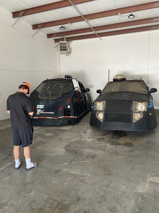
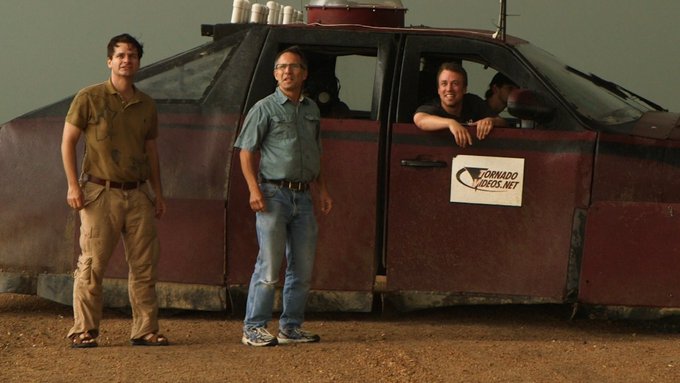
All three Dominators are in the same place for the first time in 10 years
137
260
3K
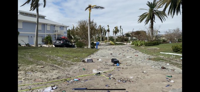
Lots of elderly folks here on Pine Island. Woman with Alzheimer’s has been found and is safe but injured. Hoping to get her medical care. 2497 Macadamia Lane, Pine Island, FL. Open wounds and was out in the elements last night. Injuries not immediately life threatening
126
483
3K
Massive mesocyclone with a wedge
#tornado
below approaching Hayti, MO, sadly causing substantial damage. This is the longest track tornado I have ever chased, but could not keep up it across the four states. More tornado warnings in western TN
70
855
3K
I didn’t know it was a crime to never stop chasing!
224
109
3K
Picked up this suit at Men’s Warehouse to storm chase so that I can look even more professional

337
80
3K
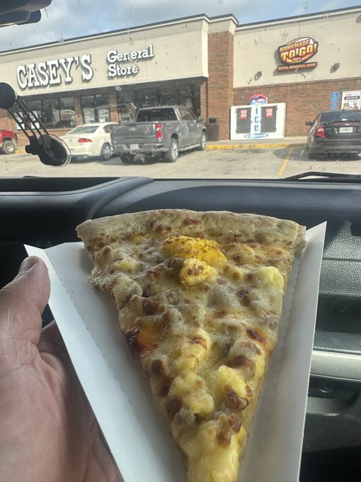
Casey’s breakfast pizza - fueling thousands of storm chasers every spring
99
119
3K