Prof Tim Barrows
@4Dlandscapes
Followers
396
Following
800
Media
90
Statuses
570
Geomorphology, geochronology, 3D modelling, palaeontology and data archaeology
Australia
Joined August 2016
Welcome to my blog on 3D models and the age of the landscape https://t.co/zqJGNAUkPC

4dlandscapes.wordpress.com
Discovering the world in 4 dimensions
0
2
6
In a paper published today in Scientific Reports, we used nearly 1,000 film photographs of Antarctica from the 1960s to reconstruct exactly what five glaciers were like decades before the Larsen B Ice Shelf collapse. https://t.co/aB7mlE8xPP

theconversation.com
Few observations exist from before the 2002 Larsen B Ice Shelf collapse. We’ve now estimated how many billions of tons of glacier ice were lost – and what it means for the future.
0
3
24

PLEASE BE AWARE that there has been a large landslip at #Seatown, Dorset overnight. @DorsetCouncilUK are aware. Be cautious and do not put yourself at risk. If you are in these areas, stay away from cliff edges and do not sit at the base of cliffs. 📸 @JLP_Dorset
44
444
1K

Ice surface speed measured from @CopernicusEU #Sentinel1 appears to show that the Totten Glacier Ice Shelf in East Antarctica is heading for a calving event of 200 sq km or more (that's 1% of the size of Wales!)
1
27
84
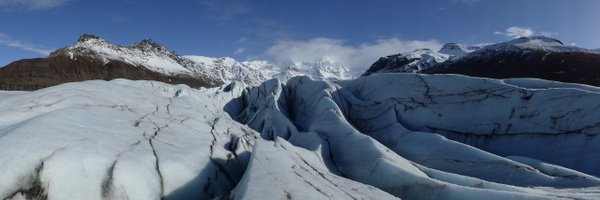
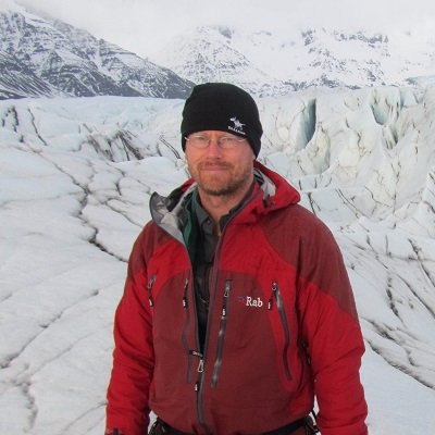
Ryan North @Ryan__North from the University of Wollongong ICE Group presenting at the Alaska International Symposium on Maritime Glaciers in Juneau
0
1
9
James Sanders @jn_sanders from the University of Wollongong ICE Group presenting at the Alaska International Symposium on Maritime Glaciers in Juneau
0
1
13
New @usnatice-named icebergs resulting from complete collapse of East Antarctica's Conger Ice Shelf (~1200 sq. km) on/around March 15, seen in combo of #Landsat and #MODIS imagery. #CongerIceShelf #Antarctica @helenafricker @jdmillstein
USNIC analysts have confirmed iceberg C-38 has calved from the Conger ice shelf in East Antarctica, very near to where C-37 calved a week ago. #iceberg #Antarctica
10
122
140
Part of the remaining iceshelf left by the 2002 breakup of the Larsen B iceshelf has collapsed after continued warming of the region.

0
0
0

1.14.2022: (correction on date) Large volcanic eruption near Tonga (Hunga Tonga-Hunga Ha'apai volcano) today as seen from outer space. Shown on visible imagery using the Himawari satellite. #hiwx #tsunami #earthquake
280
4K
12K
Our latest paper on temperature change during the last ice age and its timing in Australia https://t.co/IOZ13hLK82
0
1
4

Wow check out the updated felt map! Felt reports coming in from Melbourne, Canberra, Sydney, Adelaide, Hobart, and Brisbane! https://t.co/YwQ0CDzmLd
6
37
128

.@niwa_nz's Water Model is forecasting a rapid increase in river flows across Canterbury on Sunday 🌊 The heavy rain is likely to cause flooding & slips. Keep yourself up-to-date this weekend & follow the advice of emergency officials. 🟪 = extremely high flows
4
24
52
Very windy day 2 of field trip at Port Kembla. Permian delta plain with lava flow and lava-sediment-water interactions. With @Drlloydwhite
0
0
4
Spectacular first field day for EESC250 field geology. Basalt dykes at Bombo quarry, Kiama with @Drlloydwhite
0
0
9

Not long til @GeoscienceNZ conference where we will present some @niwa_nz led glacial research at Lake Tennyson. Progress mapping landforms using LIDAR & chats w @GIShaun @4Dlandscapes and @AaronPutnam14. Part of the site shown here w a 25cm DEM, N aspect hillshade & 1M contour
1
2
13
Talented colleagues @niwa_nz collected LIDAR data for our Lake Tennyson glacial history project with @GIShaun @4Dlandscapes. Oblique aerial (top) has boulder locations and LIDAR model (below) exposes fine-scale topography. High-res terrain + moraines = targeting the right samples
0
2
7
Our new paper has been published. We find water in the lake during the last glacial maximum with rapid drying after 19 ka
0
6
21

Animation showing the 12-month cycle of all plant life on Earth — whether on land or in the ocean. Rather than showing a specific year, this is the average yearly cycle Credits: NASA's Goddard Space Flight Center
2
93
188

The breaking up of Gondwana—Precambrian terranes(pink); mid-ocean ridge growth(red); mantle plumes (yellow stars), creation of large igneous provinces (blue/orange) & transforms/fracture zones(pale blue) https://t.co/9N3Mf5WIfB
#EarthScience #geology #maps
7
256
587

Some more incredible coastal geomorphology, this time at Montgomery Reef in Australia's Kimberley region. These shifting sandbanks are driven by some of the world's most extreme tides, which rise and fall by over 10m! (30 years of #DigitalEarthAU @USGSLandsat data, 1988-2018)
0
23
77