
Zachary Pike
@wxmanpike
Followers
15
Following
90
Media
147
Statuses
260
Weather Photographer and Storm Chaser. Certified Elite NWS Skywarn Storm Spotter 🌪️ = 2
Joined May 2023
Quick shot of some turbulent skies in CT as a small squall line pushes through. This is probably the "whale's mouth" or the underside of a forming shelf cloud. #shelfcloud #thunderstorms #squallline #ct #ctwx
0
0
1
Here's Part 1 of my personal 2024 Severe Weather Season Re-Cap! Part 2 coming down the line! Follow me on TikTok @wxmanpike #Recap #2024 #severeweather #thunderstorm #shelfcloud #storms #tornado #clouds #wxtwitter #wxx
0
1
1
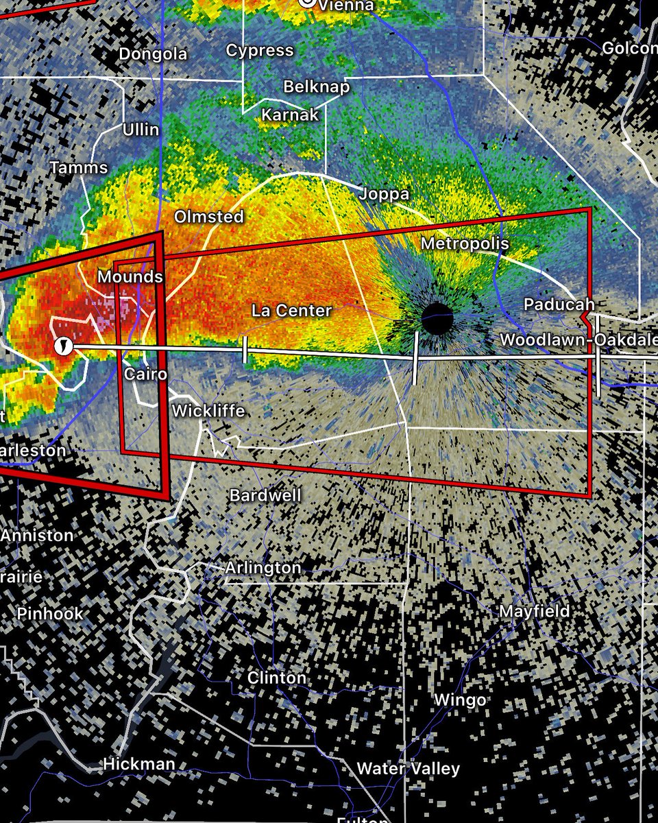
The exact same supercell I was warning on approach to Paducah, KY was the exact one that originated in Southeast Missouri, and tracked over 500 miles and directly hit Somerset and London, KY, all the way across the state of KY, killing at least 14. #mowx #kywx #supercell #tornado

0
0
3
This tornado warning has now been extended to Paducah, KY. Ballard, Mccracken, and northern Hickman and Graves Cos. need to seek shelter next 15 minutes, this supercell has and probably will plant another large tornado. #kywx #tornado #tornadowarning #supercell
0
0
0
A PDS (Particularly Dangerous Situation) Tornado Warning for Charleston and Wyatt, MO and Cairo, Ill. This supercell has planted a large cone tornado. Hickman, Ballard, and Mccracken Co. in KY need to take shelter next 20-30 minutes. 4:20 PM CT. #tornado #tornadowarning #kywx

0
0
0
This Southern most tornadic supercell continues to beeline towards Paducah, KY. I am not liking the look of this on approach. 4:00 PM CT. #tornado #tornadowarning #supercell #kywx

0
0
0
A Pair of tornadic supercells are making a beeline for Paducah, KY and extreme Southern Illinois. 3:35 PM CT. #tornado #tornadowarning #kywx #illinoiswx #supercell

0
1
1

0
0
3
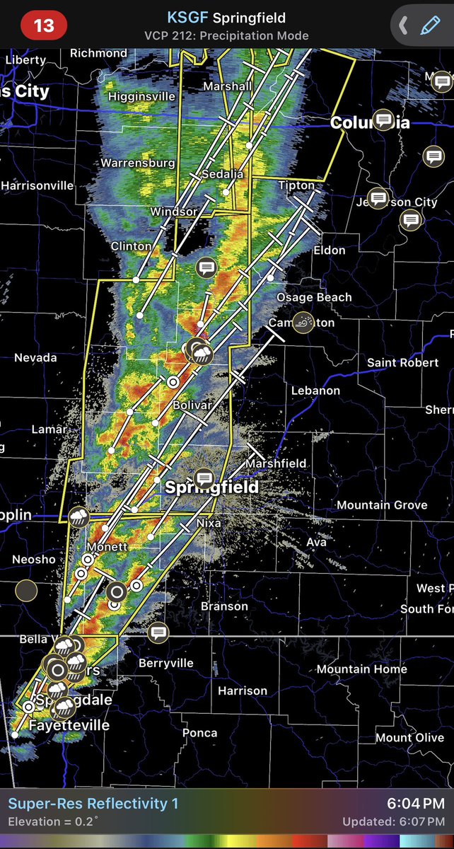
Cells have begun to fire off along KS/OK/AR/MO line, pushing into Springfield area now . 5:09 PM CT #severewx #thunderstorms #tornadoes #outlook
0
0
0
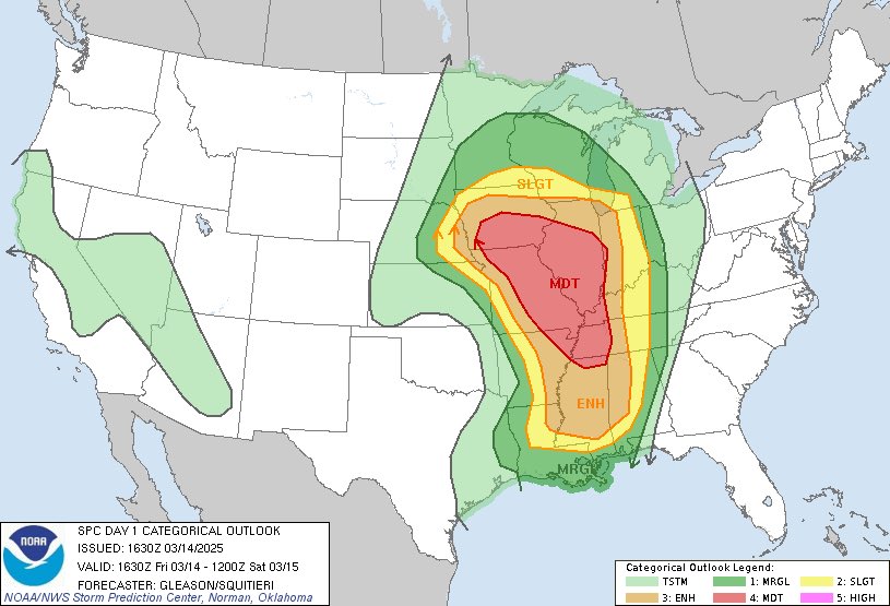
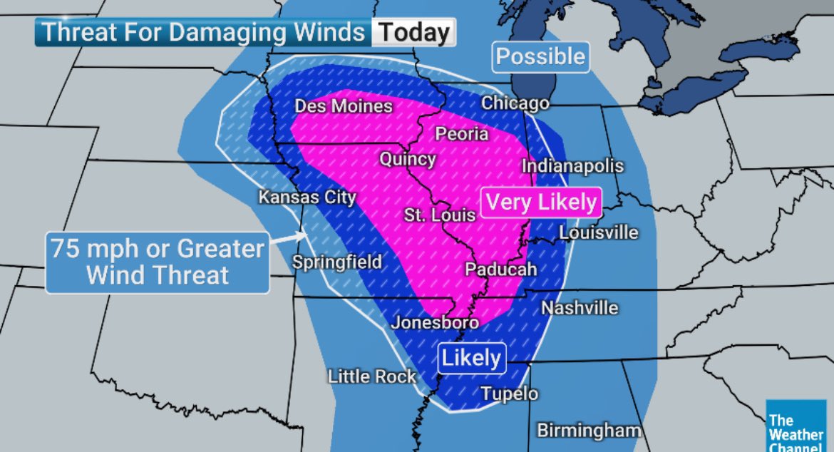
Significant severe weather and possible tornado outbreak is looming for this afternoon into the night. Have your severe weather protocol in place and keep yourself educated and notified for watches and warnings. #severewx #thunderstorms #outlook #wind
0
0
1
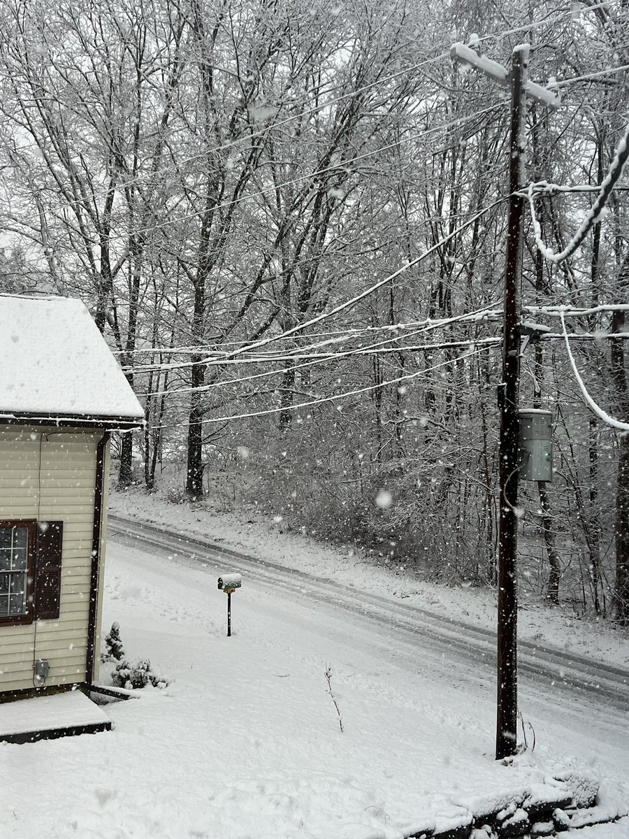
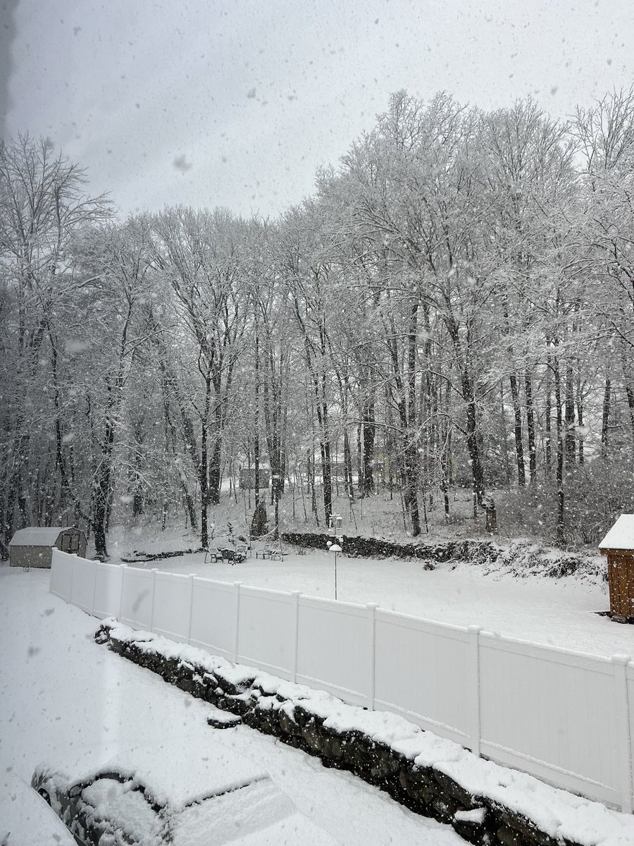
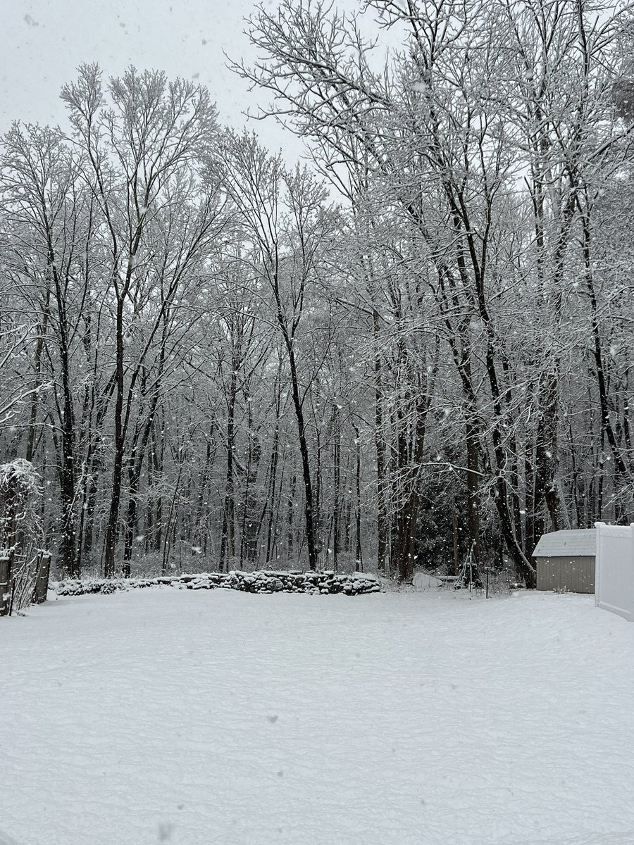
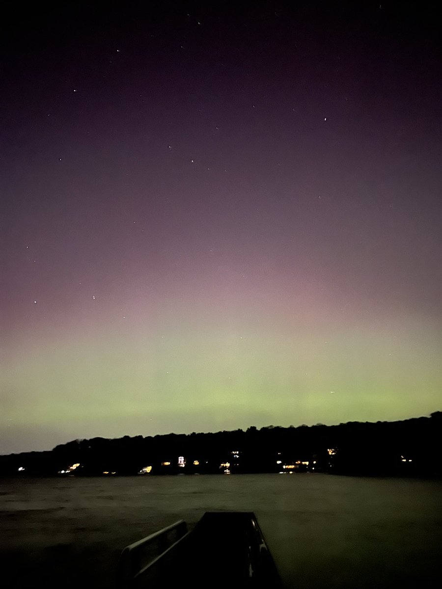
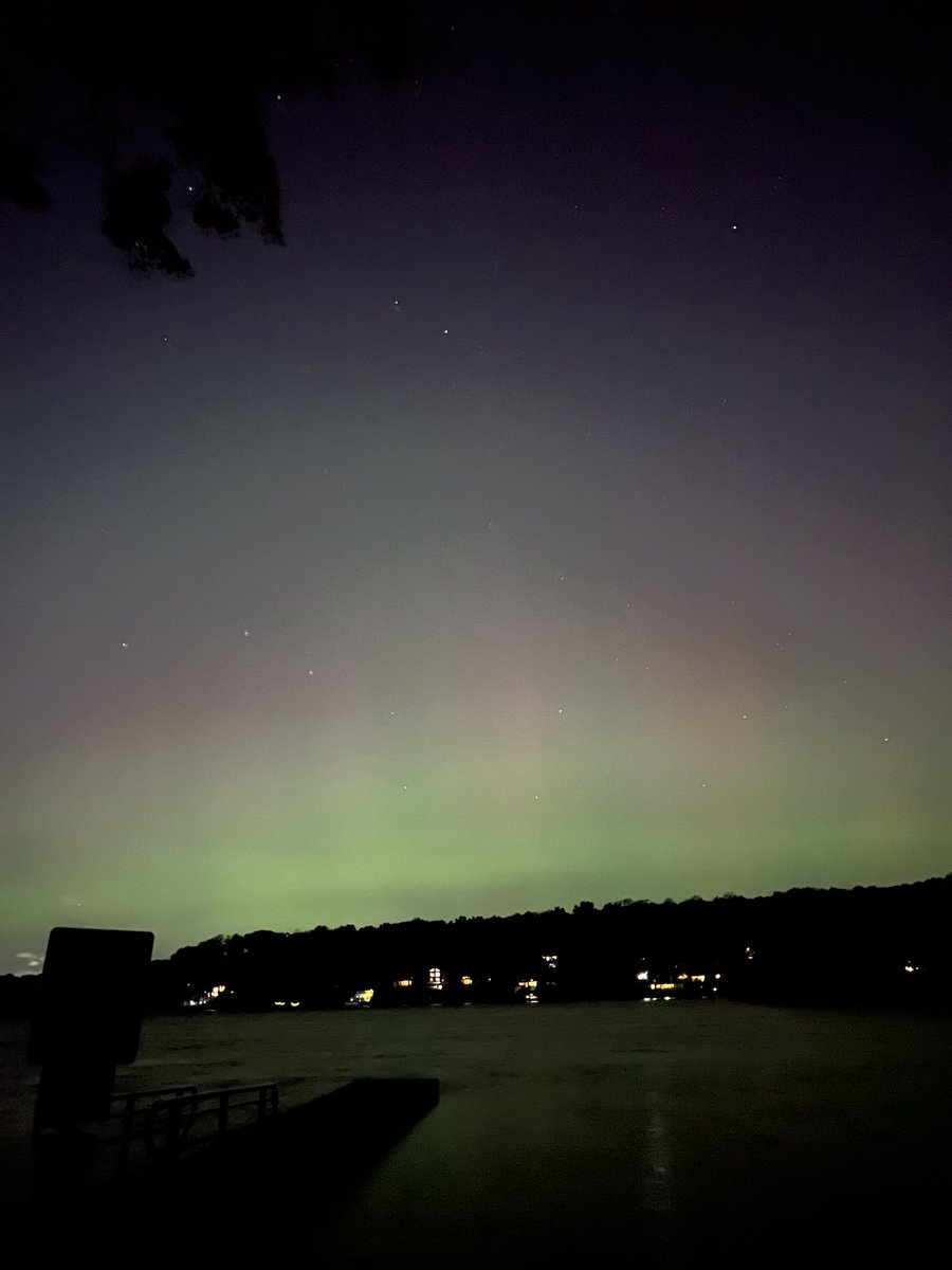
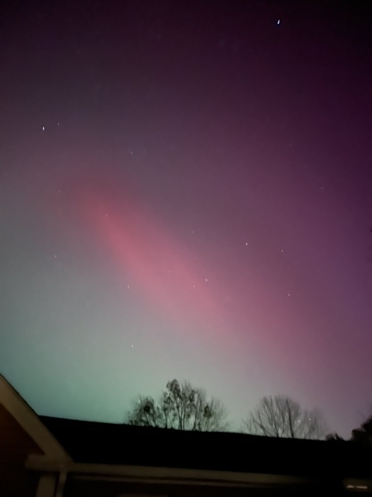
First snow of the season finally! Heavy, wet 4" in Coventry, CT. @ryanhallyall @ReedTimmerUSA #ctweather #snow #northeast

0
0
0


0
0
1


2
0
3
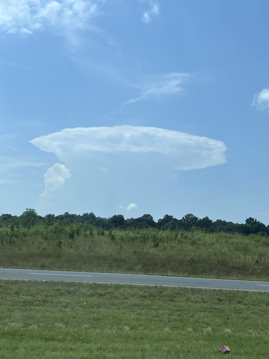
Just a distant little wall cloud and rain shafts. #wallcloud #downpour #rainshaft #thunderstorm #southernillinois #illinoisweather #severeweather #wxtwitter
0
0
2
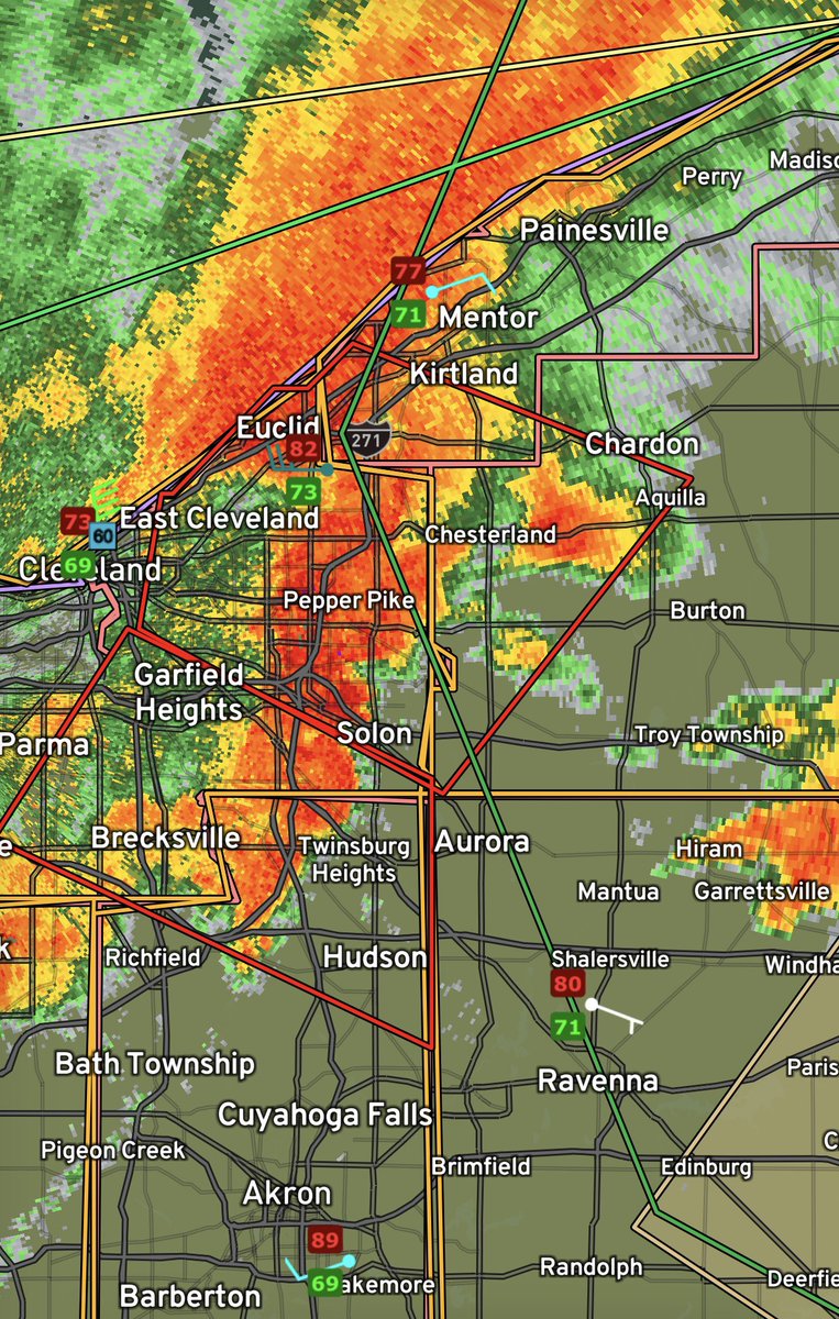
TORNADO WARNING now extended into Southern Geauga, and Northern Portage Cos. in Ohio! Big hail and heavy winds accompany these tornadic storms! #TornadoWarning #SevereWeather #Ohio #Ohwx

0
0
2
TORNADO WARNINGS out for Lake, Cuyahoga, Geauga, Stark Cos. In Ohio! Confirmed tornado for the southern warning heading for Hudson and Ravenna! 80 MPH winds, 1 inch hail are reported! #TornadoWarning #SevereWeather #Ohio #ohwx
0
0
3
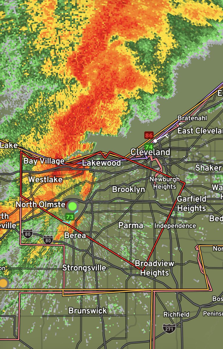
TORNADO WARNING for Cuyahoga Co.! Westside and Southern Cleveland suburbs take shelter! #tornado #Warning #SevereWeather #Ohio #Ohiowx
0
0
1
You gotta be kidding me with this #wxtwitter #lightning #thunderstorms #SevereWeather #kywx @BeauDodson @NWSPaducah @ReedTimmerUSA
1
1
4