Francis Rengers
@pyrogeomorph
Followers
718
Following
4K
Media
109
Statuses
2K
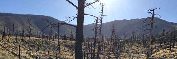
Researcher of post-fire debris flows and landslides. Trying to make pyrogeomorphology “a thing”.
Colorado, USA
Joined February 2008
RT @BoulderOEM: The National Weather Service has issued a Flash Flood Warning on 8/7/24 until 6:30 p.m. for the Stone Canyon Fire burn scar….
0
10
0
RT @NWSBoulder: A strong thunderstorm just developed right over the Stone Canyon burn area! The heavy rain will lead to flash flooding. Mov….
0
10
0
RT @NWSAlbuquerque: Here's a look at the hydrograph for the Rio Ruidoso. The water will continue to race downstream toward Glencoe this aft….
0
8
0
RT @NWSAlbuquerque: The Rio Ruidoso at Hollywood jumped into MAJOR flood stage - over 15 feet! Look at the last few frames of this video. S….
0
36
0
RT @USGS_CO: Recently, @USGS @UArizona @AZGeology @CAGeoSurvey & @CAFireScience organized the Establishing Directions in Postfire Debris-Fl….
0
3
0
RT @NatRevEarthEnv: 🚨New Review!. Fire effects on geomorphic processes🔥🏞️. Learn how landscape attributes, rainfall & burn severity influen….
0
6
0
RT @USGS_CO: May is Wildfire Awareness Month! 🔥🔥 A recent publication with @BGCEngineering, @USGS, @UNRScience, @CalConservation, and @UniM….
0
4
0
RT @babowling12: A timelapse of the wildfire in @NewRiverNPS from the iconic Grandview Overlook tonight. 📍Grandview, WV .
0
105
0
RT @SatelliteSci: The scale of the fires currently burning across northern Australia is pretty unfathomable. This animation visualises jus….
0
3K
0
RT @US_Stormwatch: Satellite image of California shows virtually no smoke across the state in typical peak fire season, with fire activity….
0
443
0
RT @SanBernardinoNF: Personnel of the San Bernardino National Forest are conducting surveys and assessments of damage to sites and areas on….
0
14
0
0
7
0
Interstate 70 closed through Glenwood Canyon due to mudslide |
0
0
2
Hi everyone! There is a new opportunity to study postfire debris flows as part of the USGS Landslide Hazards Program in Golden, Colorado! Application deadline is November 1st.

1
23
64
RT @subfossilguy: #Fluchthorn rock avalanche (2023-06-11) volume estimate yielded 1 Mio m³ - that makes it one of the biggest high-alpine r….
0
48
0
RT @NWSPueblo: The damage survey along Pikes Peak is complete and the survey team found damage consistent with an EF-1 tornado with estimat….
0
92
0
RT @davepetley: In recent days, multiple landslides have been triggered by intense rainfall in South Korea, killing several people:- https:….
0
17
0