Explore tweets tagged as #GLiHT

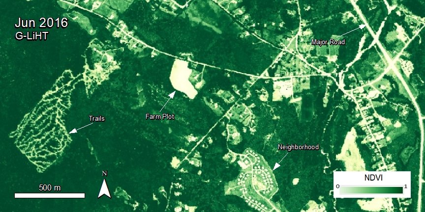
Goddard’s #LiDAR, Hyperspectral and Thermal Imager (#GLiHT) #DigitalTerrainModel data products are now available. These data provide bare earth elevation at 1 m spatial resolution over ecoregions in North America. Visit NASA’s #LPDAAC to learn more.

1
26
74


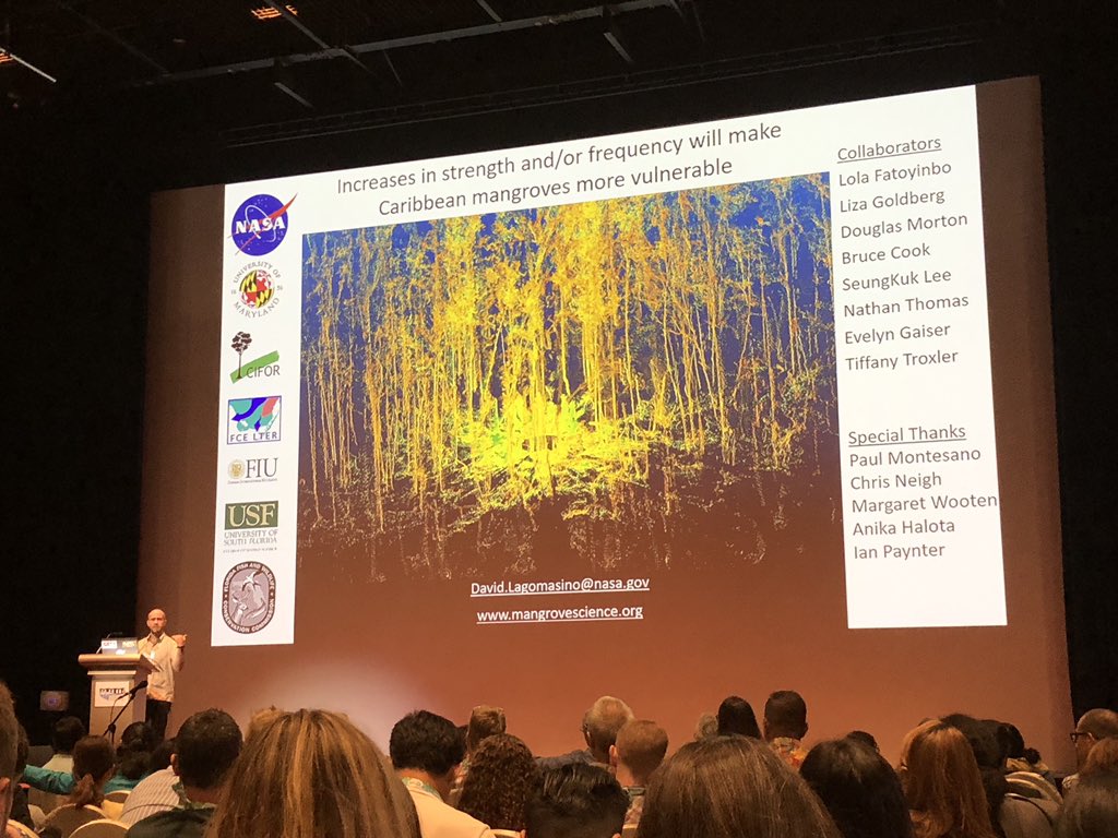
What are the effects of intense hurricanes on mangrove forests? @DLagomasino gave a fascinating talk today explaining the relationship between hurricane strength, canopy height and vulnerability at #MMM5 using @NASA_Landsat #Gliht and #GMAO data
0
7
20


A new Goddard #LiDAR, Hyperspectral and Thermal Imager (#GLiHT) Canopy Height Model dataset provides maximum canopy height and variability over forested areas and locally-defined ecoregions in North America. Discover G-LiHT data at #LPDAAC: #OpenScience

0
6
5

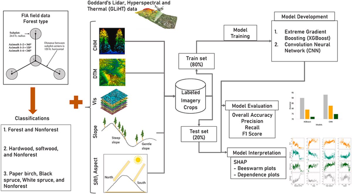
Using #Landsat and #lidar (#LVIS, #GLiHT) quantify the regional magnitude and variability in #siteindex, showing the age-dependent rates of forest growth. ➡️Montesano et al. Patterns of regional site index across a North American boreal forest gradient. 🔗

0
5
37


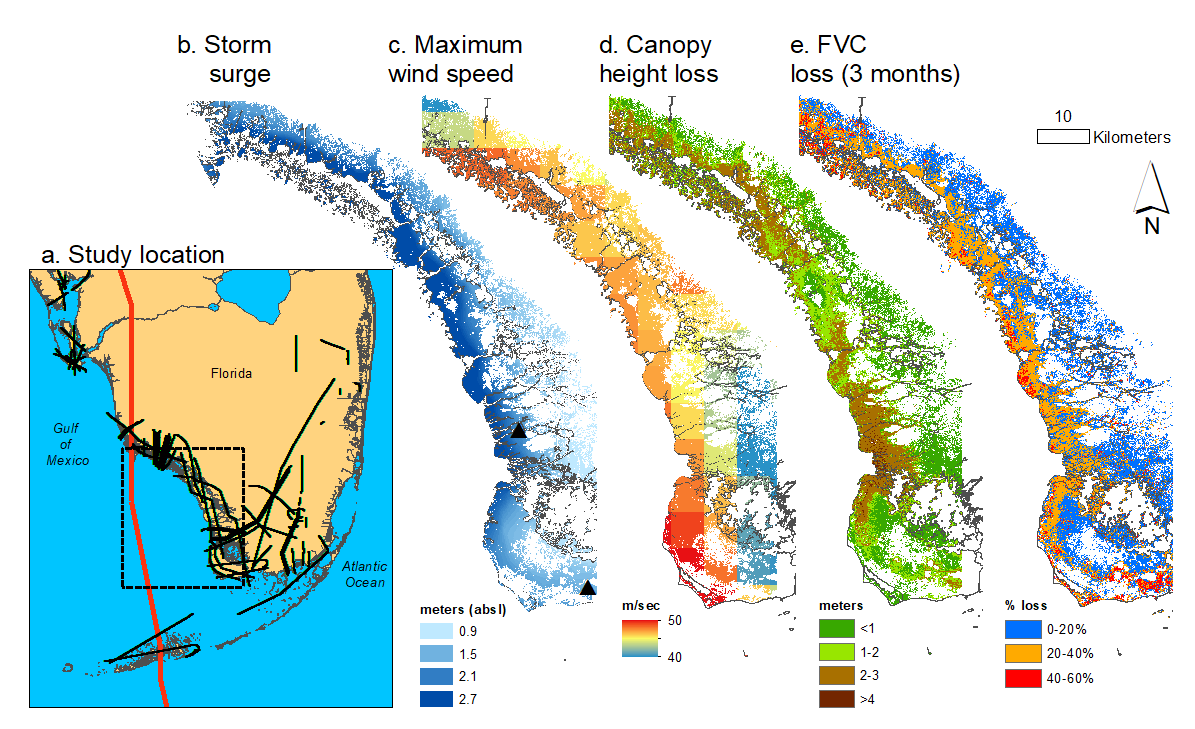
#RemoteSensing imagery from @Landsat, @maxar, and @NASAGoddard #GLiHT were collected before and after #HurricaneIrma. We used this information to follow the damage and recovery of mangrove forests in the year after the storm.

1
2
3

(The amazing digital circus) jax&ponmi .Gliht - ponmi conose el terror

3
0
4