

Mike Wulder
@mikewulder
Followers
14K
Following
11K
Media
2K
Statuses
5K
Senior Research Scientist with the Canadian Forest Service. 🍁 #Landsat super-fan. #Lidar. #Forests. #Remotesensing. 🌲🛰 Member of the #OrderOfCanada. 🎖
Victoria, BC, Canada
Joined October 2011
Canada's new satellite-based forest inventory (#SBFI) uses image segmentation to create detailed, stand-level maps for forest science & monitoring, including tree species and biomass, available via open access. #Landsat Paper: https://t.co/wuTiwDZ1VT Data: https://t.co/W64X4OTOdu
4
68
273
White et al. Enhanced forest inventories in Canada: implementation, status, and research needs. #EFI ➡️ #Lidar is operational for forest inventory in Canada enabling EFIs. ➡️ Coverage exceeds 66% of Canada’s managed forest area (~230 million ha). 🔗 https://t.co/GVwjxO0C7r
0
4
17

🔥 New study: Time-series forest stand segmentation using decades of Landsat data to track fire-disturbed areas in British Columbia, Canada. Paper: https://t.co/yaIstgMk4h
1
4
10

Tomorrow, August 26 SpaceX will launch an Earth observation–exclusive Falcon 9 mission, with 8 EO payloads. Likely the first of its kind, this is another showcase of just how rapidly the commercial EO market is growing. The satellites about to be launched include:
3
8
30
Landsat is not just famous for being the longest-running EO program. It is trusted because a pixel from 1984 still matches a pixel today, which is the result of decades of calibration, validation, and data stewardship. That continuity has been the backbone of open science and
1
1
4
Y además te va a hacer entender mejor la problemática de los #IncendiosForestales #iiff y qué podemos hacer. @rescodedios esto lo grabamos en julio, con El #Bierzo verde, sin saber que íbamos a estar rodeados de fuego. Estar informados y formados es fundamental #soyforestal

En este vídeo, grabado antes de que los incendios nos rodearan, @floralvareztab1 nos regaló su recomendación literaria para este verano. Ecomitos, de @rescodedios, nos ofrece muchas de las respuestas a esas preguntas que hoy nos hacemos.
0
1
10

“A picture is worth a thousand words.” But #Landsat’s are worth decades to the study of Earth science. Check out the change at over 100 areas around the world through the years: https://t.co/ILOtM78Ehi.
#WorldPhotoDay #EarthFromSpace
1
8
10
Curious about #GEDI mission status, competed science team projects, and applications? Look no further than our latest article in The Earth Observer👇👇👇 Summary of the 2025 GEDI Science Team Meeting https://t.co/nZEyFEW5z9 via @NASA

science.nasa.gov
Introduction
0
10
20
A new #USGS Data Release helps users verify the accuracy of clouds flagged by various cloud masking algorithms using #Landsat Collection 2 Level-1 products. Learn more: https://t.co/EbeqVDwlGi.
0
2
9

From logging to wildfires, our forests tell a story of change. 🌲🔥 See what’s being done to protect these vital ecosystems #onEarth→ https://t.co/YRinUfBmKx
0
31
136

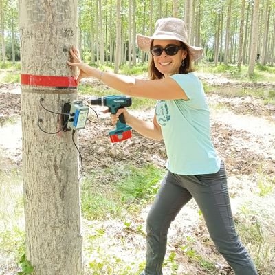
Ready to learn how to use LiDAR for research in #forestry and natural resources using #R? This week I am releasing a 7-part series to help you get started! Share with anyone you know who wants to get started. Part 1 covers acquiring, & viewing LiDAR data! https://t.co/55J69efgCM
6
101
384

What a week! 🚀🛰️❤️ Very excited the #SatelliteEmbedding dataset is now available in the #EarthEngine Data Catalog 🌎👀 — ICYMI learn more here: https://t.co/SRY1eCBA4Y (+ a small grants opportunity for researchers! 🧑💻) Can’t wait to see how you use it! 🗺️⚙️ #AEF

medium.com
By Valerie Pasquarella, Research Scientist and Emily Schechter, Product Manager, Google

The Satellite Embeddings from AlphaEarth Foundations is now available in @GoogleEarth Engine. Congrats to the @GoogleDeepMind and Geo teams and thank you to the 50+ organizations who helped test our dataset on real-world applications. Read more:
1
5
19
The NISAR mission is launching in a few hours from India. As someone working in Earth observation, I think it is one of the most important EO satellites ever because of the scale of global impact it could have. As an Indian, I am glad that it is a collaboration between NASA and
0
3
15

Our new AI model AlphaEarth Foundations is mapping the planet in astonishing detail. 🌏🔍 Scientists will now be able to track the impact of deforestation, monitoring crop health, and more – significantly faster, thanks to our new datasets. 🧵
216
682
4K

Google just released the AlphaEarth Foundations with 64 dimensions of satellite embeddings at 10-m resolution at the global scale! It is very interesting! Check it out Blog post: https://t.co/6hOBuM7pT5 Dataset: https://t.co/uWDiCFDLls Paper: https://t.co/64Ga3gguxy
#AI
13
231
1K

The 2024 State of Canada’s Forests Annual Report is now available. This year’s report focuses on the evolution of forestry in Canada and the 125 years of the Canadian Forest Service. 🌲🍃 Read the full report to learn more: https://t.co/o2MrJ1OCzR
0
4
9

Our new publication at Environmental Research Letters: Evergreen forest loss and shrub/grass expansion are quietly remaking Arctic–Boreal climate extremes, and our new Environmental Research Letters study has the numbers to prove it. By incorporating 30 m Landsat land-cover maps
0
2
10
Waite et al. (2025) find that heat & drought affect Douglas‑fir red‑edge spectral indices differently by tree size—mature trees show steeper red‑edge declines mid‑drought than saplings. #UAV #Lidar
https://t.co/opa9vGxdAa
0
1
11
#OTD in 1982, #Landsat4 was launched into orbit from #Vandenberg. Equipped with two imaging sensors, the #MultispectralScanner and #ThematicMapper, the mission represented a new era of #EarthObservation and #SpaceTechnology. Learn more here: https://t.co/GU3mJ7EGJV.
0
1
4
New release: Annual Tree Canopy Cover data for 1985-2023. This info from the USDA Forest Service Geospatial Office supplements the Annual National Land Cover Database (NLCD) for the lower 48 states produced at EROS. Explore the viewer and data here: https://t.co/7i0hIz7R2O
0
6
26
We tested ways to improve Canada’s National Forest Inventory estimates by integrating #Landsat-derived #landcover data. Combining sample-based plots with wall-to-wall maps boosted estimation efficiency and helped track tree cover change. #NFI Baral et al. https://t.co/a8wC212x8O
0
9
46