

Heather Bricca
@h_bricca
Followers
583
Following
10K
Media
401
Statuses
3K
@upnorthlive Morning Meteorologist. Stories? Email me at [email protected] - @ValpoU B.S. Meteorology & Digital Media ‘21.
Traverse City, MI
Joined October 2015
Our new @upnorthlive News Today morning show promo is done! So much hard work went into this…including our very talented creative services team. You’ll be seeing this air very soon! ☀️☺️
1
1
3

This #TimelapseTuesday, we're reviewing this captivating imagery of a pair of low pressure systems beautifully swirling over the Gulf of Alaska. This extended GeoColor imagery loop, captured by @NOAA's #GOESWest (#GOES18) satellite, spans from March 21–23 and covers roughly 53
7
107
479

#MeteorSighting: A fireball was observed by witnesses in Illinois, Indiana, Michigan, Ohio, Wisconsin, and the Canadian province of Ontario on the night of March 23. The meteor was first detected over the Michigan town of Hope. It traveled northeast and disintegrated above
57
255
975

If possible, we need your ice measurements…just watch your step and be cautious of measuring on trees near powerlines.
1
5
8

#News - @USCG Cutter Mackinaw rescued a snowmobile operator stranded on ice near #MackinacIsland, Michigan, March 15, 2026. The person was brought aboard, received medical care, & is in stable condition. The snowmobile was also recovered by the cutter. #IceRescue #GreatLakes
59
261
2K

No words to describe the experience of seeing an overhead corona aurora at THE SAME TIME as a total lunar eclipse--this happened last night on our aurora workshop. Crazy experience. The aurora was so bright and the snow glowed green under the blood moon.
40
586
5K
Rain will spread across the area this morning, eventually switching to a rain/snow mix by this afternoon. Highest amounts of 1-3” are expected across parts of the eastern U.P. and Tip of the Mitt, leading to slippery roads and localized hazardous travel into this evening.
1
4
4
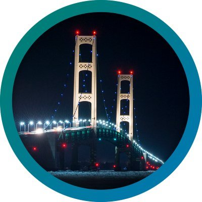
#Mackinac Bridge is closed due to hazardous ice conditions. Currently, there is no timetable for reopening. Motorists should avoid the bridge area to allow maintenance vehicles to operate. We will share more information as it becomes available.
1
13
45
A combo of heavy, wet snow and freezing rain will impact much of northern Michigan late tonight into Wednesday night. Heaviest snow and icing is expected Wednesday morning, leading to hazardous travel and the potential for localized power outages. #miwx
1
5
10
A storm system will bring mixed precipitation to much of northern Michigan starting Tuesday evening and lasting through much of Wednesday. There is high potential for 4” or more of snow across eastern Upper, and high potential for 0.1” or more of ice accumulations. #miwx
1
3
6
For #TimelapseTuesday, @NOAA's #GOESEast 🛰️ took advantage of mainly clear skies to capture 8 hours of lake ice moving on the #GreatLakes from Feb. 1. More than 50% of the Great Lakes were covered in ice as of Sunday, with shallow Lake Erie having over 95% coverage. #GOES19
3
27
119
Here's a beautiful look at (most of) the Mitten State! Note the ice cover across the Straits, Whitefish Bay, and along many lakeshores. Current Great Lakes ice cover is at 51%, which is close to 20% higher than average to start February. Image from 1/31/26 curtesy NASA Worldview.
5
69
337

Recent arctic cold and lighter winds have led to a jump in Great Lakes ice cover (43.3% as of yesterday) and now well above the historical average. This can be important for winter forecasting as ice cover can limit lake effect snow. More cold days and increasing ice is expected!
17
155
837

Absolutely stunning footage of last night’s geomagnetic storm as seen from the ISS. Russian cosmonaut Sergey Kud-Sverchkov said it was like flying straight through them. https://t.co/OrQko80SMc
66
2K
9K
Here is the latest on the major winter storm tonight into Monday. Expect a period of icing this evening from the Tip of the Mitt northward, then a transition to heavy snow and strong winds later tonight, continuing into Monday. #MIwx
0
6
14
Weather systems will impact northern Michigan late this week into the weekend. A wintry mix is increasingly likely late Thursday night into Friday, with rain, snow, and freezing rain all possible. Stay tuned to the latest forecast for updates!
0
1
4
Hey fam, cap'n obvious here, but it's windy right now (sustained winds = black arrows; red text = gusts at 7pm). Strongest winds likely thru midnight, but it will remain blustery all nite. Expect more power outages and downed trees/limbs. #miwx #northernmichigan
0
1
5

No, it's not a painting and it wasn't photoshopped either. These are polar stratospheric clouds over Iceland.😍
42
449
2K

At 5:30 PM EST, Grayling [Crawford Co, MI] Public reports Snow of 18.00 Inch. 24 hour total. Heavy snow still in progress. #miwx
https://t.co/pWBXjYV1GH
1
2
5
Resending the earlier graphic, with the corrected time stamp in the upper right corner.
0
1
7
Wondering what the fuss is about this winter storm warning? Here's what it's like under the heaviest snow bands (it's probably worse in real life b/c cameras can make heavy snow look less bad). This is I-75 btwn Grayling & Waters. #miwx #northernmichigan #drivesafe

Ferocious lake-effect snow slams the Grayling-to-Otsego Lake corridor in #Michigan, shredding visibility and paralyzing travel 🚨. #MIwx Whiteout bands hammer highways and backroads alike, burying vehicles and erasing landmarks in a blinding, icy chaos ❄️. Conditions turn
1
2
26