Dominique Evans-Bye
@StyxDvr
Followers
229
Following
10K
Media
308
Statuses
8K
Educator - Biology, Geospatial Technologies, Public Safety Diver, ROV operator
Joined July 2011

Want to create ✨STUNNING✨ maps? Say less! @John_M_Nelson shows how he created these Imhof-inspired maps in ArcGIS Online using Imagery and Terrain layers available in ArcGIS Living Atlas. https://t.co/IeDOUwqupY
1
11
65

💡 Stay connected, stay inspired! The YPN Blog is your hub for career advice, industry trends, and inspiration from rising leaders. #Leadership #Networking Subscribe and keep your edge: https://t.co/oadHDUnvXK
0
2
3


What's trending? The Cartography. MOOC! 🌎🌟 Opening day is less than a week away—save your spot today! 👉 https://t.co/dcY2ROZm8R
#GIS #ArcGIS #Maps
0
6
36

Say goodbye to manual data labeling and hello to instant insights! Our new #VisionLanguageModels can extract features from aerial images using just simple prompts. Simply upload an image and ask a question such as "What do you see?" Learn more: https://t.co/KhRHqQtKsj
0
8
32
Ever wondered how your GPS knows where to take you? It’s all about spatial data! 🚗🗺️ Learn the basics of mapping, vectors, and rasters in this free web course. 🌍✨ Start exploring: https://t.co/kkpDJY8lCz
1
12
38

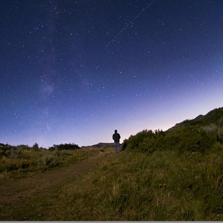
The Earth has a ‘pulse’ , and satellites help us see it.
65
306
1K
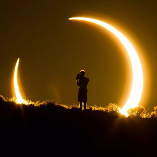
On the night of September 7-8, 2025, nearly 7 billion people — about 85% of the world population — will witness a total lunar eclipse coinciding with a SuperMoon.
189
2K
8K
Opening up #ArcGISPro for the first or almost first time? Don't sweat! We know it can be daunting. To help get you started, check out this blog containing our top 5 tips for getting started. https://t.co/PnZXY5W06w
0
3
25


Golden retriever brings emotional support duck to hydrotherapy session
75
2K
34K
🥳 One month until Cartography. opening day! Get ready to learn from experts and create maps in ArcGIS Pro—the MOOC opens August 27 🎨🌎 Register today: https://t.co/FssXY9hQaS
0
11
40
Doggo noticed that his owners were packing for a trip, so he started packing his things too
183
3K
40K

Check out these great new @ArcGISStoryMaps from the GEOMAR Helmholtz-Zentrum für Ozeanforschung Kiel on discovering the "seascapes" of the ocean floor, including dangerous hidden volcanoes! https://t.co/Xv33rlnr18 and https://t.co/zvt56iQzxG
0
3
13
Incredible close-up footage of a massive tornado near Dodge City, Kansas, filmed by Reed Timmer in 2016. https://t.co/W8ka9rOyij
11
64
559

A lava-spewing fissure has opened up along Iceland's Sundhnúkur crater row as the Reykjanes peninsula experiences another volcanic eruption.

livescience.com
A lava-spewing fissure has opened up along Iceland's Sundhnúkur crater row as the Reykjanes peninsula experiences another volcanic eruption.
0
4
6
#DYK in 2024, the median wage for geographers was $97,200? There are hundreds of jobs that require geography skills, and the diversity of careers available to graduates grows every year. Check out the AAG Job Board for all your professional growth: https://t.co/WrnKNsOu1A
0
2
5
Why lidar? Seeing how the elevation of an area has changed helps track erosion, vertical land motion, and more. Download 2022 - 2023 @NOAA @USGS lidar for Kahoolawe, Lanai, Maui, Molokai, and Oahu islands. https://t.co/3PdiDtsChL
#Hawaii
0
1
3