USC Spatial Sciences
@USC_SSI
Followers
2K
Following
3K
Media
942
Statuses
3K
We are the USC Dornsife Spatial Sciences Institute. Official Twitter page.
Los Angeles, CA
Joined January 2012
To preserve ancient knowledge and defend their land, Indigenous communities in Colombia are turning to #opensource maps. 🗺️ #ClimateChange #Cartography @forumdc
https://t.co/5EnGRJRamA
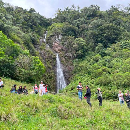
dandc.eu
For the Inga people, the Andes-Amazon region in Colombia represents far more than just the land on which they live. They defend their territory against climate damage, the exploitation of natural...
0
0
1

Who is ready for #GISDay2025? 🌎✨ Regardless of your field, GIS enables us to solve complex problems and view our world in new and exciting ways. 📣Share with us how you are celebrating on November 19, 2025! https://t.co/XmhW61F3f6
1
4
12
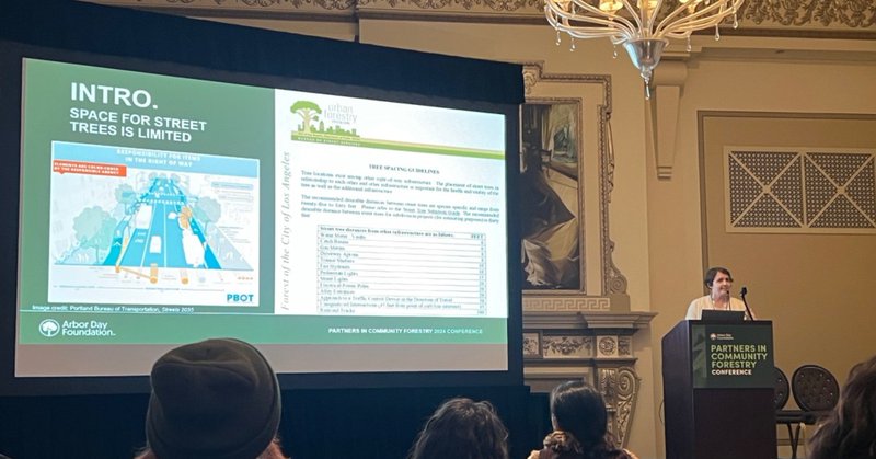
When it comes to tree spacing, there's more than meets the eye. 🌳 @USCDornsife SSI's Laura Messier, Beau MacDonald & John P. Wilson used a #spatialmodel to compare tree capacity in a low- and high-income LA neighborhood in this #casestudy: https://t.co/vknHHKlUoK
0
0
1
Students, share your work at the 2026 LA Geospatial Summit (Feb 27 @ USC). Showcase your GIS skills, connect & get noticed! 🗓 Abstracts due Dec 5, 2025 👉 Details: https://t.co/7e69q8UjGM
#Geospatial #GIS #StoryMap #USC

dornsife.usc.edu
Students in GIS and related disciplines at USC and other Southern California institutions are encouraged to apply to present their work
0
0
2
📣 Laura Messier (@USCDornsife Population, Health & Place PhD Candidate) talks #sidewalks with @FastCompany: https://t.co/fXoso840Tg
#CityInfrastructure #USCStudent
0
0
2
Want to use your #geospatial skills to highlight a cause you care about? 👫🌍🏘️ The 2025 @Esri ArcGIS #StoryMaps Competition is your chance to tell a story using #GIS tools, geospatial data, and your unique talents. Submit now through Dec. 12, 2025! https://t.co/ih4xfz91k5

esri.com
Enter the 2025 ArcGIS StoryMaps Competition. Get competition details and find inspiration for your story in our online gallery.
0
0
1
Next week: Discuss the '25 SoCal #wildfires with Gregory Elwood (@vcfd GIS). 📅 10/23 | 12:30–2 PM (PDT) 📍 AHF B57J & Zoom Learn how #geospatialtech supported emergency responders — and aids future #disasterplanning. https://t.co/iTJ3kibbUQ

calendar.usc.edu
An in-depth look at the 2025 Southern California Wildfires, with Gregory Elwood, Ventura County Fire Department GIS. Learn how geospatial technologies were leveraged to assist in disasters response...
0
1
2
Want to map the future? 🔮 @USCDornsife's Population, Health & Place #PhDProgram prepares you to pursue #publichealth issues that will change lives in a rapidly changing world. Applications are open now through Dec. 10, 2025. Start yours today! https://t.co/5R5u3auaIE
dornsife.usc.edu
USC Spatial Sciences Institute Ph.D. PHP program is a Public Health degree that combines Geography/GIS and Sociology.
0
1
1
#EarthScienceWeek starts on Sunday, October 12th! This year's theme is "Energy Resources for Our Future," which pairs perfectly with SSI's enduring commitment to a sustainable future. How will you celebrate? 🌲🌏♻️ @earthsciweek @AGI_Updates 📷 Hannah Benet | @USC Peace Garden
0
0
0

“Jane Goodall’s spirit lives on in the questions we ask, the way we study, and the deep respect we hold for the natural world.” Prof. Goodall left an enduring mark on USC Dornsife and inspired generations of students and faculty.

dornsife.usc.edu
Trailblazing primatologist Jane Goodall advanced the study of great apes at USC Dornsife, and left a lasting mark on its students and faculty
0
1
2
Congrats to the new Executive Board of #SCMappers, led by President Emerson Sonoda & Vice President Shammu Meyyappan! The @USC chapter of @youthmappers uses maps to target real-world community concerns — follow them on IG @ scmappers. Pictured: Inaugural event, 2011! ✌️🗺️
0
0
4
Xiao Huang, Peter Kedron, and @USCDornsife SSI's John Wilson & Siqin Wang didn't just get published in @SpringerNature — their book "GeoAI and Human Geography" also amassed 10K+ views in 1 month! 🤩 📖 https://t.co/0g0z9GcjwY
#GeoAI #GIS @EmoryUniversity @UCSB
0
1
2
Two weeks till @Esri's 2025 Fall Education Open House! 🏡 📅 10/15 | 12:30–5 PM (PT) 📍 Redlands, CA Tour the #Esri HQ campus, learn about internship opportunities, and meet distinguished @USCDornsife SSI alumni. Spaces are limited — register today: https://t.co/BmLA2bbpqs
0
0
3
📷 At the '25 @geospatialworld GeoGov Summit, John P. Wilson spoke about collaborative models for geospatial education and research with a focus on #geospatial infrastructure and capacity building — topics closely explored at #USC. @USCDornsife #GeoGov #USCProfessor
0
0
5
Shout-out to all who attended the @USCDornsife HSGI & GSEC Fall Welcome Event this month! 🙌 Thanks to you (and the speakers who shared their experiences and perspectives), we had an excellent turnout and inspiring discussion. #USCEvents #FallSemester
0
0
1
Our M.S. in Spatial Economics and Data Analysis program trains students to blend geospatial intelligence, urban economics, and data analytics to uncover business opportunities and solve real-world challenges. Learn more: https://t.co/pCuAJQ3zYq
0
0
1
Offered by the USC Spatial Sciences Institute and Viterbi School of Engineering, our M.S. in Spatial Data Science program equips students with the technical and analytical skills to lead data-driven projects using geolocated information. Discover more: https://t.co/OTi68odRuq
0
1
2
0
0
0
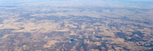
Archaeologists' satellite tools = a better, faster, more meticulous way to map forest biomass, track #carbon, and transform forest management on a global scale. 📡🌳 Full report from @sciencedaily: https://t.co/WGI8wLZh8u
#ClimateScience #AI

sciencedaily.com
A pioneering study reveals how archaeologists' satellite tools can be repurposed to tackle climate change. By using AI and satellite LiDAR imagery from NASA and ESA, researchers have found a faster,...
0
1
1