
NOAA Digital Coast
@NOAADigCoast
Followers
20K
Following
10K
Media
9K
Statuses
13K
@NOAA Office for Coastal Management is a fed govt office working w/partners to provide data, tools & info. Verification: https://t.co/uWyZK12IPJ
Charleston, SC
Joined November 2010
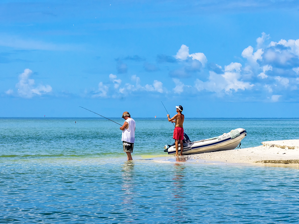
Summertime is a great time to get into a reserve!. Reserves are great spots to hike, swim, and fish. Rookery Bay Reserve in Florida boasts fishing opportunities in beautiful blue waters from the comfort of the beach or your boat!.#ParksAndRecreationMonth
0
0
1
Get the latest from NOAA’s Digital Coast! Learn about the #GreenInfrastructure database, hear how #TampaBay put economic data to use, and read about nutrient credit trading oysters in this month’s newsletter.

1
0
0
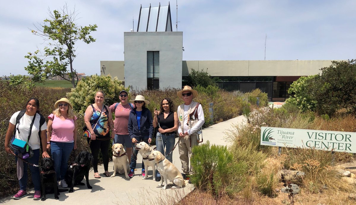
Expertly guiding participants along the Tijuana River Reserve’s trails, Ron Peterson, a docent who is blind, showcases nature’s wonders beyond the realm of sight. #ParksAndRecreationMonth
0
0
1
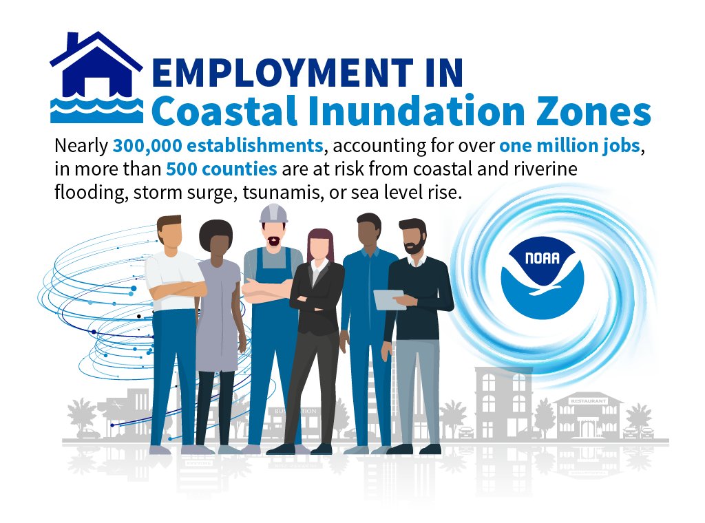
Did you know?. Over 1M jobs are in @fema special flood hazard areas in the coastal U.S. Over 1.4M jobs are in the storm surge zone for a category 4 hurricane. Learn more about employment numbers in coastal inundation zones:.
0
2
3
Why lidar?. Because you can see details in the data!. Download 2022 NOAA topobathy lidar for Swains Island, #AmericanSamoa and get the details down to the palm tree.

0
0
3
We’ve got a new web service for 2024 #VesselTraffic transit counts via the Marine Cadastre. Explore the site and find that data, the AccessAIS tool, and more:

0
0
0
When recurrent flooding cut off a main village road, Suamico, WI realized a gated culvert was the best solution. They used the Lake Level Viewer to ID at what water level the road would flood and used that info for a grant application.

0
0
1
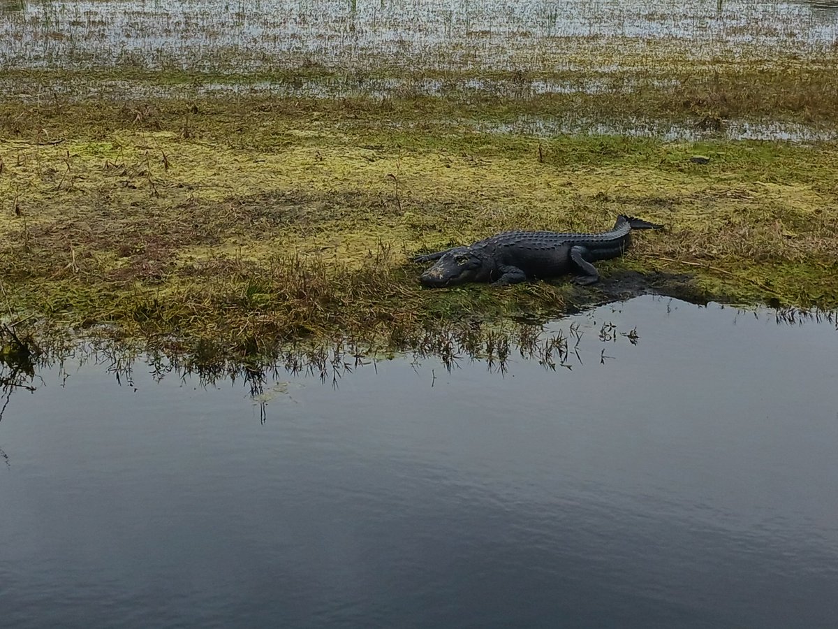
It’s Friday, and you know what that means…another #MomentOfZen to usher in the weekend. 😌. See you later,🐊. 📷: Candace Killian
0
0
2
#FeelGoodFriday: A Delaware neighborhood’s low-lying location and aging infrastructure meant recurring flooding after storms. Now, a 30-acre wetland park is solving the decades-long challenge while providing community green space. #ParksAndRecreationMonth


0
0
2
A Florida county incorporated NOAA land cover data into their watershed management plan, using cost-effective methods to achieve higher accuracy. Learn from their approach:.#GIS #WaterQuality

0
0
2
Changing water levels and more intense storms put our nation’s coasts at greater risk from flooding. Access key data like #SeaLevel trends, #GreatLakes water levels, and extreme water level probabilities to help plan for the short and long term:.

1
0
3
Use the Sea Level Calculator to explore how #SeaLevel and coastal flooding have changed in frequency and magnitude for your chosen location.
0
0
0
Hot off the presses: 2024 lidar of the Indiana coastline. Always free to download through the Data Access Viewer!

0
0
1
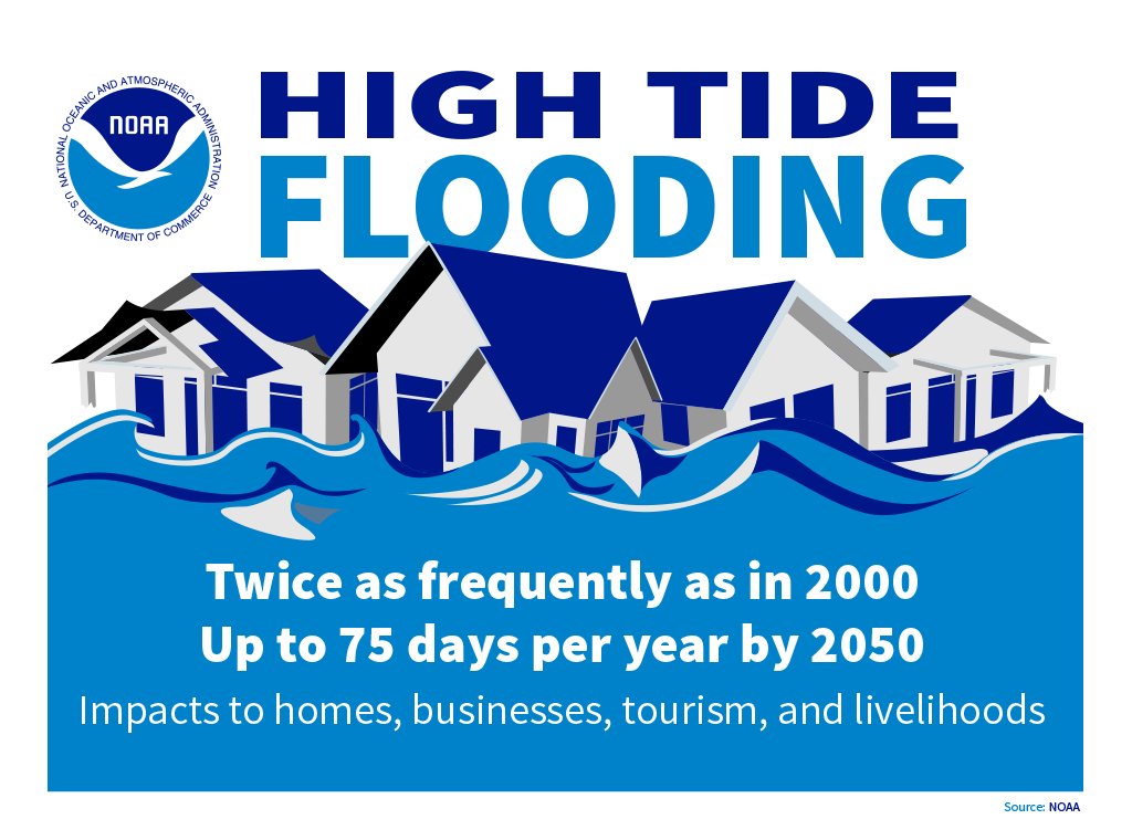
Decades of data show the national trend in high tide flooding frequency is accelerating. On the coast, high tide flooding is now more than twice as likely as it was in 2000. Find more flooding fast facts:
0
6
9
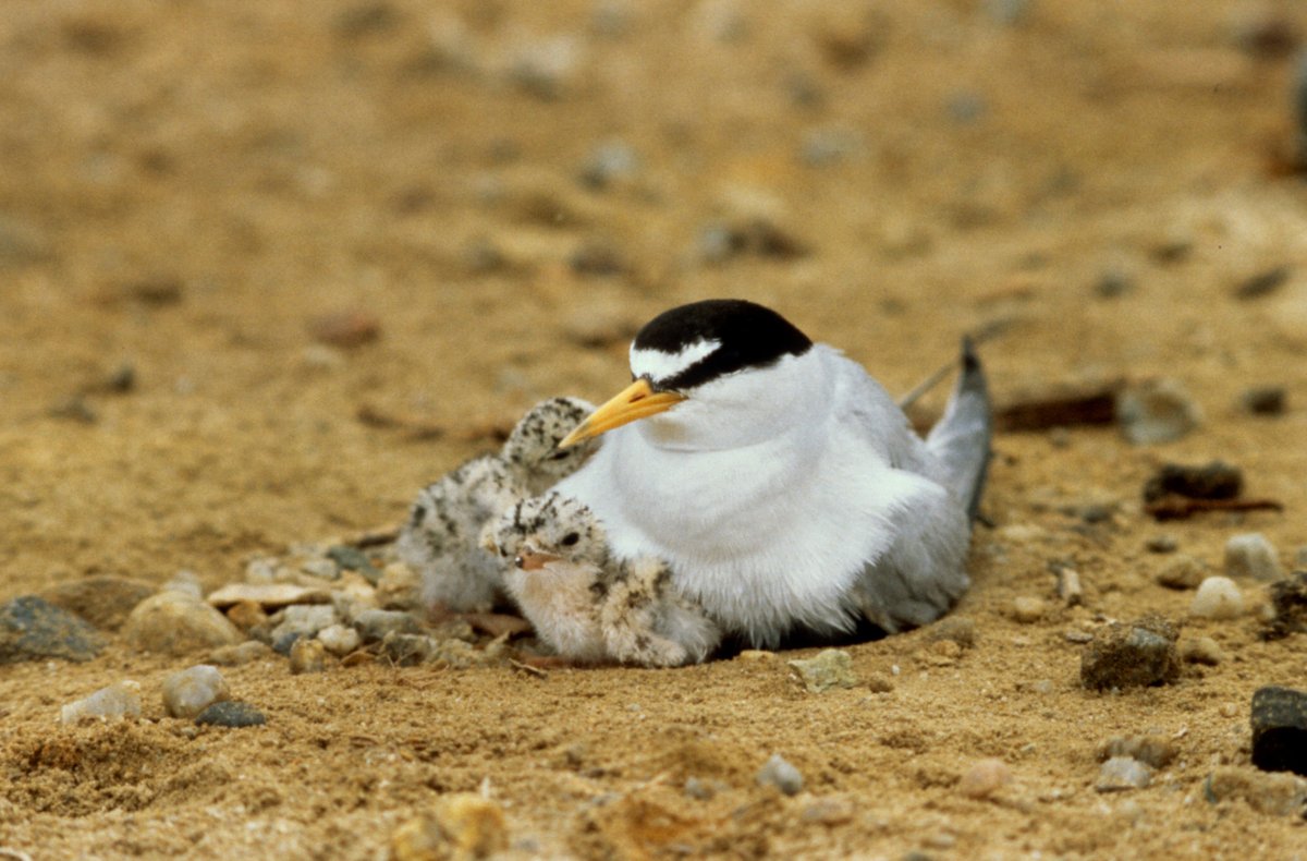
Birders of all stripes flock to the estuarine research reserves! The reserve system provides nearly 1.4 million acres of habitat where migratory birds rest and raise their chicks. Learn how NOAA & partners protect bird habitat:.#ParksAndRecreationMonth
0
1
3
Maryland coastal partners developed a program to promote oyster aquaculture in the #ChesapeakeBay while addressing water quality. Through a credit trading market, the program incentivizes using oysters to remove excess nutrients from the water.

1
0
1

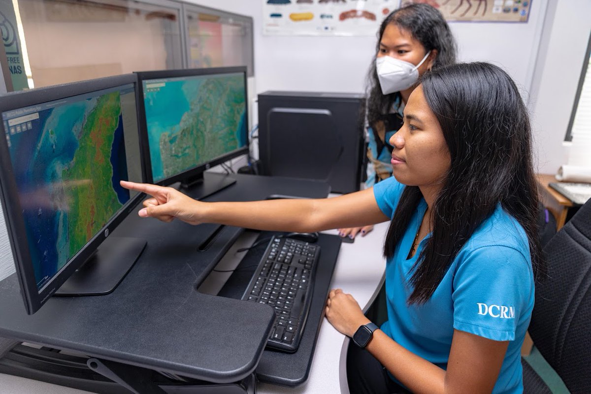
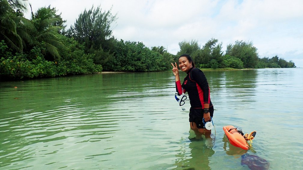
CNMI’s internship program is building knowledge and skills for future coastal managers and it’s working. 25% of current staff within the #CoralReef and coastal management programs are former interns!.
0
0
2
RT @noaaocean: NOAA's National Geodetic Survey (NGS) continues to collect aerial damage assessment images following the devastating floodin….
0
4
0
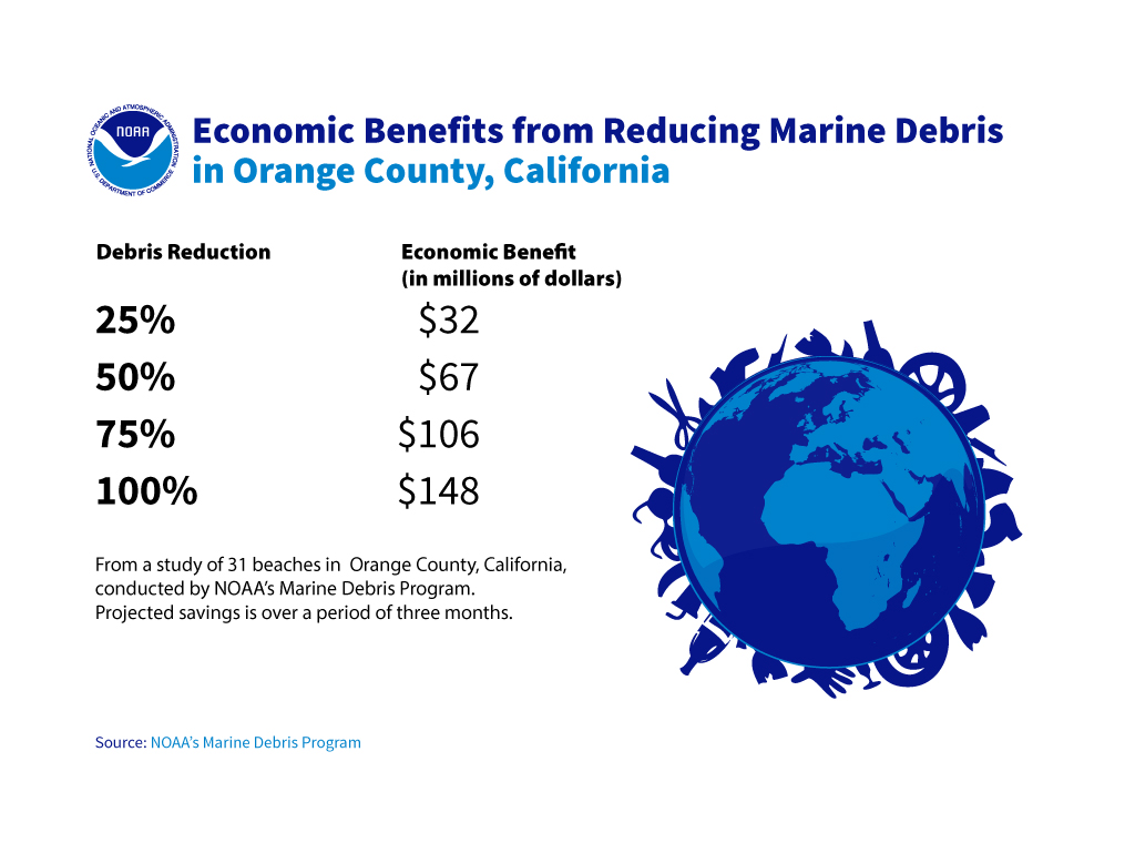
There’s a good reason to keep our beaches #DebrisFree!. In one study, Orange Co, California found that reducing #MarineDebris by just 25% resulted in $32 million in increased tourism and recreation over just the summer months.
0
0
4