
Behzad Valipour Sh.
@ShValipour
Followers
52
Following
204
Media
20
Statuses
127
Ph.D. candidate in Environmental Exposure Science @SwissTPH @UniBasel #GIS #RS #ML #Forestory #GeospatialAnalysis #Health #ClimateChange #Pollen #AirPollution
Basel, Switzerland
Joined July 2019
RT @PopDataSci_SU: Welcome to our newest member of the team Dr Behzad Valipour Shokouhi @ShValipour👋. Behzad has just completed his PhD in….
0
4
0
RT @MartinRoosli: 🆕We are hiring a #PhD student in #epidemiology. Excellent opportunity to collect experiences in all aspects of complex #e….
0
23
0
RT @geopandas: GeoPandas 0.13 is out! This new version comes with a couple of new features like a method to sample random points, sorting a….
0
26
0
RT @IEEE_GRSS: 🌍Ready to learn about the latest Machine Learning techniques for #RemoteSensing? Join our tutorials at #igarss2023!🚀. 🗓️Four….
0
39
0
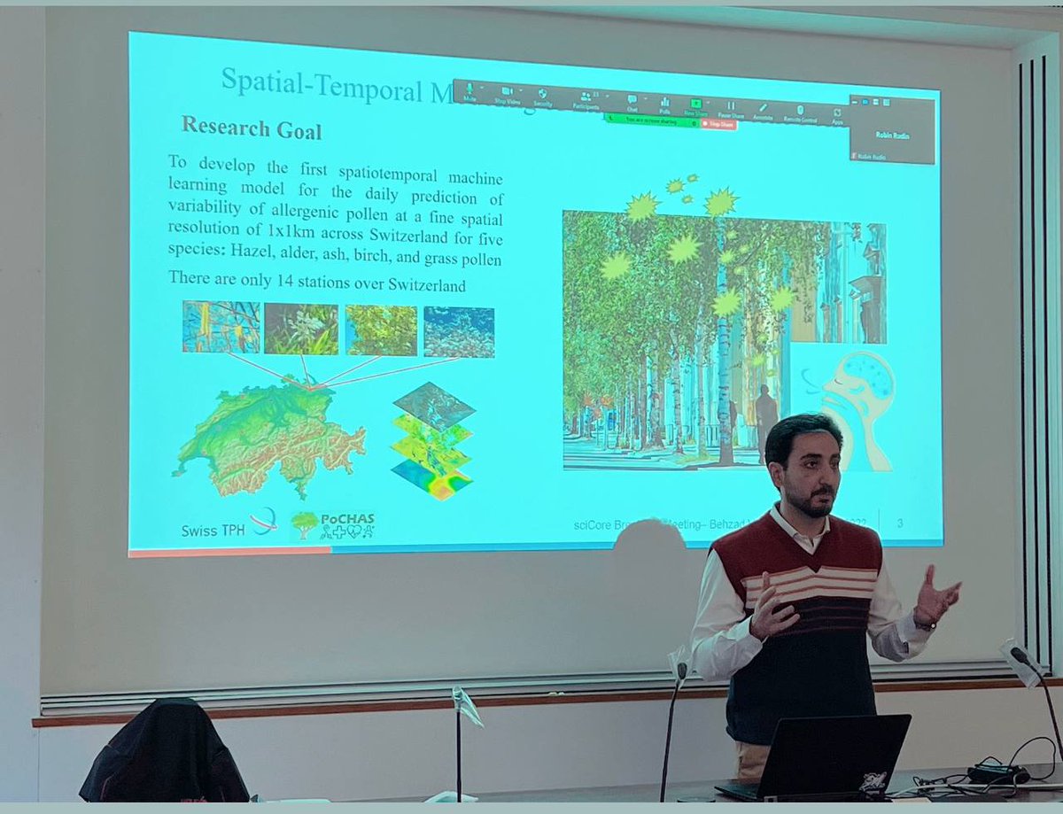
Early morning presentation in @sciCORE_Basel breakfast on how #artificialintelligence can be used to help people with #pollen #allergies, and how we can use #parallelprogramming for time-saving, and also decrease #carbonfootprint .#airpollution #publichealth #GIS #machinelearning
1
1
5
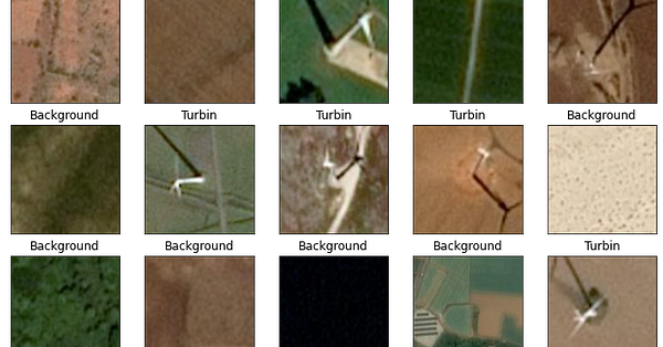
I started to implement my #deeplearning skills in #remotesensing datasets which are available in #kaggle. 🛰️ 💻.At first, I implemented image classification to classify patches with or without #windturbine .#data #geospatialintelligence #DeepLearning .
link.medium.com
wind energy today offers one of the most economical sources of electricity in most countries across the world and is a major factor in…
0
0
4
RT @darribas: This is an important stepping stone for the Geo-Data Science community 🎉🎉🎉 Boosting geopandas with Dask makes analysis at pla….
0
10
0
RT @summarizedml: We introduce TorchGeo, a Python library for integrating geospatial data into the PyTorch deep learning PsyNetecosystem. 📄….
0
17
0
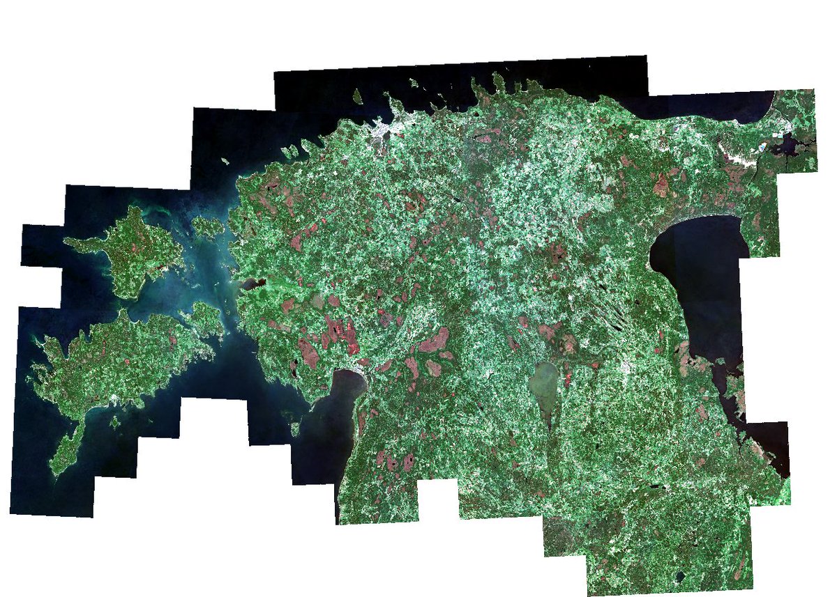
Guess where is this country? October was busy with generating 10m #sentinel2 data for #Estonia for both summer & spring using @sentinel_hub Batch API.#remotesensing #geospatial #GIS #dataengineering .🛰️💻😀💪
0
0
3
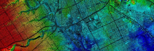
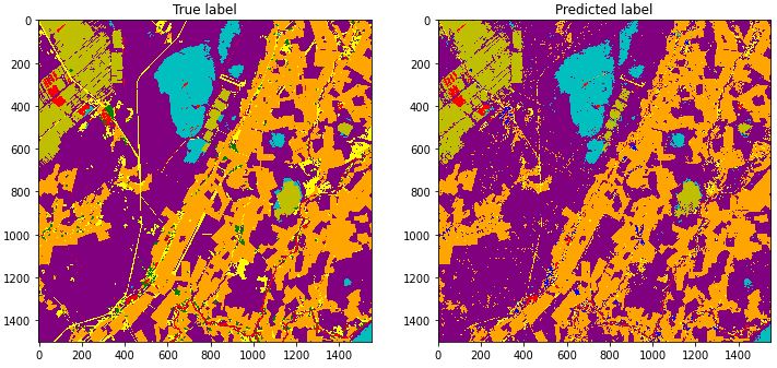
As a practice used #sentinel2 imagery to train #xgboost model for #imageclassification and predict out_of_sample data. Overall accuracy was 90%.#geospatialdata #satelliteimagery #datascience #machinelearning #remotesensing
0
0
3
RT @MSFTResearch: Today, we're thrilled to accept nominations and proposals for the Microsoft Research PhD Fellowship across Asia-Pacific,….
0
705
0
RT @opengeohub: 📣The @opengeohub Summer School 2021 goes online! Join us for free live presentations & workshops by leading #R, #OSGeo, and….
0
93
0
RT @GEOSEC2025: The full programme of the GEO Virtual Symposium 2021 is now available online. From Climate to Health to Urban topics, join….
0
45
0
RT @svpino: 5 courses in Coursera to become a Machine Learning engineer:. 1. Machine Learning.2. Deep Learning Specialization.3. TensorFlow….
0
707
0
RT @svpino: Machine learning pipeline:. 1. Project scoping.2. Data definition.3. Data preparation.4. Model training.5. Error analysis.6. De….
0
322
0
RT @OurRadiantEarth: Discover high-quality, open geospatial training data from @Stanford @GFDRR @Spacenet_AI @Microsoft @BigEarthERC & more….
0
20
0
#PoCHAS project aims to model the ambient exposure to airborne pollen retrospectively using spatiotemporal models in collaboration with @SwissTPH @meteoschweiz @bfh_hesb @UZH_ch.Read about the project here 👉 #pollen #epidemiology #environmentalexposure

0
3
5
RT @gdaltips: As already pointed out by @Saquibclimatex one can generated different state of shades using e.g. azimut and sun altitude. gda….
0
6
0