Group on Earth Observations
@GEOSEC2025
Followers
19K
Following
8K
Media
2K
Statuses
6K
🛰️ Translating Earth Intelligence with global collaboration. ℹ️ https://t.co/I3zKOfaBls #EarthIntelligenceForAll #MapEcosystems
Geneva
Joined December 2013
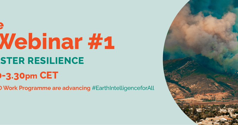
This week, we kicked off a series of webinars to explore how activities in the Post-2025 GEO Work Programme are advancing #EarthIntelligenceforAll. In case you missed it, the recording can be found here ⤵️ https://t.co/5tYqwmU1Xk
0
2
5

Do you have a story about how Earth observation strengthens climate resilience? Wth @CEOSdotORG, we are calling for Earth observation-based case studies to be featured in the 2026 CEOS Earth Observation Handbook on Adaptation and Resilience. Link below.
1
0
0
This week, we kicked off a series of webinars to explore how activities in the Post-2025 GEO Work Programme are advancing #EarthIntelligenceforAll. In case you missed it, the recording can be found here ⤵️ https://t.co/5tYqwmU1Xk
0
2
5
From coastal resilience to glacier monitoring, countries need Earth observation support. At #COP30's Earth Information Day, we were proud to hear about how the GEO community helps governments access data to respond to climate risks. Read our highlights from COP30 (ink below).
1
1
1
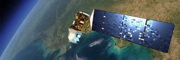
The GEO Space-Security community turns data into #EarthIntelligenceforAll to strengthen global resilience and security. Watch the recording of our recent GEO Work Programme Open House Webinar, featuring speakers including @sergio_albani ⤵️ https://t.co/5tYqwmUzMS
0
0
0
Earth observation becomes transformative when knowledge flows. Do you have a story that shows how Earth observation is improving decision-making and resilience in development contexts? Submit it now to @esa_gda_'s Impact Stories from Space Challenge ⤵️ https://t.co/CWWz5B9hBT
0
1
4

🌍 EuroGEO showcased its One Health leadership at the GEO Health CoP Annual Meeting 2025. Dr. Haris Kontoes highlighted Europe’s growing commitment to Earth Intelligence and key outcomes from EuroGEO studies & Workshop 2025. 🔗More: https://t.co/pfGZCCjW78
0
1
3
Earth observation becomes transformative when knowledge flows. Do you have a story that shows how Earth observation is improving decision-making and resilience in development contexts? Submit it now to @esa_gda_'s Impact Stories from Space Challenge ⤵️ https://t.co/CWWz5B9hBT
0
1
4
At #EuroGEO2025, GEO Blue Planet introduced the new Marine & Coastal Action Group, bringing Europe closer to a coordinated approach to marine & coastal Earth Observations. Discover more – inc how you can participate: https://t.co/ipdbTPzGm2
0
4
6

📣 Call for peer review! If you're a CBD or SBSTTA focal point, represent indigenous peoples & local communities, or work in a relevant organisation, @GEOSEC2025 is calling for review of draft guidelines for the development of national ecosystem maps ⤵️ https://t.co/lWbvIImTCq
0
2
3
Starting now. Find the meeting link here ⤵️ https://t.co/5tYqwmUzMS
earthobservations.org
The GEO Open House Webinar Series is a cross-learning opportunity to explore how activities in the Post-2025 GEO Work Programme are advancing Earth Intelligence for All. Each session in the series...
Join us on 3 December for the first session of the GEO Open House Webinar Series. This is an opportunity to explore how activities in the Post-2025 GEO Work Programme are advancing #EarthIntelligenceforAll. Find out more ⤵️ https://t.co/5tYqwmUzMS
0
1
2
[EVENT] Don't miss this thursday 4th our panel session co-hosted with @geoaquawatch at the International Ocean Colour Science meeting! We'll discuss on future challenges and needs in the ocean colour science and earth observation space. Register https://t.co/chIdnPzuaB
0
4
5
Join us today at 1.30pm CET for the first in a series of webinars to learn about GEO Work Programme activities. Speakers include Fernando Sedano (@EU_Commission), who will present the work of the Global Wildfire Information System initiative. Info ⤵️ https://t.co/5tYqwmUzMS
0
2
2
Just us on Wednesday for the first in a series of webinars to learn about GEO Work Programme activities. This week: weather, hazard and disaster resilience. Speakers include Michelle Parks (@Vedurstofan), who will talk about @GeoGsnl. More info ⤵️ https://t.co/5tYqwmUzMS
0
0
1
🌍Cities are growing fast, even as populations stabilise. Using #CEMS GHSL data, the UN #WUP25 report predicts two-thirds of global population growth by 2050 will happen in cities. Find out where tomorrow's megacities will be: https://t.co/14o4jT6Ury
0
3
9
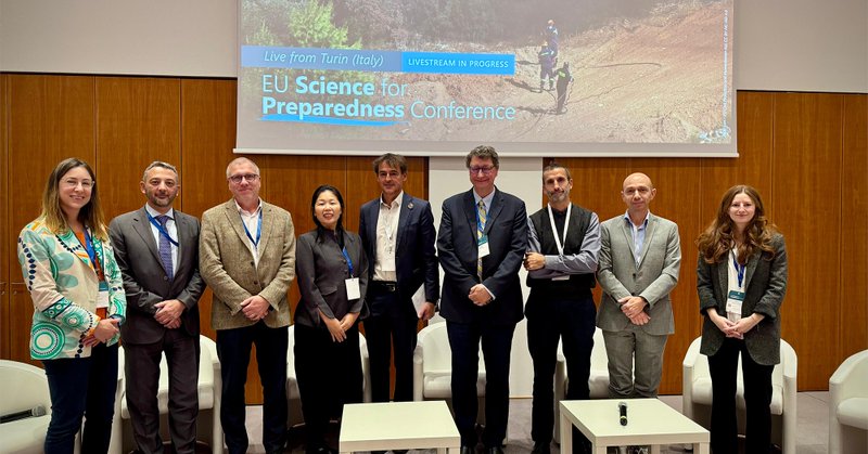
At this year’s EU Science for Preparedness Conference in Turin, we heard about growing appetite among countries to turn Earth observation data into real-world action for disaster preparedness. Read more in this new blog from @EU_ScienceHub's Thomas Kemper ⤵️
earthobservations.org
What struck me most at this year’s EU Science for Preparedness Conference in Turin was how international cooperation around disaster preparedness is expanding, with eager partners ready to turn...
0
1
1

🌍Our report from the #HumanPlanetForum 2025, where global experts showcased new open data, urban analytics and EO innovations driving better population and urban planning. https://t.co/g6vjcn0gx5
#Global2 #SustainableDevelopment #UrbanPlanning #DataForGood #Geospatial
0
2
6
📔EuroGEO Workshop Report 2025 is out! – A moment of reflection, another significant step toward our shared vision for #OneEuroGEO. 🔎Explore the full report and continue walking with us toward a more connected, capable and sustainable EuroGEO. 🔗 https://t.co/U8FqjCUxU1
1
2
3