

Robert E. Roth
@RobertERoth
Followers
2K
Following
2K
Media
204
Statuses
2K
Professor @UWMadisonGeog & Faculty Director @UWCartLab. I teach & research interactive, online, & mobile mapping. He/him. #uwcart #mapsrock
Madison, WI
Joined April 2010

Today you may take a look at the book of abstracts from the ICA Workshop on AI, Geovisualization, and Analytical Reasoning - CartoVis24 @icawebsite https://t.co/I6pRfiSjWm Thank you @iza_golebiowska @acolt @RobertERoth @KatSlomska for your work on workshop and this collection.
0
3
7
Our review paper "Making maps & visualizations for mobile devices: A research agenda for mobile-first and responsive cartographic design" is out & open access https://t.co/kmFUe74F8h Warning: It's comprehensive! 50-pages w/o the references :) cc @RobertERoth great work on this :)

tandfonline.com
In this article, we present a collective research agenda for mobile-first and responsive cartographic design. The research agenda explicitly focuses on challenges regarding design, and we begin by ...
2
8
37
Announcing: ICA Workshop on AI, Geovisualization, and Analytical Reasoning, September 7th ahead of EuroCarto 2024! Hope to see you in Warsaw this fall! https://t.co/xwijxOWrjN
0
5
26

Happy to publish our review paper on #AI in #cartography and #maps in CaGIS. My great pleasure to work with @song and @RobertERoth! We have reviewed methods, cartographic design decisions ethics. Read our paper https://t.co/EJwnGCHweC watch the video https://t.co/3GvfbMMmdL!
2
12
48

0
1
39
CfP: International Journal of Cartography Special Issue on Cartography & Sustainable Development, guest edited by @bricker & @cartofish! Indication of interest due Sept 8 (I am!)! Read more on the new @icawebsite Sustainable Development Commission website:
0
6
19
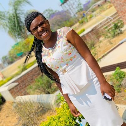
Beautiful faces from the Mapping for a Sustainable World Workshop by the International Cartographic Association in Harare today #mappychats
#SustainableDevelopment
#DiversityInclusion
2
5
10

Huge thanks to @PennStateGIS & @UWMadisonGIS for hosting a copy of my "Californian Snowflakes" map in the #EsriUC2023 showcase. Stop by to take a look, then learn how it was made in the "Map Wizardry" technical workshops today & Thu where I'll also have a special giveaway!
3
8
34
Hey past, current, and future badgers, come say hi and get some swag! We are at the Academic Fair now and will be in the Exhibition Hall all week! #uwcart @UWMadisonGeog #esriUC

0
2
12

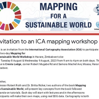
Interested in learning how to create your own global thematic maps with @qgis? Meet us @roberteroth + @ptmakanga in Harare, Zimbabwe Aug 8-9 for the free two day @icawebsite hosted Mapping for a Sustainable World Workshop - more info and sign up here
docs.google.com
This is an invitation from the International Cartography Association (ICA) to participate in a free two-day Mapping for a Sustainable World Workshop in Harare, Zimbabwe to be held Tuesday 8 August &...
0
3
2
Ch-ch-ch-changes (in our Spatial Web and Mobile Programming course)! Learn more here: https://t.co/a7u9LF2477 or at @EsriUC in just 21 days! #EsriUC #UWMadisonGIS #GISPP #GIS
instagram.com
0
2
2

#GISphere Interested in GIS/Cartography? Curious about this field? Want to apply related program? We got you covered! Join this webinar on Friday, 16 June, 3-5pm EDT at https://t.co/nF2vITL7q2
#GISalon #GIS #Cartography #GraduateStudies #gischat
3
7
13
Fresh out: New directions for the state of the art & science in cartography https://t.co/IFEZylSzrF Editorial to double IJC special issue, lit reviews on age-old (e.g., representation) as well as contemporary (e.g., virtual reality) topics! @A_C_Robinson @icaviz #cartography
tandfonline.com
Frontiers in cartographic research are often found at the intersections where cartography overlaps with other domains in art, science, and technology. In this editorial, we summarize the major them...
0
12
33
Congratulations to @thesilentcarto for successfully defending his thesis titled "Towards a Code of Ethics for Journalistic Cartography: Graphics Professionals' Perspectives on Visual Storytelling"! Extremely well done! Best of luck @WSJGraphics! #uwcart @UWMadisonGeog 📷
1
2
17
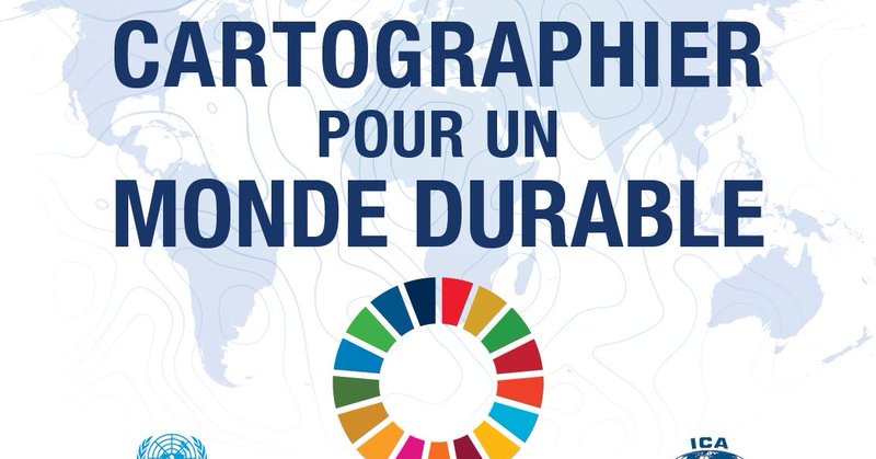
Mapping for a Sustainable World has now been published in French! download a copy of Cartographier pour un monde durable via the UN library here https://t.co/sdi0FucnQo lien direct à la publication en pdf: https://t.co/VTHa1fpFYP
#SDG #cartography @icawebsite
lnkd.in
This link will take you to a page that’s not on LinkedIn
0
4
17

Aujourd'hui, nous publions la version française de « Cartographier pour un monde durable », notre publication conjointe entre les Nations Unies et l'Association cartographique international #nationsunies #geospatial #cartographie #cartography #agenda2030… https://t.co/CyXNpbeTiA
linkedin.com
Aujourd'hui, nous publions la version française de « Cartographier pour un monde durable », notre publication conjointe entre les Nations Unies et l'Association cartographique international #nation...
1
5
10

I'm excited to announce my FIRST first-author paper, “Range Mapper: An Adaptable Process for Making and Using Interactive, Animated Web Maps of Late-Quaternary Open Paleoecological Data” in @OpenQuaternary: https://t.co/B6K0TpoHgi
2
5
14

So excited to see #RangeMapper officially out! I've been using it a ton in talks already - it's a great animated map visualization of deglacial species range shifts in North America, Europe, Indo-Pacific. And, code is extensible to new regions & taxa! Thx to @RobertERoth
1
5
17
Let's meet for coffee tomorrow! This semester’s final round of our virtual lecture series, Coffee Talk, is tomorrow at 11 am CT. We hope to see you there! https://t.co/GsGxuFUJyx
0
2
2
Posted: Slides to my @icawebsite 2023 Spring Symposium position paper "Mobile Atlases: Their Design & Use". It's good to be back in Olomouc!
0
0
6