
ᴮʳⁱᵗᵗᵃ ᴿⁱᶜᵏᵉʳ
@bricker
Followers
2K
Following
7K
Media
273
Statuses
4K
PhD, Digital Geographer, Researching accessible geospatial technologies + small islands w drones. @UniUtrecht in @UUCopernicus in @UUGeo US citizen- Marylander.
The Netherlands
Joined April 2008
Coordinating a course called Consultancy Project Aruba - proud to see students' research about rainwater harvesting featured in the local news! Minister Ursell Arends a atende presentacion di Rainwater Harvesting https://t.co/TYmRZYoMjE via @24ora

24ora.com
Diamars mainta seis studiante di Universidad di Utrecht, den colaboracion cu Santa Rosa y Universidad di Aruba a presenta nan proyecto “Rainwater Harvesting”, esta coleccion di awasero. E studiante...
0
0
5

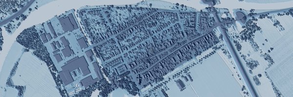
While Geo-tagged 🌍Street View Images 📸 are super useful for different research, commercial data's legal & copyright aspects can cause challenges in using them. We (W/ @HelbichMarco, M. Danish, @bricker) explored these in this 📢new paper! Check it out: https://t.co/mZv1wtFYVf
0
3
17
0
0
4
Open postdoc position - help us develop models for a just energy transition to address energy poverty - visualizations, thermal cameras and drones are involved 😃 check it out
1
1
4
Having a great time at @knag Royal Netherlands Geographic Society with geographers-playing @UUCopernicus Utrecht 2040 Game!
0
0
1
Want to join the Cartography and Sustainable Development Commission listserv? part of the International Cartographic Association @icawebsite Sign up to join the effort to Map a Sustainable World or/and learn about what others are doing

docs.google.com
Please join the Working Group (soon to be commission) for Cartography and Sustainable Development for the International Cartographic Association list serve to receive news and opportunities via...
0
3
23
Cool job alert - ASSOCIATE PROFESSOR SPATIO-TEMPORAL DATA VISUALIZATION
0
3
6
Choropleth map - animation over time displaying Share of final energy use that comes from renewable sources, 2020 - SDG indicator 7.2.1

ourworldindata.org
Renewable energy includes solar, wind, geothermal, hydropower, bioenergy, and marine sources.
0
1
3

We're thrilled to announce the recipients of the 2023 GEO #SDG Awards! 🏆 Five outstanding orgs have been spotlighted for their innovative use of Earth observations in promoting sustainable development. 🌍 Explore the awardees 👉 https://t.co/epjLVRFl3F
0
19
49
This looks like such a special and dreamy job 😍 Positionality - my parents are/were librarians and I now make and use maps

NEW JOB - Reference Librarian in Library of Congress, Geography and Map Division Information at: https://t.co/Pr3L5KawIi Please share widely
1
0
13
What is your perception of urban spaces🌇? Let us know your opinion in capturing what makes a place green🌳, walkable 🚶♂️, bikeable🚲, safe, and pleasant. Join our web app to share your perception of Amsterdam using street view images📸! https://t.co/8QyeeUY310
0
3
9
Ecosystem degradation does not affect everyone equally. Women and girls, marginalised and impoverished communities are often the hardest hit. #GenerationRestoration efforts help those affected build resilience and adapt to a changing environment. https://t.co/2b8yM9TPpg
16
146
246
📢 Help us spread the word!🌍Please reshare this invitation Let's bring together #Indigenous and non-Indigenous scholars to make a difference in #water & #EarthObservations 📌#GEOIndigenousWaterSummit Lets drive positive change! Submit your abstract by 🗓Oct. 15 More info 👇
🌊 Calling all #Indigenous & non-Indigenous scholars working at the intersection of #water & #EarthObservations Join us #GEOIndigenousWaterSummit 🗓Oct 25-27 Submit your abstracts on key topics by 📌Oct 15 📚 Topics & Submission👇 https://t.co/tzdJHoFVmz Let's innovate together!
1
18
33
Really nice to see what participants learned from this event 😀
#Mapping4SDGs Thank you @bricker and @RobertERoth for making this possible for this young network of mappers in #Zimbabwe Hats off @ptmakanga To more of these 🫶
0
0
0
Check out my talk "Understanding, analyzing and visualizing big data: A geospatial approach for the SDGs" at the Integration of Geospatial Information and Statistics for the SDGs in the context of Big Data - UN Datathon 2023 Training Webinar — UN-CEBD:
2
6
25

On this #InternationalWomensDay, @PalomaMerodio the co-Chair of @UNGGIM shares her thoughts on how geospatial information can help empower women, bridge the gender gap and help foster a more egalitarian society between women and men 🌐♀️🙌👇
1
19
52

We welcome you to the second day of the Thirteenth Session of the United Nations Committee of Experts on Global Geospatial Information Management @UNGGIM . Watch it live on UN Web TV! Connect here https://t.co/TZnkqiUWh6
#UNGGIM13
2
6
22