
Jim Cantore
@JimCantore
Followers
1M
Following
4K
Media
17K
Statuses
119K
Certified Broadcast Meteorologist and AMS Fellow. WX GEEK at TWC for 39+ years. Always awaiting mother natures latest temper tantrum. The journey is the reward.
Location: Up to mother nature
Joined February 2009
RT @SamWalkerOBX: NC 12 on the north end of Ocracoke Island is covered with sand and water from Thursday morning's high tide. [mandatory cr….
0
59
0

RT @PardonMyTake: Tuesday night max woke Big Cat up with a flashlight at 2am because he thought we were going to get sued. @forthepeople ht….
0
6
0
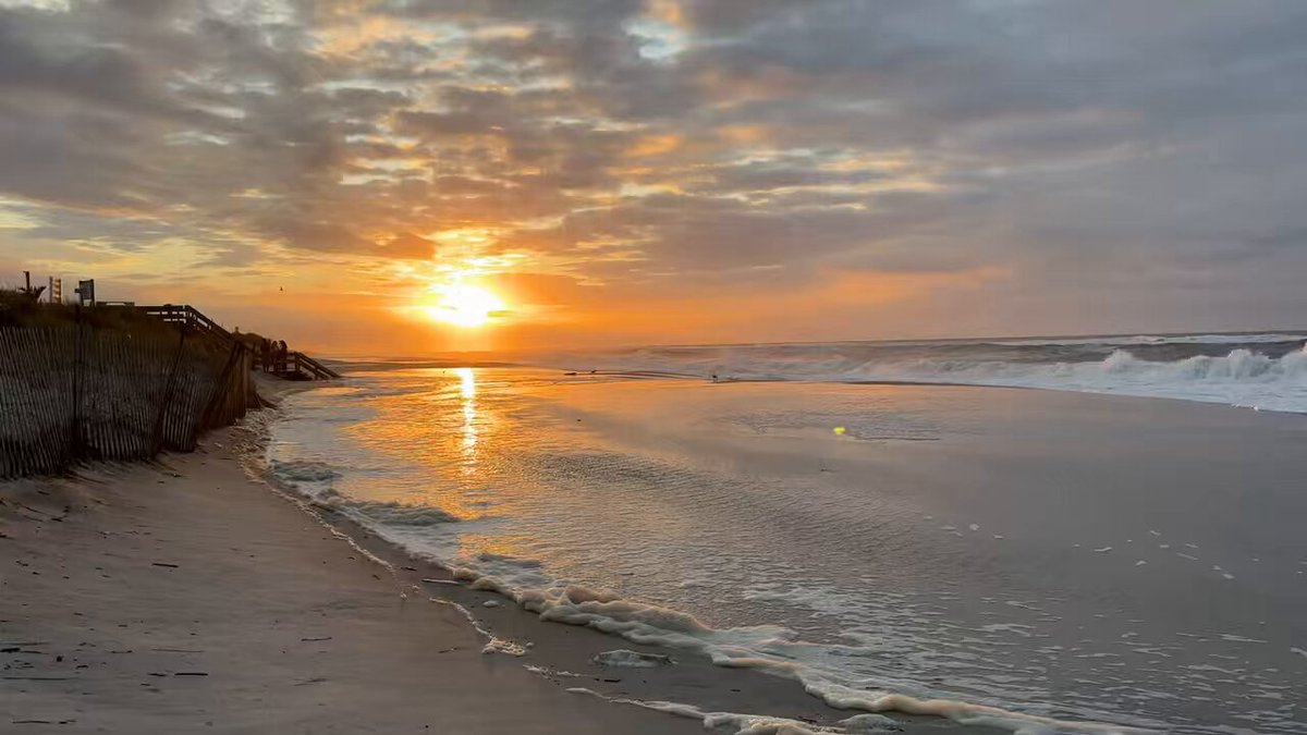
extensive wave run up in Corolla.

2
6
92
RT @Dutchmanchasing: Jeanette Pier in nags head NC, waves considerably larger than last night. #ncwx #HurricaneErin #wxtwitter @KeystonePRI….
0
7
0
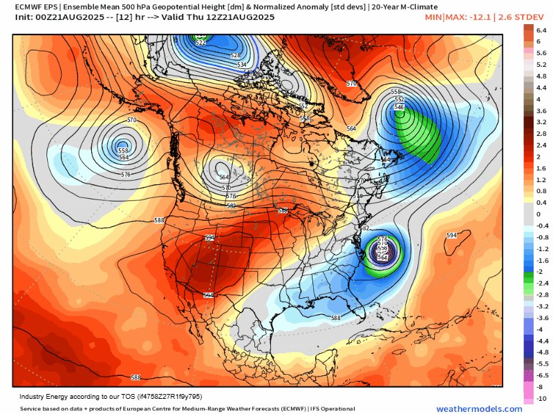
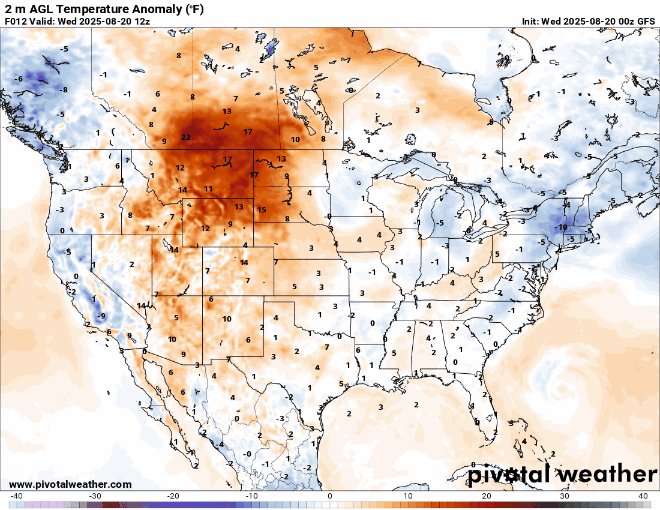
We can focus on a nice eastern cooldown (except FL, sorry) this weekend with a touch of fall. New England has already had one this week so why not enjoy another. It will also keep topical stuff away from the east coast for the moment. This pattern also has a nice moisture


11
21
273
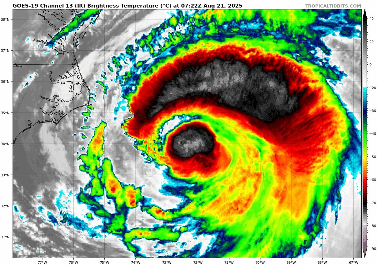
1) Gameday for Erin as it does exactly what its expected to do. Storm surge flooding, accompanied by significant wave impacts will occur today. This thing has over 600 miles of a wind field and is moving a hell of a lot of water over the ocean and towards the coastline. Stay


6
68
524
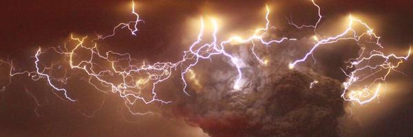
Some Yankee thunder after the epic light show!.

Nature's Thunder, followed by Yankees' Thunder!!!.1 hour and 55 minute rain delay during Yankees vs Rays Monday evening in Tampa had a crazy lightning show. After the rain delay the Yankees thundered out a season tying 9 home runs in a 13-3 win! Here's a look at the real-time
0
0
44

Always curious and full of energy, Beagles turn every walk into an adventure 🐾🎉.

88
336
7K
11 millibars down from 5am advisory! Erin on the comeback trail. 943mb latest drop.

2
6
40
Fire Island this morning with the wave run up.

Fire Island NY beach inundated at high tide this morning. #HurricaneErin #stormhour @spann @AccuRayno @hurricanetrack @JimCantore
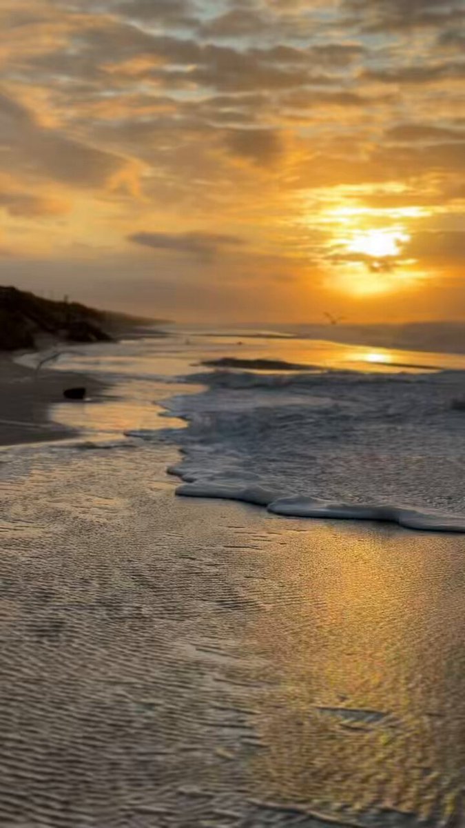
6
13
189
Some nice deep convection towers wrapping around a reinvigorated center of Erin. We will see if the wind responds to this as the pressure falls too. It really doesn't matter if its a 100mph hurricane or a 115mph hurricane over water, what matters is with an expanding wind field
7
51
356
With the bone dry conditions this could not come at a better time. Plan your hikes and your time in low ground areas accordingly.

With the Four Corners high now in place, the best shot a monsoon moisture so far this summer looks to soon be upon us! #azwx
3
5
58
Avoid the RIP! Stay out of the water till the weekend.

Rips were observed again during Tue, including this strong rip observed by Wrightsville Beach Ocean Rescue's drone. Dangerous rips & rough surf will continue Wed through Fri as swells from Hurricane Erin impact the area beaches.
20
152
974
RT @MichaelRLowry: Erin has one heck of an outer wind max this morning – almost as strong as its inner eyewall, but a whopping 100 miles fr….
0
51
0
Hurricane Erin (1) is trying to make a comeback this morning before it begins its new life as an extratropical cyclone by Friday. Regardless any recreational beach activities should be postponed till the weekend. Guidance still lowers the pressure considerably over the next 36
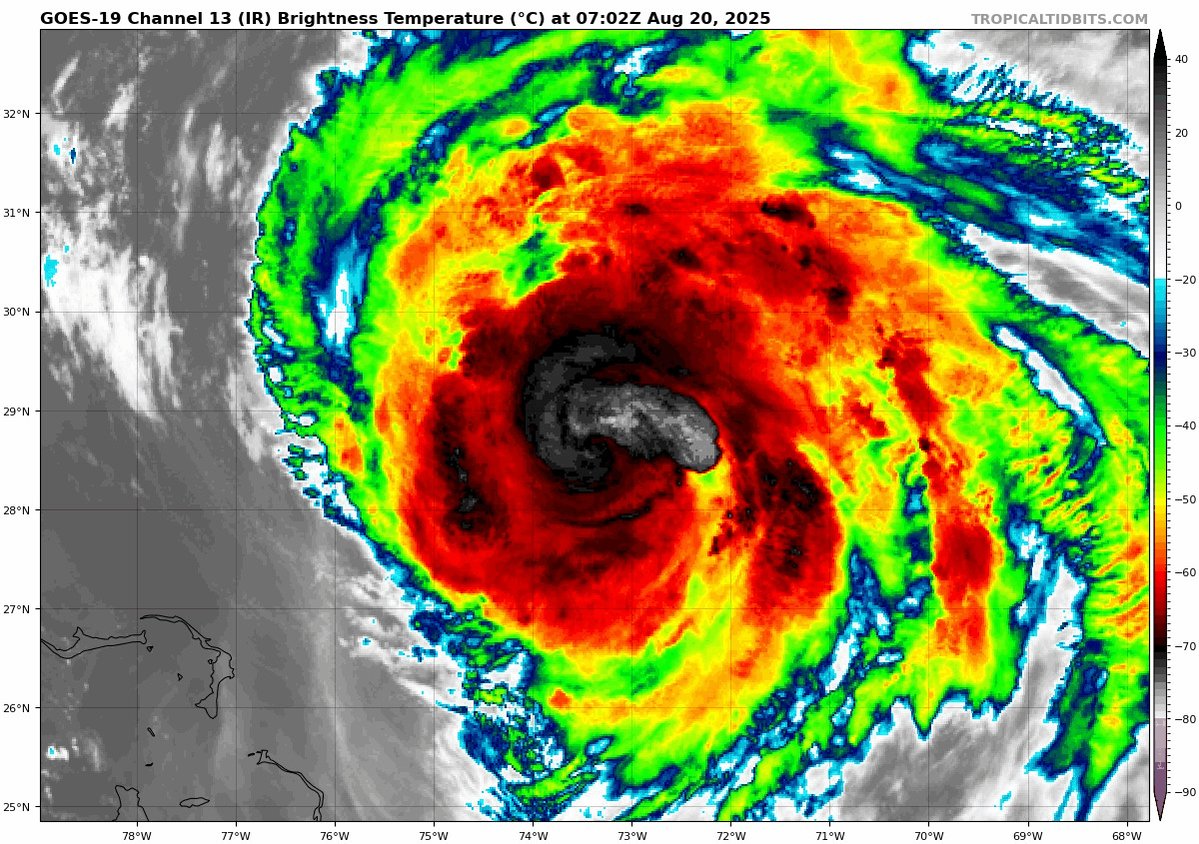


8
68
454
Signs of the cool down lasting the rest of the month in the east and even a little western monsoon! Everyone wins.

15
42
469

BREAKING: Trump is more likely to win in 2028 than Harris, despite being constitutionally ineligible

385
302
4K
Touch of Fall for many. .
Recent cool weather has it feeling like Autumn across Vermont and northern New York. We'll warm up over the weekend, but the following cold front next Monday will bring chilly conditions, potentially nearing the freezing mark in cold hollows of the Adirondacks next week.

10
9
182
Heavy Rain NOT associated with Erin, but with a front continues to prompt FLOOD WARNINGS for southeastern VA in Northampton and Accomack counties. Car stuck in water in Accomack on Front Street earlier.
5
19
127
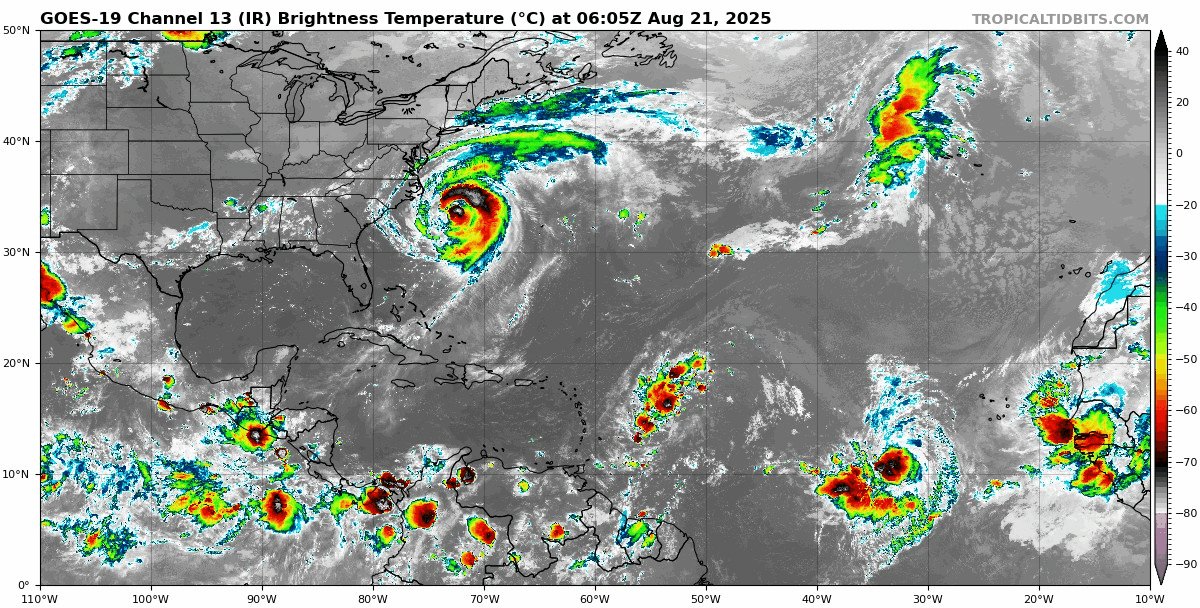
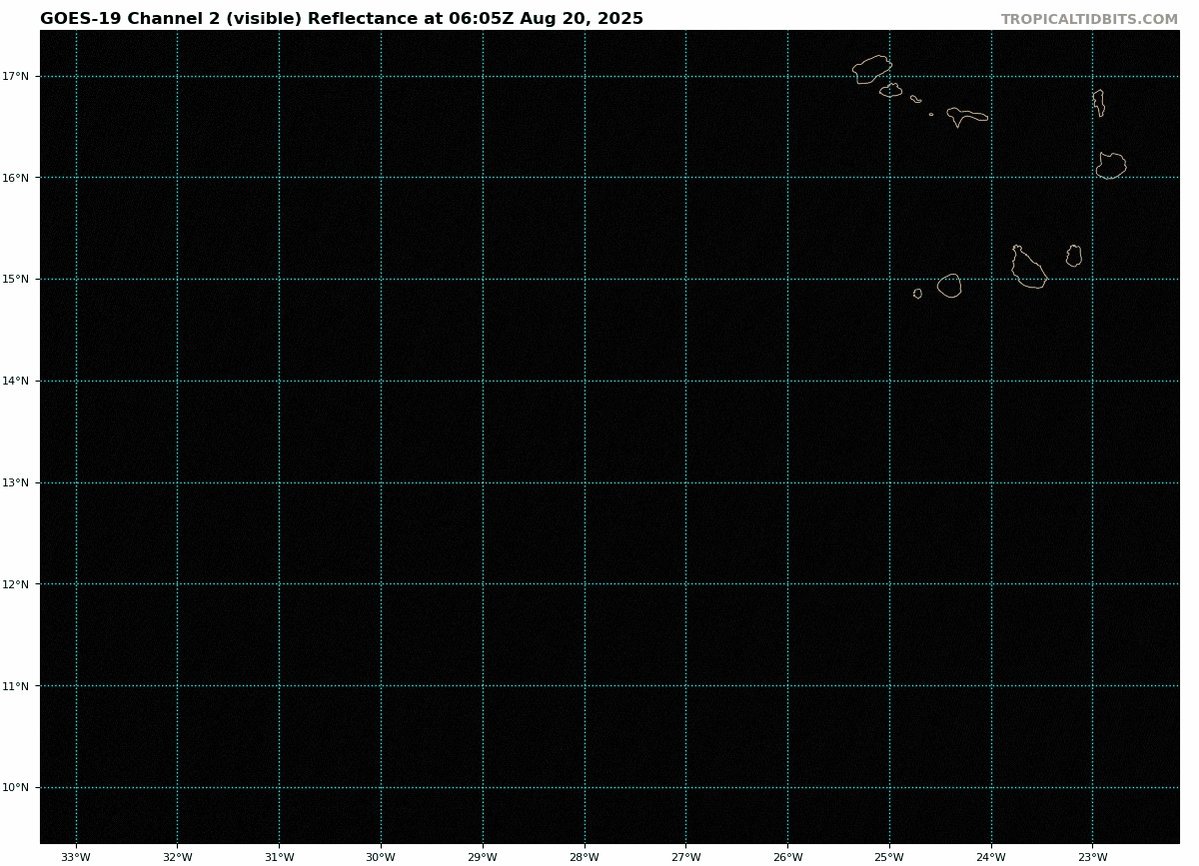
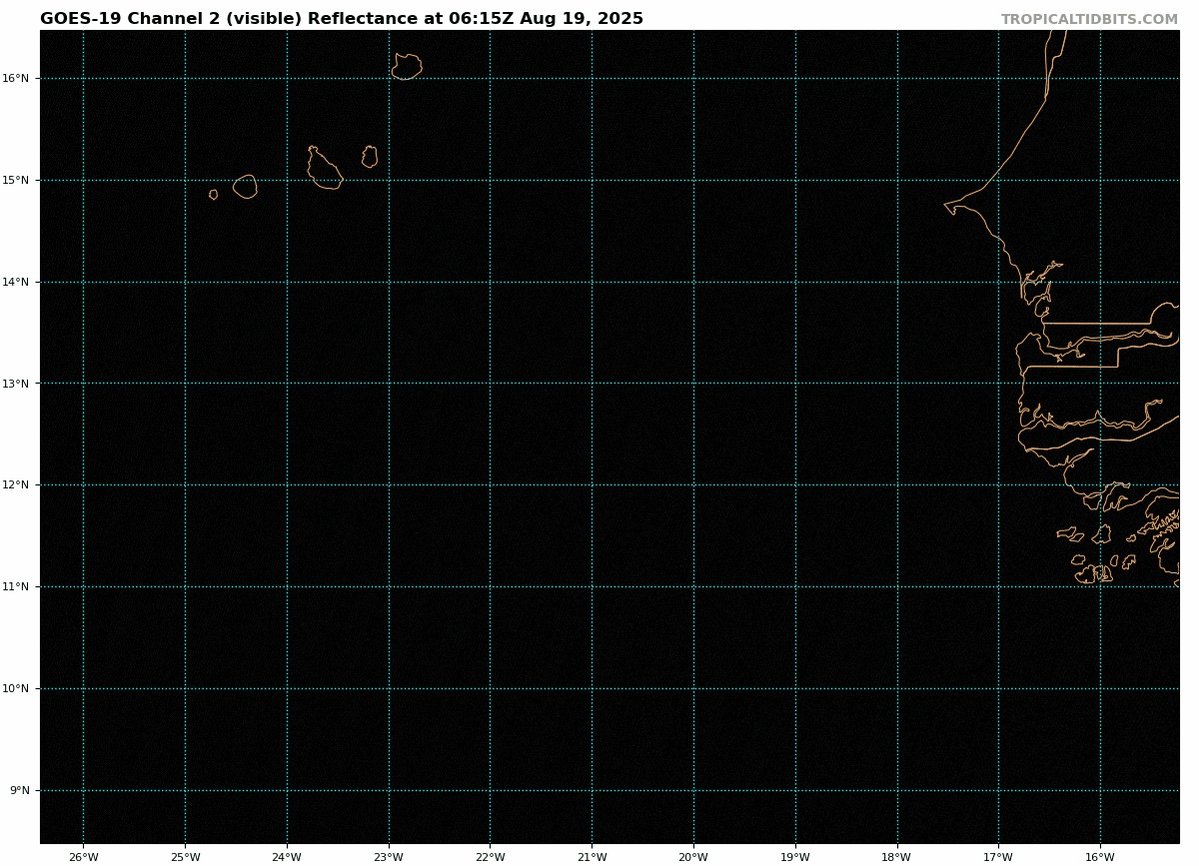
Here is a look at all the spinning and the early visible loop of 99L (~13N 23W) which looks rather robust and close to impacting the Cabo Verde Islands that got trashed by Erin before it was Erin. Several lives were lost there. 99L looks healthy this morning.

5
18
230