
Dónal Casey
@Pearoid
Followers
946
Following
6K
Media
158
Statuses
2K
Urban Planning, GIS, Cartography.
Joined March 2013

NEW: We've tracked the world's largest iceberg, A23a, and it's on the move again! It travelled along the seafloor ridge from the Filchner Ice Shelf to past South Orkney islands, pushed by currents, and is now in deeper waters en route to South Georgia.
7
20
80

It's time to log off. People are ingesting too much negative news, and it’s not only affecting them personally but impacting society at large. Psychology experts say you need to know your limits—and when to put down the phone.

wired.com
There’s a devastating amount of heavy news these days. Psychology experts say you need to know your limits—and when to put down the phone.
8
41
114
Place names with 'bear' overlaid on black bear habitat in North America:
1
1
3

🆕📘 'Merging statistics and geospatial information, Experiences and observations from the national statistical authorities, 2016–2020, 2024 edition'. Read it here ⬇️
0
3
9
Interesting read:
petapixel.com
How Germany lost its spirit of privacy in the face of technological progress.
0
0
0
Very interesting article:
undark.org
By analyzing reports of people who got off track, researchers are advancing the science of “lost person behavior.”
0
0
2

Population of the Republic of Ireland by birthplace and age-group in 2023 https://t.co/dpNmPMEEat
9
15
58
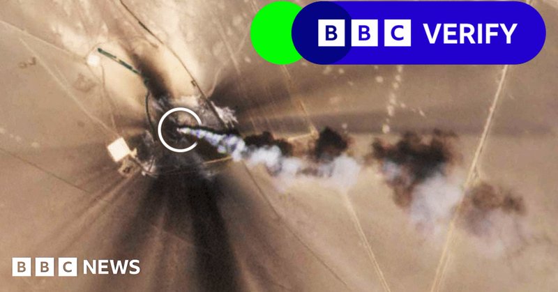
NEW: One of the worst methane leaks ever recorded revealed. Using satellite data, scientists estimate 127,000 tonnes of methane escaped from an exploratory well in Kazakhstan. We analysed @planet satellite images to understand exactly what happened, from the blowout to its fix
8
48
123
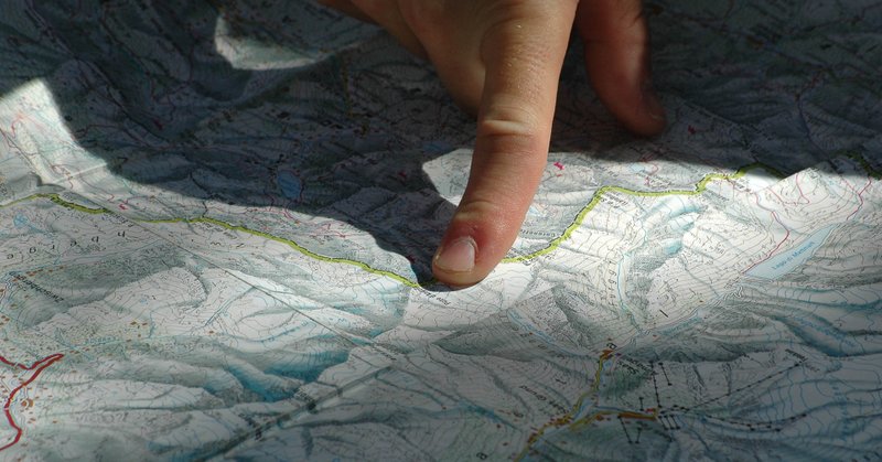
My analysis of finding the most remote building in Ireland: https://t.co/A2cc7frHzk
#remoteness #QGIS #Ireland
0
0
5

I also looked at a good few streets such as 'Woodstreet' which joins the N77 outside Portlaoise. Besides from OSM, I cannot find any record of it. Officially it's the 'L26812'. There is a wood design business on the road which may explain the name on OSM. (3/3)
0
0
0
The reason they were disappointing is that the longest streets and roads were colloquial names such as the below. OSM refer to it as 'South Perimeter Road' whereas the actual road signs (and MapGenie) refer to it as the 'R108' (2/3)
1
0
1
Being a quiet New Year's Day I thought I'd take a quick look at what the longest road and street are in Ireland. I downloaded the data from geofabrik and processed it using Osmium and GDAL then ran a few SQL queries in PostGIS. The results were disappointing (1/3)
1
0
0

About 1.2 million people die from tuberculosis every year. Until now, however, we didn't cover this infectious disease on @OurWorldInData, it was an important gap in our publication. @salonium and @f_spooner changed this. Here is our new page on TB: https://t.co/5d892nWE1l

ourworldindata.org
Tuberculosis is still among the most common causes of death globally. Explore global data on tuberculosis and its trends over time.
4
31
108

Et si les villes devenaient des montagnes, collines et plateaux, et les campagnes des mers ou des lacs ? Voici une carte de la France version "topographie humaine", tout juste finie ! 🗻👥🗻
73
416
2K

New paper just dropped (I think that's what you say) on Valeriepieris Circles, aka Yuxi Circles "The Valeriepieris (VP) circle is the smallest circle containing half of the world's population." It's very cool and does it for countries as well 🤓🥳⬇️ https://t.co/BpIReYTKsx
4
8
47

Check out my new website that scrapes and formats random entries from cia world factbook json files
2
1
9

Day 27/28 of #30DayMapChallenge: Dot / Is this a Chart? To finish off my maps for this month's challenge, a somewhat experimental visual of NZ Wikipedia articles by view count, as tagged in OpenStreetMap.
3
14
127

Night time satellite data is one of the most promising proxies for economic growth. • How does it work? • How accurate is it? • What are its issues? Having worked on this extensively during my PhD and after, here’s everything you need to know:
1
28
130