
Andrew DC 🌈
@andrewdc_nz
Followers
1K
Following
4K
Media
216
Statuses
1K
Cartographer and award-winning procrastimapper. Follow @themapkiwi to keep up with my mappy projects! 🇳🇿🏳️🌈 he/him https://t.co/KmiNf1gZUL
Christchurch City, New Zealand
Joined December 2009
Here's my interview with @ArcGISStoryMaps about last year's award winning @nelsoncitynz Climate Adaptation story map!.

Meet Andrew Douglas-Clifford—cartographer at @TonkinTaylor + 2022 #ArcGIS StoryMaps Competition winner for storytelling w/#data. Andrew used 3D #maps & other impactful #dataviz to show coastal flooding projections in NZ. #climate . Read about his work🏆
1
1
8
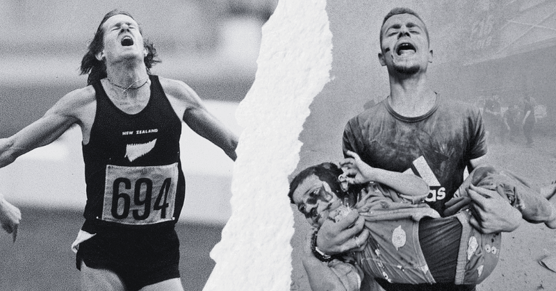
RT @JoelMacManus: In 1976, New Zealand's silence on apartheid led to an Olympic boycott and left a lasting black mark on our international….
thespinoff.co.nz
The 1976 Olympic boycott over our silence on apartheid left a black mark on New Zealand’s reputation. Our inaction on Gaza could leave another.
0
31
0
RT @HaydenDonnell: in my latest column I have created a data visualisation on the dilemma facing local councillors .
0
15
0
RT @HaydenDonnell: in what will be remembered as an innovative and possibly foolhardy move, I have tried to include numbers and even a grap….
0
18
0
RT @themapkiwi: An expedition to the New Zealand Pole of Inaccessibility (the most remote place in New Zealand) is not for the faint of hea….
0
1
0
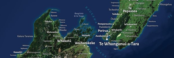
RT @themapkiwi: Some long awaited updates to my interactive Te Reo Māori Place Names map, with a brand new look, search and even more detai….
0
1
0
RT @ShijiaWendy: 🆕 #3Dpainting #MapArt: 𝐌𝐭. 𝐓𝐚𝐫𝐚𝐧𝐚𝐤𝐢 & 𝐏𝐨𝐮𝐚𝐤𝐚𝐢 𝐓𝐚𝐫𝐧. Inspired by my trip to the area last month. I didn’t get to see the mo….
0
14
0
RT @simongerman600: Regular reminder to keep these three statements in your head at the same time: The world is awful. The world is much be….
0
39
0
Day 30 of #30DayMapChallenge: The final map. To sign off this year's mapping challenge, I'm making it easier to discover the locations of my mapmaking over the years in NZ and around the world - a truly staggering number!. View it here:.

0
1
8

Day 26 of #30DayMapChallenge: Micromapping . A stretch of central Christchurch street contains an eclectic mix of 21 lamp posts from cities all over the world, donated following the 2011 earthquakes 💡

0
3
44
Day 24 of #30DayMapChallenge: Circular Shapes. Christchurch's Botanical Gardens were established with the first oak planted in 1863. Today, visitors to the gardens and surrounding Hagley Park are greeted by trees young and old, big and small!

0
7
75
Day 22 of #30DayMapChallenge: 2 colours . Taking the stricter interpretation that the map background counts as a colour (and because I'm enjoying this style), here's a wine themed map of vineyards in Marlborough's Wairau Valley around Blenheim.

1
4
41
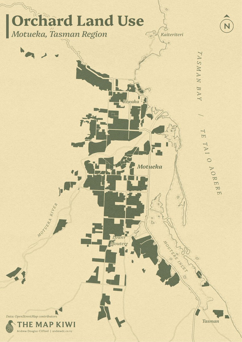
Day 20 of #30DayMapChallenge: OpenStreetMap . The Motueka area, situated northwest of Nelson in the Tasman District, is well known for its many orchards.
0
1
6
RT @ShijiaWendy: #30DayMapChallenge Typography.Same tools and process as used in the last post:.generating landscape model from LiDAR data….
0
65
0
RT @HaydenDonnell: As always I recommend reading the article and supporting our beautiful dying media industry but this gives me a chance t….
0
106
0
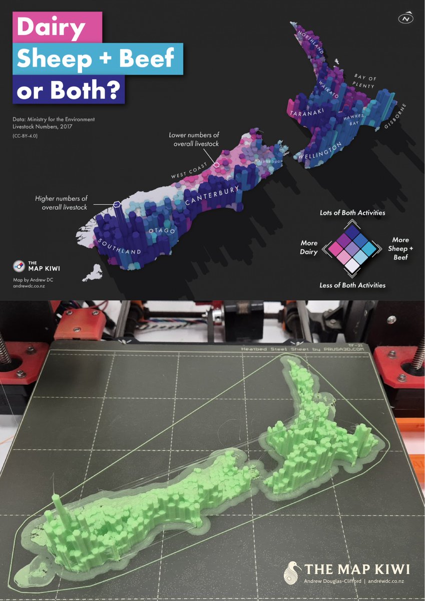
Day 18 of #30DayMapChallenge: 3D . I recently had a chance to experiment with our office 3D printer, so here's my previous livestock counts map rendered with physical materials! .You can find the original map here:
1
4
13
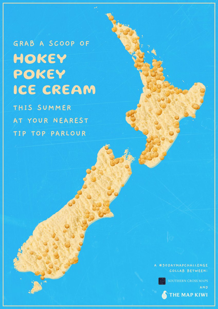
Day 17 of #30DayMapChallenge: Collaborative map . With summer just around the corner, here's a tasty Hokey Pokey ice cream map. This map was a collab with Sam Keast (@SouthCrossMaps)!
0
1
10
Day 15 of #30DayMapChallenge: My data . Using geolocated photos and tracks from my European overseas experience, here's which cities I took the most photos in!

0
2
11
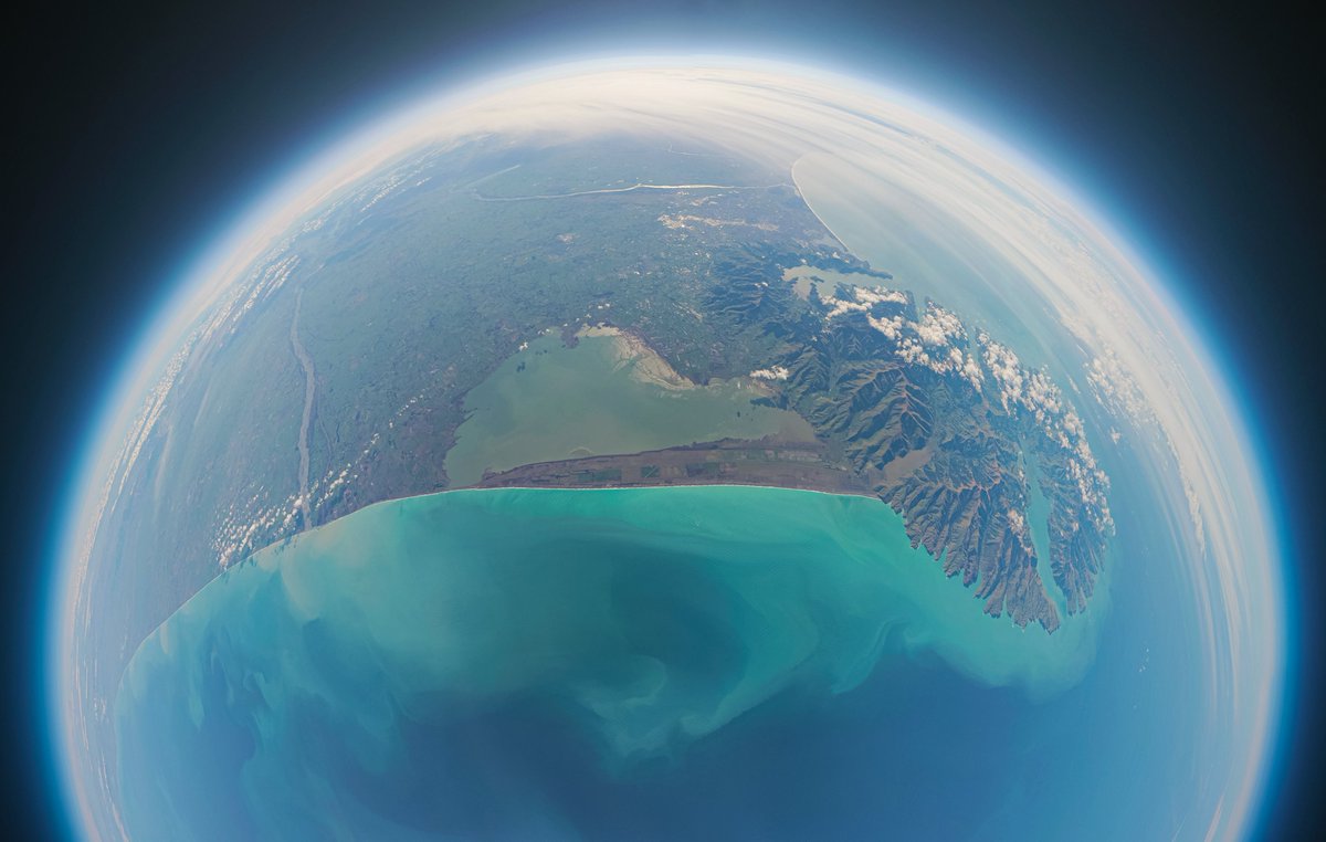
Day 13 of #30DayMapChallenge: A new tool. Today I'm trying out the AerialOD height mapping tool to produce this render of New Zealand's Pole of Inaccessibility, the furtherest inland point from the coast or roads!

1
7
80