
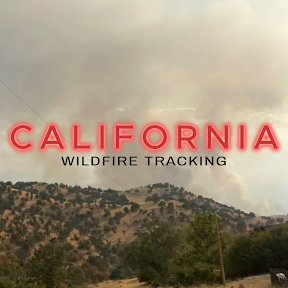
Kathryn's World - Wildfire Tracking Team
@KWildfires
Followers
1K
Following
4K
Media
90
Statuses
3K
Live, often 24/7 - during crisis. YouTube stream Coverage of West Coast wildfires. Your facts-only resource. Evacuation / survival info. Team leader.
Joined August 2021

With more winter weather in the forecast going into the new year, now's the time to make sure you're prepared. Visit https://t.co/ZXWES45Ewd and stay tuned to the weather as you make your holiday plans.
0
1
1
You can't make this up...A building on Columbia Blvd, is currently on fire due to "fire weed whacking." Smoke is filling a bathroom after flames went into the siding. 😅 I'm listening to "Portland Area Fire and Resccue." @ScannerRadio

scannerradio.app
Multnomah County, Oregon
0
0
0

A British Columbia government report foresees more than 3,400 fatalities and more than 10,000 injuries if an earthquake with a magnitude of 9.0 strikes off Vancouver Island.

cheknews.ca
A British Columbia government report foresees more than 3,400 fatalities and more than 10,000 injuries if an earthquake with a magnitude of 9.0 strikes off Vancouver Island.
13
3
12

Wild lightning show over the Oregon coast! ⚡️ Be prepared as dry thunderstorms are in the forecast for Oregon, Montana, Idaho, and Washington over the next two days. #WAwx
0
14
30
https://t.co/0EKSiZnpkr The best channel to listen to the desperate fight against dozens of wildfires rampaging in California. Chinese Camp is burning. Battle to save it and Murphys happening now. Not just the Sierras, Hayfork has a plume. Half-dollar hail, thousands of strikes

broadcastify.com
Calaveras County Sheriff, Calaveras and Tuolumne Counties CAL FIRE Dispatch Live Audio Feed on Broadcastify.com
0
2
6
Lightning storm of decade is ripping across the Sierras. Currently over Tahoe, headed for Quincy. Multiple structures "involved" in Chinese Camp. Burning more than an hour. One of the best gold rush towns. Not enough aircraft. Our heroes are doing their best, but "out of water"

3
5
13
INCIDENT: #27Fire The fire is 100 acres and burning in the foothills of the Sierra within Calaveras County. The southern part of the city of Murphys is under an evacuation order, as well as other rural areas around Vallecito to the south.
0
6
14

#BurdoinFire This fire has been marked as fully contained and should stay confined to its boundaries, FINAL UPDATE
0
1
4


Flying over any type of emergency scene without permission could result in fines or arrest. Drones over an emergency scene means responder aircraft and resources have to avoid the area. Don't be the cause of an accident or escalation of an incident.
0
3
4
A plane crashed at HIO (Hillsboro-Portland) airport a few hours ago. My YouTube mod/pilot Seaprobe was there at the time. 2 occupants climbed out - after hard belly landing w gear collapse. Fuel on board, but no fire. Glad everyone is ok!
0
1
8
this memorial to the ones who died in the fires just out side of town
0
3
11

North Ops fire: Rapid drying = fuels to become noticeably more flammable with longer burn periods due to poor overnight RH + warm nighttime temps. Dead Fuels: ERCs well above the 97th percentile and "setting new daily records" for the North Coast. Others: 85th to 95th %. #cawx
0
4
7

A capture from this afternoon as a helicopter drops water on the #GiffordFire. You can see conditions live from multiple ALERTCalifornia cameras at: https://t.co/ZiIPL38bds
2
6
20

CAL FIRE firefighters making access to the Ponderosa Fire. The vegetation fire is located North of Marysville Road and East of Willow Glen in the Dobbins area of Yuba County.
5
17
97
Several new fires are taking off this afternoon in Northern California. The Ponderosa Fire, in the Yuba County Foothills has the most potential for damage to communities. The second new fire (Clark Fire) is burning near Little Valley, in northern Lassen County. Our biggest fires
0
21
94

One month after the Oakdale fire, community still searches for answers

chicoer.com
One month ago, on July 1, just before 6 p.m., a fire and subsequent explosion at a fireworks storage facility in Esparto resulted in the death of seven people, leaving an entire community mourning …
0
1
1

Shout out to the Aviation Photographers out there that capture stunning photos like this of 10 Tanker in action! We love seeing what you all capture and thank you for sharing your talent. 📸: @Ryan9186695315
#10_tanker #ReadyToServe #WildfireReady #VLAT #inthistogether #dc10
4
39
239

⚠️ #GiffordFire UPDATE: Additional EVACUATION ORDERS issued and EVACUATION WARNINGS added for #SantaBarbaraCounty. 📍Details and resources at: https://t.co/sdgxKfTXI1
#ReadySBC
1
32
46