GeoAIR Lab
@GeoAIR_Lab
Followers
553
Following
829
Media
7
Statuses
129
GeoAIR Lab directed by Dr. Liping Yang @lipingyangGeoAI. Research focuses: #GIScience, #SpatialAI, #GeoAI, #ComputerVision, #RemoteSensing, #MachineLearning
Albuquerque, NM
Joined June 2020
Very honored to be part of this great research panel at the University Consortium for Geographic Information Science (UCGIS) 2022 symposium at Syracuse University about the past, present and future of AI in spatial decision support!.
1
1
4
RT @GeoXplore: Excited to share our new paper in Transactions in GIS with the brilliant @lipingyangGeoAI and her exceptional PhD student, @….

onlinelibrary.wiley.com
We are surrounded by overwhelming big data, which brings substantial advances but meanwhile poses many challenges. A very large portion of big data contains geospatial information and hence geospat...
0
1
0
RT @RemoteSens_MDPI: 🌍🌎🌏 Enhancing #LandCover Mapping and Monitoring: An Interactive and Explainable #MachineLearning Approach Using #Googl….
0
25
0
RT @hardmaru: Language is primarily a tool for communication rather than thought. “Language is a defining characte….

nature.com
Nature - Evidence from neuroscience and related fields suggests that language and thought processes operate in distinct networks in the human brain and that language is optimized for communication...
0
324
0
0
998
0
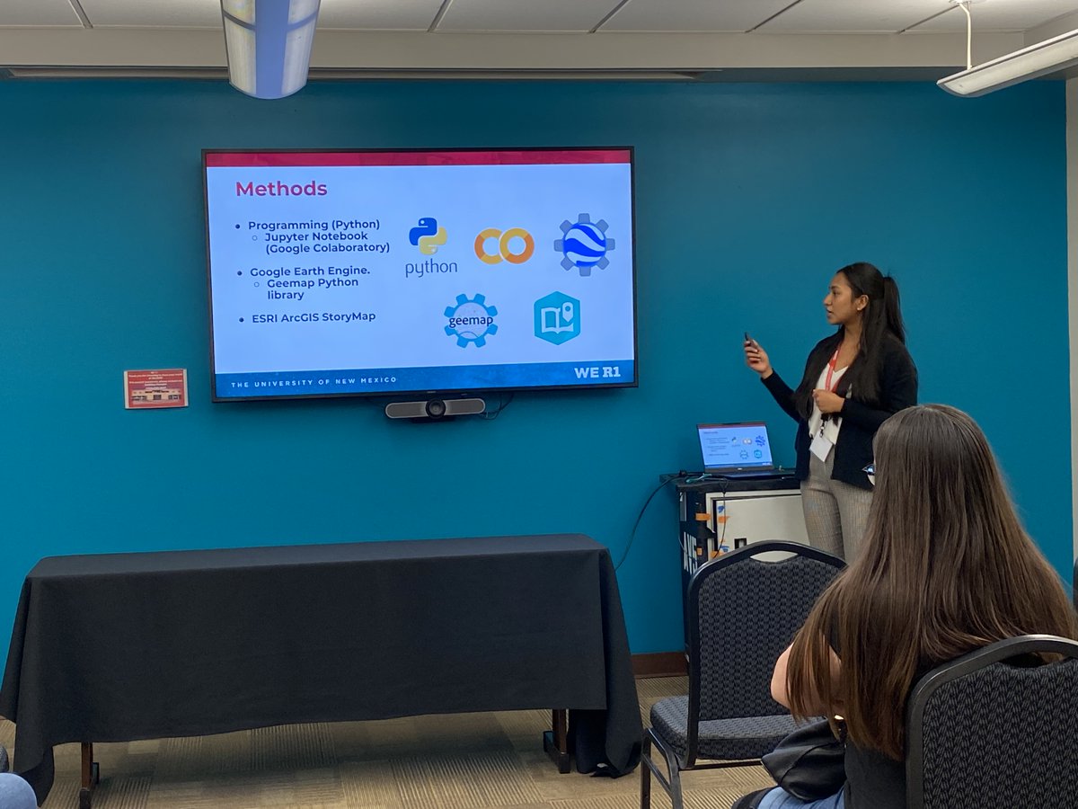
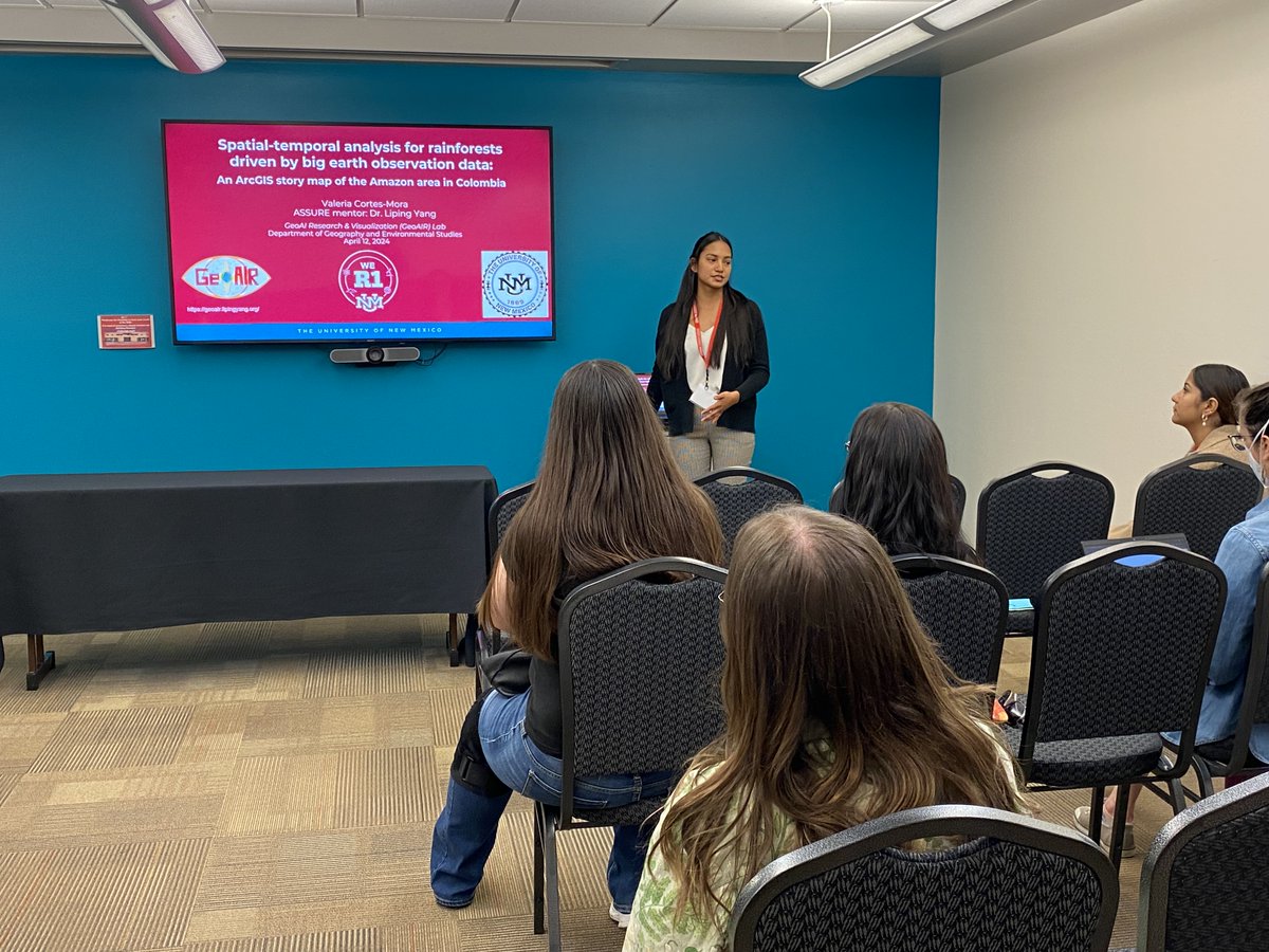
Our own Valeria presenting her ASSURE award project, mentored by Dr. Liping Yang @lipingyangGeoAI. GeoAIR is very proud of you, Valeria! Way to go!

0
2
4
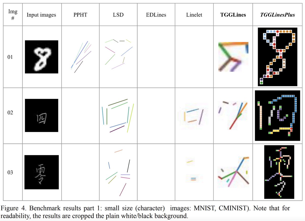
Looking for a robust algorithm for line detection or image vectorization? Check out our new and robust algorithm (with open-sourced Python implementation) at @giswqs
0
2
15
RT @soumithchintala: If you have questions about why Meta open-sources its AI, here's a clear answer in Meta's earnings call today from @fi….
0
387
0
RT @NMGIC_Inc: Dr. Liping Yang @UNM_GES, @GeoAIR_Lab, and @aspireUNM presenting on Enhancing Land Cover Mapping and Monitoring using @googl….
0
2
0
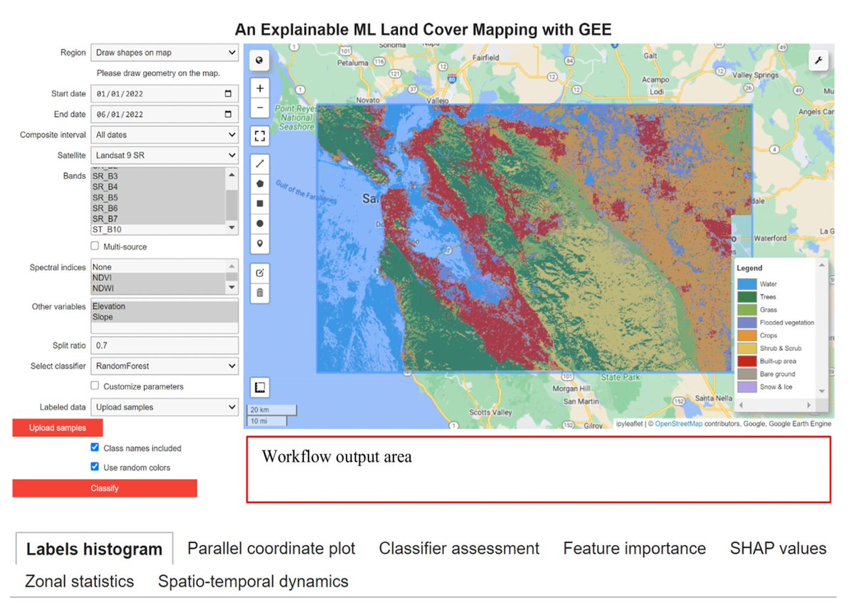
We hope our open-source tool will inspire researchers to facilitate explainable AI (XAI)-empowered remote sensing applications with GEE and geemap.
0
0
1
@giswqs This is the first important attempt to combine the power of GEE + XAI (Explainable Artificial Intelligence). In the paper, we use LULC classification and monitoring as two demonstrative cases, but our method and workflow is pretty flexible to adapt to other use cases.
0
0
1
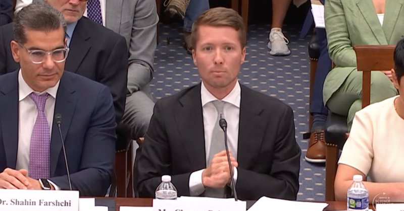
RT @sharongoldman: In testimony to the US House this morning, @huggingface CEO @clem said in his opening statement that open science and op….
venturebeat.com
Hugging Face CEO Clement Delangue, told the U.S. House Science Committee that open science and open-source AI "are extremely aligned with the American values and interests."
0
43
0
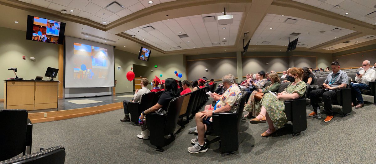
GeoAIR lab's very own Joshua received the outstanding graduate student award. Very well done, Joshua! GeoAIR lab's very proud of you. Very best wishes for a bright future:)
0
2
5
great job, Joshua! GeoAIR lab is very proud of you. @UNM_GES @lipingyangGeoAI.

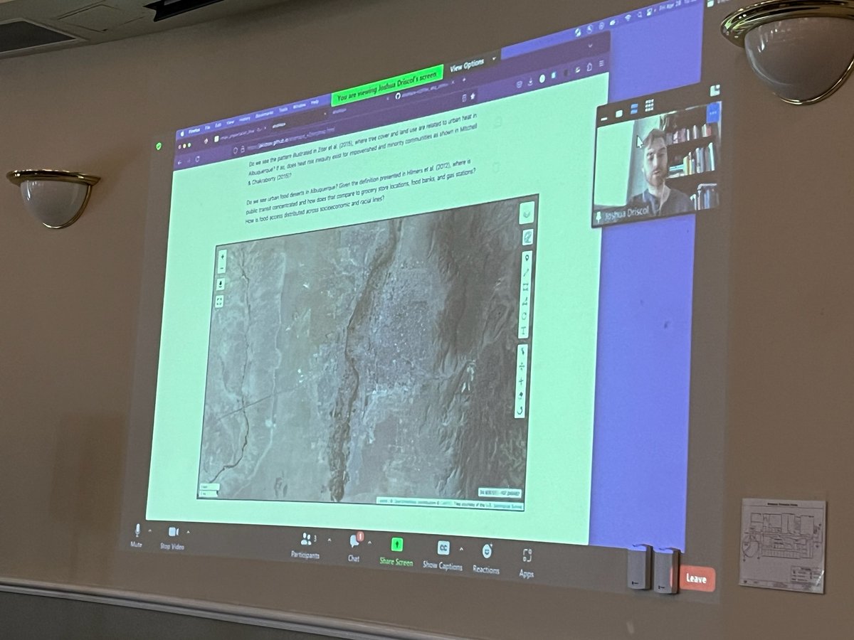
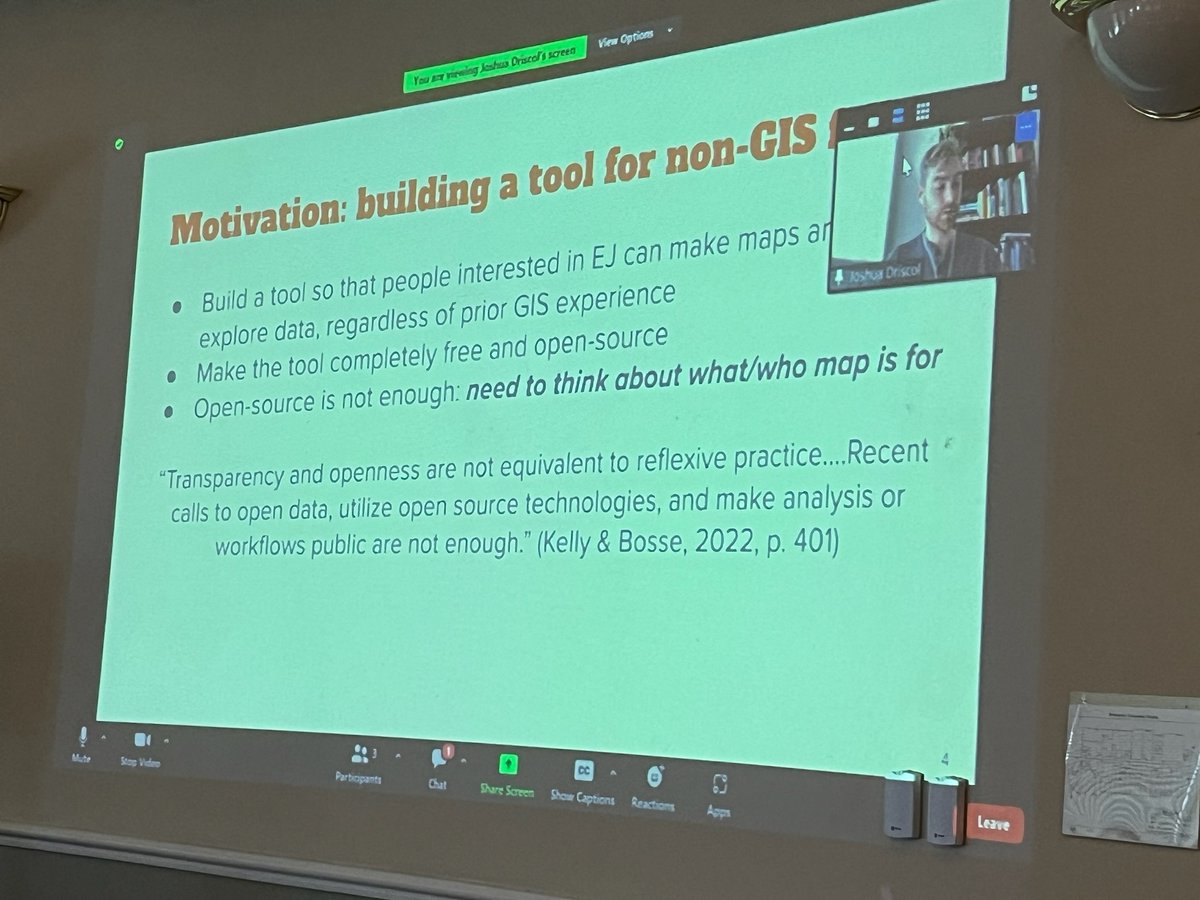
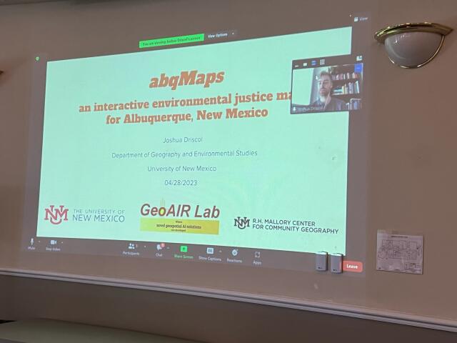
Joshua Driscol from the @UNM_GES @aspireUNM @GeoAIR_Lab is our NMGIC Scholarship awardee. Joshua is presenting a project on "abqMaps: an interactive environmental justice map for Albuquerque, NM".

0
2
6
RT @ProfMarkMaslin: Dear #ClimateChange deniers and bots . Over 99% scientist agree that #climatechange is happening and it is due to human….
0
1K
0
RT @ProfMarkMaslin: #EarthDay2023 . #ClimateChange is about consumption of the very richest people in our global society. 50% of global em….
0
2K
0
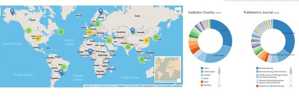
GeoAIR lab led paper "Google Earth Engine and Artificial Intelligence (AI): A Comprehensive Review" is Editor's Choice article and is one of the Highly Cited Papers, top downloaded and viewed papers! @giswqs @RemoteSens_MDPI
mdpi.com
Remote sensing (RS) plays an important role gathering data in many critical domains (e.g., global climate change, risk assessment and vulnerability reduction of natural hazards, resilience of...
2
28
100
RT @giva_uzh: Most insightful graph…🧐.“GIScience and cartography degrees take up a larger proportion of current degree conferrals, particul….

aag.org
AAG - The State of Geography: Data and Trends in Higher Education - All -
0
3
0