Eduard
@EduardShading
Followers
2K
Following
135
Media
31
Statuses
129
Eduard creates beautiful and accurate Swiss-style shaded relief images for maps. Available for macOS on the App Store.
Joined September 2022

Altitude is everything, especially on my new map of High Mountain Asia. Get it here for free: https://t.co/2ON59RaEes

1
0
5
eduard.earth
Eduard for Mac, the tool for creating beautiful shaded relief images for maps.
My "Austral Earth" map needed a new shaded relief flipped upside down and illuminated from the SE to minimize relief inversion. Did it with Eduard software. https://t.co/Uk6jpUEuQ7
0
0
6
eduard.earth
Eduard for Mac, the tool for creating beautiful shaded relief images for maps.

Compositing a Monterey Bay, California map: 1) Terrain + bathymetry + land cover (What an undersea canyon) 2) Adding drainages, built-up areas, roads 3) Adding labels Data: NOAA NCEI CUDEM, USGS GNIS, NLCD, US Census Bureau Tools: @qgis , @EduardShading , Photoshop, Illustrator


1
0
7
If you like tropical islands, this is the map for you. Get it for free here: https://t.co/i4zB00s8Mm

0
0
3
Eduard 1.4.13 can now download the great new Global Ensemble Digital Terrain Model #GEDTM30 at various resolutions. https://t.co/JZuWPG34BX

1
17
132
My updated maps of the Adirondack Park in northern NY State, the woodsy place where I grew up. With tapered rivers as a nod to classic manual cartography. https://t.co/zfuJd0kf7U

1
0
3
I made a map of Tahiti and Mo‘orea, French Polynesia, as a cartographic escape from winter. You can check it out here: https://t.co/qPWDMqolMc

0
2
9
Eduard 1.4.12 released: bug fixes and improvements, including a test to make sure elevation model downloads are not too large. https://t.co/JZuWPG34BX
2
30
226
National Park of American Samoa, by NPS cartographer, Joe Milbrath. His map cleverly combines Eduard shaded relief and plan-oblique relief.

0
2
20
My latest: A physical map of Africa with 4,000+ labels. You can get it here: https://t.co/BVkBwSqKar
5
42
231
Quick tip: As an alternative to median, the oil paint filter in Photoshop does a nice job cleaning up noisy shaded relief. Lightly applying the stylize and cleanliness sliders does the trick.
0
8
64
Eduard 1.4.9 can now download Copernicus surface and GEBCO bathymetry models. https://t.co/JZuWPG34BX

1
3
62
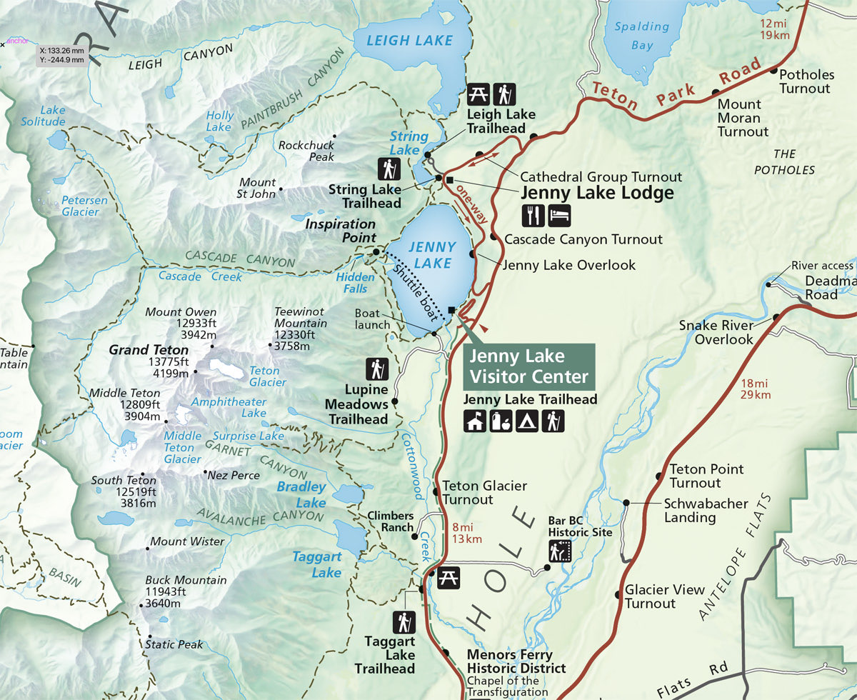
A snippet of the new Grand Teton National Park map by @BeccaHoldhusen featuring @EduardShading. GRTE-Becca.jpg
0
1
13
Eduard 1.4.7 adds image masks, improves aerial perspective, and includes bug fixes and improvements. https://t.co/JZuWPG34BX
eduard.earth
Eduard for Mac, the tool for creating beautiful shaded relief images for maps.
0
3
13
Easy Swiss-style relief with Eduard by Jess Zimmerman https://t.co/g06Jhyd0pN via @YouTube
0
3
12
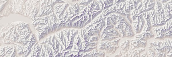
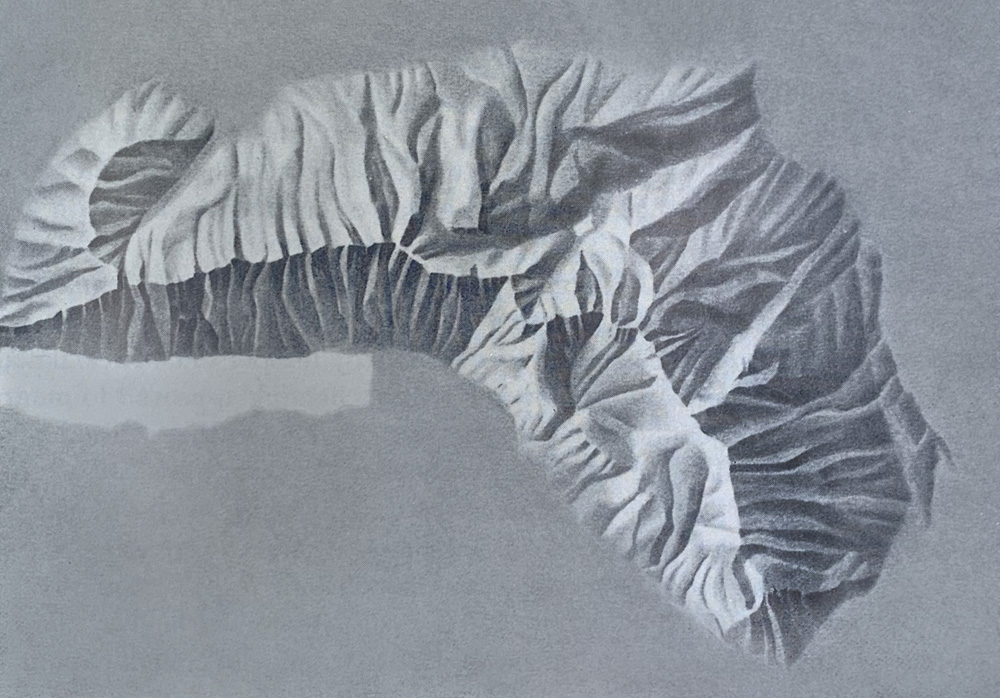
A manual shaded relief of Churfirsten, Switzerland, by Eduard Imhof. You can try emulating his style digitally with multi-scale DEMs of the same mountain available here: https://t.co/Dk4kJvV2oU
2
8
68
Eduard shadings will soon be included in Natural Earth #shadedWithEduard
We are preparing new shaded reliefs for Natural Earth v6 with varying amounts of terrain detail. Available soon.
0
3
42
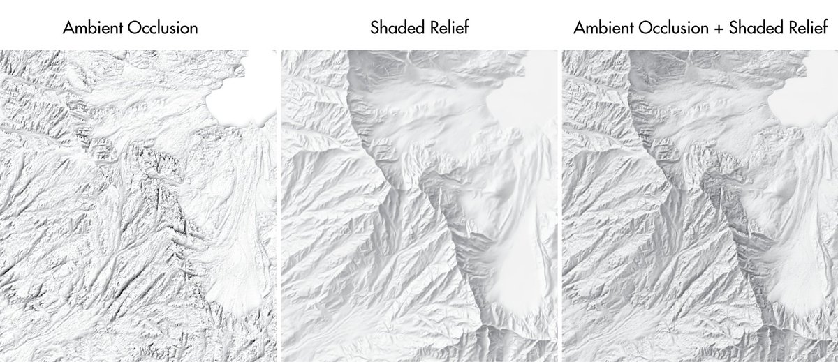
Crater Lake, Oregon with ambient occlusion. Read more about ambient occlusion in Cartographic Perspectives: https://t.co/rXoylrdVm0
https://t.co/JZuWPG34BX

0
5
38
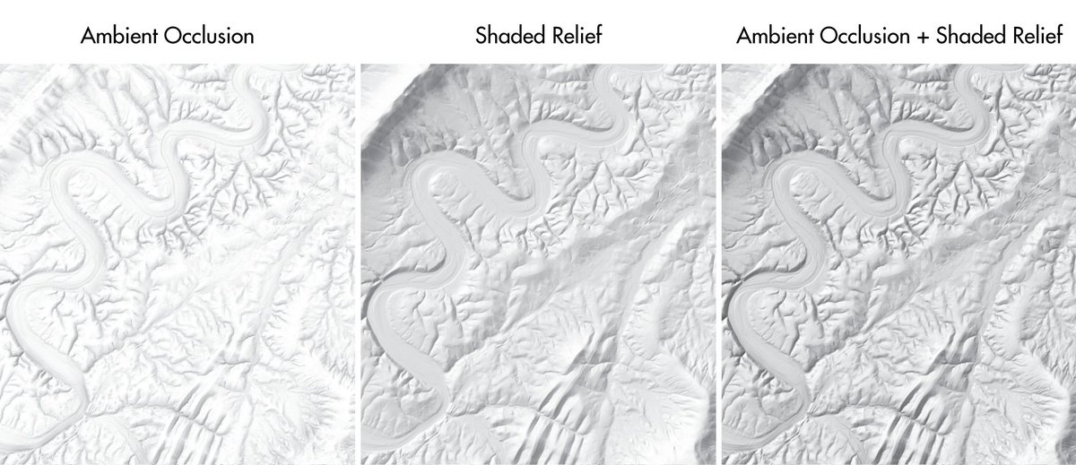
Read about creating "Ambient Occlusion for Terrain Shading" with Eduard in Cartographic Perspectives https://t.co/rXoylrdnws
https://t.co/JZuWPG2wMp
0
12
88