Vance Russell
@vancerussell
Followers
305
Following
591
Media
24
Statuses
811
Forest ecology, restoration, tech4wildlife
Joined February 2009
Do you need geospatial analysis for your conservation and forestry projects but don't have the funds, time, or capacity to get started? This book is for you. Check out the full version at Please send me your constructive feedback!
0
0
0
Great intro to QGIS tutorials from Statistics Canada.
🌍 Free QGIS Training — Learn GIS Step by Step. Ever wanted to make your own maps or analyze spatial data, but didn’t know where to start?.The Government of Canada (Statistics Canada) has put together a free, beginner-friendly training series on QGIS — the world’s leading
0
3
10
RT @Verukita1: 📕 [FREE] Data Wrangling Recipes in R."This book is designed to demonstrate what is required when preparing data for analysis….
0
62
0
Check out my latest article: 3 Things Organizations Get Wrong About Funding via @LinkedIn.
linkedin.com
Working with businesses and nonprofits across California, we noticed three things that organizations are getting wrong about funding: Mission. Without a well-designed program to achieve long-term...
0
0
0
Check out my latest article: The Business of Forest Health Is Booming. And there are some maps! via @LinkedIn.
linkedin.com
The Forest Business Alliance is pleased to release the first chapter of our guide to forest business development. The Analysis chapter examines funding for CAL FIRE’s Business and Workforce Develop...
0
0
0
Fantastic! Well done @spatialthoughts.
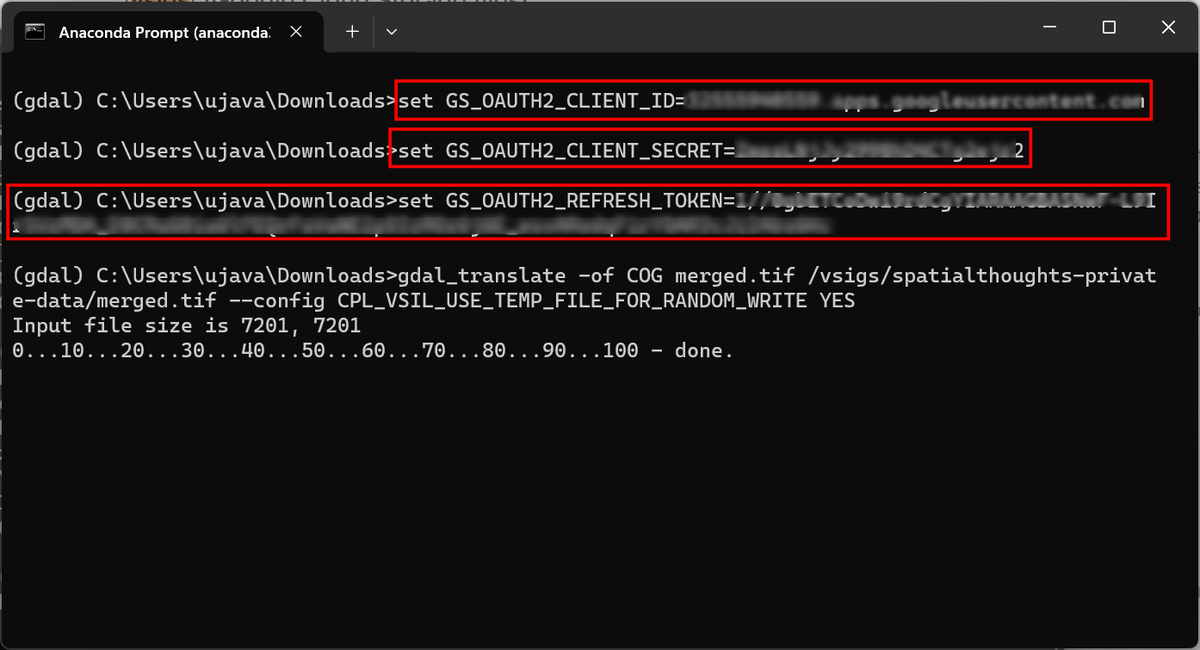
New Post: GDAL and Google Cloud Storage (GCS). GDAL can directly read or write data to a cloud-storage bucket. The tricky part is setting up authentication. I document and explore best practices for using #GoogleCloud Storage with #GDAL Tools.
0
0
1
RT @spatialthoughts: Just announced - The next #QGIS User Conference will be in Slovakia from 10-11 September 2024. Looking forward to visi….
uc2024.qgis.sk
9-10 September 2024
0
16
0
RT @timmackrill: It’s encouraging to see how well the White-tailed Eagles are fitting into southern England - here G818 catching a grey mul….
0
18
0
RT @hansakwast: Want to create amazing #QGIS forms with widgets and use them in the field? Join this webinar on my YouTube channel on 16 Ja….
0
9
0
'Advances in AI and satellite imagery allowed researchers to create the clearest picture yet of human activity at sea, revealing clandestine fishing activity and a boom in offshore energy development.'
theverge.com
New maps show how much more crowded the sea is than previously known.
0
0
1
Love this time-lapse map!.
All named Antarctic icebergs until 2023 in a single clip! Data from @usnatice. Source file and code:
0
0
1
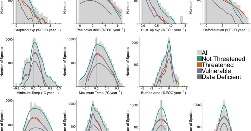
RT @JCSvenning: More than 17,000 tree species are at risk from rapid #globalchange - check our new data-driven assessment @NatureComms sugg….
nature.com
Nature Communications - Tree species may be vulnerable to multiple global change factors. Here, the authors find that more than 17 thousand tree species are exposed to increasing anthropogenic...
0
97
0
¡Que vivan los castores!.
Stunned to see even Daily Star running front page on #beavers today. A newspaper not known for it's progressive thinking clearly gets how beavers can help address flooding crisis. Come on Welsh Government when you going to let Beavers return to wild - even Daily Star gets it!
0
0
0
The world's climate to-do list.
Eight things the world must do to avoid the worst of #ClimateChange.1. Stop methane emissions.2. Stop deforestation.3. Restore degraded land.4. Change what we eat.5. Go #RenewableEnergy.6. Use energy more efficiently.7. Stop burning #FossilFuels.8. #ActNow
0
1
3
RT @opengeohub: All global environmental (open) data sets listed at one place: .If you are aware of some relevant o….
0
80
0
RT @spatialthoughts: We have put together comprehensive learning plans to help you master #QGIS, #Python, #EarthEngine, and #GDAL from our….
0
104
0
RT @giswqs: Visualizing GEDI L4A Footprint Level Aboveground Biomass Density . Notebook: Dataset: .
0
16
0


