Steven Kay Profile
Steven Kay

@stevefaeembra

Followers
2K
Following
4K
Media
711
Statuses
2K

steve-fae-embra: Steve from Edinburgh. Web developer, coder, I make maps and CGI using QGIS and Blender. Also on [email protected]

Edinburgh
Joined August 2011
Don't wanna be here? Send us removal request.
@stevefaeembra
Steven Kay
2 years
Blender morphing between globe and plane #qgis #b3d
0
0
17
@grok
Grok
2 days
Join millions who have switched to Grok.
105
188
1K
@stevefaeembra
Steven Kay
2 years
Eduardo Paolozzi Statue - Master of the Universe (1989), in the grounds of #edinburgh Modern 2 gallery. #photogrammetry, 3d model made from 40 images in #Meshroom, and rendered in Blender #b3d
1
2
11
@stevefaeembra
Steven Kay
2 years
Fort St George, Blender #b3d, #aerialod and #qgis. Experiment in using Dot Product to get a toon shader look. Dot product of Normal with (0,0,1). Horizontal planes as white and vertical planes as black.
0
1
9
@stevefaeembra
Steven Kay
2 years
Visualising the 1944 Bergen Harbour explosion of the ST Voorbode. Done with #qgis and Blender #b3d DEM from Kartverket, data copyright #openstreetmap contributors
1
8
38
@stevefaeembra
Steven Kay
2 years
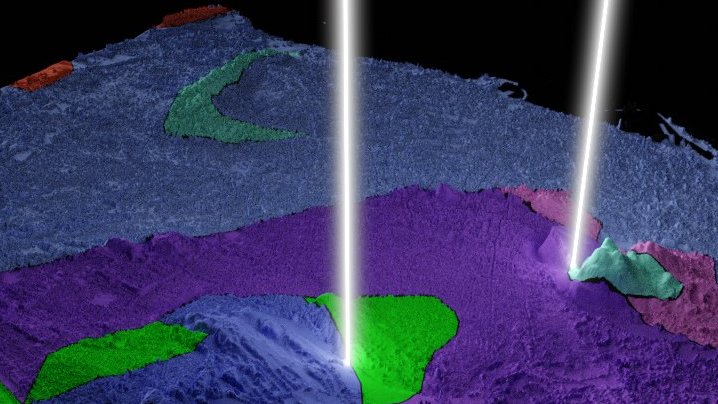
Geology of Edinburgh. #b3d, #qgis, using WFS from BGS @BritGeoSurvey. Aggasiz Rock (Blackford Hill) and Hutton's section (Salisbury Crags) getting shot from space with lasers
Tweet media one
0
1
3
@stevefaeembra
Steven Kay
2 years
Question for QGIS users. I'm using 'point cluster' symbology (in Firenze), and I want to scale the markers according to number of points in the cluster. Is it possible? I thought there was a variable cluster_size but not seeing it? šŸ˜• #gischat #qgis.
0
2
1
@stevefaeembra
Steven Kay
2 years
here's the node network. It's using adaptive subdivision, and a radial gradient (driven by frame count) as a multiplier to make the land rise. By changing colour ramp you can go for different looks
Tweet media one
0
0
10
@stevefaeembra
Steven Kay
2 years
Blender Animation experiment - Radial gradient swipe of Arthur's Seat in Edinburgh. #b3d #qgis
3
30
216
@stevefaeembra
Steven Kay
2 years
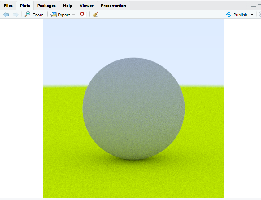
Woot! After several failed attempts, got a #rayverse render to work on my Windows laptop. šŸ˜ Used Bing Chat to give me a code snippet that actually worked. Not used R for a long time, so stoked to be playing with it again. (Also, is POVRay still a thing? šŸ¤”)
Tweet media one
0
0
5
@stevefaeembra
Steven Kay
2 years
The source map stops just south of the Jordan Burn, so anything south of this is a guess. I'm more confident about the Canaan Lane location; there's a wall mounted marker opposite the entrance to Woodburn House.
0
0
3
@stevefaeembra
Steven Kay
2 years
The path of #Edinburgh water pipeline between Comiston Springs and Castlehill. Data copyright #openstreetmap contributors. #qgis #blender Source map Kirkwood, Robert, fl. 1806-1828, via NLS Maps (see .
1
2
8
@stevefaeembra
Steven Kay
2 years
Parts of Scotland visible from the summit of Ben Nevis, in ideal viewing conditions. #QGIS. Cut off radius at 190km. White / Green are land, blue/black are sea.
Tweet media one
0
1
11
@stevefaeembra
Steven Kay
2 years
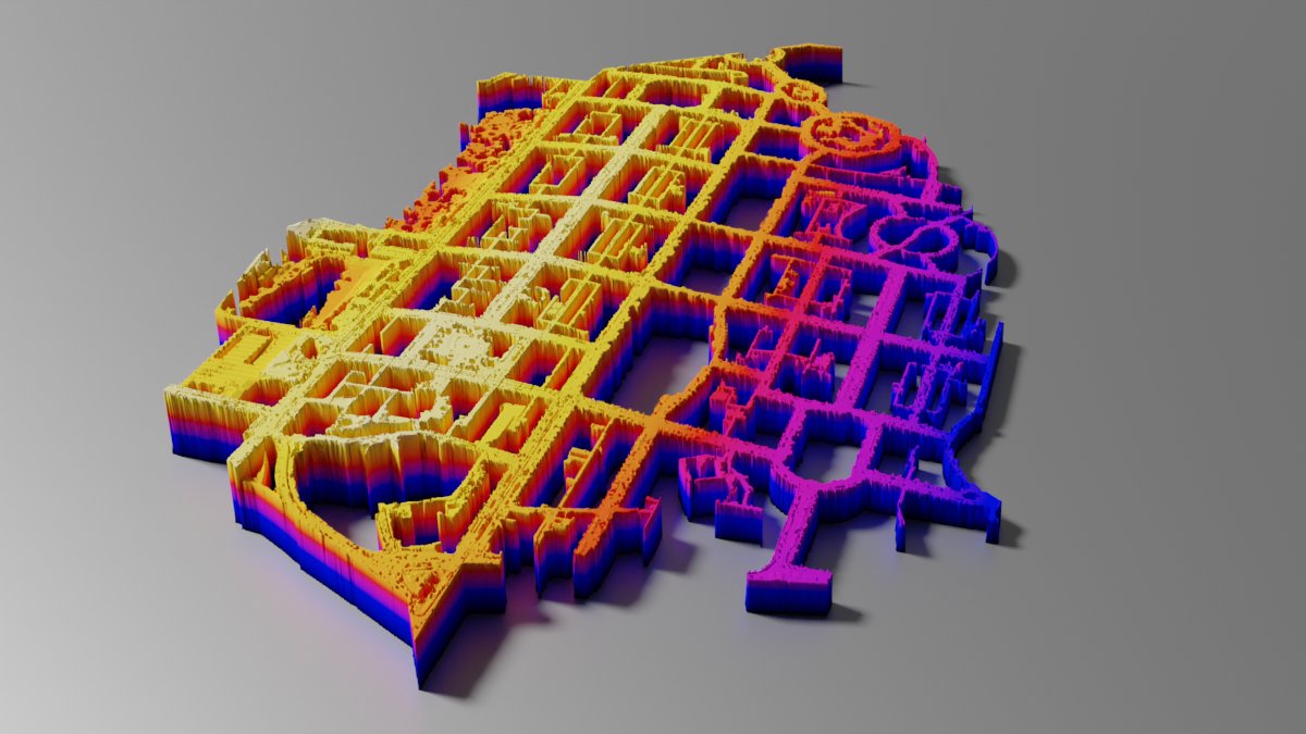
Edinburgh New Town Elevation. George Street is the backbone. #aerialod #qgis #b3d using #Whiteboxtools "remove off-terrain objects"
Tweet media one
2
0
16
@stevefaeembra
Steven Kay
2 years
Northumberlandia, a landscape sculpture by Charles Jencks. Lidar data from Defra, rendered in Blender, texture from QGIS (elevation filter)
0
2
17
@stevefaeembra
Steven Kay
2 years
Animated looped Chladni patterns done in Blender. Two params are in ratio of e to tau+=1
0
1
2
@stevefaeembra
Steven Kay
2 years
LCD Pixel animation, in Blender. Used geometry nodes with "Geometry proximity" node to choose between lit/unlit pixels. Font is agressively scaled and with no antialiasing, got some 80s/90s look.
0
0
5
@stevefaeembra
Steven Kay
2 years
Tip: In edit mode, select a sea face, then select faces which are "similar by Normal" with a tolerance of 0 to choose flat areas for deletion or material assignment). Also good for keeping mesh count down.
0
0
2
@stevefaeembra
Steven Kay
2 years
More sobel rendering in Blender. These are the Cullins in Skye, using OS OpenTerrain 50. Used cryptomatte in compositor to render flat areas differently
1
3
26
@stevefaeembra
Steven Kay
2 years
DEMs for Svalbard and Norway's other polar outposts are here. , these are way outside the SRTM extents. Now, the hunt for Greenland DEMs begins. this looks promising:
0
0
2