
British Geological Survey
@BritGeoSurvey
Followers
52K
Following
19K
Media
6K
Statuses
24K
Our vision is to be a leading and trusted provider of geological data and knowledge to meet the societal need for a sustainable future. 🌎 RTs ≠ endorsement.
Nottingham HQ
Joined February 2009
Our lives are intrinsically linked with the Earth. Geology is the answer to many of the challenges we face in the UK and globally. We're proud to share our new video, which outlines BGS's commitment to delivering the crucial data and insights needed for a sustainable future.
10
32
117
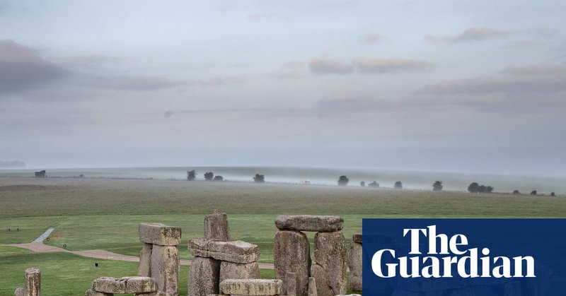
Could an ancient cow's tooth unlock the origins of Stonehenge? . BGS Honorary Research Fellow Jane Evans speaks to the Guardian about what her isotopic analysis on a cow's tooth, found at Stonehenge, tells us about the possible origins of the structure.
theguardian.com
Isotopes shows animal began life in Wales, adding weight to theory cattle used in hauling stones across country
0
0
5

Cutting-edge analysis of a Neolithic cow tooth dating back to the construction of Stonehenge provides evidence of Welsh origins. This is the first time that scientists have seen evidence linking cattle remains from Stonehenge to Wales.


0
0
5
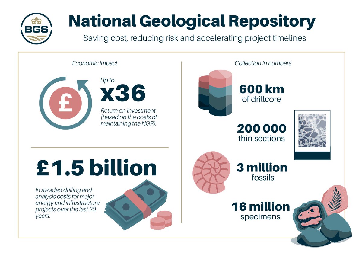
A new economic valuation report has revealed the scale of the National Geological Repository's impact on the UK economy - highlighting that the facility has saved major energy and infrastructure projects £1.5 billion over the last 20 years.

1
6
14
Join us from 12 to 14 September at the 58th Earth Science Teachers' Association (ESTA) Annual Conference, for 3 days of learning, networking, & fun! . We'll be running a mapping workshop, & @CliveBGS will be Saturday's after-dinner speaker. More details:.
0
3
10
If you fancy a challenge this summer try our 1000-piece ‘Magnetic Rocks’ jigsaw, based on a magnetic anomaly image from the BGS Global Geomagnetic Model. It's on sale and available from our online shop for £13 (plus P&P).


0
4
12
We have a new role on offer, located at our Nottingham HQ. You will be responsible for the management of BGS' travel system and will work with the Business Development team who lead on income generating activities for BGS.

0
1
6
What is a gravity survey, and how is it useful to ascertain the geothermal potential of Northern Ireland? . Read this update from @GeoSurveyNI about the recent survey they've been undertaking, covering 393 km2, extending from south of Antrim to north of Ballymena.

🌍 Antrim’s Gravitational Pull 🌍. GSNI is undertaking a gravity survey across County Antrim as part of the #GEMINI project to explore geothermal energy potential. Learn more about the survey and the GEMINI project here:.➡️ #Geothermal.
0
0
1
From sinkholes to radon: new maps highlight the most geologically at-risk regions around Britain. The maps provide regional decision makers with an important indication of where more detailed hazard data may be required.


2
10
22
In terms of crowd energy, Some Might Say Oasis are still the #1 Rock 'N' Roll Stars! Tuesday's Supersonic concert at Murrayfield Stadium exceeded their 2009 peak power reading during their performance of Cigarettes & Alcohol.

Oasis revealed as Edinburgh’s most ‘seismic’ concert of the last 20 years 🎸🥁🕶️. Archived data from a nearby BGS seismic monitoring station, showed the energy of their fans set them apart as the true 'Shakermakers' in Scotland’s largest stadium.

1
32
161
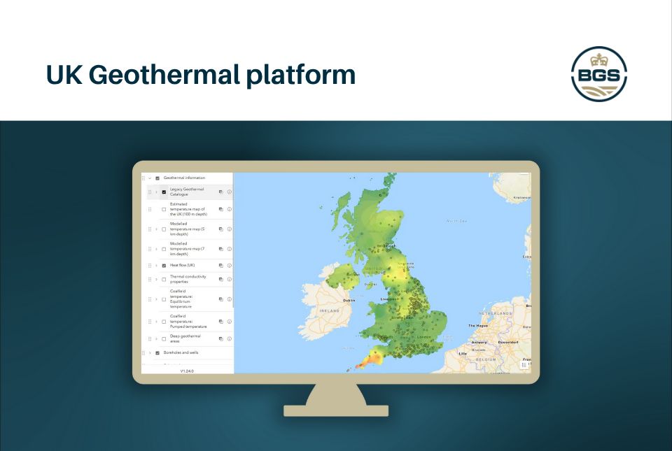
BGS has launched the UK Geothermal Platform, providing national- to local-scale info on geothermal potential. Geothermal technologies have the potential to decarbonise heating and cooling, supporting the energy transition to net zero in the UK.

1
3
15
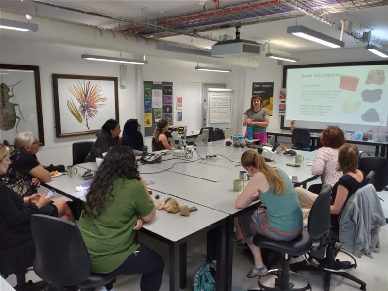
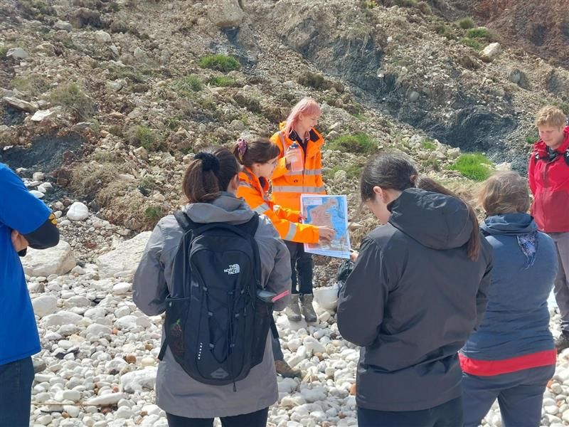
Summer days at the beach looking at pebbles is a pastime that can't be beaten! . Here BGS' Rock Doc, Clive Mitchell discusses spotting, identifying & collecting the pebbles you can find on Britain's beaches - and the history that these pebbles contain.

0
3
17
Assuming clear dark skies, there is an increased chance of seeing the aurora Friday and Saturday night. Those in Scotland, northern England and Northern Ireland have the best chance if the weather is favourable.
0
0
4
We are expecting an increase in geomagnetic activity on Friday and throughout the weekend due to the combined effects of a coronal hole high speed stream (HSS) and the arrival of an Earth-directed Coronal Mass Ejection (CME).

2
4
9
For the first time scientists have managed to take water and sediment samples from beneath the ocean on the New England Shelf. The sample core will help scientists to understand the origin and age of offshore freshened groundwater systems.

0
1
13
Oasis revealed as Edinburgh’s most ‘seismic’ concert of the last 20 years 🎸🥁🕶️. Archived data from a nearby BGS seismic monitoring station, showed the energy of their fans set them apart as the true 'Shakermakers' in Scotland’s largest stadium.
2
17
72
New tool helps identify coal mine gas risk for housing developments in Scotland. It utilises publicly available data and information from BGS and the @MiningRemAuth on the subsurface to inform an instant risk zone rating.

0
1
4
Interested in joining a world-leading geological organisation? We have two vacancies available: . 🌱 Organic geochemist .📋 Administrator / business assistant. Keep updated on these and all of our latest vacancies over on our jobs page:

1
1
6
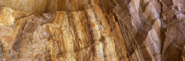
It's tempting to pick a spot on the beach near cliffs: they provide shade and wind protection. But take a look at this pic: can you see the potential risks?. Click here to find the answers, and learn more about beach safety:

0
3
14
If you felt the quake this afternoon, please take a moment to fill out our 'felt report' questionnaire 👇.
0
0
4
Additional Information:.Epicentre was 23km West of Invergarry, and has been reported felt as far as Fort William. One report described it as “like a washing machine spin”. There have been no reports of any damage at this time.
1
0
5