
Thomas Hinterdorfer
@hinto62
Followers
826
Following
1,057
Media
118
Statuses
15,803
Meteorologist, Storm Chaser, Sports Fanatic
Brisbane, AUS
Joined August 2012
Don't wanna be here?
Send us removal request.
Explore trending content on Musk Viewer
Northern Lights
• 240636 Tweets
オーロラ
• 202844 Tweets
DeNA
• 62036 Tweets
#withMUSIC
• 44840 Tweets
Fulham
• 32294 Tweets
BQUIK X BKPP
• 24972 Tweets
太陽フレアのせい
• 24350 Tweets
NUNEW AT BITEC
• 23656 Tweets
#العين_يوكوهاما
• 21491 Tweets
ベイスターズ
• 18910 Tweets
バチコン
• 18854 Tweets
ハマスタ
• 17752 Tweets
FOURTH SINGING TIME
• 15899 Tweets
マリノス
• 12705 Tweets
自分の魚
• 12465 Tweets
#マルハニチロ
• 12413 Tweets
GenG
• 12299 Tweets
#誕生魚診断
• 11706 Tweets
わたしの誕生魚
• 11570 Tweets
Buju
• 11454 Tweets
Last Seen Profiles


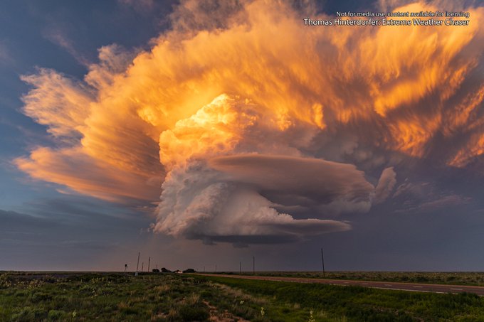
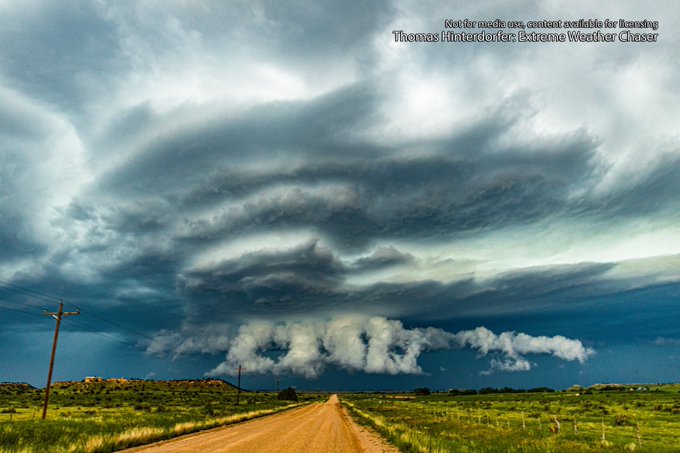
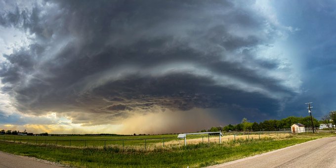
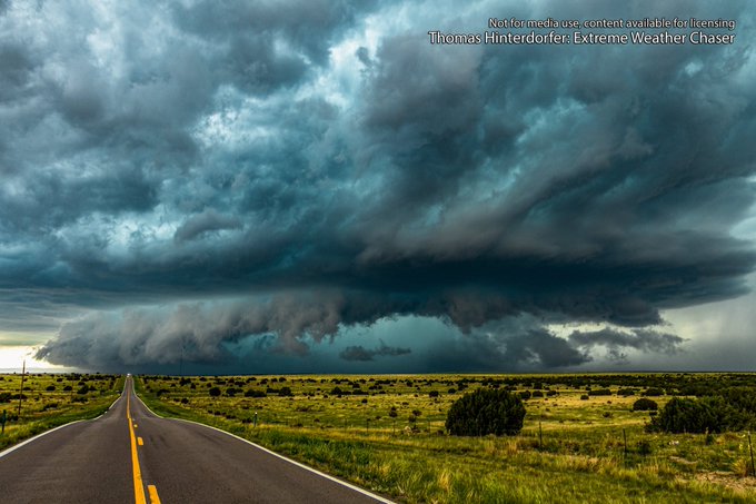
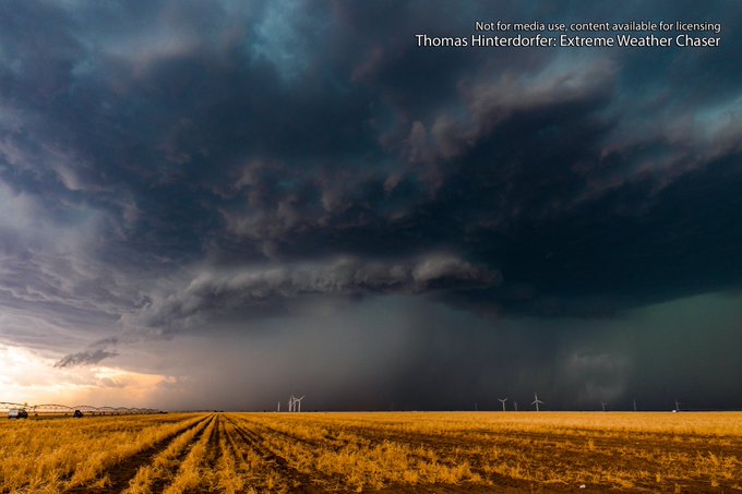
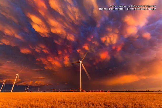
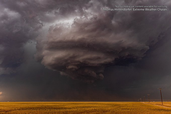
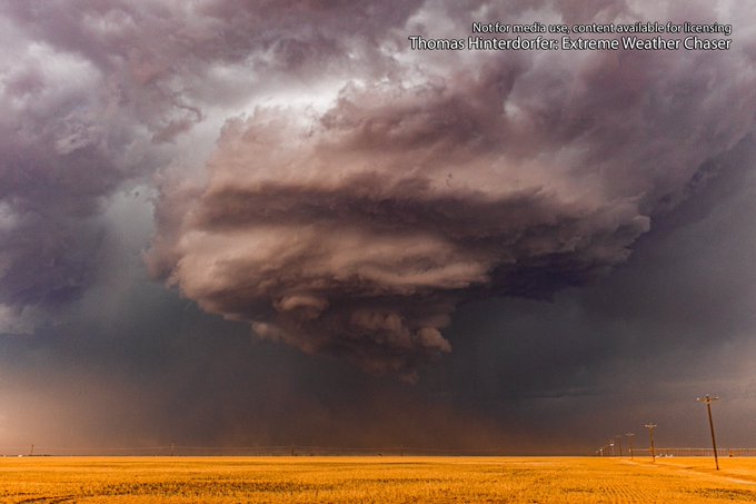
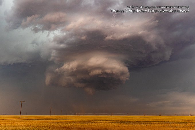
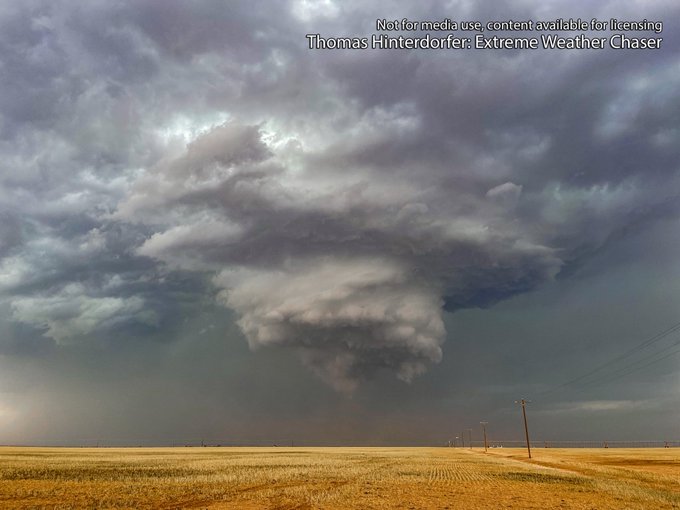
One of the most gorgeous, non destructive supercells I’ve seen. South West of Dalhart, Texas this evening.
#TXwx
@NWSAmarillo
16
138
970
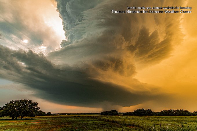

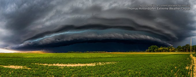
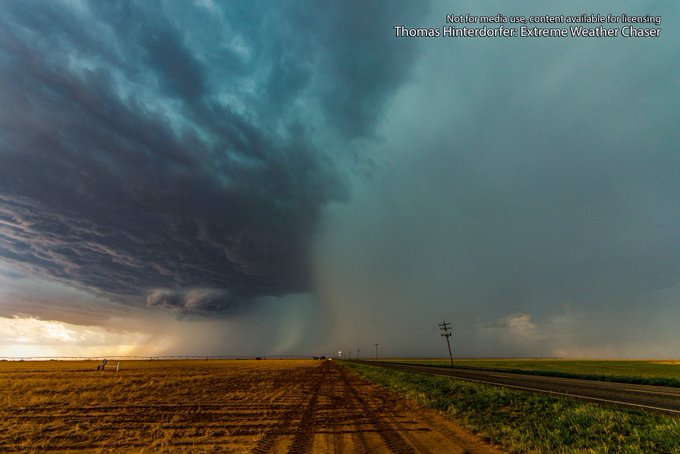
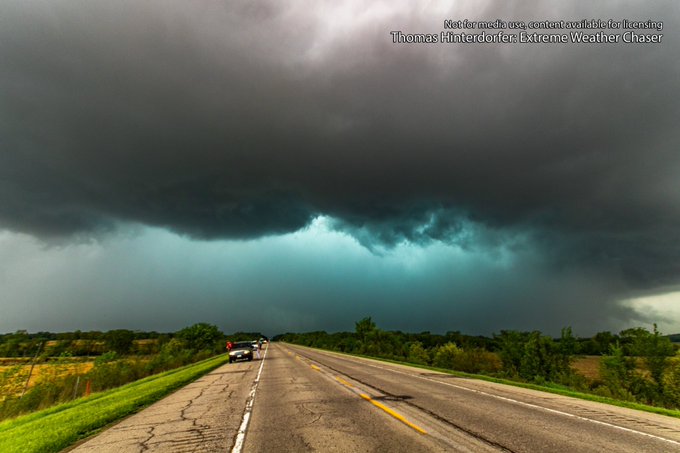
This was our view East of May, Oklahoma before we were overrun by the tornado warned supercell and subsequent MCS 😳😳
@NWSNorman
#OKwx
4
41
190
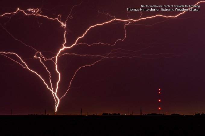
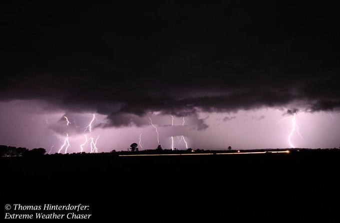
My first upward lightning strike captured. Single 25sec exposure. This was taken around 11pm West of Slaton, looking West to the South of Lubbock, Texas
@NWSLubbock
#TXwx
5
22
108
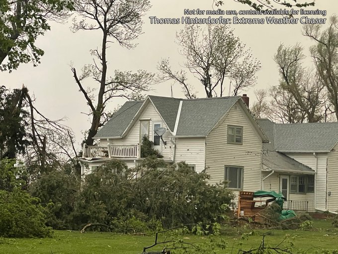
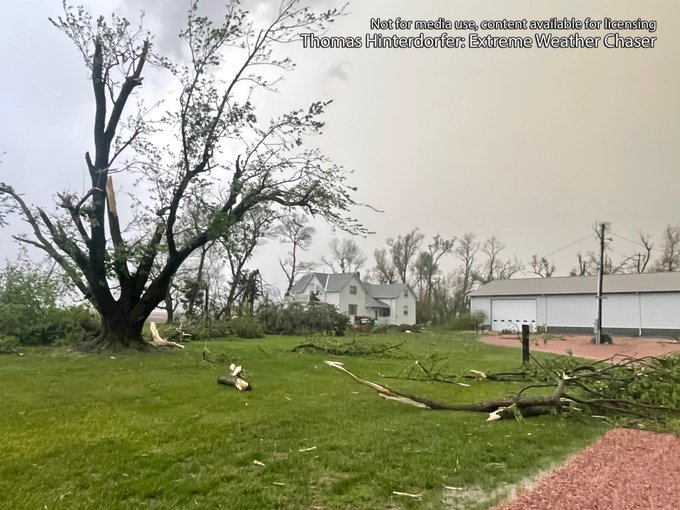
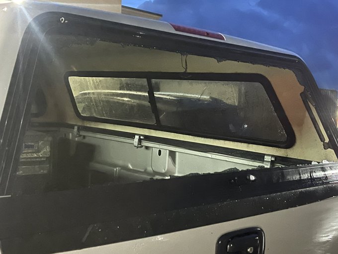
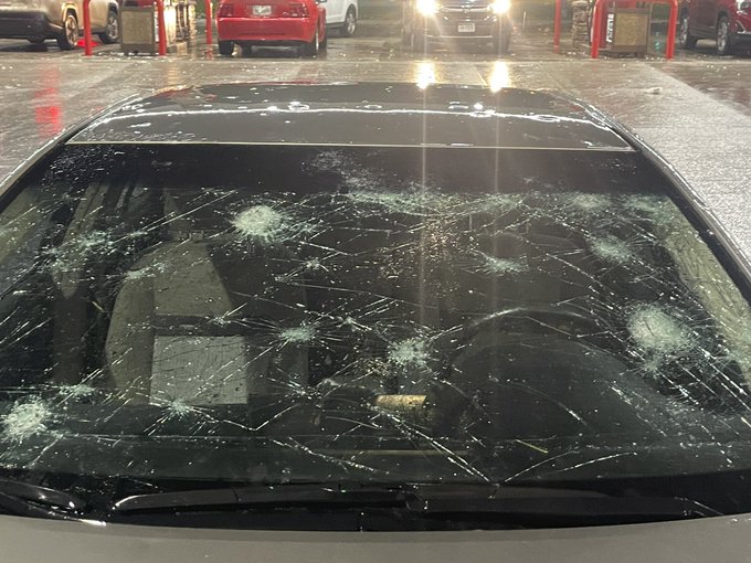
Wind driven baseballs just hit Scottsbluff, Nebraska. Countless cars with entire windscreens caved in and holes.
@NWSCheyenne
1
16
94
Marble Bar is almost at 47ºc before 10am... "hot" is an understatement. It took until around midday yesterday for Marble Bar to reach 47ºc, so its well and truly on track to beat yesterday's 48.5ºc.
2
22
61
We may complain about quiet tornado seasons (as chasers), but this is the most positive thing we could ever ask for... to be honest, id take a quiet season for...
3
13
62
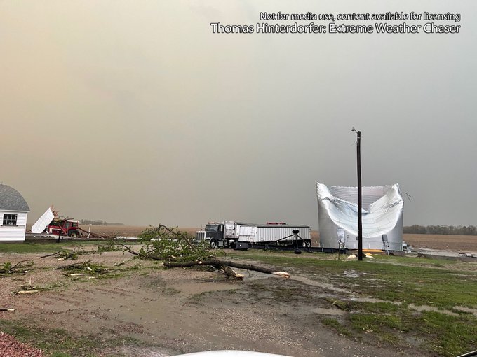
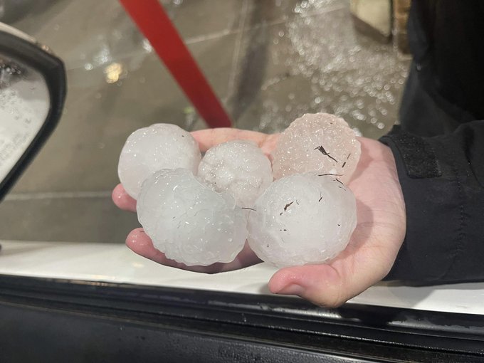
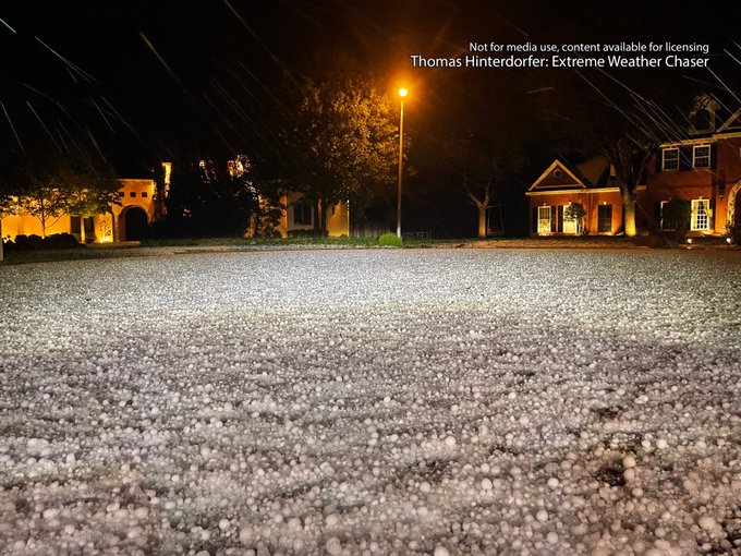
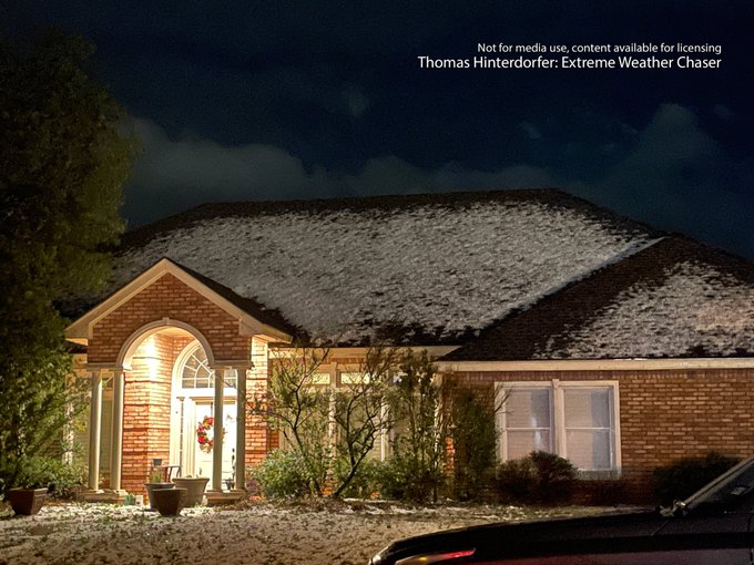
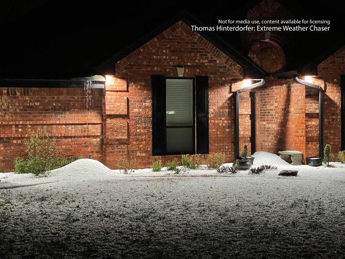
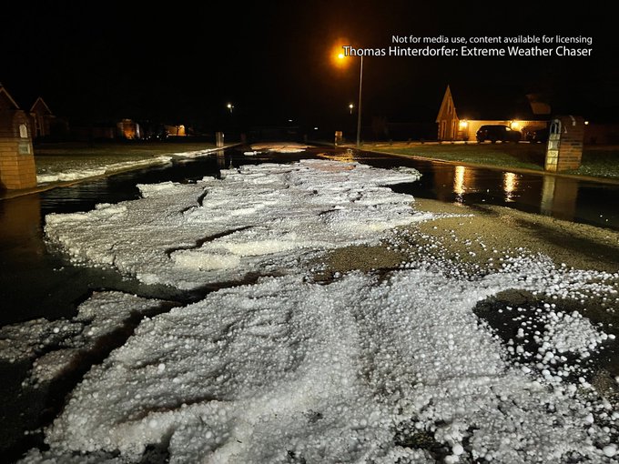
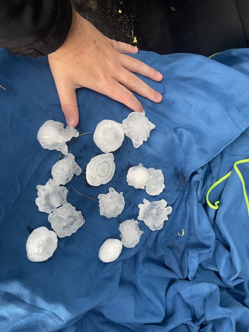
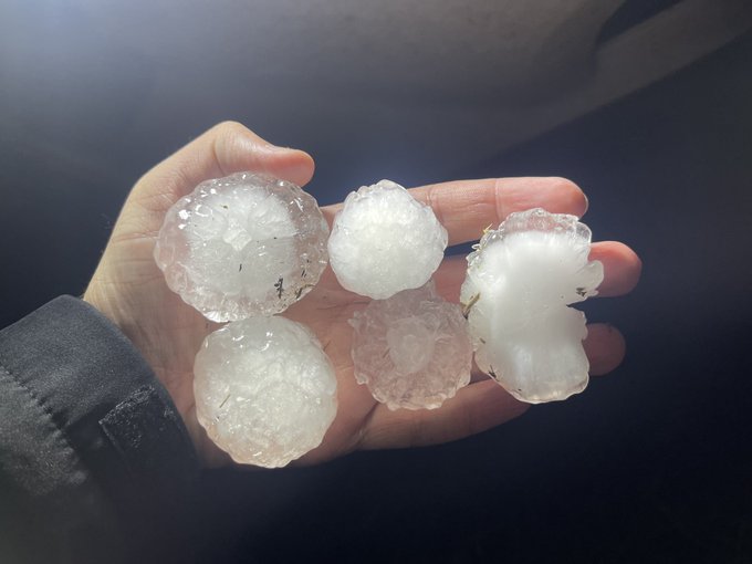
INCREDIBLE hail accumulations with peak stones measured up to golf ball size in the Saddle Lakes community, 6 miles South of Abilene, TX at 9:30pm CDT.
Trees shredded, some cars damaged and some houses sustained minor window damage.
@NWSSanAngelo
0
14
51
This was the view as
#Larned
, Kansas was impacted by a high-precipitation
#supercell
yielding baseball to possible softball size hail this afternoon. The green and aqua hue of the precipitation core was mesmerising.
#kswx

3
8
42
This
#supercell
was such a beast through SE Colorado and into the OK Panhandle. This was our view West of Kim, CO when the storm had radar indicated 4 inch stones.
#COwx
0
5
39
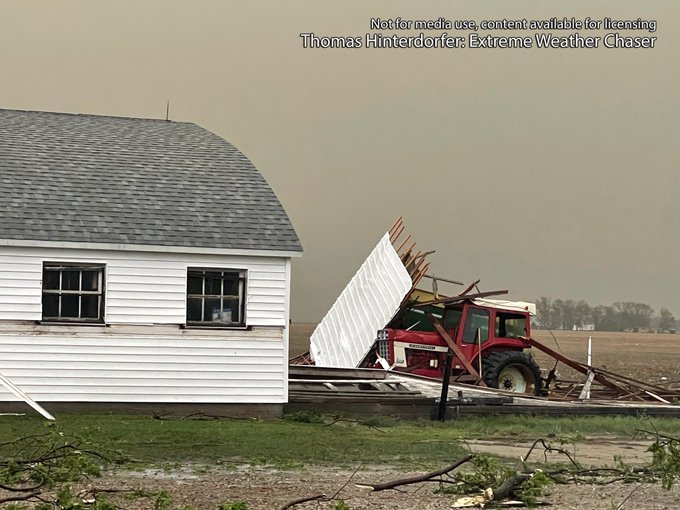
Wind driven baseball size hail has destroyed car windows in Scottsbluff, Nebraska a short time ago
@NWSCheyenne
#NEwx
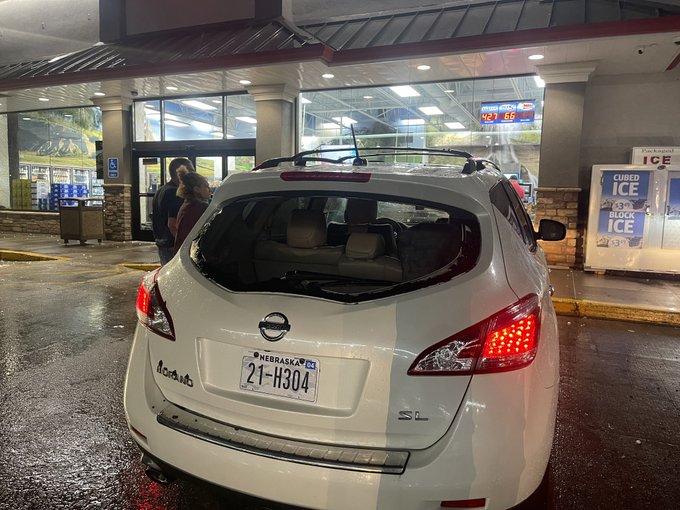

0
7
29
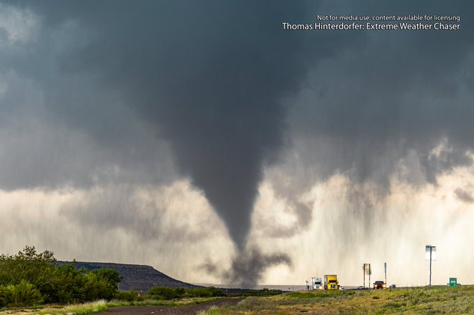
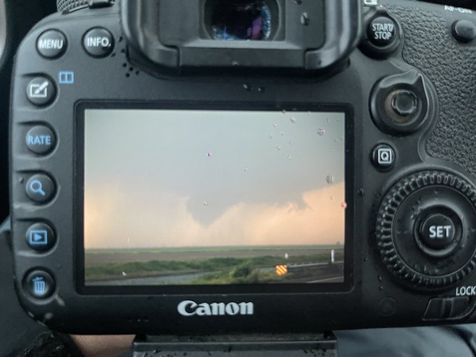
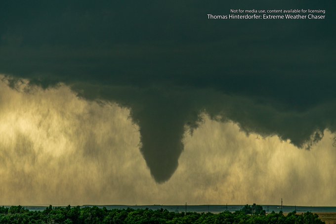
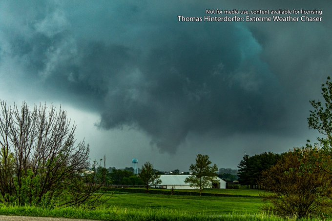
Tornado observed West of Booker, TX - likely much closer to Perryton 5mins ago. Became rain wrapped shortly after. Condensed 5/6th of the way to the ground
@NWSAmarillo
0
9
31
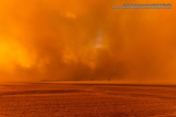
Inside the dust storm, South of Merkel Texas this evening 😳😳 zero visibility for a good 10-15mins, with winds comfortably exceeding 60mph at times. Definitely a wild experience.
#txwx
@NWSSanAngelo
1
4
28
@reedtimmerTVN
@SeanSchoferTVN
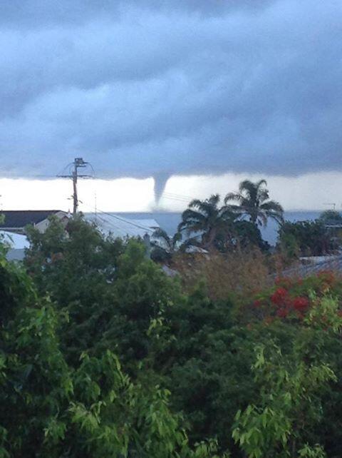
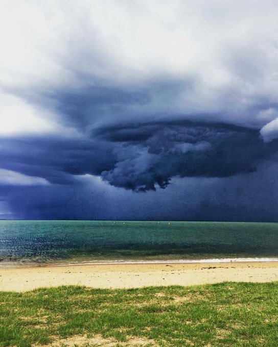
Waterspout off Moreton Bay, Australia this morning in a large super cell
http://t.co/YJcaI2Y7Mi
5
16
19
Wild scenes at the hotel in SW Abilene. Golf balls in the video. Iso tennis balls after videoing. Cars have cracked windshields
@NWSSanAngelo
1
4
17
Brief tornado approximately 3-4 miles N to NW of Plains, TX. Video taken at 8:28pm CDT
@NWSLubbock
1
4
16
You know you're too into the game when the neighbours yell at you because you scream "C'mon Tom" after he kicks a goal
@GeelongCats
0
5
15
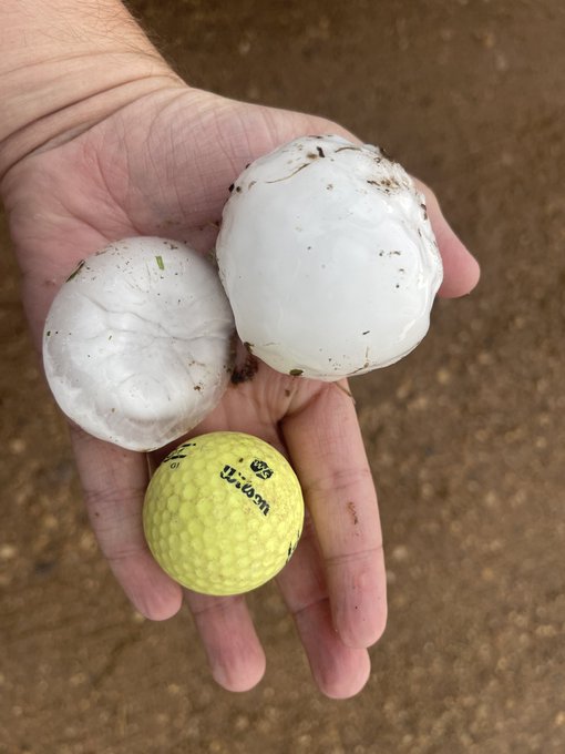
Golf ball to very isolated tennis ball size (1.75-2.5in) hail found North of I-20 along FM1235 & Wimberley Rd. Fell 10-15mins ago. Plenty of stones in the 1.25-1.75 range lying along & beside the road
@NWSSanAngelo
1
3
14
Tennis ball hail South of Turpin along Hollow E0150, 2 miles West of NS 122 Rd
@NWSAmarillo
#OkWX
0
2
11
@SvrWxChaser
@EMoriartyWX
Make whatever excuses you want. The way you passed on the right was horrible. That speed, direct hit on Reed and you’re splitting his car in half. Not the first incident from you either…
0
0
12
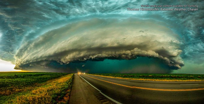
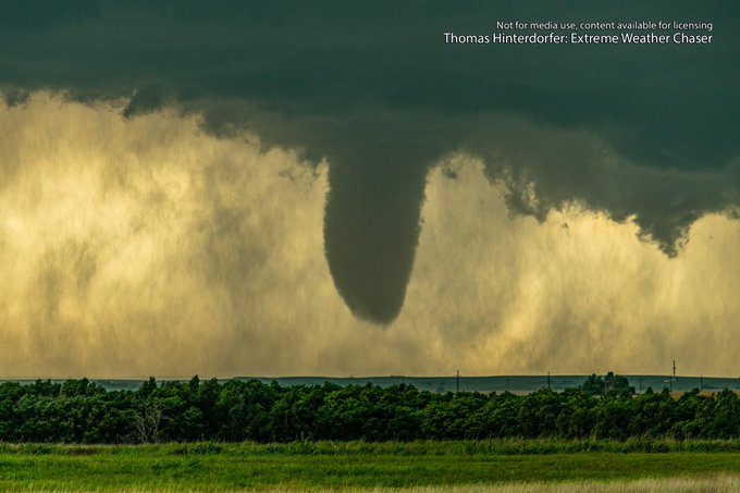
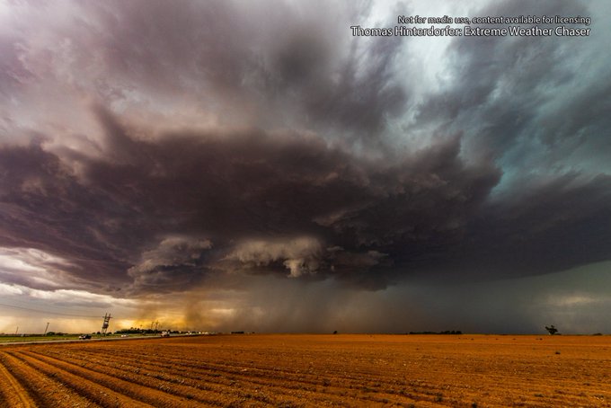
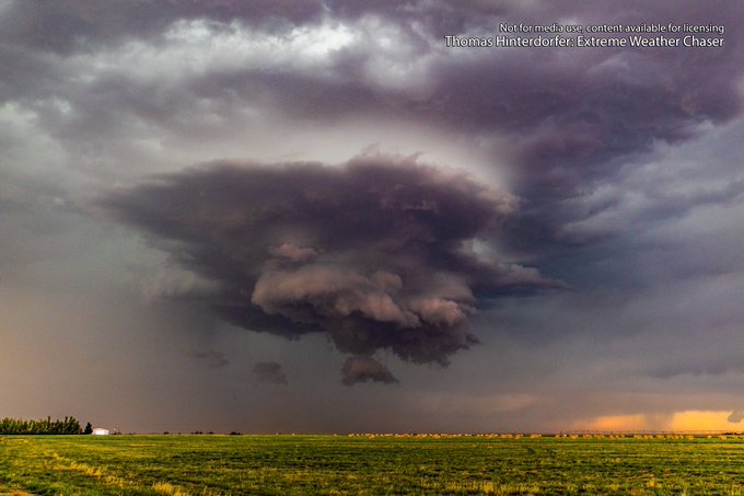
Ridiculous structure observed on a slow moving supercell North & East of Farwell, Texas this afternoon. We moved about 5 miles in 1 hour watching this beast. Multiple attempted dusty swirls were noted but nothing could consolidate & plant properly
#txwx
@NWSAmarillo
@NWSLubbock
0
2
12
2-2.5in hailstones found beside US-160, 1.5-2 miles North East of Walsh, Colorado following the impact of the supercell. The hail is melting quite quickly too.
@NWSPueblo
0
1
11
@Robbo_heraldsun
@GerardWhateley
We just donated $25 as a 3 person family towards the MND foundation. Cheering you on Gerard for the slide!
0
1
10
@JordanHallWX
@MurphyRobertsWx
I’m probably out there more than all of them combined and I live on the other side of the world 😂
0
0
6
HELLOOOOOOOOOO are you there????
Please like or comment this if you can see this post 😘😘😘
0
0
6
@marcusreynold19
We are constantly interrupted at some ridiculous hour, even with a ‘do not disturb’ sign on the door & late check out request. More often than not they’re not copping an earful
1
0
6
@NickKrasz_Wx
Wasn’t Briarwood Elementary, Oklahoma the reason for EF5 damage during the 2013 Moore EF5?
1
0
3
Amazing to see 😍 this is the second time in as many years that a storm chaser has proposed in front of a tornado.
There’s beauty and serenity in the eye of the storm 👌...

0
0
5
WA took the heat this year for Christmas.
• Marble Bar 48.0C
• Telfer 46.7C
• Fortescue Dave Forrest 46.0C
• Shark Bay 46.0C
• Christmas Creek (ironic name) 45.8C
• Paraburdoo 45.5C
• Karijini North 45.3C...
0
9
5
Rapid flash flooding in New Town, Hobart where falls of nearly 50mm have been observed in the last hour!

0
5
3
Insane hail damage from the mammoth HP Supercell that hugged the international border between Canada and the U.S the other day 😳
1
1
4
In the past 24hrs courtesy of multiple storms, Menindee in South West NSW has topped 50mm.
From January 1st until October 3rd, Menindee had only recorded 25.2mm, so this is double the entire year to date.
Its also...
0
0
4
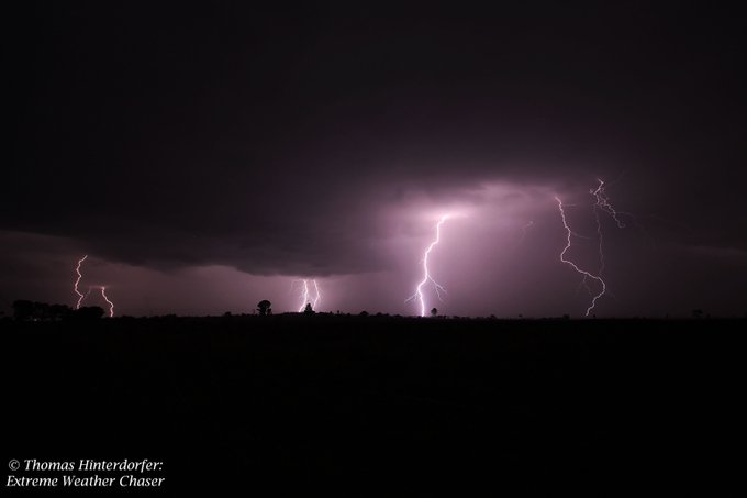
Bolts from tonight's lightshow in Toogoolawah.
@WINNews_TWBA
@7NewsQueensland
@couriermail
@TonyAuden
0
1
4
5:20PM EST SEQ/NENSW UPDATE: Heads up Beaudesert! Severe storm incoming with likely large hail, heavy rain and...
0
1
3
Melbourne just recorded its hottest day since 2014 with 42.6ºc before the temperature plummeted 16ºc in 16minutes as the change hit! Avalon hit 45.8ºc before dropping 17ºc in 18mins.
The change is yet to hit the...
0
3
3
@Liam2799
@danderfield
You realise the post says “consecutive” games. That means they’re in a row. Carlton have won 4 “in a row” by 50+ with WCE this upcoming weekend to make it 5.
1
0
1
@NWSShreveport
massive hook echo, looks to be very rain wrapped. Hope it's just a very strong supercell and not a wedge
1
3
3
Fairly decent hail dumping from the mesocyclone near Shepparton (N VIC) a short time ago. Looks to be mostly...
http://t.co/m3WmeHPTtH
0
2
3
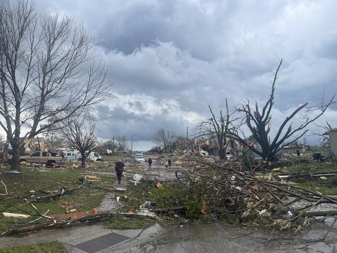
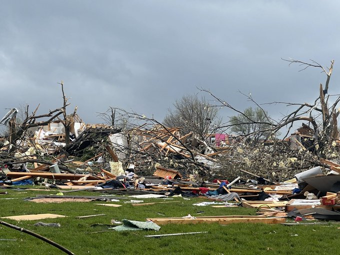
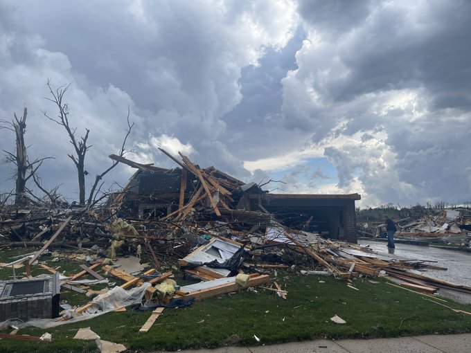
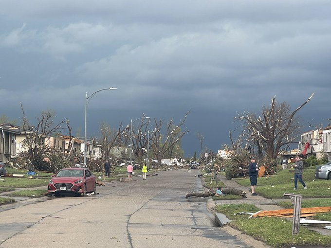
Welcome to Kansas, where for the 2nd day in a row violent tornadoes are wreaking havoc.
0
2
3
** TROPICAL CYCLONE LIKELY IN THE CORAL SEA MONDAY **
Invest 08P as of Sunday night is currently situated to...
0
1
3
Some incredible photos out of WA this afternoon as Severe Storms ripped through the Gascoyne and Central West....
http://t.co/7EpHfyB7FA
0
4
3
WOW! Giant hail at Armidale this afternoon from a supercell which directly impacted the town!
0
1
3
Oh no :(
Damage photos are emerging from Taichung in Taiwan following the crossing and impact of Soudelor....
http://t.co/r0R6Sz7OJB
0
1
3
A beautiful time-lapse of the Storms as they rolled in yesterday over the City. This was taken up at Mount...
http://t.co/7hGwNSU0tU
0
1
3
This is fantastic news!
From a weather perspective to get these 4 radars in will be hugely beneficial for weather coverage. Between Longreach, Townsville and Mount Isa has been a notorious...
0
0
3
Half a metre of rain leads to record flooding overnight in Far North QLD! Cairns falls 1mm shy of recording its wettest day in 25 years!
0
0
3
INSANE! 130km/h winds caused significant widespread damage across Mudgee. Heres Facebook live video of the storm...
0
1
3
** 15 YEARS AGO, THE WORLD STOPPED ***
September 11 Terror Attacks - We remember!
Families that lived normal,...
0
1
3
Scary scenes just South of Kingaroy near Coolabunia earlier today where a likely rain wrapped tornado hit the area! This cell went on to produce another possible tornado South of Gympie later on, and a likely tornado offshore near Tin Can Bay.
0
3
3
Fix this bullshit
@AFL
who the fuck thought 2:20, 3:20, 5:20 is a good schedule and who the fuck decided to open the roof again 🙄🙄🙄🙄
#AFLDogsSuns
1
0
2
Very brief and weak tornado North of Tatum, NM / South West of Bledsoe, TX at 6:10pm MDT. Funnel overhead was captured better by other chasers further back.
@NWSLubbock
@NWSAlbuquerque
#NMwx
0
0
3
Here comes the heat! Temps pushing into the low 40's by Wednesday across SEQLD & NENSW.
0
1
2
Don't forget, the double giveaway is drawn on Friday in amongst all of the severe storms and cyclone potential coming up. This is to ensure the prints are received prior to Christmas. If you havent entered, please ensure that you do :) :)
0
0
2
WOW. What a beautifully structure storm moving NE through the Border Ranges this evening
0
1
2
Has anyone ever wanted to visit the United States and experience what it's like as a storm chaser to be face to face with a tornado? The heat the train like road? The watch Mother Nature at her finest?
Have you...
1
0
2
TOP PRIORITY FOR IMMEDIATE BROADCAST
SEVERE THUNDERSTORM WARNING - SOUTHEAST QUEENSLAND
for DAMAGING WINDS and...
0
0
2
Arrived in Oklahoma. Lots and lots of issues thanks to the delays in Houston, after we sort them out tomorrow... the chasecation (chasing vacation) begins 🙂 — at Wyndham Garden Hotel Oklahoma City
1
2
2
I believe the NSW and QLD drought CRISIS should be labelled as a NATURAL DISASTER!
A natural disaster is “a natural event such as a flood, earthquake, or hurricane that causes great damage or loss of life.”...
0
0
2
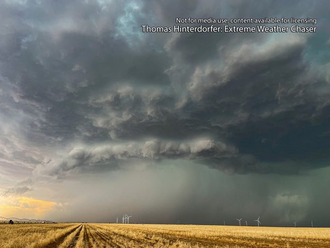
Tracking a dangerous, tornado warned Supercell with a powerful wall cloud feature and sporadic funnel clouds
Radar image via RadarScope
0
0
2
Extreme, almost catastrophic, fire danger conditions are being observed in Rockhampton. The temperature has just hit 44.4ºc with winds gusting to 72km/h and humidity at just 11% - this is giving a fire danger rating...
0
2
2
#Severe
#Thunderstorm
Warning *Detailed -
#SEQ
* - Damaging Winds, Large Hail
#QLDStorms
#Storms
#Weather
...
http://t.co/WouogQODFv
0
1
2
** OWEN TO MAKE LANDFALL FRIDAY AS CATEGORY 3 OR 4 SYSTEM - THEN SWEEP QLD COAST WITH SEVERE IMPACTS **
Ex-Tropical Cyclone Owen is highly likely to re-intensify into Tropical Cyclone Owen overnight tonight...
0
2
2
We've received multiple reports on HSC since Midday of a possible Tornado or Waterspout in Hervey Bay.
A Strong...
http://t.co/BI7Wm4Os2F
0
3
2
*** CHRISTMAS TRAGEDY ***
Amidst a December Tornado Outbreak in the United States (this morning for Aus time),...
0
1
2
Port Hedland has just broken its March record for daily rainfall set back in 1988 (data going back to 1948). The town has copped 158mm since 9am yesterday which beats the 1988 record of 156.8mm
0
0
2
Severe storm currently tracking towards North Brisbane and Brisbane CBD. Damaging winds, large hail likely! This...
0
1
2
Large hail has hit SE Melbourne Metro this afternoon as severe storms moved through.
Image Credit:
•...
http://t.co/sW0NEkmriu
0
1
2
While it wasn’t as cold across VIC this morning, parts of NSW were even colder than yesterday. Did anyone record any frost?
• Cooma -11.0C
• Glen Innes -8.4C
• Marrangaroo -8.3C
• Perisher -7.8C
• Goulburn...
0
1
2
** EXTREME HEATWAVE TO HIT SEQ, CQLD... AGAIN!! **
• Comment/F for newsfeed, Tag/Share to family and friends...
0
0
2
Fantastic to see the music industry come on board for the drought appeal. Let’s hope the concert is a MASSIVE success!
0
0
1