Explore tweets tagged as #mapvisualization


Can you see all the colors in this map? Not everyone can. Here's how #cartographers are designing #maps for the visually impaired #MapVisualization

1
31
60
Not everyone can enjoy the beauty and usefulness of #maps. There might be several reasons why #Cartography #MapVisualization

0
27
50

Who Owns More: The Bottom 80% or the Top 0.001%?. Lees meer: #GeoICT #WealthInequality #GlobalEconomy #MapVisualization #DataInsights. ©️ Ruben Mathisen | Source: Credit Suisse Global Wealth Report

0
0
0

データ抽出をGUIで効率化したSuperset。MapVisualizationで位置情報ダッシュボードを構築したLuup社のSuperset活用事例をご紹介✨. #Superset #findy_tools.

0
0
2

Fascinating #mapvisualization #uptodate #weather info. #WindMap #TropicalStormSimon
http://t.co/alxCpv5Upn
@cambecc
http://t.co/X5XF0lSIEz.

0
3
3

Finally, the newest #mapvisualization has been published! . What can the #streets names reveal about #Singapore's community and identity? 🇸🇬 Visit and learn about the history, culture, and society of your streets. 🛣. 💚 Made with @Mapbox & @vuejs
2
9
43

I've made some maps with colours by road name. Inspiration from @puntofisso's maps earlier this year. Can you guess where each one is?. Names, code and more details to follow. #mapgeek #gis #osmnx #opensource #visualization #python #mapvisualization #OSM #FridayFeeling

2
5
5
I made some maps (this time with place names) with colours by road names. Inspiration from @puntofisso's maps earlier this year. Code at the end of the thread. Barbados to start!. #mapgeek #gis #osmnx #opensource #visualization #python #mapvisualization #OSM #SaturdayMorning

2
2
5


0
0
8

今日ご紹介するのは【MapVisualization】の動画です😊.HoloLensを用いて場所に紐づく情報を可視化・共有するコンテンツなのですが、操作するときに出る音がイイ感じなのです!💡.ぜひ聞いてみてください~🔊🎶.#HoloLens #MR #MapVisualization. ※ 音が出ます
0
1
22

🗺️ Utility businesses need more than maps — they need real-time, scalable solutions. How to choose the right tech for map-based visualization?.🔧 Tools, tips & a real case from NetLS 👇.📖 Read on our blog: #GIS #UtilityTech #IoT #MapVisualization #NetLS

0
0
0

Analyze data using Pie-Chart and Column-Chart within Dynamics 365 CRM with Heat Maps . . #mapvisualization #PowerPlatform #MSDyn365 #datavisualization #heatmaps #MSDynCRM #Dynamics365 #piechart #powerapps #dataverse

0
4
1

gischart #maps can be exported as #xml files to embed #mapvisualization in any webapplication. http://t.co/aQNmcJNWMt.

0
1
0

. Into the domain. of Digital Cartography. #DigitalCartography #Geospatial.#DataVisualization #GIS.#Mapping #ExcelData #OfflineMapping #MapVisualization #LocationData.#SpatialAnalysis
0
0
3

Create stunning Label Animations directly in the . #GEOlayersApp #MapAnimation #Maps #AfterEffects #DavinciResolve #PremierePro #VideoProduction #MapVisualization #MotionDesign #Postproduction #VideoEditing #CreativeMaps #Filmmaking #ContentCreator
1
0
1

Unlock the power of location in Microsoft #PowerBI for your whole organization! Now you can with the all-new organizational Plus subscription in ArcGIS Maps for Power BI. Learn more #mapvisualization #mapping

0
2
8


Où sont tournés les films Disney ?. #carte #Disney #cinema #datavisualisation #cartes #mapvisualization #map #data #monde

0
0
2
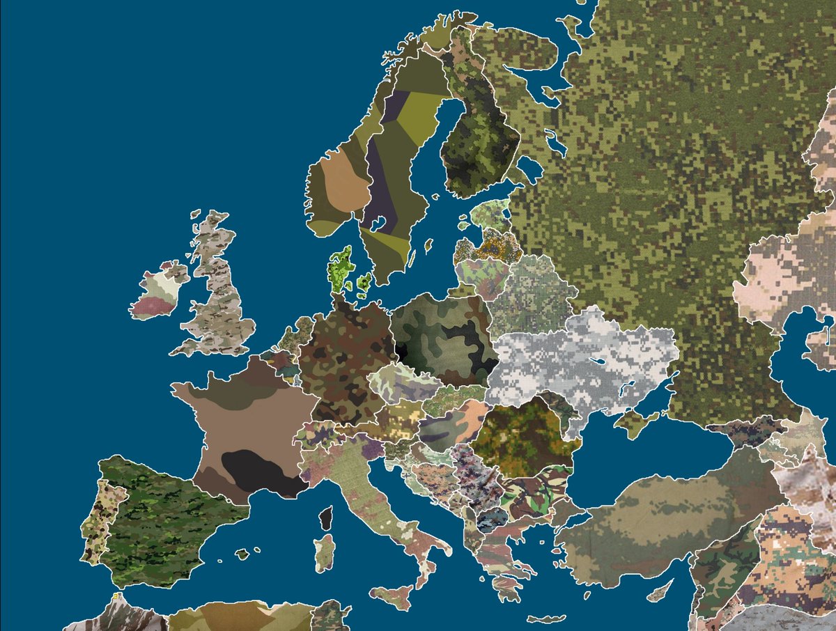
Différents types de motifs de camouflage en Europe. #map #camouflage #Europe #mapgeek #armee #geogeek #maplife #mapvisualization #data #carte #militaire
0
0
1