Explore tweets tagged as #geospatialmapping

Norway’s $1.6T fund maps every asset for biodiversity + water stress. Nature risk is no longer abstract. #NatureRisk #ClimateRisk #ESG #BiodiversityLoss #GeospatialMapping #SustainableFinance #OperationalResilience #SupplyChainRisk
0
0
0

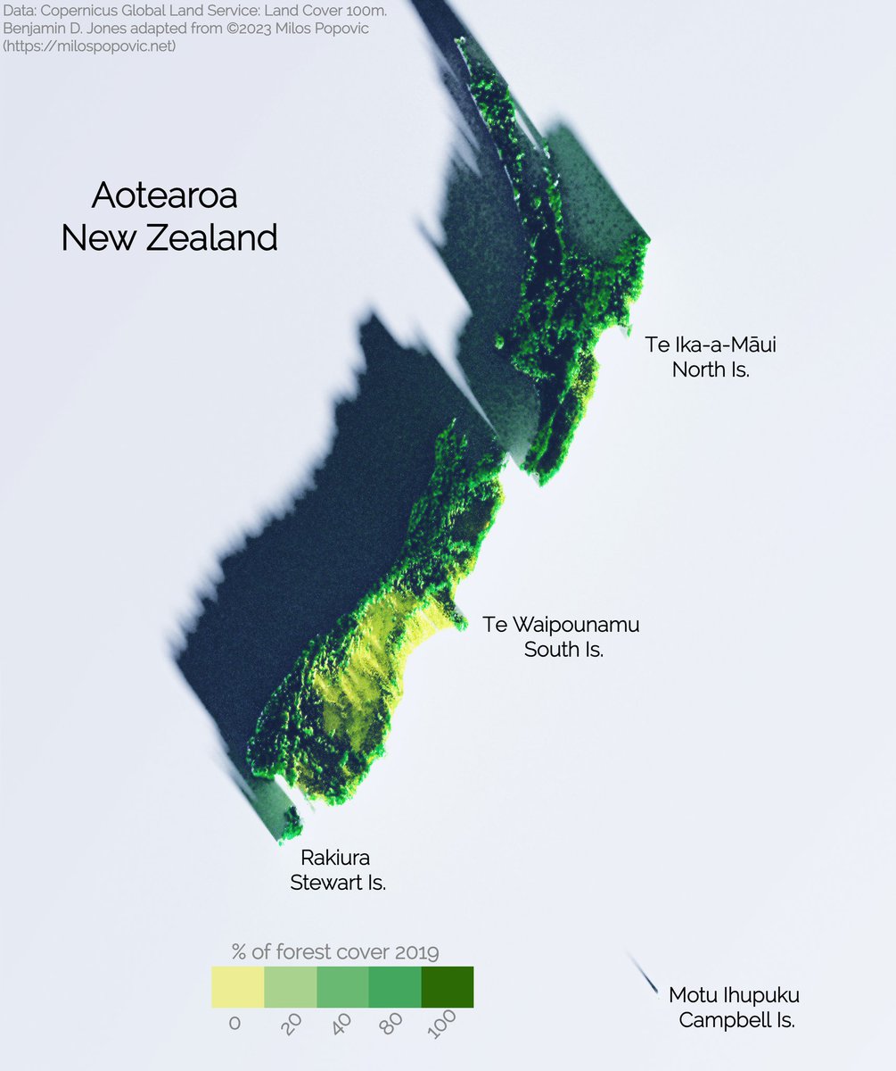
Copernicus 100m 2019 3-D forest cover map of Aotearoa / New Zealand. Inspiration from Milos Popovic, PhD "3D map with rayshader and ggplot2 in R" tutorial on youtube. #DataVisualization #RProgramming #R #SpatialAnalysis #GeospatialMapping #3DMapping #DataScience
0
1
10

Driving Space Innovation with Geospatial Intelligence.Visit: #ACWCircle #SpaceTech #GeospatialAI #GeospatialMapping #NextGenTechnology #SpatialAnalytics #InfrastructureOptimization #FutureOfSpace #TechInnovation #EarthObservation
0
0
0
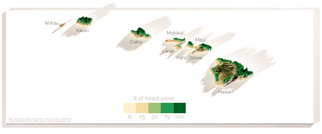
Hawaiian islands🏝. slowly getting through the Polynesian triangle. #RProgramming #ggplot2 #SpatialAnalysis #GeospatialMapping #hawaii #islands. Source Copernicus 100m R code - Milos Popovic
0
0
3

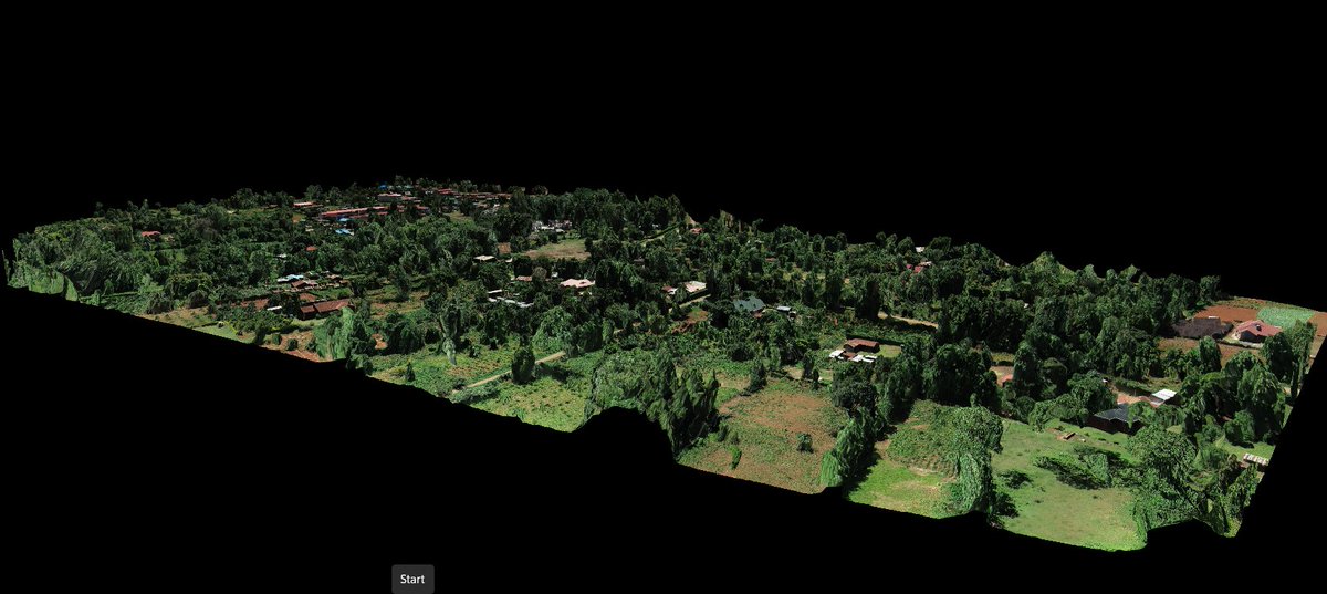
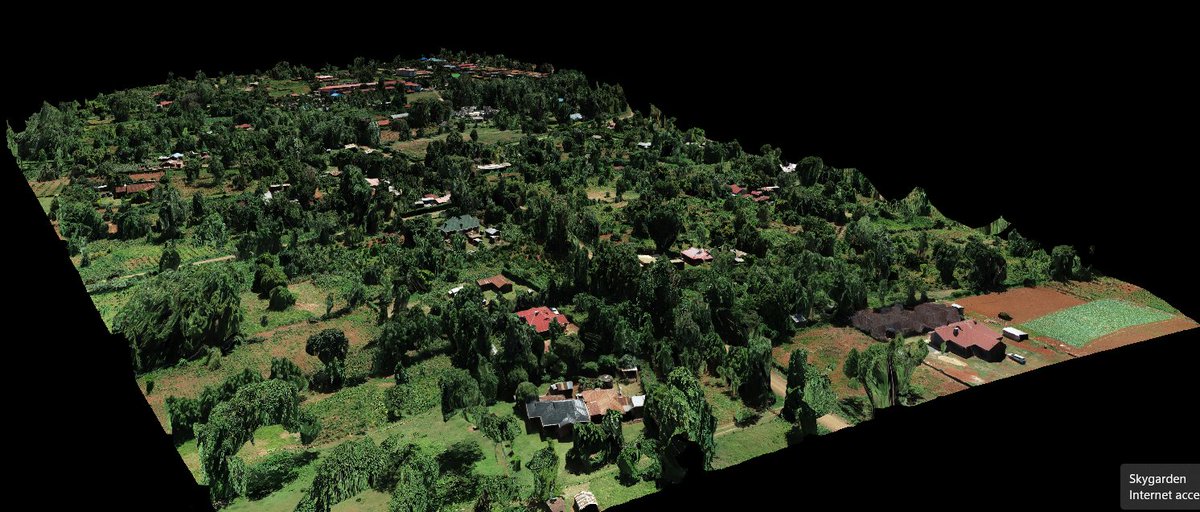
✨ Perfectly stitched 3D model of a rural neighborhood, reconstructed from high-resolution drone images taken by DJI ZENMUSE p1, using #DroneDeploy. This 3D orthomosaic is a high-resolution, distortion-free map, created by seamlessly combining multiple images.📡#GeospatialMapping
0
6
22

Arch Aerial is soaring to new heights in efficiency with their cutting-edge drone LiDAR technology, pushing the boundaries of geospatial mapping and redefining what's possible. #GeospatialMapping #DroneLiDAR #InnovationInFlight #DroneServices #DronePilots
0
0
1


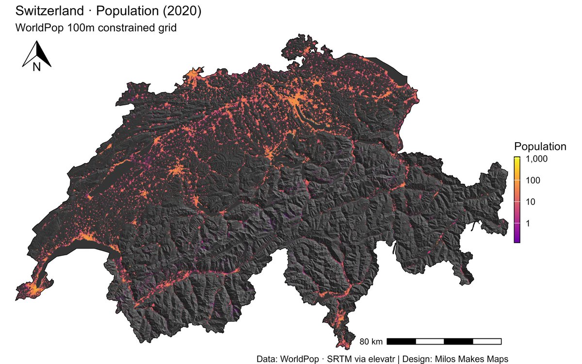
Want the secret to stunning maps like this Switzerland hillshade & population visualization?. My latest YouTube tutorial shows you exactly how!. 🎬 Watch here 👉🏻 #GIS #Cartography #RStats #DataViz #MilosMakesMaps
0
2
4
If you have experience in one of the roles above, please consider signing up via our volunteer form on our website: . Thank you!. #Volunteer #Democracy #Recruitment #Nonprofit #VRM #GIS #GeoSpatialMapping #DataReporting #DataReports #Paralegal.
0
0
5


Preserve history with FiOR CARTOgraph! Map sites, track changes, & compare historical data with precision. #HistoricalPreservation #GeospatialMapping
0
0
0

Empowering Indigenous rangers with cloud-based geospatial tech, Winyama Digital Solutions, co-founded by Andrew Morumburri Dowding, bridges cultural heritage and modern innovation. #IndigenousTech #GeospatialMapping

0
0
0
Introducing DCM Trishul: Your versatile UAV for defense and commercial applications. Ideal for precision missions. #DCMTrishul #UAV #DefenseTechnology #GeospatialMapping #Surveillance.
0
0
0

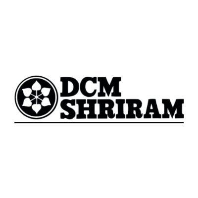
❗Last days to apply! Call for consultancy on geospatial data analyses and technical support for spatial planning is open until 13 October!. For more details on how to submit your proposal, check: #ISA #Consultancy #Hiring #GeospatialMapping #DeepSeabed
0
1
2
📢 ISA is seeking an organization with expertise in scientific and technical aspects of geospatial mapping and analyses. For more information, and how to send your proposal: #GeospatialMapping #GIS #DataAnalysis #GeospatialData #ISAat30

0
1
1

Exciting times for #Malawi! MUBAS trains its first-ever geospatial experts, promising significant advancements in mapping and sustainable development. #GeospatialMapping #YouthInvolvement #Malawi2063

0
0
0

#LoadSpring makes #GeospatialMapping easy with cloud-based/hosted applications so you can access and view anywhere in the world.

0
0
1

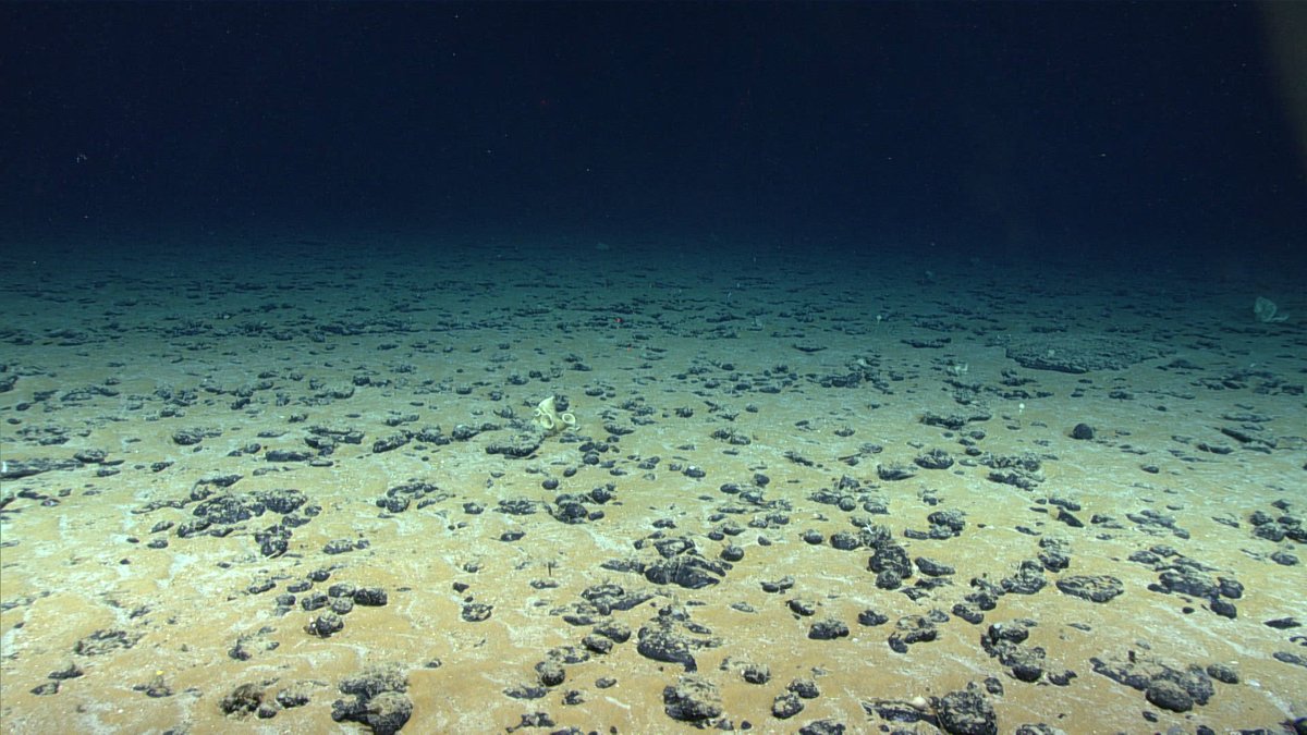
Gorgeous #SatelliteImagery of #Dubai! Check out our #ImageHunter tool for more at #SatelliteImages #AerialImages #GeoSpatialMapping
0
0
1

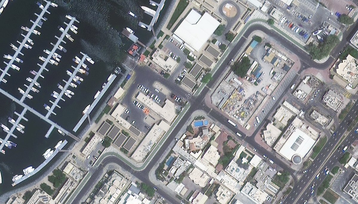
@FHI360 & our partners are excited to announce the launch of the @USAID Healthy Behaviors Activity in #Ethiopia 🇪🇹 . The Activity will increase healthy behaviors using social and behavior change & innovative community engagement and data use approaches, like #geospatialmapping.
0
0
2