Explore tweets tagged as #GeospatialMapping

Norway’s $1.6T fund maps every asset for biodiversity + water stress. Nature risk is no longer abstract. #NatureRisk #ClimateRisk #ESG #BiodiversityLoss #GeospatialMapping #SustainableFinance #OperationalResilience #SupplyChainRisk
0
0
0

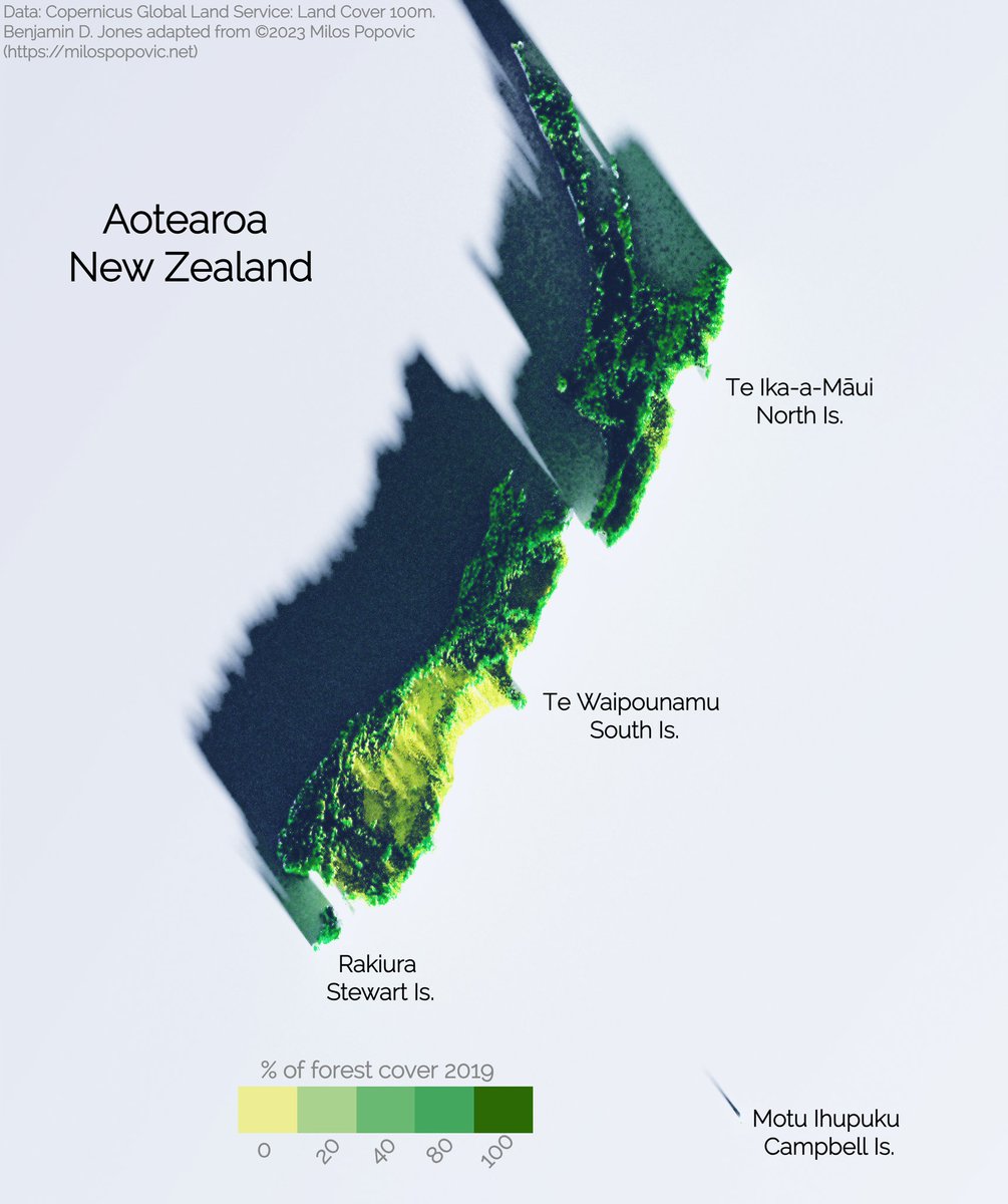
Copernicus 100m 2019 3-D forest cover map of Aotearoa / New Zealand. Inspiration from Milos Popovic, PhD "3D map with rayshader and ggplot2 in R" tutorial on youtube. #DataVisualization #RProgramming #R #SpatialAnalysis #GeospatialMapping #3DMapping #DataScience
0
1
10

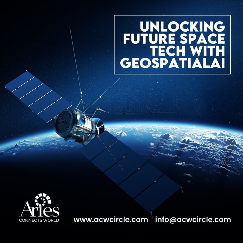
Driving Space Innovation with Geospatial Intelligence.Visit: #ACWCircle #SpaceTech #GeospatialAI #GeospatialMapping #NextGenTechnology #SpatialAnalytics #InfrastructureOptimization #FutureOfSpace #TechInnovation #EarthObservation
0
0
0
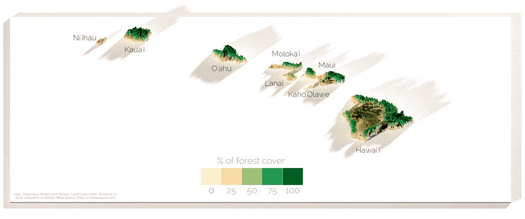
Hawaiian islands🏝. slowly getting through the Polynesian triangle. #RProgramming #ggplot2 #SpatialAnalysis #GeospatialMapping #hawaii #islands. Source Copernicus 100m R code - Milos Popovic
0
0
3

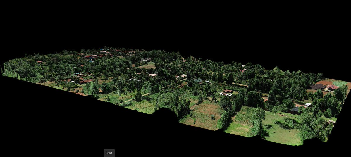
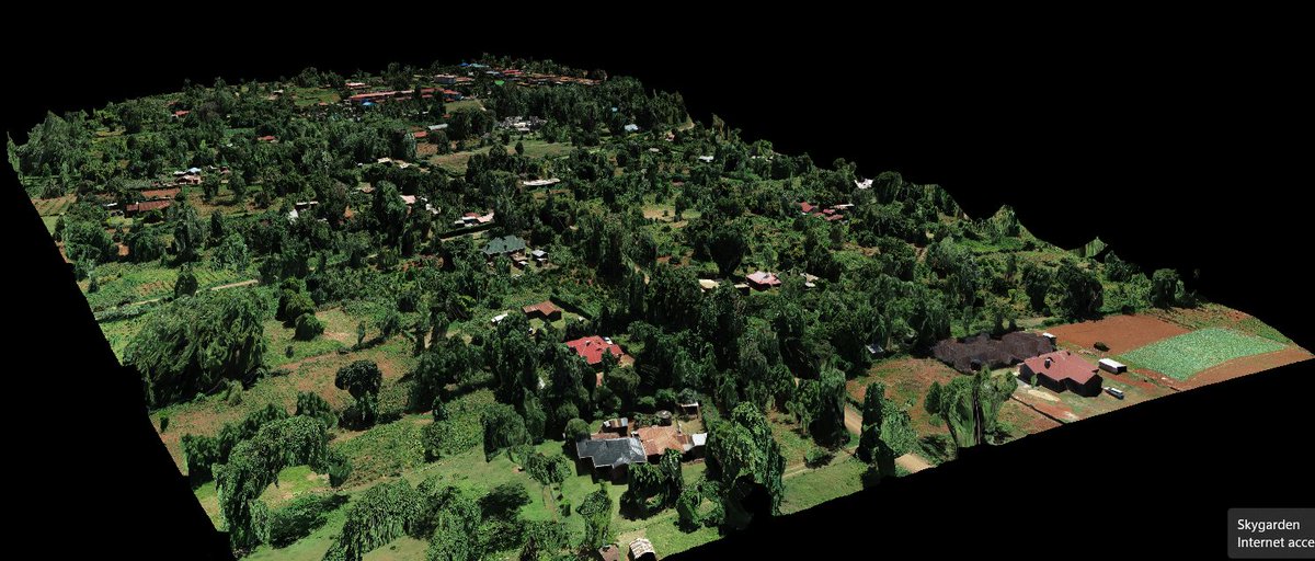
✨ Perfectly stitched 3D model of a rural neighborhood, reconstructed from high-resolution drone images taken by DJI ZENMUSE p1, using #DroneDeploy. This 3D orthomosaic is a high-resolution, distortion-free map, created by seamlessly combining multiple images.📡#GeospatialMapping
0
6
22

Arch Aerial is soaring to new heights in efficiency with their cutting-edge drone LiDAR technology, pushing the boundaries of geospatial mapping and redefining what's possible. #GeospatialMapping #DroneLiDAR #InnovationInFlight #DroneServices #DronePilots
0
0
1

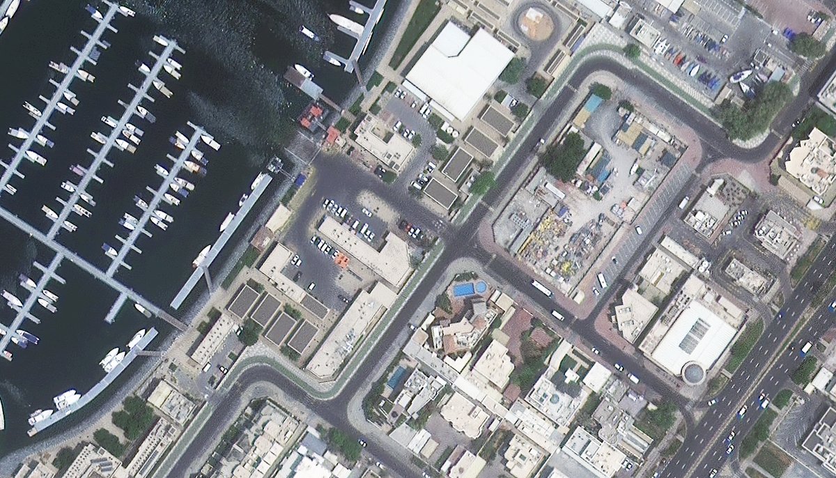
Gorgeous #SatelliteImagery of #Dubai! Check out our #ImageHunter tool for more at #SatelliteImages #AerialImages #GeoSpatialMapping
0
0
1


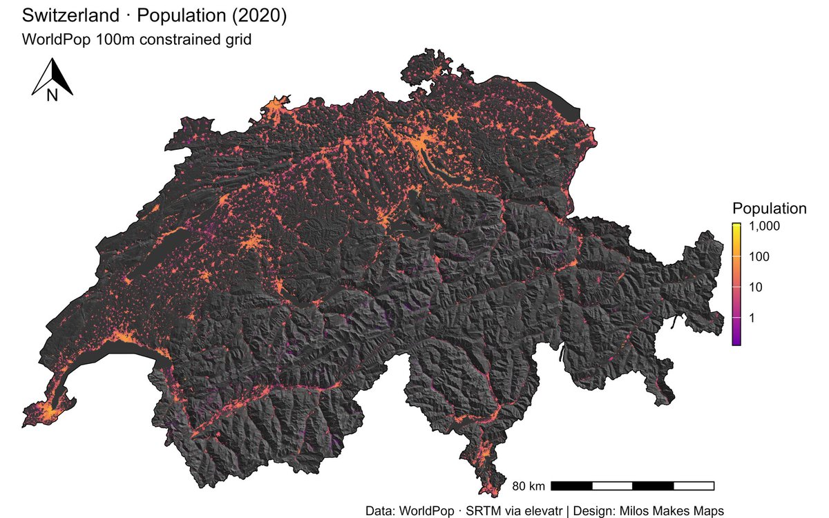
Want the secret to stunning maps like this Switzerland hillshade & population visualization?. My latest YouTube tutorial shows you exactly how!. 🎬 Watch here 👉🏻 #GIS #Cartography #RStats #DataViz #MilosMakesMaps
0
2
4
Such a gloriously beautiful satellite view of Provence France! Want more great satellite imagery? Visit our Image Hunter tool at . #satelliteimagerycollections #ImageHunter #GeospatialImaging #GeoSpatialMapping #AerialImagery


0
0
1


Introducing DCM Trishul: Your versatile UAV for defense and commercial applications. Ideal for precision missions. #DCMTrishul #UAV #DefenseTechnology #GeospatialMapping #Surveillance.
0
0
0
What an amazing #aerialimage of #FaroPortugal! Visit our #ImageHunter tool at to see some other great #aerialimagery! . #satelliteimagery #satelliteimages #geospatialmapping

0
0
0
Such a gorgeous #satelliteviewimage of the #ChemtoolPlantFire in #IL! Check out our #ImageHunter tool for more at #satelliteimagery #aerialimagery #geospatialmapping

0
0
0

Empowering Indigenous rangers with cloud-based geospatial tech, Winyama Digital Solutions, co-founded by Andrew Morumburri Dowding, bridges cultural heritage and modern innovation. #IndigenousTech #GeospatialMapping

0
0
0

Preserve history with FiOR CARTOgraph! Map sites, track changes, & compare historical data with precision. #HistoricalPreservation #GeospatialMapping
0
0
0


#LoadSpring makes #GeospatialMapping easy with cloud-based/hosted applications so you can access and view anywhere in the world.

0
0
1

Exciting times for #Malawi! MUBAS trains its first-ever geospatial experts, promising significant advancements in mapping and sustainable development. #GeospatialMapping #YouthInvolvement #Malawi2063

0
0
0
Such a splendid view from above of the Flooding In Erfstadt Germany! Check out our Image Hunter tool for more! . #satelliteimagery #satellitepictures #birdseyeview #viewfromabove #geospatialmapping #ImageHunter

0
0
0