Explore tweets tagged as #QGIS2threejs

ここ1-2か月はコード書くよりも遊び含めQGISを結構触った印象。netCDFをそのまま可視化できるのもスゴイ. 個人的ヒットプラグイン.1. Qgis2threejs:3D地図.2. DataPlotly: 地図連動のplotlyグラフ.3. profile tools:断面可視化.4. quickOSM:OSMから地物データ.5. Point sampling tool: 空間結合


0
2
12

جرب إضافة (Qgis2threejs) لعرض بياناتك الجغرافية ثلاثية الأبعاد داخل المتصفح. حول طبقات QGIS إلى مشاهد تفاعلية 3D بنقرة واحدة. رابط الإضافة: هل جربت تمثيل الارتفاعات أو المباني مجسمًا؟

1
7
45

DAS Cikapundung divisualisasikan secara 3D dengan QGIS2threejs. Untuk tampilan interaktif bisa masuk di blog saya pada tautan berikut:.

1
11
63


With the latest version of qgis2threejs in QGIS you can set your 3D scenes to autoplay in the browser, following any path you like (as you can see I need to work on this!) - here's the live web page example shown in the video #QGIS .
2
68
484


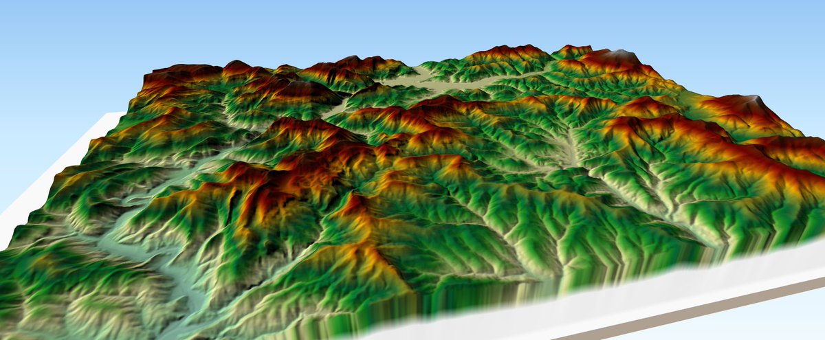
Day 07 of @tjukanov #30DayMapChallenge - Raster. Oblique view of the Ammergau Alps, a mountain range lying in Bavaria and Austria. Two rasters combined - 80 cm orthophoto and 25 m DEM . 3d rendering in #QGIS using QGis2threejs. Labeling in Photoshop.


3
5
73
I'm getting up to speed with new stuff in QGIS 3.4 so I made Madeira using the updated qgis2threejs - you can have a play around with it here
6
26
145

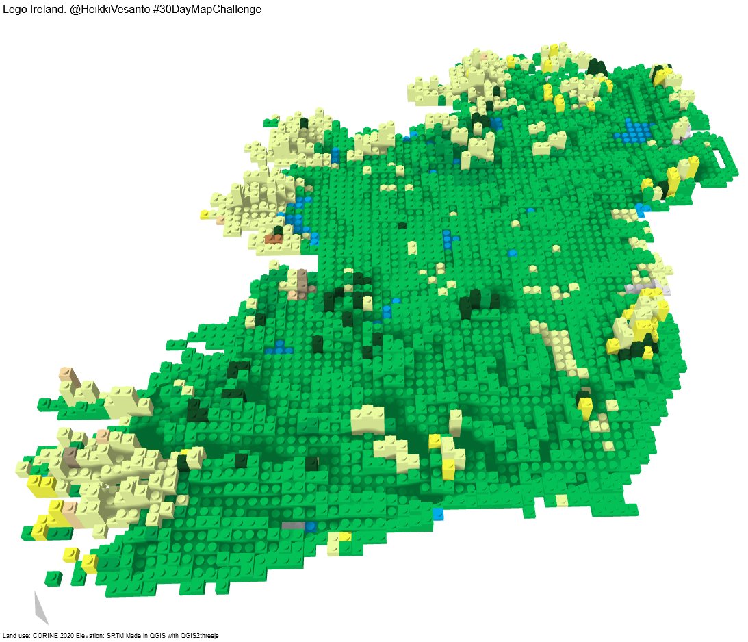
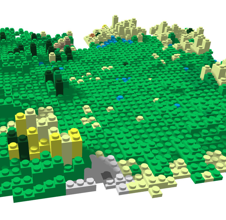
#30DayMapChallenge Day 11 "3D" - Lego Ireland. Created in #QGIS with QGIS2threejs. Interactive: Elevation from SRTM and land use from CORINE.

1
13
99

0
6
18


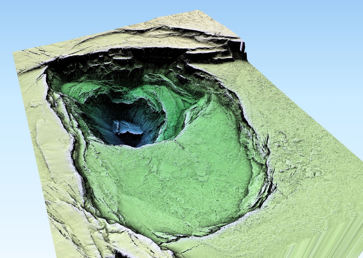
静岡県点群データ富士山。TerrainShadingとQgis2threejsプラグインでお手軽に生成。富士山の上部は火砕丘だというのがよくわかる。一方の裾野には蛇のように伸びる溶岩地形が広がっている。


1
40
135

#30DayMapChallenge: Elevation. Jan Mayen is a Norwegian volcanic island in the Arctic Ocean. It is 55 km long and 373 km² in area, partly covered by glaciers. It has two parts: larger northeast Nord-Jan and smaller Sør-Jan, linked by a 2.5 km wide isthmus. Made with qgis2threejs
1
3
16

I wish this was native to the 3D map canvas in QGIS, the transparency and extruding an object to the ground. This was done using QGIS2threejs, still want to know how can I increase the resolution of the basemap as there is no setting to do that

0
1
3

This time using plugin #qgis2threejs instead of #QGIS built-in 3D support. Worked a lot better and was really a lot easier to handle. Still far from perfect, and completed in #Gimp (CC-0).
2
12
96

Here is the interactive 3D model on the web #TopoUSM + #Qgis2threejs with USGS July 2018 Kilauea LiDAR data.
6
44
103

Just doing some things with plugins for qgis. This one is qgis2threejs. $ spent on habitat projects as red balloons. 🤔 😁

4
2
28

Found this interesting tool whilst experimenting for map 11 of #30DayMapChallenge, QGIS2threejs allows 3D quick visualisation of data from QGIS. Here is the Langdales to Scafell Pike visualised in 3D! #Elevation #Langdale #LakeDistrict. Data: OS 5m DEM


0
3
12