

Damien Symon
@detresfa_
Followers
213K
Following
3
Media
2K
Statuses
3K
OSINT, Doodles, Balloon/Carrier Tracker, Typ0s Views my own | Media - https://t.co/LARrtLMg4z @theintellab | @thewarzonewire | @Platracker | @TheWorldToday
Joined November 2012
Hi @DefenceSahil, since you chose to hide the reply, here's a message you cant hide - stop removing watermarks & pasting your name over someone else's work, no one appreciates theft, imitation is still understood, but cropping the image to paste your name on it is unethical
34
102
946
Now a fourth Chinese research vessel is enroute to the Indian Ocean Region - 'Lan Hai 101', capable of aquaculture research is heading to Sri Lanka, 'Shi Yan 6' heads to Mauritius while 'Shen Hai Yi Hao' & 'Lan Hai 201' have begun surveys
41
253
1K
India issues a notification extending its danger zone for a likely sea launched missile test off the coast of Visakhapatnam, the range is near 3,485-km Date | 01-04 December 2025
India issues a notification extending its danger zone for a likely missile test in the Bay of Bengal region off the coast of Visakhapatnam, the range is near 1,695-km Date | 01-04 December 2025
94
316
2K
India issues a notification reserving airspace for an Indian Airforce Exercise near the southern section of its border with Pakistan Date | 03-06 December 2025
68
261
2K
India has re-issued a notification near the Andaman & Nicobar Islands for likely missile test(s) Date: 01-03 December 2025
20
144
958
India issues a notification extending its danger zone for a likely missile test in the Bay of Bengal region off the coast of Visakhapatnam, the range is near 1,695-km Date | 01-04 December 2025
India issues a notification for a likely missile test in the Bay of Bengal region off the coast of Visakhapatnam Date | 01-04 December 2025
40
174
960
India issues a notification for a likely missile test in the Bay of Bengal region off the coast of Visakhapatnam Date | 01-04 December 2025
30
140
911
India issues a notification for a likely missile test in the Bay of Bengal region Date | 06-08 December 2025
65
257
2K
A third Chinese Research vessel is now in the Indian Ocean region, 'Shi Yan 6' - capable of geophysical ocean research is heading to Mauritius, while 'Shen Hai Yi Hao' & 'Lan Hai' have begun surveys in the region
23
162
712
Pakistan issues a new notification for firing by naval ships in the Arabian Sea Region (likely missile test) Dates: 25-26 November 2025
14
71
492
Notification from Pakistan Issued - 19 Nov 2025 Valid - 23 Dec 2025
3
6
50
As Pakistan again extends its airspace denial for India linked aircraft till Dec 23 2025, this report indicates India's flag carrier is looking to use Chinese airspace to counter rising operating costs imposed by this overflight ban https://t.co/R8Mg1SPow0
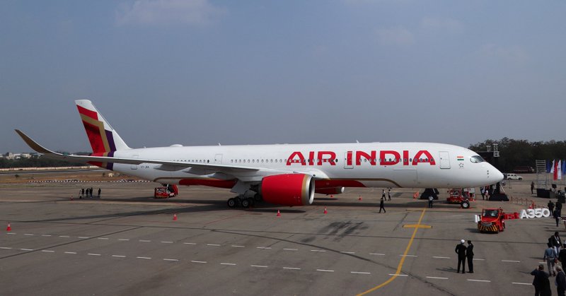
reuters.com
Air India is lobbying the Indian government to convince China to let it use a sensitive military airspace zone in Xinjiang to shorten routes as the financial toll from a ban on Indian carriers flying...
15
57
432
India has issued a notification near the Andaman & Nicobar Islands for likely missile tests Date: 25-27 November 2025
33
233
2K
Update - as of 18 November 2025 both ships have returned to port
2
3
63
Imagery from earlier today shows China's newest aircraft carrier, Fujian has left port for the first time since it was commissioned earlier this month, possibly on its first deployment. Aircraft carrier - Shandong is also observed outside the port.
18
145
971
Pakistan appears to have constructed a new facility at Nur Khan Airbase, at the location India targeted during its May 2025 conflict
55
238
1K
Imagery over the past few months reveals the hangar targeted by India at Jacobabad Airbase, Pakistan during the May 2025 conflict, has had its roof taken apart in stages likely as internal damage checks continue before the structure is repaired
69
331
2K