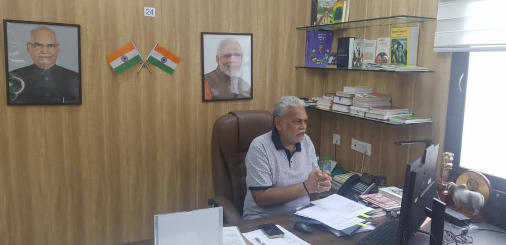
Agendra Kumar
@agendra
Followers
221
Following
27
Media
9
Statuses
42
Managing Director - Esri India, Past President - Association of Geospatial Industries. Nature and heritage photographer.
Delhi, India
Joined June 2009
The 2025-26 budget boosts the geospatial sector with the #NationalGeospatialMission. Steps like Rs 1L Cr urban challenge, Rs 20,000 Cr for private sector R&D, Rs 500 Cr for CoE in AI for education and 10,000 PM research fellowships will make India a global innovation leader.
2
1
5
This #NationalPollutionControlDay , let's collectively pledge to make our contribution towards climate protection & conservation. Small steps taken in this direction can help us be more environmentally conscious & ensure a more #sustainable future @moefcc @EsriIndia

0
2
12
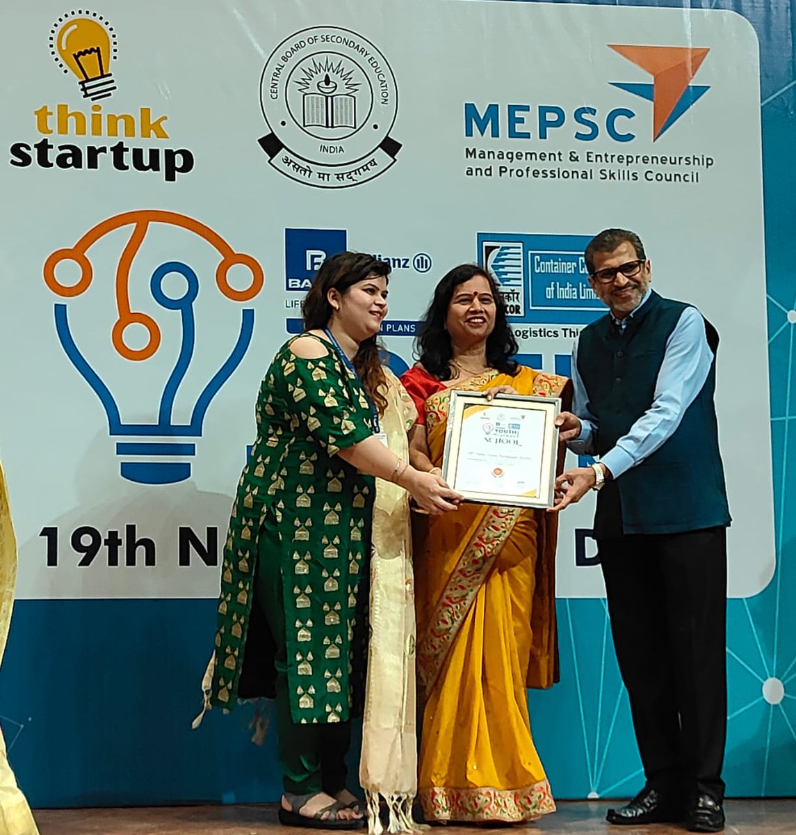
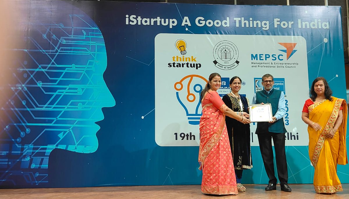
Was delighted to meet & recognize some great teachers who inspired students from 4 to 12 grade to come up with amazing ideas. #YouthIdeathon is addressing the need to inculcate spirit of innovation in future generation. Kudos to @ThinkStartup team for this mission @Cbse_official
1
0
7
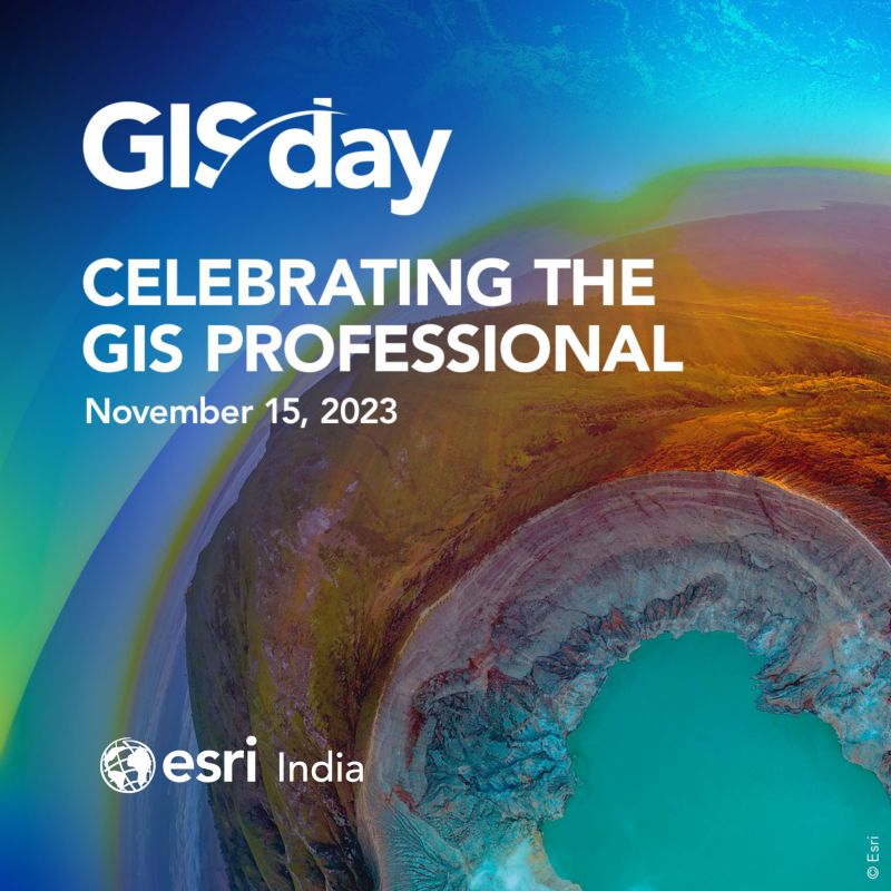
Today is a day to celebrate & share the amazing work of GIS professionals. My congratulations to all the GIS professionals, members of academia, and users, who address the most pressing social & business challenges using #GIS technology. Wishing you all a happy #GISday2023.
0
3
19
RT @EsriIndia: The #launchevent of our new and exciting offering #ArcGISPlatform is just a few days away. Join us for an exclusive virtual….
0
3
0
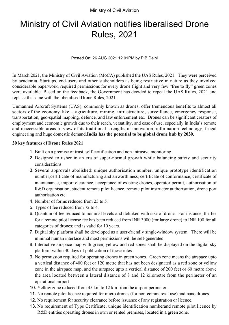
The new #DroneRules reduce the number of permissions and simplify process for use of Drones. Agriculture, infra dev, security, utilities, land mgmt, transportation and other sectors will benefit a lot. @MoCA_GoI @JM_Scindia @Gen_VKSingh @DGCAIndia @agiindia @dronefed

0
4
11
Another great milestone for @Geospatial sector in India. New Drone Rules announced by @MoCA_GoI are simple and encouraging, will speed up development, job creation thru higher use of GIS. @JM_Scindia @Gen_VKSingh @DGCAIndia #DronePolicy.

Ministry of Civil Aviation notifies liberalised Drone Rules, 2021. @MoCA_GoI @JM_Scindia @Gen_VKSingh @DGCAIndia . Details:
0
5
9
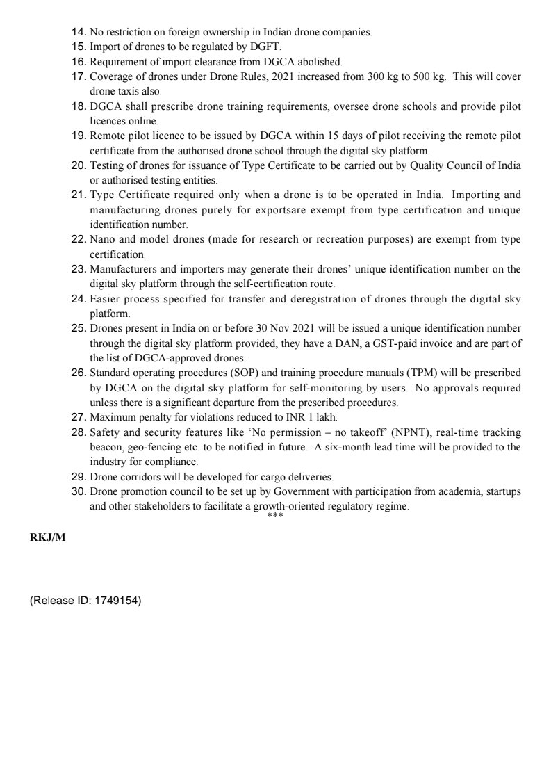
This MoU under Sh Naveen Tomar, Surveyor Gen of India's leadership will go a long way in @geospatialskill building in the country. An honor and a great milestone. @sgi_soi @PMOIndia @NITIAayog @skilldevelopmp.

#newsupdates : Survey of India and @agiindia have signed a Memorandum of Understanding for Geospatial Skill Development in the country. Read more:
0
2
10
It was inspiring to hear views from eminent members of the Panel on Day 1 of Esri India UC - how GIS is helping in better sustainability. Join us for another action-packed day of learning from technological expositions and discussions today at 2 PM (IST).
0
1
6
Water restoration & conservation are key to our sustainable future. NMCG is using geospatial technology extensively in its efforts towards the #CleanGangaRiver mission which provides water to nearly 40% of India’s population. #NamamiGange .Read more:
0
0
5
Maps can integrate complex data and present simple to understand location intelligence through GIS systems. This helps in better investment decisions, efficiency, resilience, collaboration and communication. Aren't these important in these challenging times?.

Discover five ways smart maps have changed the business world. #LocationIntelligence.
0
1
4
Congratulations Jack Dangermond for this achievement.Over past decades,Esri technology has been heart of major programs focused on sustainability. Your vision is driving force for innovations which empowers user to understand & solve challenges using #GIS.

igu-online.org
The Awards Committee of the International Geographical Union is delighted to announce the recipients of the IGU Awards for 2021. Mr. Dangermond is awarded the Planet and Humanity Medal (which hono…
0
0
3
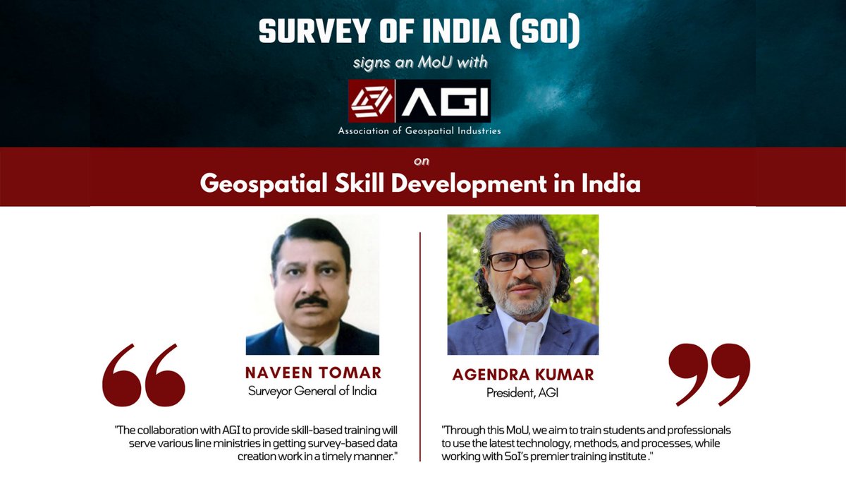
Oceans play a critical role in maintaining the ecological balance of our planet. Geography and GIS help in the understanding and building collaborations for sustained life and livelihoods connected with the ocean. #WorldOceanDay One Ocean, One Climate, One Future
0
3
10
Key points of the session:.-Maps & GIS are transformative for both govt. & private sectors. -Indian #Geospatial Sector has been deregulated.-New geospatial data policy will bring growth in Indian Geospatial Market.-#AtmanirbharBharat will create new opportunities for this segment.
0
0
2
Recently, I had the opportunity to share my views with economists, investment houses, venture capitalists, & other financial leaders on the economic impact of new geospatial policy in the webinar hosted by Elara Capital. It was an informative session.Link:
1
0
5
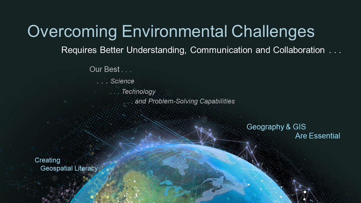
Spatial thinking is essential to understand the magnitude of threats we face today. #GIS provides valuable insights for better understanding, collaboration, & timely decisions for #EcosystemRestoration & a sustainable future. #WorldEnvironmentDay #ForNature #SaveThePlanet
0
3
10
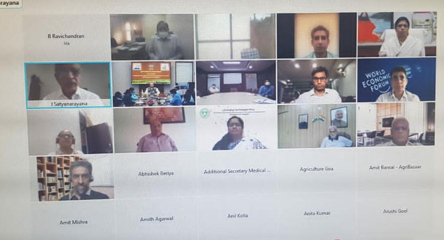
Digital Agriculture is the future. @EsriIndia is proud to be part of this visionary step by @AgriGoI and will set-up "National Agriculture GeoHUB". #GIS will transform agriculture sector, drive farmers' welfare & help in increasing their income @nstomar @IndiaDST @drharshvardhan
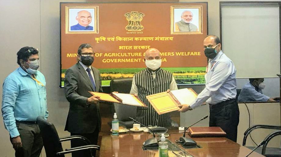

I participated in video conferencing of the signing of MoU between the Ministry of Agriculture and Farmers Welfare with (i) Patanjali Organic Research Institute, (ii) Amazon Web Services, (iii) ESRI India Pvt. Ltd and (iv) Agribazaar India Pvt Ltd from Delhi residence. (Part-1)

0
2
7
Geospatial data and GIS are making a big difference in every walk of life. #esri #GIS #SmartCities #utilities #SDGs.

India is fighting back with upsurging COVID-19 with help of GIS technology. Esri GIS dashboard & maps help in monitoring the pandemic spread and containment zones. To know more click on: #GIS #EsriIndia #GISMapping #EsriCovidDashboard.
0
4
11
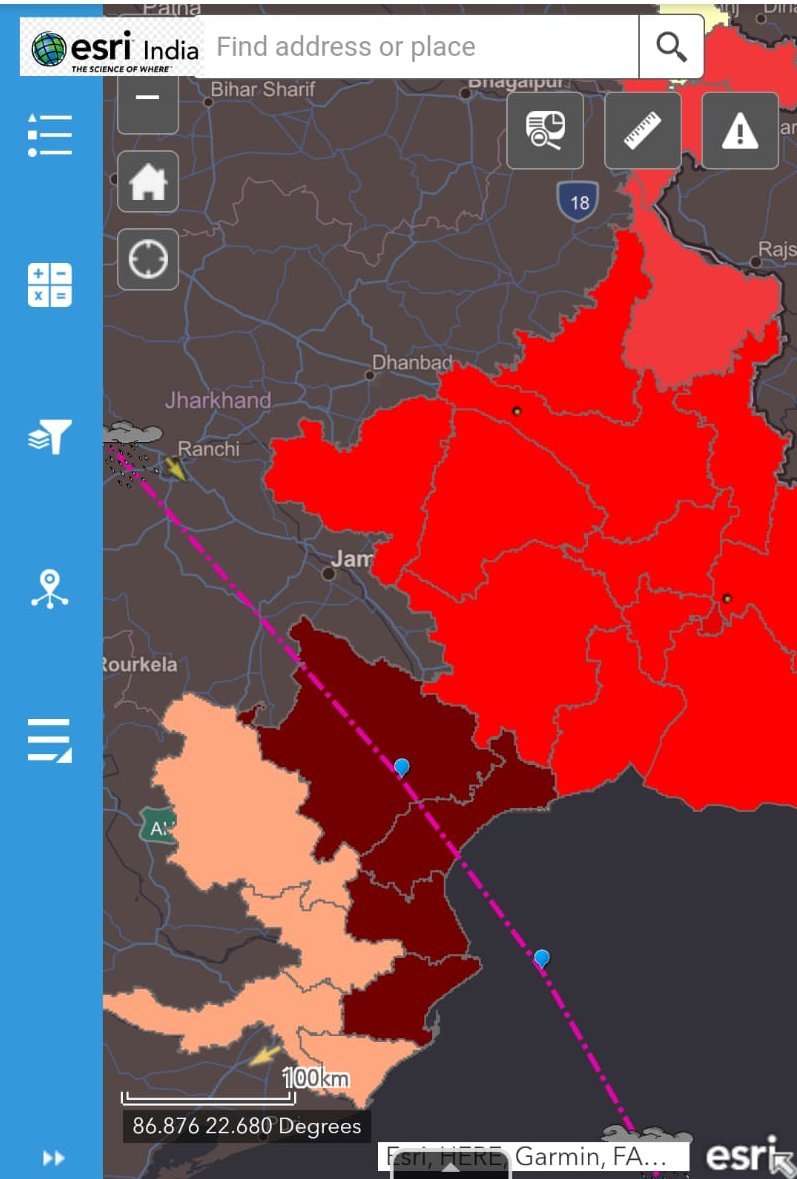
Within 2 days the map has been viewed by over 200,000 people. @EsriDRP team is always there to support the users & community in any emergency with resources, maps, and data to be better prepared to tackle such situations. #YaasCyclone @ndmaindia @NDRFHQ @IMDWeather @IndiaDST.
Get an integrated view on the movement and impact of Cyclone Yaas on Esri India GIS map. Built with #ArcGIS. RT to spread the word.Track Yaas Cyclone - #CycloneYaas #Esri #GISMap #Cyclone #OdishaFightsYaas
0
5
9