

🌪️TornadoClips🌪️
@TornadoClipss
Followers
1,668
Following
1,692
Media
3,288
Statuses
24,575
Weather enthusiast since April 2021. I want to help predict and conduct research on tornadoes. I want to become an Oklahoma storm chaser. + space and volcanoes
United States
Joined April 2023
Don't wanna be here?
Send us removal request.
Explore trending content on Musk Viewer
Modi
• 404524 Tweets
#ElectionsResults
• 358510 Tweets
#KutamiTsunami
• 128738 Tweets
Hindus
• 103699 Tweets
#400Paar
• 93896 Tweets
DJ JKP OFFICIALLY 30
• 88516 Tweets
उत्तर प्रदेश
• 75912 Tweets
Bihar
• 74842 Tweets
天安門事件
• 71296 Tweets
Maharashtra
• 61169 Tweets
Uttar Pradesh
• 59601 Tweets
समाजवादी पार्टी
• 46361 Tweets
Karnataka
• 38624 Tweets
Ram Mandir
• 35616 Tweets
#लोकसभा_आमचुनाव_2024
• 35396 Tweets
Rajasthan
• 33589 Tweets
स्मृति ईरानी
• 33378 Tweets
Nitish
• 33125 Tweets
Varanasi
• 32766 Tweets
Ayodhya
• 31007 Tweets
Caste
• 30520 Tweets
竹内涼真
• 24823 Tweets
桐生一馬
• 23996 Tweets
Naidu
• 22003 Tweets
Yogi
• 21465 Tweets
Amethi
• 20441 Tweets
ゼウスシルエット
• 17374 Tweets
नीतीश कुमार
• 16120 Tweets
الفصل الدراسي الثالث
• 14502 Tweets
राम मंदिर
• 13683 Tweets
Smriti Irani
• 13668 Tweets
ガンレオン
• 13133 Tweets
TolongAdili KasusTimah
• 11655 Tweets
スト6半額
• 10570 Tweets
Last Seen Profiles


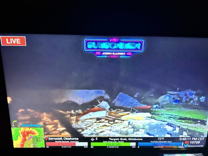
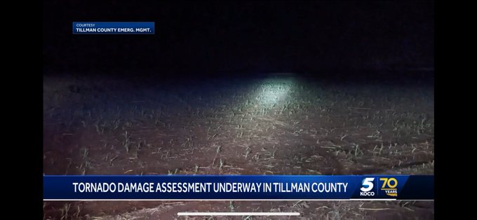
Bradon copic has significant damage. He is search and rescue
15
53
271
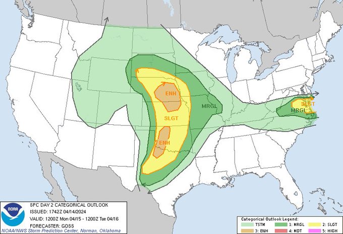
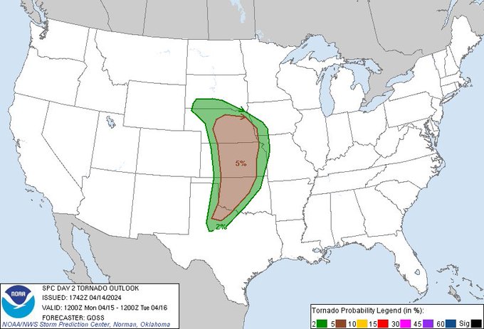
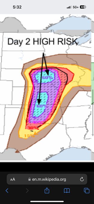
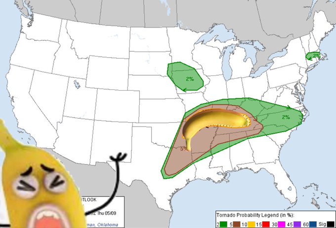
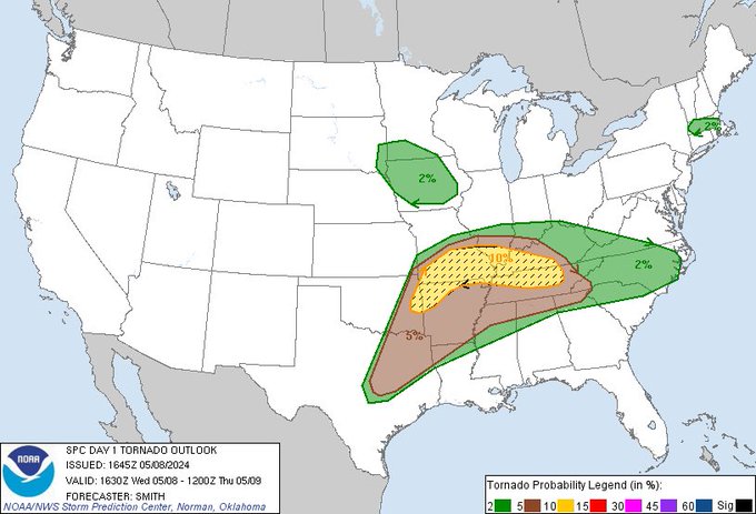
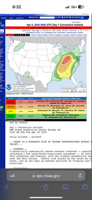
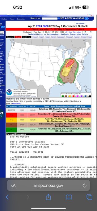
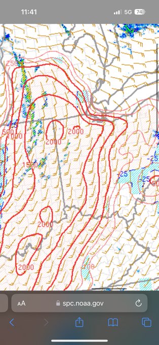
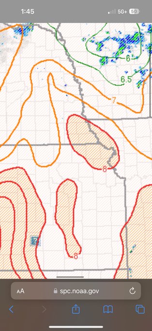
Watch today’s 10 sig outperform yesterday’s high risk drastically.
28
7
198
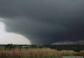
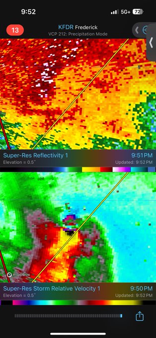
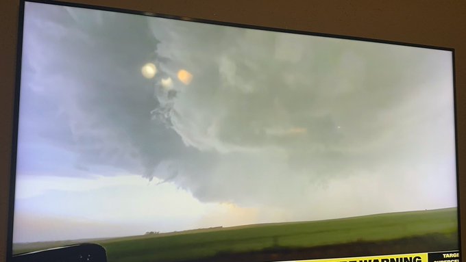
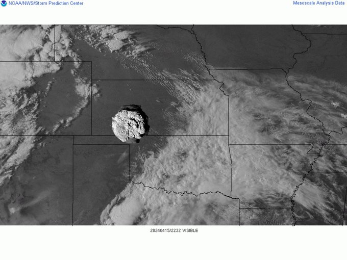
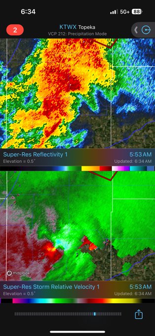
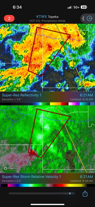
What in the Oklahoma rainwrapped 200+ mph wedge EYE just happened
2
19
191
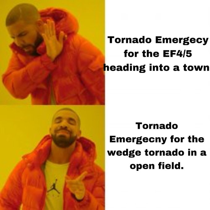
So when did we start issuing tornado emergencies in farm land but not when there is a violent tornado heading into a town?
14
8
190
Anyone who need to understand this solar storm in weather terms it’s basically an EF4 195 mph and a moderate risk.
9
13
175
Tornado season from hell now about to turn into hurricane season from hell
15
16
162
Watch this thing produce a mega wedge in two hours.
15
11
163
People screaming it’s over then we get the violent tornado after dark
15
12
163
Todays events have significantly underperformed from what models where showing today wow.
I swear these models becoming more broken. Trying to print supercells like it’s May bruh
18
6
150
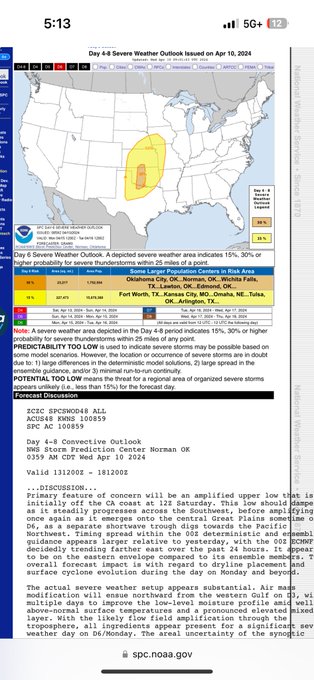
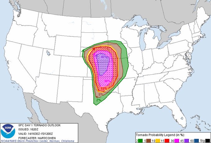
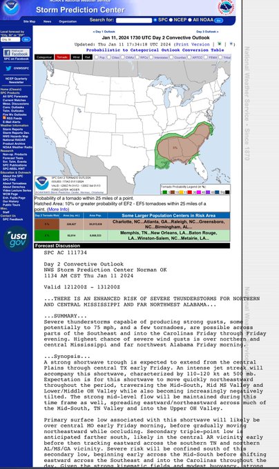
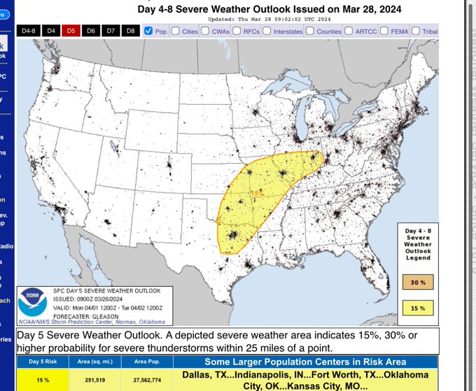
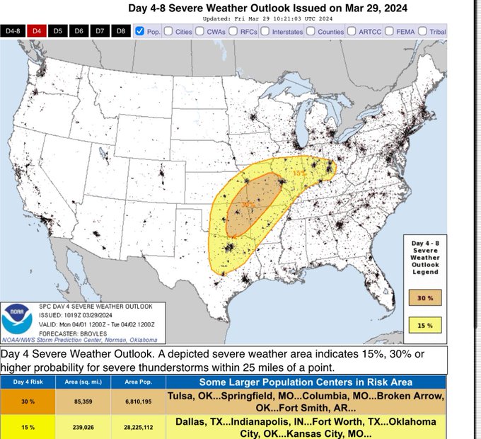
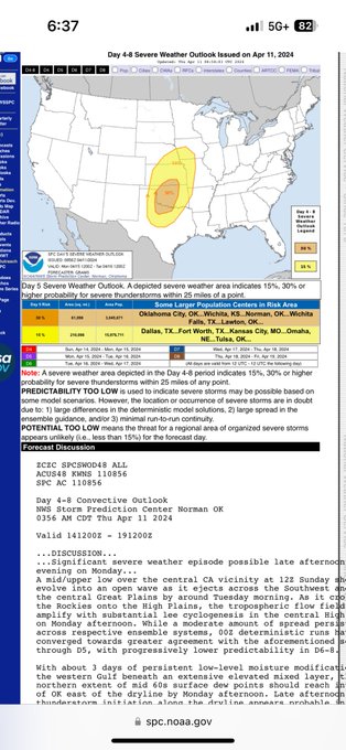
Woah woah woah. I have never seen a plains 30 percent risk in day 6 before. They most be pretty confident in something big happening.
11
19
145
…
Watch today’s 10 sig outperform yesterday’s high risk drastically.
28
7
198
9
3
141
First time I have been in a high risk. Pretty scary ngl.
28
7
140
Reed predicts significant tornadoes in the next two hours
3
19
109
992 LOW. We could see the most significant tornado outbreak so far this year!!
6
12
100
Wow these lifts are very strong this is a high end tornado

5
10
101

Is this real can anyone confirm?

16
8
95
El Reno 2011 isn’t talked as much as it need to and that’s because it’s overshadowed so much by the other tornadoes that year.
It was spinning so hard and fast that it was able to generate enough friction with the ground to create 2 horizontal rolling vortexes. Insane.
10
5
94
Is it me or have high risk become less common especially in April and May. Is it because we are better at forecasting? Or is the environment becoming weaker? Like why haven’t we seen this in a while? We had 2019 but it busted tho. Idk it’s just odd to me
22
4
93
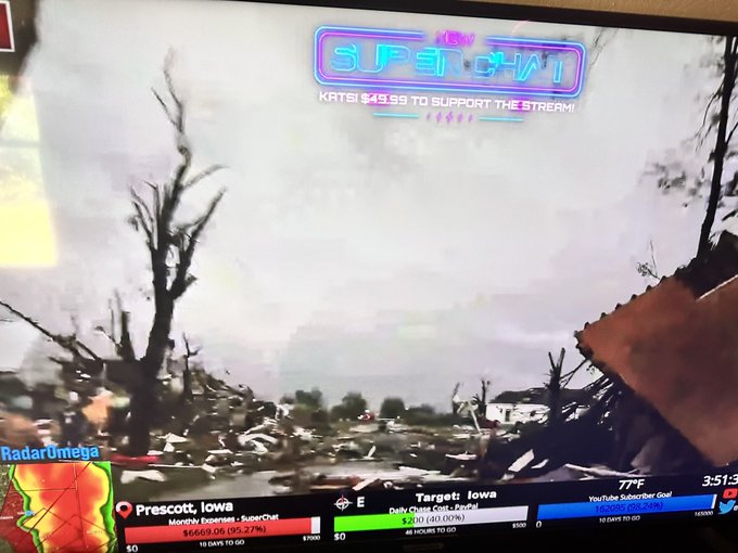
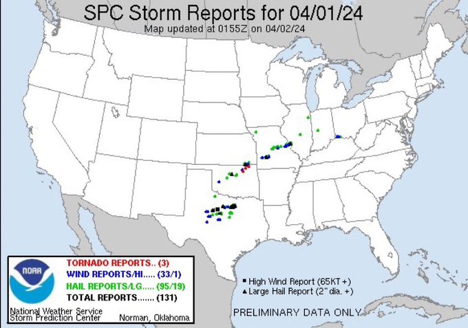
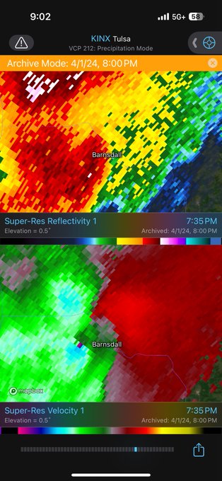
April 1 2024! Nearly forgot about this! BARNSDALL was hit by an EF1
3
3
90
I miss 2019 when everything in the world was still just normal life and peaceful.
These past four years have been so horrible for humanity.
10
5
86
Umm third largest tornado right!!??

WOW. The Decatur, Arkansas EF3 tornado from May 26th is confirmed at 3200 yds wide.
That is 1.8 miles. That is insane.
More info here:
9
113
507
5
1
81
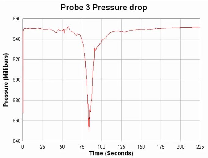
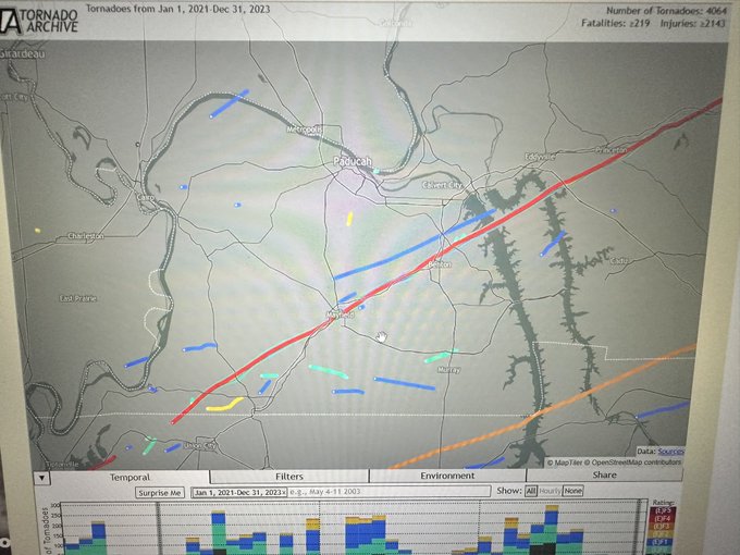
A lot of people think Typhoon tip hold the record for lowest pressure ever recorded on the surface of the earth however it’s actually The 2003 Manchester South Dakota wedge tornado. I have been looking for Tims prob data for so long and finally found it. CONFIRMED 850 MILLIBARS!!
9
10
76
This is scary. This hurricane season might be insane.
7
10
73
This might just set a record for the fastest moving tornado

New video of the tornado that moved through Temple earlier.
This as the view from Tyson in the Parks of Westfield area
#txwx
@NWSFortWorth
26
323
1K
9
3
75
Multiple meteorologist in Oklahoma have been informed ahead of time of the upcoming high risk that will be issued.
2
13
76
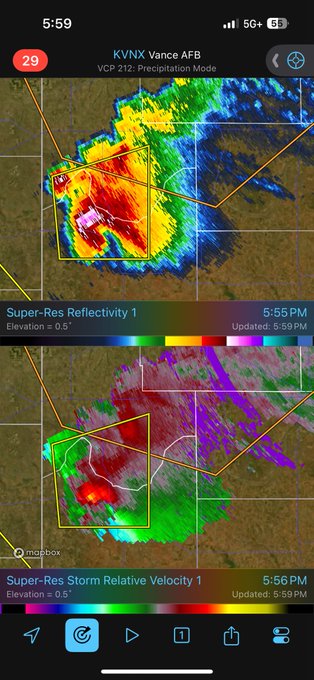
So apparently Saturday is now looking like another major tornado outbreak across Oklahoma and Kansas
6
7
75
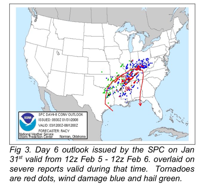
I think everyone need to look at the February 8 2008 Super Tuesday tornado outbreak as a analog to this upcoming event. Not saying it will be anything like it but some of the synoptics are similar.
10
8
75

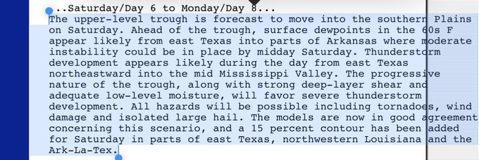
Wow that’s some pretty strong wording by the SPC this far out. They are pretty confident that there will be an All hazard threat this Saturday.
7
11
74
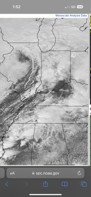
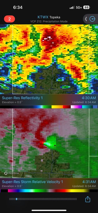
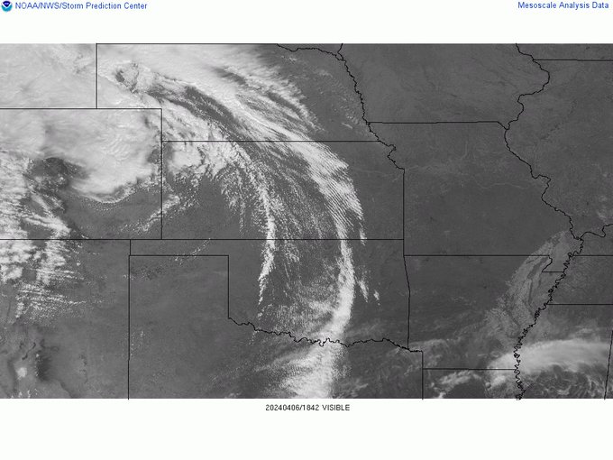
Plenty of clearing behind that MCS. It should recover fine today.
7
8
73
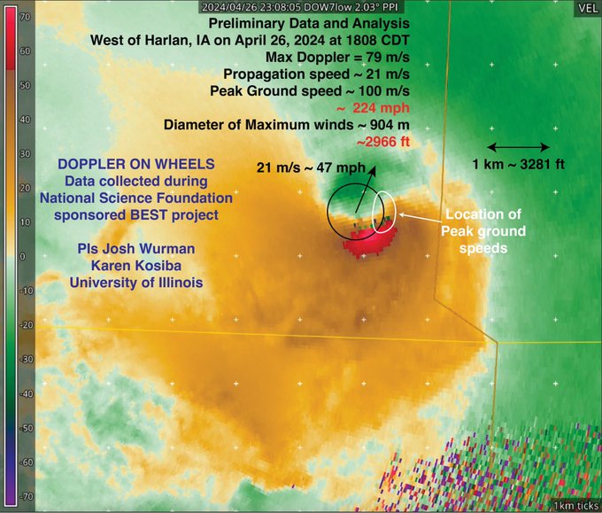
They say the Iowa tornado had peak ground winds of 224 mph however it won’t be rated EF5 because no damage will be found.
(Thankfully glad it didn’t hit anything more glad it wasn’t any worse)

Preliminary Wind Summary Measurements and Analysis from Harlan, IA tornado on Friday (26 April 2024).
Winds of ~224 mph and diameter of max winds of ~2966 ft.
Observations were taken as part of the
@NSF
-sponsored
#BEST
project led by
@karen_kosiba
and
@JoshuaWurman
59
588
2K
3
7
73


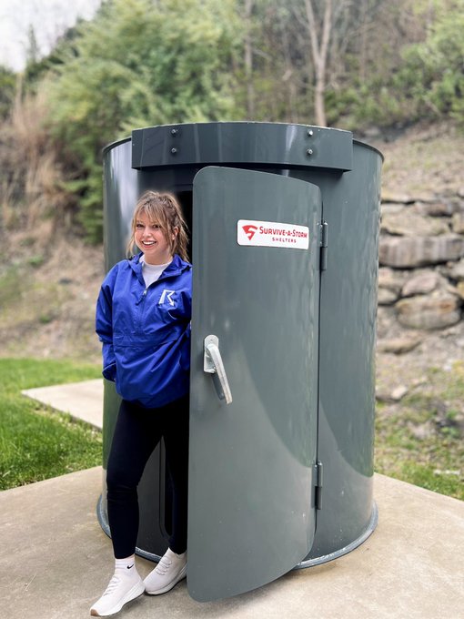
I’m no expert. However. Based on the curved metal door alone That ain’t gonna stop high end EF3. The fact that those hinges on the outside as well big no no imo. Also the fact that it’s not even half inch thick steel. I’m sorry but this one ain’t cutting it

When we get a tornado warning at the Weather House, our safe place is inside our storm shelter!
#SafePlaceSelfie
47
39
677
16
4
70
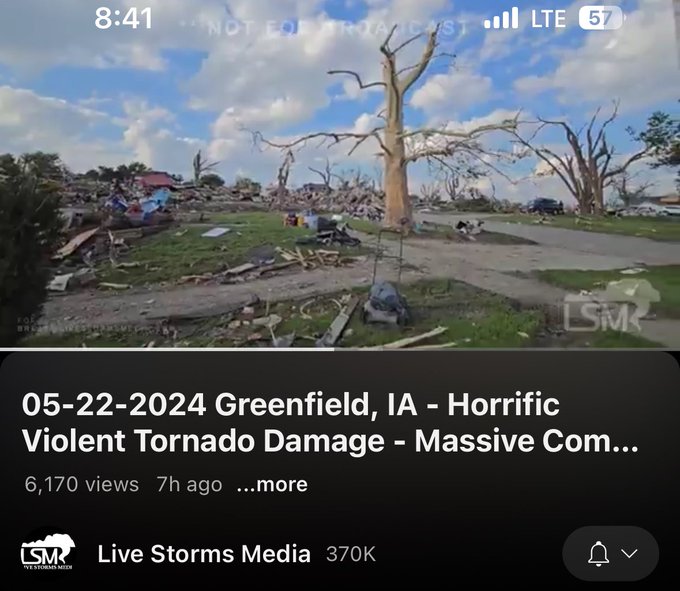
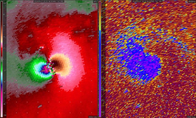
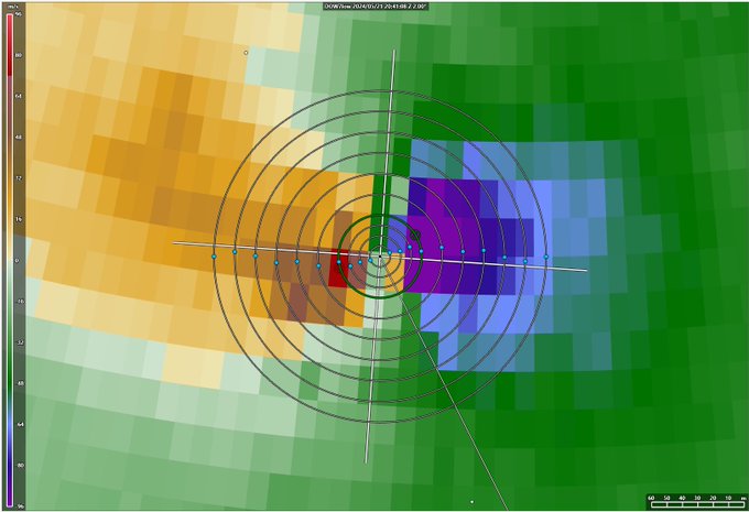
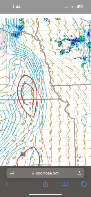
I believe this is now the third strongest tornado ever recorded by the DOW.
I could be wrong though.
Very prelim analysis of DOW data show
>250 mph peak winds, possibly high as 290, at 44 m (144 ft) above ground in Greenfield, IA. Tornado very intense & also very small, so worst winds were in narrow swath. Raw data from DOW7 (L); Prelim DOW-measured center path. POD blue dot (R)
63
656
2K
6
4
69
Wow this landspout is amazing! Did you know landspout are tornadoes too!
Landspouts = Tornadoes

4
3
68
People just need to be thankful yesterday wasn’t worse and move on.
5
7
68
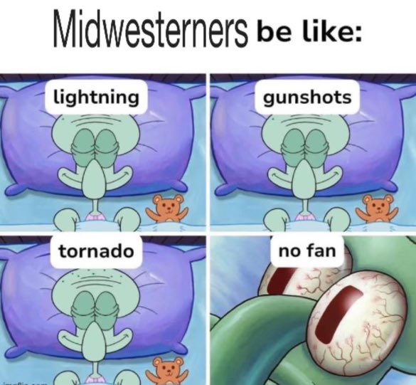
This is so real. I don’t understand you people who don’t sleep without a fan. Like it’s a necessary need in the mid states

7
4
65
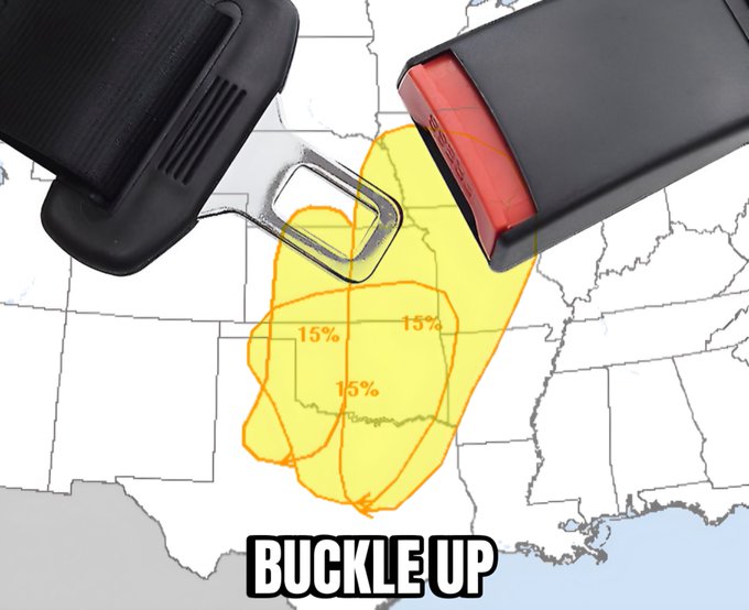
Wow. Likely a widespread severe weather outbreak that will include all hazards from Oklahoma Arkansas and Missouri
5
11
65
I just woke up to that so wow. Wednesday there will likely strong long track tornadoes
6
9
64
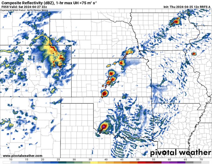
Oh my gosh. Saturday is the only day so far this year I have feeling a day 2 moderate. Strong to violent tornadoes imo or likely with any storm able to develop. Could go high ngl depends if models continue to show discrete cells

12z RRFS with a supercell explosion by 5pm in the plains on Saturday. Any storm in the open warm sector could be strongly tornadic given the favorable parameter space.
6
2
47
8
10
63
Ngl I wouldn’t rule out long track violent tornado today across Iowa if a discrete cell can sustain.
7
7
63
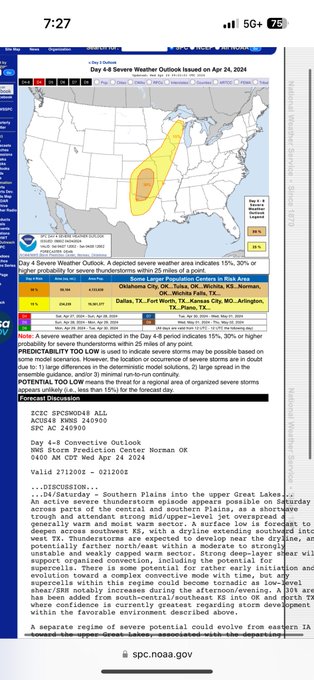
April 27 2024 Saturday Oklahoma high risk. The hype is real
8
2
59
Today gotta be the best tornado outbreak of 2024 wow
9
4
56

Wow long track Kansas supercell likely produced 3 tornadoes over this morning
4
4
55
Wow likely a widespread severe weather outbreak now.many people including the SPC are very confident that large hail tornadoes and damaging wind are all possible.
4
5
55
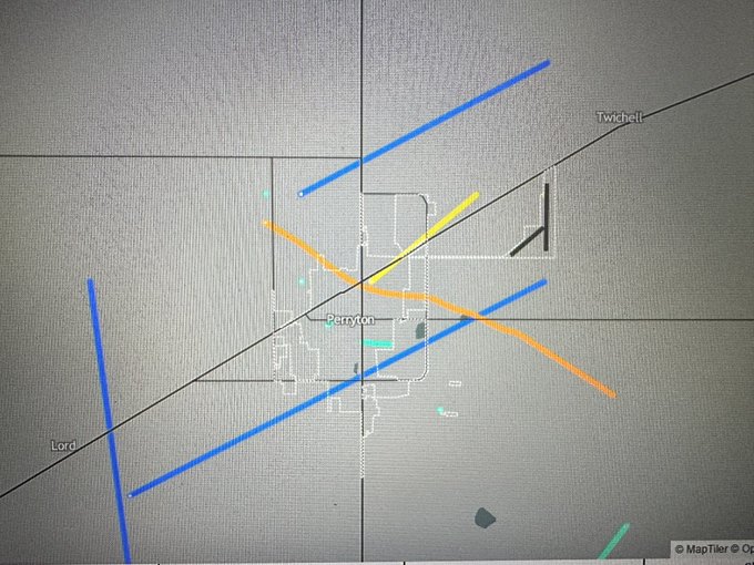
Perryton Texas is a little hotspot in tornadoes I guess
3
5
52
SIGNIFICANT Tornado outbreak today across Ohio and Kentucky!
6
10
52
Boy oh boy, where do I even begin. Broyles. Honey. My pookie bear. I have loved you since I first layed eyes on you. 🥰❤️🫶

3
0
52


@DOWFacility
@JoshuaWurman
@karen_kosiba
@NSF
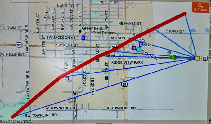
I wonder what it was like before it entered the town because it looked much stronger.
5
1
50
I am getting more concerned for an isolated but strong tornado threat in Illinois and Ohio again..

7
7
50
Why do 10 sig events in the south bust more than a random 2 percent day in the north

Sunday's Verification Report:
Hail Risk (30#) @ 1630z verified okay, although a lot of the significant hail occurred before the ENH was issued.
Wind Risk (15%) saw 10 wind reports, all within the 15% area.
Tornado Risk (10#) @ 1630z did not verify. The 1 tornado report occurred

1
8
70
7
2
49
Getting active guys

5
3
50

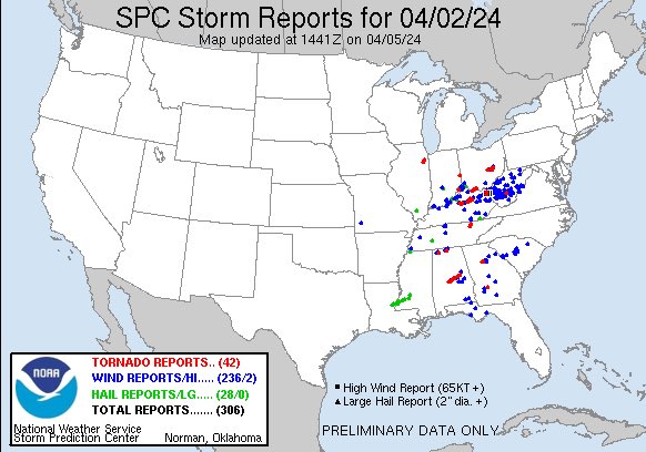
This was a significant tornado outbreak idc what you say

Saw some people sawing April 2nd wasn’t a tornado outbreak, and that the term “tornado outbreak” is thrown around too much
No, this was 100% a tornado outbreak
12
19
152
3
3
47
Dude if it was May we would be talking some crazy stuff
4
3
47
The average 10 sig has overpreformed this years 15-30 sig.
Mainly I think it’s just how crappy the models have been. No fault on the SPC at all. This year the models have been trash imo
8
3
46
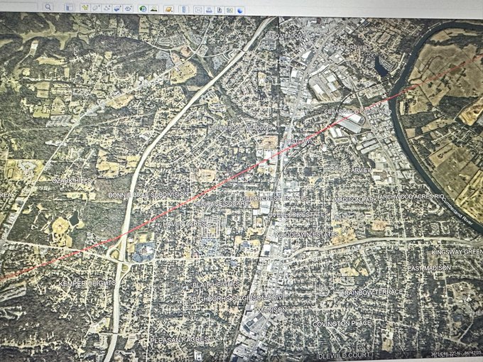
I have made an estimated damage path of the tornado. No the color doesn’t mean EF4 and no I am not predating I am simply outline where an estimated path of the tornado was in Nashville

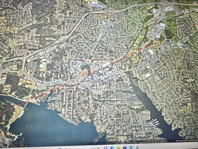
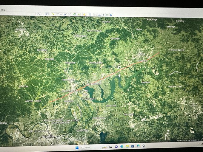
4
10
45
Man these people need a break.. 2021-2023 tornadoes only
3
5
45
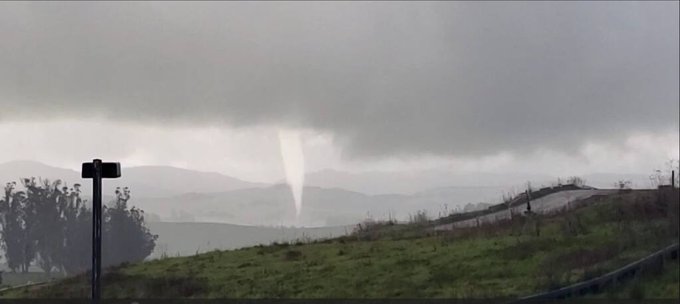
Whattt no feaking way. First tornado of February

Tornado spotted in Sonoma County, CA today...photo from Matthew Beat
7
45
163
7
4
45
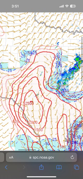
Wow Nam going nuts for Oklahoma on Monday with triple point. We are really far out for Nam so it will change. However All hazards seem possible with this upcoming widespread severe weather outbreak

The 12Z nam is valid at 7:00 pm Monday with triple point WC-SW/OK. All modes of severe are possible across OK.
#okwx


6
43
225
7
2
44
Dude.. that formed…

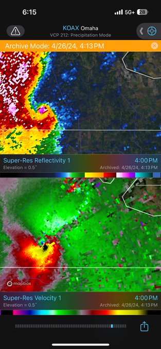
Multi vortex tornado LIVE on KETV. Extremely dangerous situation unfolding in the Omaha NE area. Tornado emergency now in effect.
#newx
20
258
1K
3
3
44
Wow they hype is so real 🤣
People already screaming high risk and automatically comparing it to some of the top plains outbreaks.
Guys chill wait for tonight’s models
12
2
43
Wow first real wedge of the year I believe dang that was a powerful one

3
5
41
Environment is getting its act back together after the morning storms. Later this evening another batch should form could bring strong tornadoes

2
7
40