
Tom Terry
@TTerryWFTV
Followers
19,381
Following
923
Media
8,460
Statuses
27,925
Chief Meteorologist at WFTV/WRDQ. Weather hound, busy dad and hubby. Helping folks #hunkerdown since 1989! Send me pics! Tweeting us? You may be on air
Orlando, Florida
Joined April 2009
Don't wanna be here?
Send us removal request.
Explore trending content on Musk Viewer
Macklemore
• 376040 Tweets
#आँखों_देखा_भगवान_को
• 307786 Tweets
WIN Premiere Night TH
• 306669 Tweets
#CantBuyMeLoveFinale
• 81273 Tweets
Switch後継機
• 78960 Tweets
#LovelyRunnerEp10
• 74605 Tweets
BINGLING ENDGAME
• 73504 Tweets
#Victor_เริ่มก่อน
• 60345 Tweets
#AppleEvent
• 60297 Tweets
iPad Pro
• 48765 Tweets
Switch 2
• 46043 Tweets
SB19 GOES INTERNATIONAL
• 45569 Tweets
Hi-Fi Rush
• 31811 Tweets
#家庭教師ヒットマンREBORN
• 31601 Tweets
Barnsdall
• 30334 Tweets
Tango Gameworks
• 26184 Tweets
Arkane Austin
• 22787 Tweets
Rebeca García
• 21716 Tweets
生田斗真
• 21476 Tweets
Redfall
• 17810 Tweets
Prey
• 16783 Tweets
桃源暗鬼アニメ化
• 16491 Tweets
退職代行
• 14372 Tweets
無痛分娩
• 13678 Tweets
Apple Pencil Pro
• 12964 Tweets
スマブラ新作
• 11419 Tweets
#ヒゲダンラジオライブ
• 11024 Tweets
#MovilizadosPorVenezuela
• 10984 Tweets
#اليسا_انا_سكتين
• 10966 Tweets


Thanks to
@BrianShieldsTV
for his caring and vigilance! Greatest team we have here with so many caring and smart meteorologists:
@GWaldenWFTV
@IreneSans
@RMcCranieWFTV
@KCrimiWFTV

You all are the absolute best. Please be careful over the next 24 hours at the coast! Flooding is likely tonight, along with strong winds. Thank you! MORE:
3
12
69
14
17
133
Got that right...

4
22
126
Martie is one of the classiest ladies you'll ever meet, and a great friend for nearly 18 years! Where did the time go?? We're going to miss you.


6
6
103
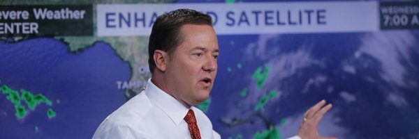
#Dorian
Winds officially 130mph, cat 4. Just happened a bit sooner than forecast. Big storm!
14
37
89


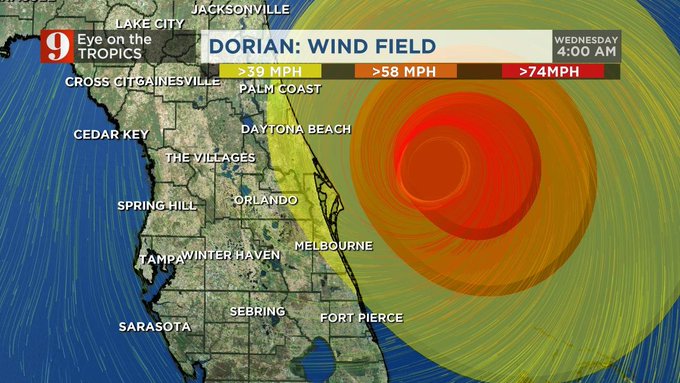
Our local impacts will depend on 3 things: The eventual track, the intensity (probably still a cat 4 nearby), and how big the eye of the storm gets. Lots of things to monitor very closely as the hurricane watches and later warnings are likely to spread up our east coast.
3
13
64
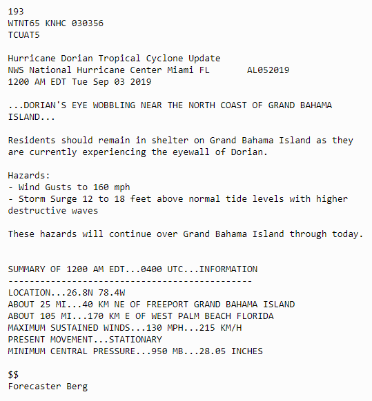
This is unlike any other storm I've covered.
#1
) Strongest ever to hit the Bahamas
#2
) Probably highest storm surge 18-23ft for this area
#3
) Stalled for almost a whole day (still not moving).

12 AM EDT Tropical Cyclone Update for Hurricane
#Dorian
: Dorian's Eye Wobbling Near the North Coast of Grand Bahama Island.
31
204
258
10
14
62
I'll be breaking out my simple 3 ingredient
#TexasQueso
dip for
#superbowlsunday
. Toss a block of Velveeta in crock pot, add 2 cans of Rotel, and fry up a pound of ground sausage, drain and add. Perfect every time.
8
5
58
Who's ready besides me??

Potential lows Friday morning include some upper 30s in northwest areas, a bunch of 40s, and some low 50s. Downtown Orlando will be around 50 degrees, but other parts of Orange and Seminole counties should sneak into the mid and upper 40s.

1
2
4
13
5
49
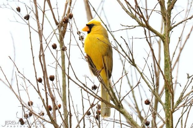
Love Cardinals, what a fantastic looking bird.

5
11
48
From Jax:EMERGENCY MANAGER REPORTS THE FLAGLER BEACH PIER IS STARTING TO SUFFER SOME DAMAGE. ONE OR TWO OF THE PYLONS ARE REPORTED MISSING.
0
55
52