

Sharon Ray
@SharonRayWx
Followers
2K
Following
287
Media
8K
Statuses
10K
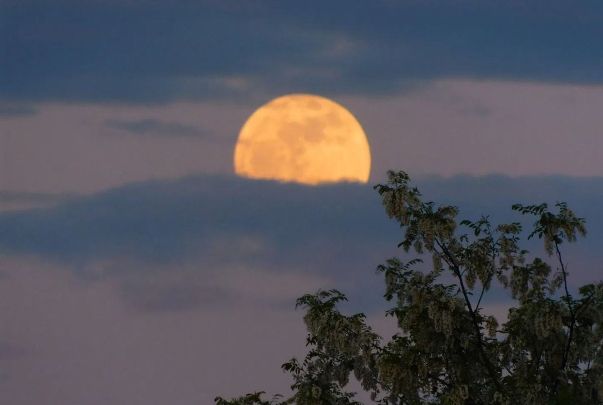
Catch the full "Sturgeon" moon rising at 8:12 this evening. A thin layer of wildfire smoke along with the higher humidity may give it an orange look as it was this morning before it set. #fullmoonaugust2025


0
1
1


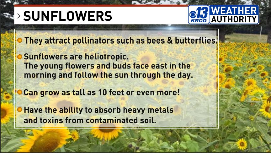
Here are a few sunflower facts along with photo of a field of sunflowers taken in Maries county by Ed Fagre.
0
0
0
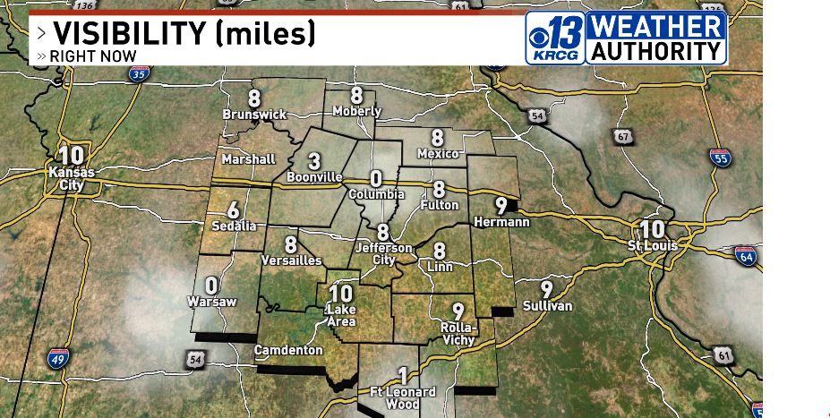
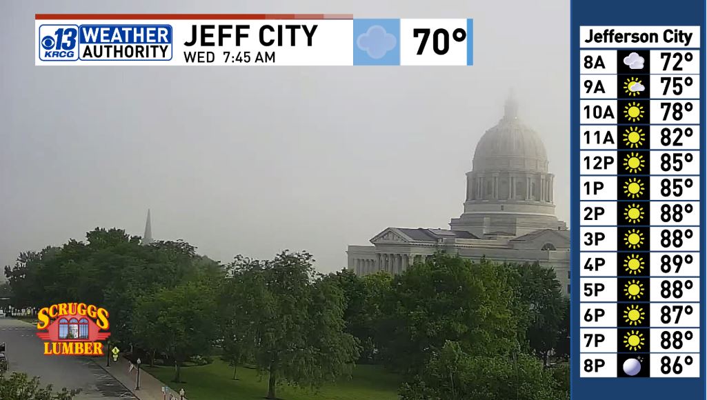
Fog is slowly lifting and it looks like a great summer day ahead! See all our skycams and forecasts at: #midmowx
0
0
0
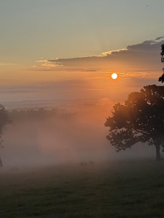
Ed Fagre captured this photo of the fog settling into the valleys this morning at sunrise in Maries county. #sunrise #fog #natwxdesk
1
0
0

1
3
4
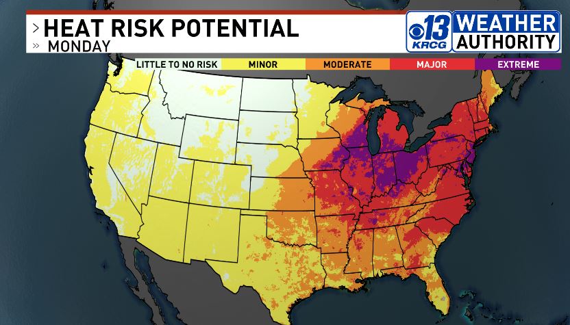
The heat wave continues for #midmo and for much of the eastern half of the nation. Temperatures will come down slightly later this week as the high pressure area aloft weakens.

0
1
0


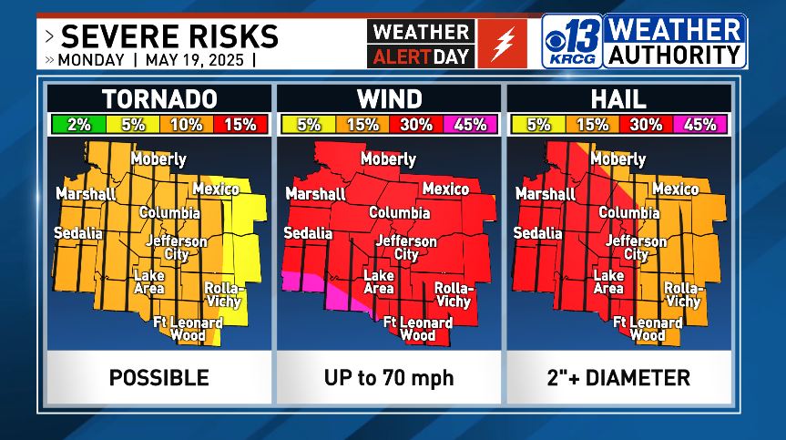
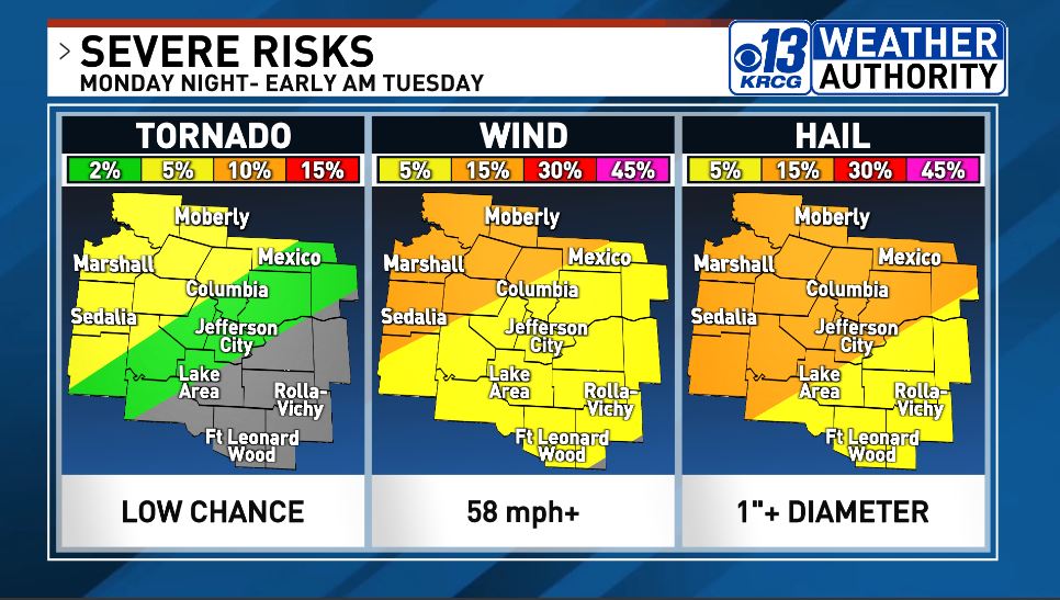
8 AM update from SPC expands level 4 to include southern Benton and Camden counties. Isolated afternoon storms are possible but storms are more likely after 5 PM through the evening in #midmo

1
0
0
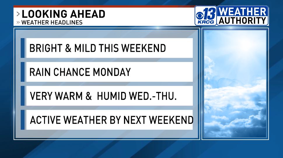
We finally have a nice stretch of weather to get outdoors, just in time for Mother's Day Weekend. We'll see more changes next week. #midmowx
0
0
2
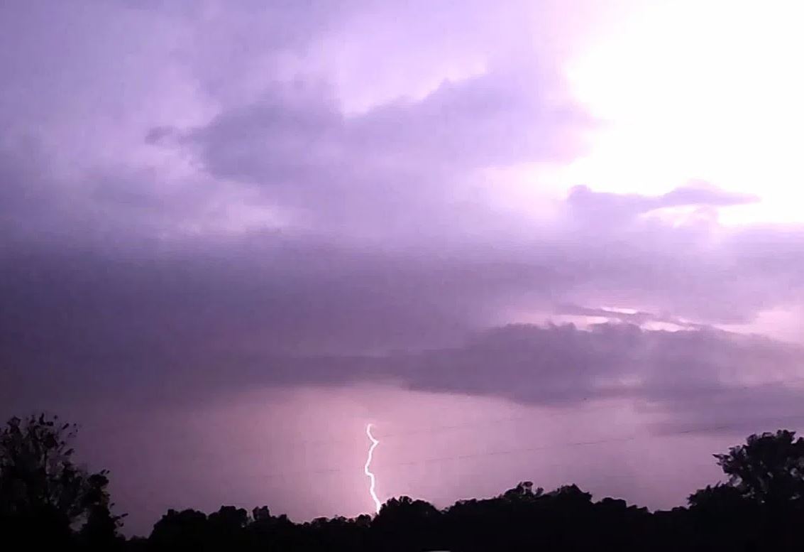
ACTIVE WEATHER WEEK: Today is the warmest and driest this week before the chance of storms returns late tonight and continuing on and off through Thursday in #midmo. Stay Weather Aware tonight and Tuesday as there could be some severe storms.

1
0
0
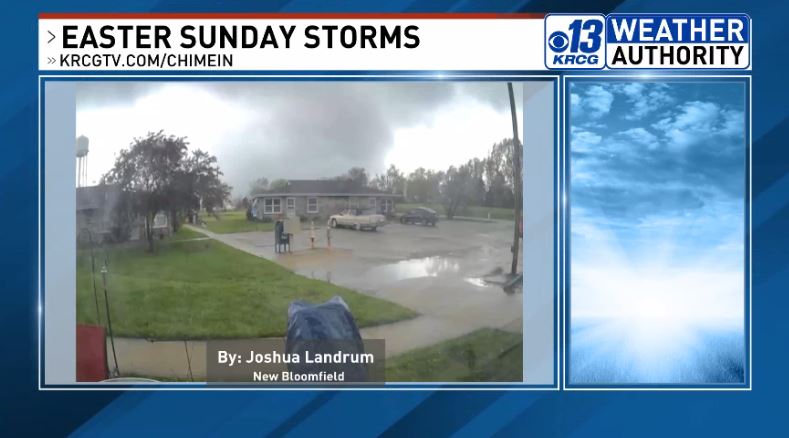
NWS survey team rated the New Bloomfield tornado an EF-2. It briefly had estimated 120 mph winds just north of County Rd 362 before weakening.

0
1
0
RT @RileyFannonKRCG: Flash Flood Warning in effect until 8PM for Camden, Maries, Miller, Phelps and Pulaski counties. If you come across a….
0
1
0
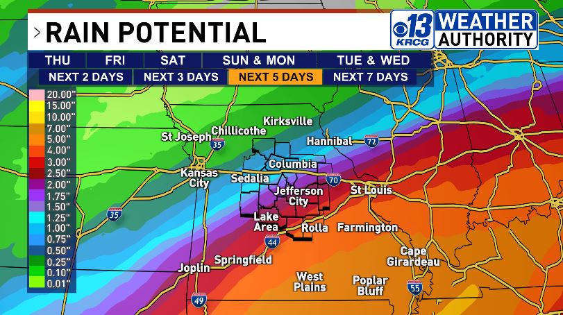
We have three rounds of rain starting today through Saturday. Severe weather looks unlikely in #midmo but there will be some heavy rain in our southeastern counties. Southeast MO could se flooding with potentially 3-6" rain from today through Saturday night.


1
0
0