
Netweather.tv
@Netweather
Followers
21,153
Following
586
Media
4,837
Statuses
26,530
Netweather is a leading UK weather forecasting company.A friendly team tweeting weather alerts,radar updates,forecasts, snow, storms, all things weather related
UK
Joined February 2009
Don't wanna be here?
Send us removal request.
Explore trending content on Musk Viewer
Celtics
• 152794 Tweets
River
• 152559 Tweets
Pacers
• 129682 Tweets
中尾彬さん
• 97404 Tweets
Tatum
• 76459 Tweets
声優さん
• 69272 Tweets
池波志乃
• 67103 Tweets
Temperley
• 55983 Tweets
Omar Geles
• 51854 Tweets
トレードマーク
• 51163 Tweets
Demichelis
• 45475 Tweets
Armani
• 45269 Tweets
#GodMorningWednesday
• 36418 Tweets
Jaylen Brown
• 29715 Tweets
古谷さん
• 27223 Tweets
Haliburton
• 25809 Tweets
#JACKANDJOKERQ3
• 24009 Tweets
妊娠中絶
• 19271 Tweets
樹脂上限
• 16267 Tweets
ブートヒル
• 15060 Tweets
PRABOWOfokus SIAPKANygTERBAIK
• 13980 Tweets
KerjaTERBAIK UntukNKRI
• 13449 Tweets
安室さん
• 13424 Tweets
声優交代
• 12883 Tweets
樹脂200
• 10844 Tweets
KupasTuntas KasusTimah
• 10088 Tweets
#JanganTutupi271T
• 10083 Tweets


Michael Fish is saying farewell after 15 years on Netweather. We're all going to miss him. Thank you for everything
@fish4weather
#Parkinsons
56
64
647
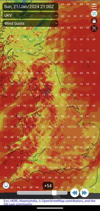
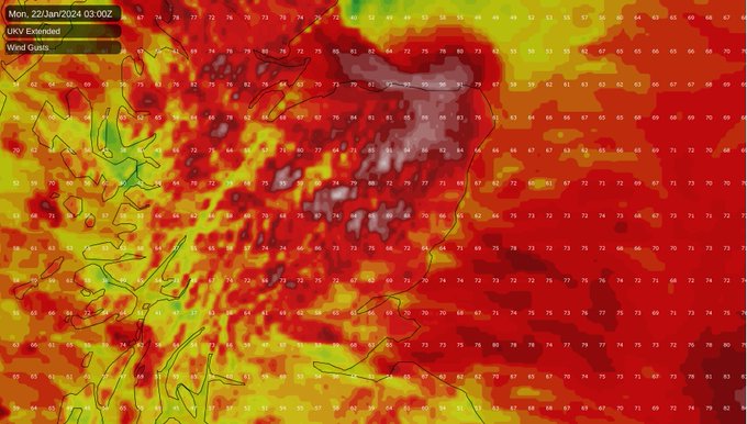
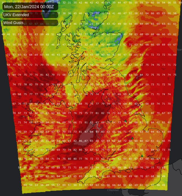
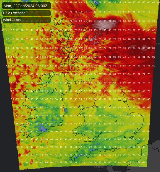
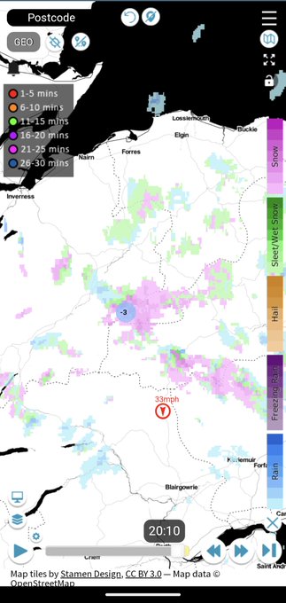
Not too often you see gusts forecast to be 60-65mph plus across such a wide swathe of England and Wales.
#StormIsha
10
18
86
From the whole team here at Netweather, wishing you a very merry Christmas.
8
1
63
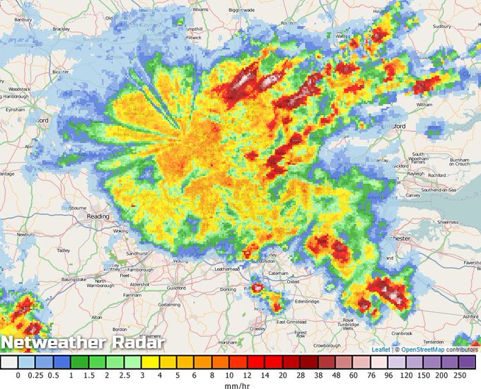
London is entirely covered by a huge downpour, almost perfectly shaped to fit inside the M25.
#UKstorms
0
18
55
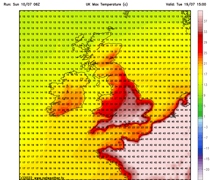
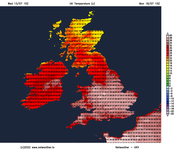
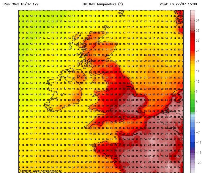
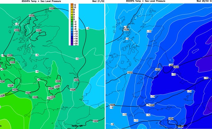
The GFS 06z is showing 40c+ on Sunday, Monday and Tuesday. Which is again quite extraordinary & with the other models not a million miles away it really does seem as if we could be heading towards a notable, potentially record breaking
#heatwaveuk


7
13
54
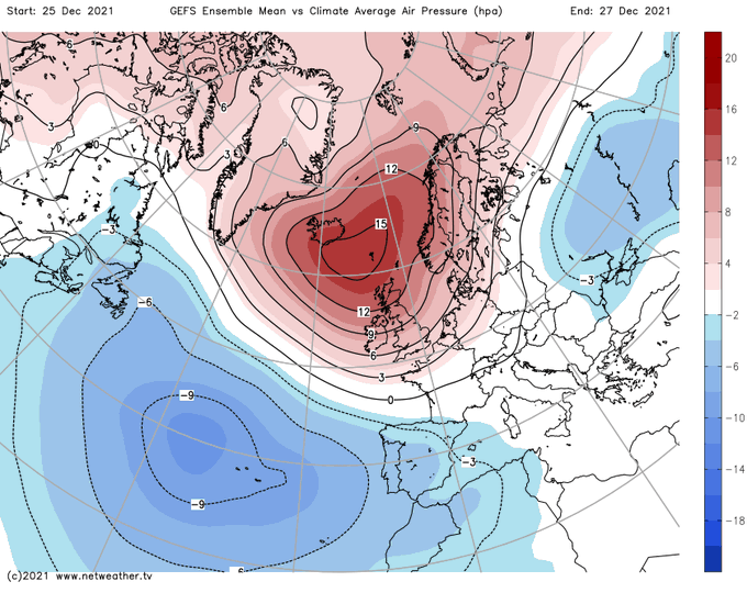
The Big Freeze of ten years ago - coldest December on record
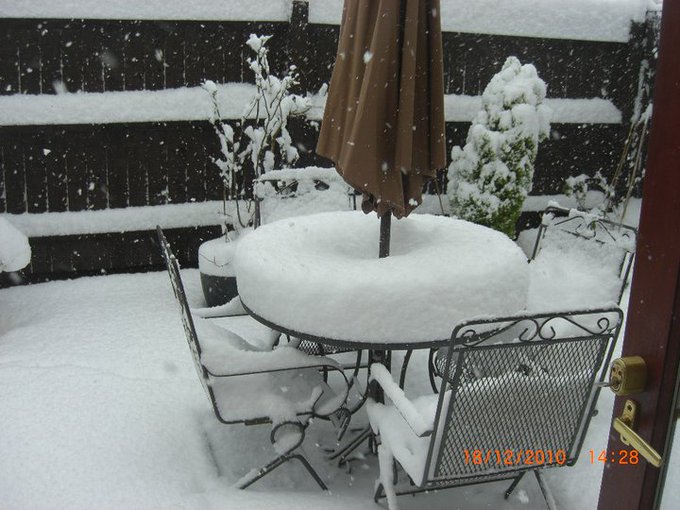
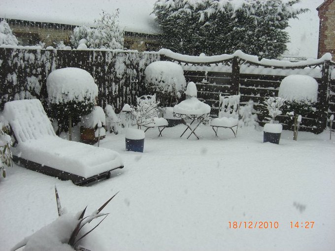
6
8
51
The new NX30 works really well in the field, this is from standard jpeg and kit lens
@SamsungUK
http://t.co/QKwO8XHpuq
5
53
47
3
12
49
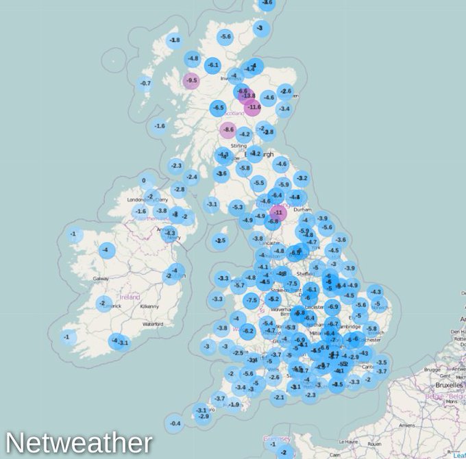
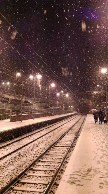
Every single station in the UK and Ireland subzero. It's going to be a bitter, snowy night.
#BeastFromTheEast
10
39
47
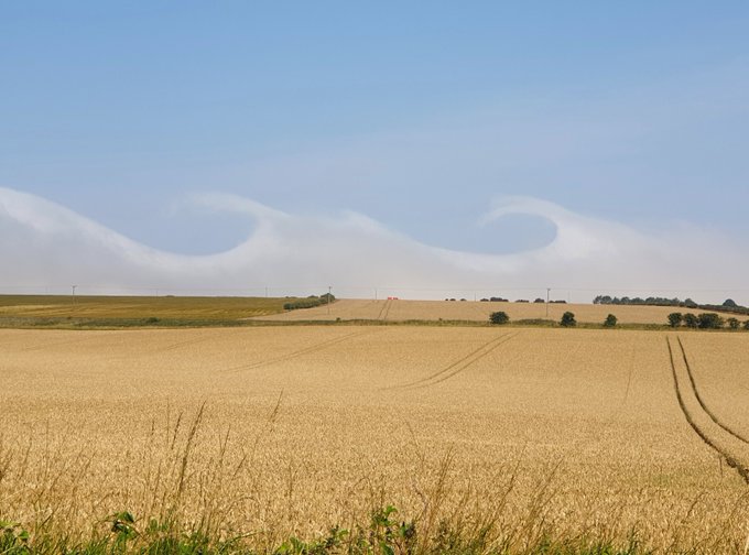
Noctilucent night-shining clouds, tis the season. How to spot them, why they are so special, are they appearing more, linked to
#Climatechange
? NASA are interested in these very high clouds.
#NLCs
#noctilucentclouds
#polarmesosphericclouds
#PMCs

2
16
41
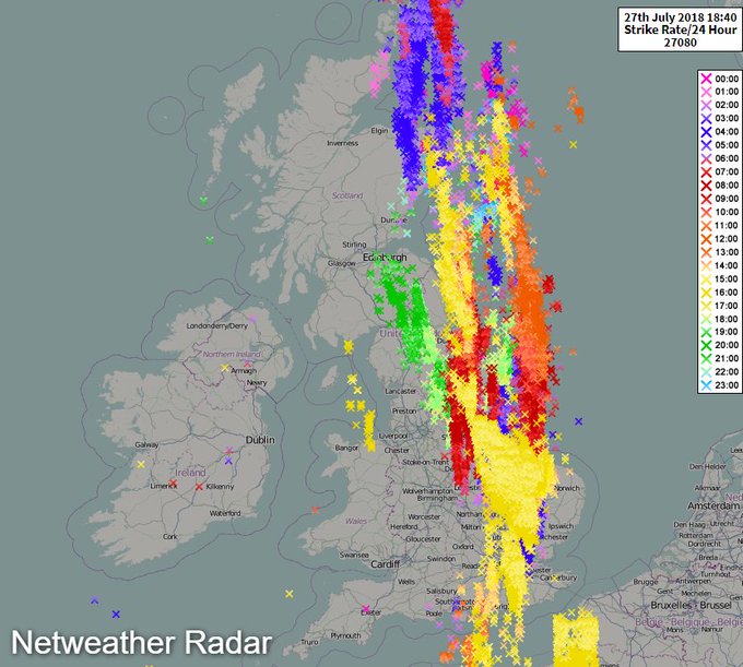
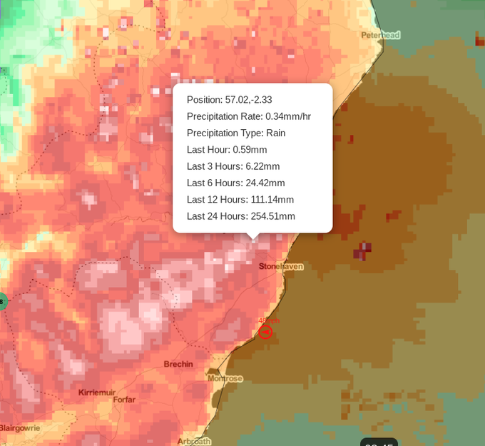
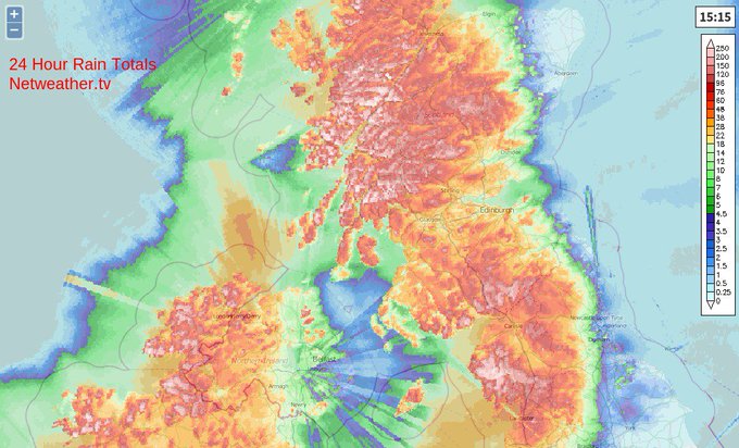
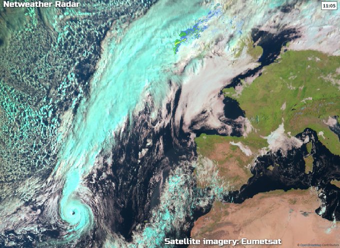
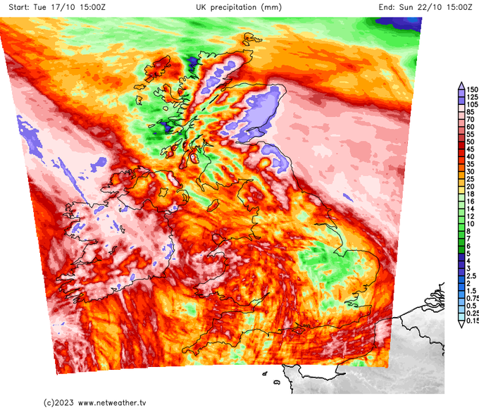
A quite mind-blowing and very concerning (radar estimated) rainfall total of 254mm over the past 24 hours, northwest of Stonehaven in eastern Scotland.
#StormBabet
1
17
38
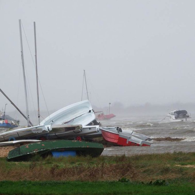
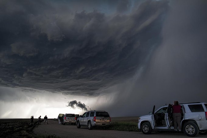
Gusts of 80mph+, torrential rain, trees down, big seas. Makes you wonder what it'll take for the
@metoffice
to issue an amber warning or name a storm this year?

9
14
35
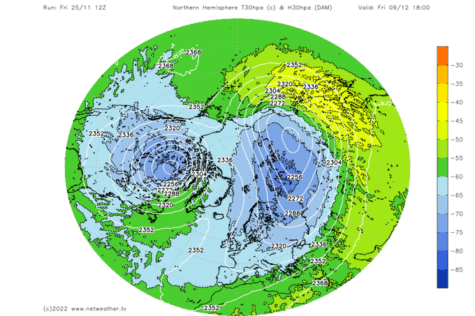
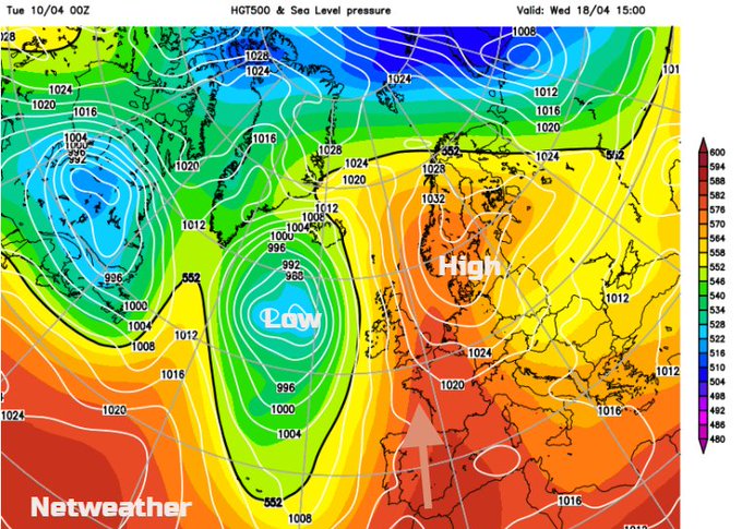
"GFS has produced a rare 'bottom-up' stratospheric polar vortex split" - Post by 'Singularity'
6
6
33
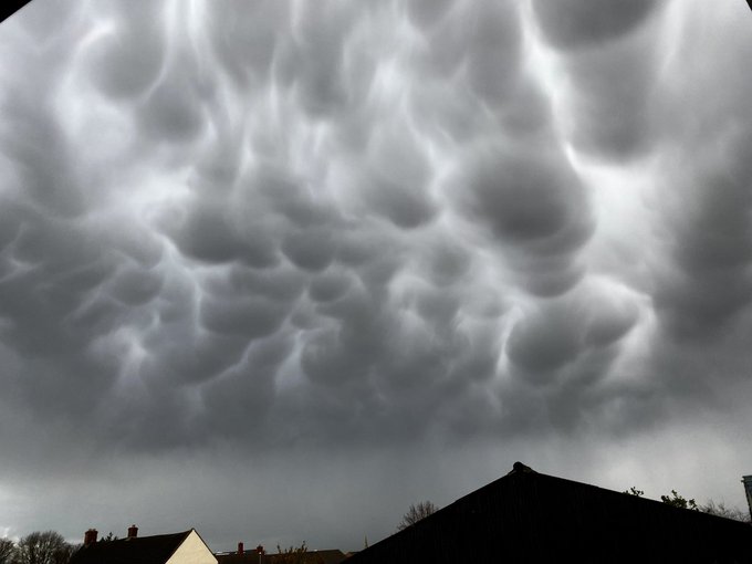
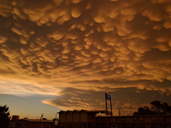
Stunning Mammatus clouds over Northamptonshire this afternoon - taken by Iceman2606. More here:
#NetweatherCommunity
2
4
33
Unbelievable rain totals in Cumbria and the NW. Thoughts with those affected by the flooding.
#StormDesmond
3
87
33
Had to share this from last night on the storm chase - stunning mammatus.
1
15
31
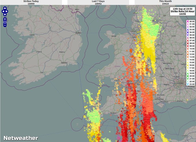
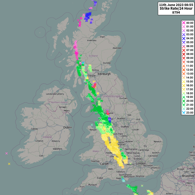
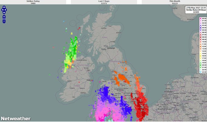
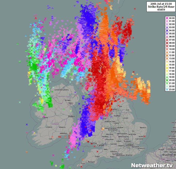
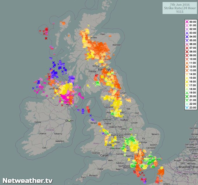
After nearly 9000 lightning strikes in the last 24 hours, there's more heat, humidity and thunderstorms to come today. Read the latest weekend weather update below:
0
6
33
COLD -
#SuddenStratosphericWarming
#SSW
will occur this weekend, but what is it and how may it affect UK weather over coming weeks? Nick Finnis looks at possible effects; triggering blocking and sustained colder weather.

5
13
31
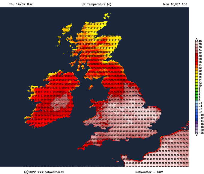
Another extraordinary run from the 6z GFS this morning. Showing 43c for next Sunday. Not certain to happen by any means though.
#Heatwave

4
12
30
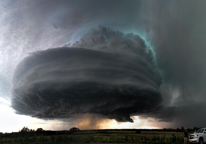
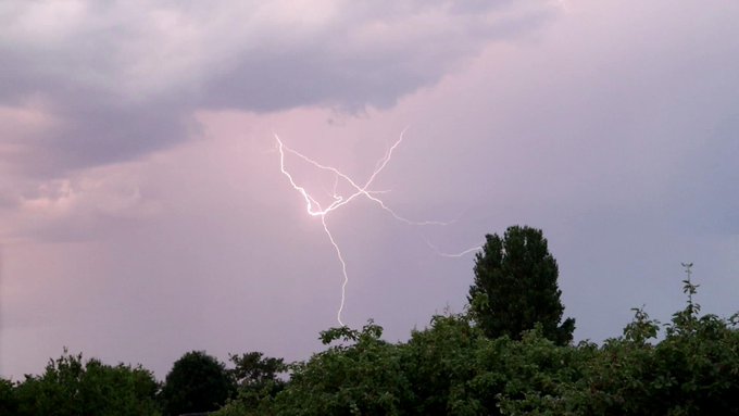
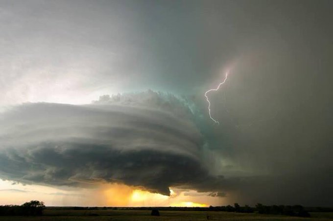
Look at the Lightning in this!

hey
@SeanBattySTV
@jofwx
beautiful night here in London clear sky and one big cloud. Is this Thor? I have never seen a solo cloud like this before.
9
63
262
4
9
30

#EasterHols
Signs of it being warmer for more of the UK next week. Isn't that always the case, as the children go back to school, the weather improves? 23C 73F
3
7
29

22
20
28
The GFS 12z has followed the morning update with another forecast of 42c for next Sunday. Still nowhere near certain but the consistency of these runs showing quite astonishing heat is quite alarming.
4
14
30
In the Sierra Nevada mountains California with over 25" snow in 24 hours, blizzard conditions and now freezing overnight. The ski resort says that there will be a delay before opening on Thursday.
#snow

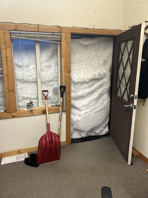
In case you are wondering why we are so slow to get info out this morning. Here is the entrance to the marketing office.
166
946
9K
0
7
28

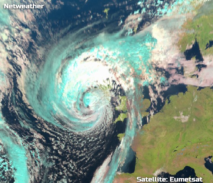
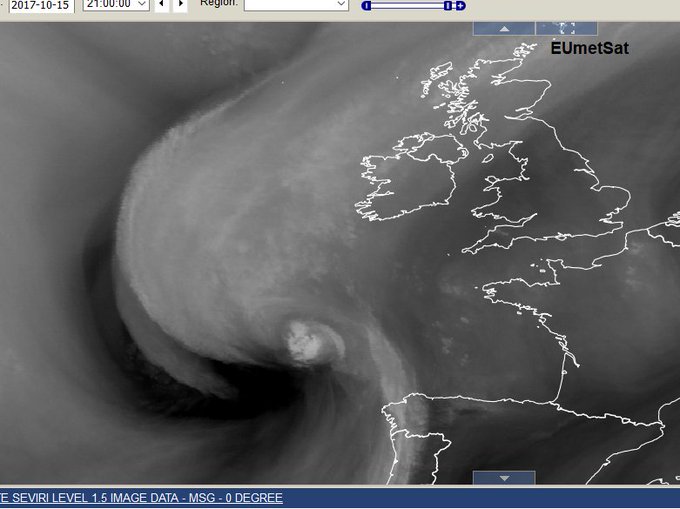
Water vapour imagery of
#Ophelia
undergoing extratropical transition Hurricane to post-tropical Low. white =high cloud, black = very dry air
1
19
25
Ferry Crossing anyone?
#EnglishChannel
Shipping forecast DOVER WIND SW 4 to 6, increasing gale 8 to storm 10, occasionally violent storm 11 later. SEA STATE Slight or moderate, becoming rough or very rough, perhaps high for a time. THAMES similar in next 20 hours.
#StormCiara
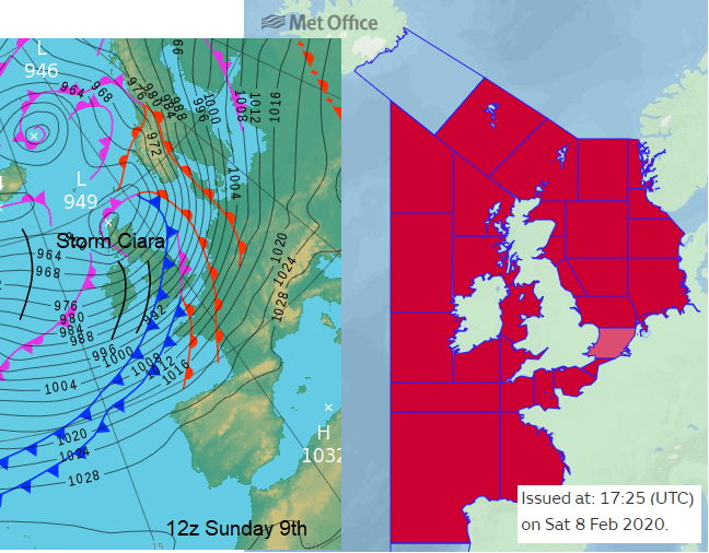
3
13
25
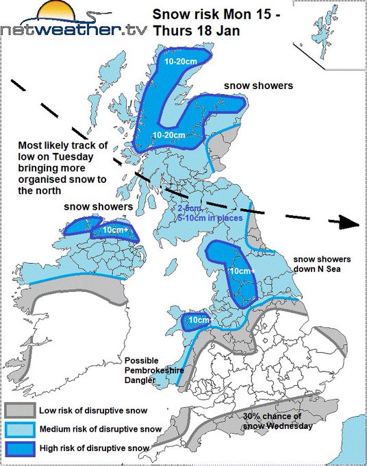
Latest blog from
@NickJF75
looking at the snow risks during the upcoming week, as Arctic air sweeps south from today.
1
3
27
Storm Oscar will be bringing the heat, quite literally. Prepare for hot and humid air, showers, and a potential risk of thunderstorms. 🌦️⚡
#UKWeather
#StormOscar
All the details in
@jofwx
's latest blog.

0
4
26
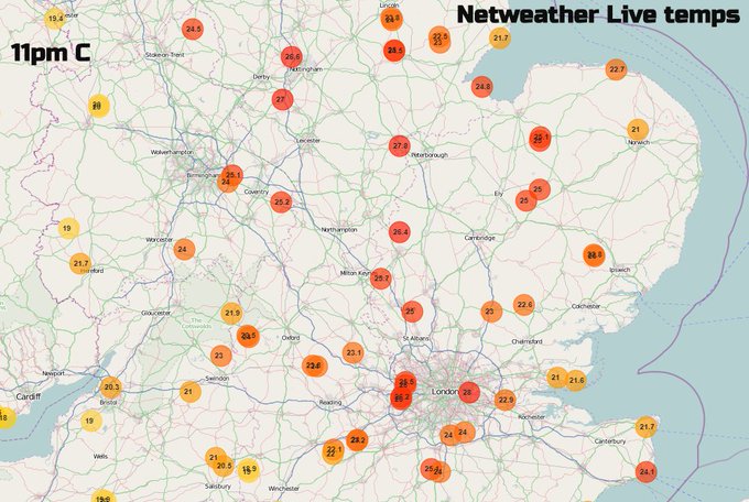
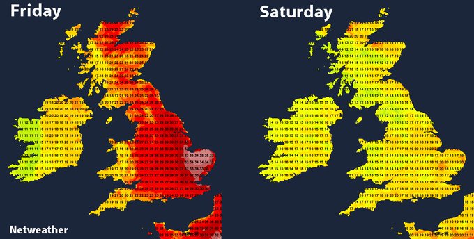
It is still 27 or 26C in places, at 11pm at night! oh dear.
10
13
24
The GFS this evening has gone for some real heat next week. Long way off of course and not guaranteed to happen at all, but definitely something to keep a close eye on.
6
7
25
#StormDudley
on Wednesday and Thursday, then
#StormEunice
on Friday. It's going to be a wild ride this week..

1
15
26
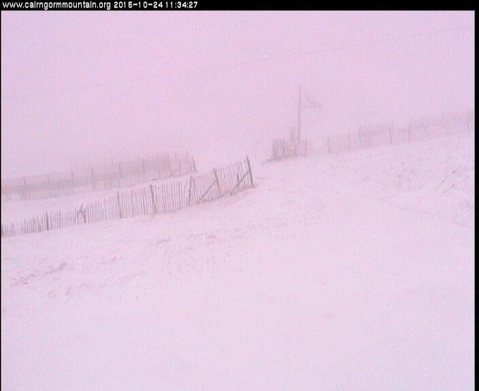
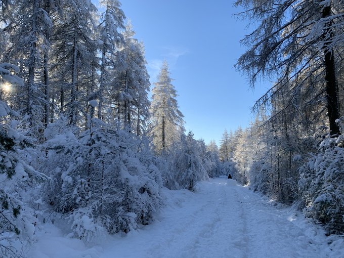
It's taken a while, but at last, some skiing and snowboarding possible in Scotland
0
8
23

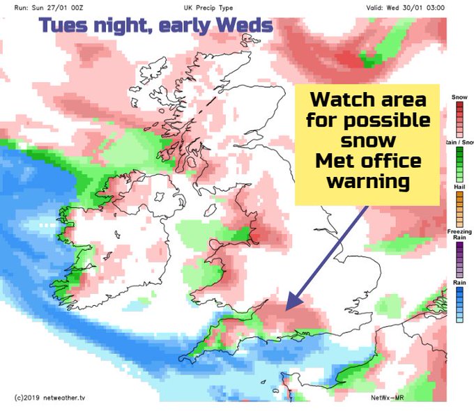
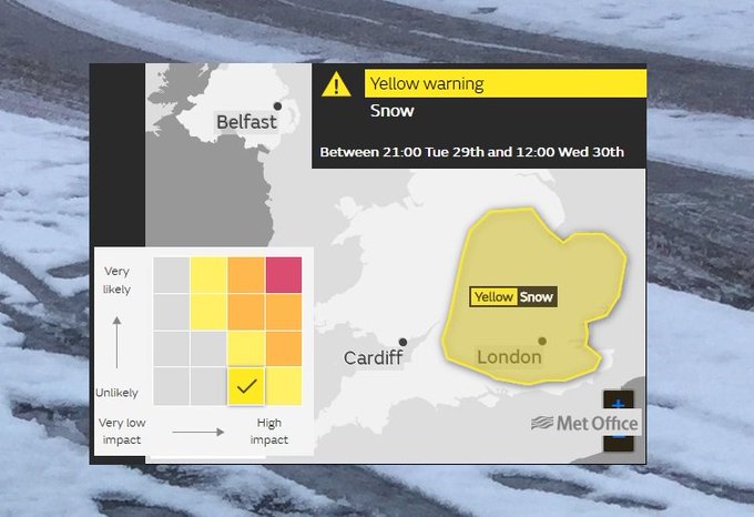
Wait for it southern England if you've only had a bit of snow and schools are closed. Main warnings don't start until 2/3pm Red/Amber.It's only going to get worse
#StormEmma
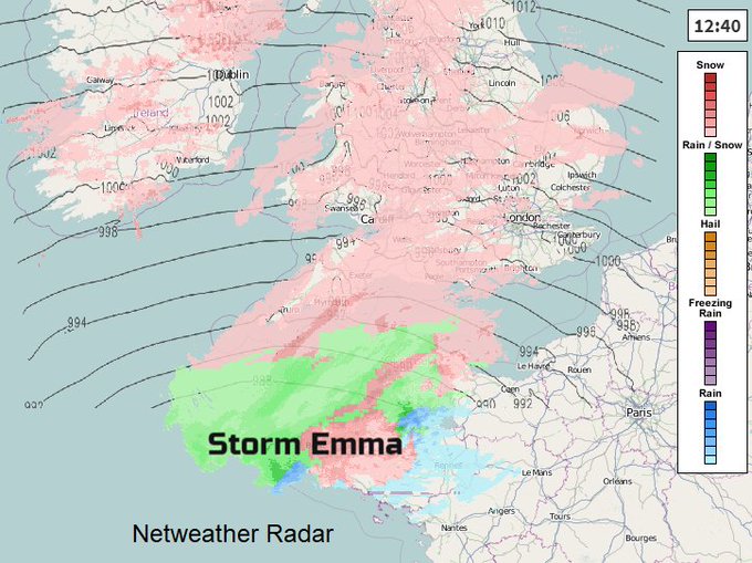
7
13
23
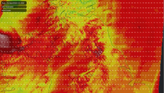
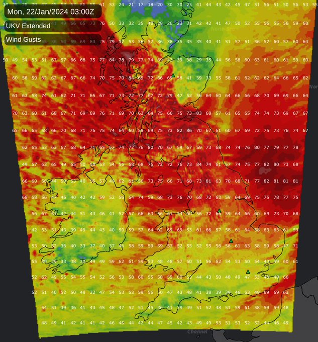
Some significant gusts, closing in on 100mph in exposed parts of Northern Scotland and Northern England shown on the UKV this evening as
#StormIsha
moves through.
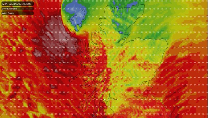
2
4
25
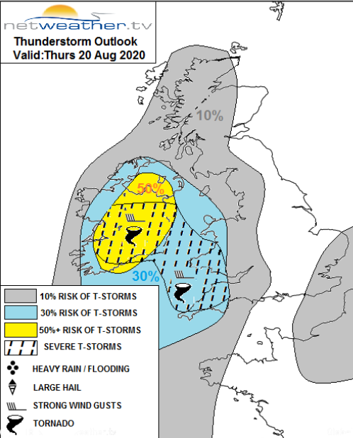
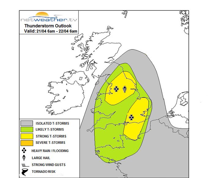
Severe weather coming up for the end of the weekend as
#thunderstorms
move up from the south. Frequent lightning, torrential downpours, gusting winds and large hail are possible in affected places. As ever with storms though, not everywhere will see them.
3
5
26

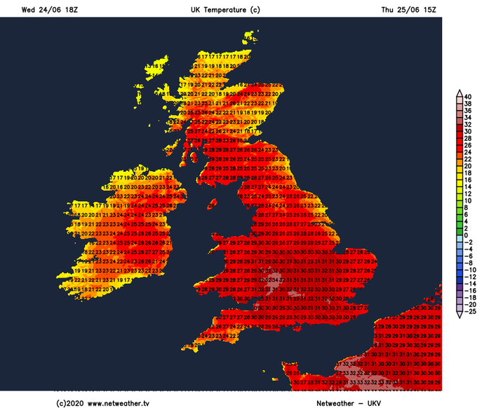
Steaming hot tomorrow. 18z UKV run showing 34c or so in places.
1
14
24
Not what you'd normally expect to see down to our southwest...
3
10
23

Much colder Arctic air will be over the UK by the end of the weekend, with snow showers in the northerly flow. The question remains, will frontal bands arrive and hit the cold air next week? This would bring more disruptive, widespread
#UKSnow
but where & when?
#uncertainty
2
4
22
#Christmas
is starting to look pretty interesting, thanks to a bout of
#NorthernBlocking
- could high pressure move far enough north to bring the threat of some snow by the big day?
1
4
23

Latest
#Christmas
forecast online - a really tricky forecast this year, which is nowhere near resolved at this stage.
#SantaShaker
1
8
24
A lively week of weather coming up

0
8
21
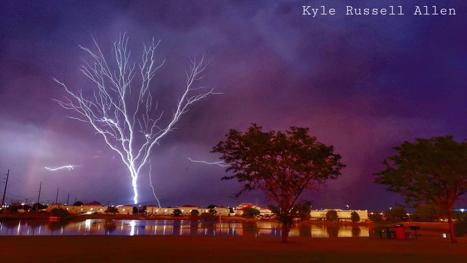
Amazing - a lightning tree!

Shhh!! The lightning is trying to become one with the trees!
@StormHour
@ReedTimmerAccu
@aaronjayjack
#StormHour
#Weather
#retweet_weather
#LightningStorm
87
605
2K
2
4
23
The latest UKV is showing some concerning wind speeds Sunday into Monday. Details are likely to change, but it's certainly a period to keep an eye on.

3
6
22
Shipping forecast PLYMOUTH sea area WIND Southwest 6 to gale 8, becoming cyclonic severe gale 9 to violent storm 11, perhaps hurricane force 12 later. SEA STATE Very rough, becoming high or very high later. WEATHER Thundery rain. VISIBILITY Good, occasionally poor.
#StormCiaran

0
15
22
Think it's cold now? Will be bitter next week. Polar Continental air .
#Snow
too coming as the flow comes in from the North Sea
3
10
20

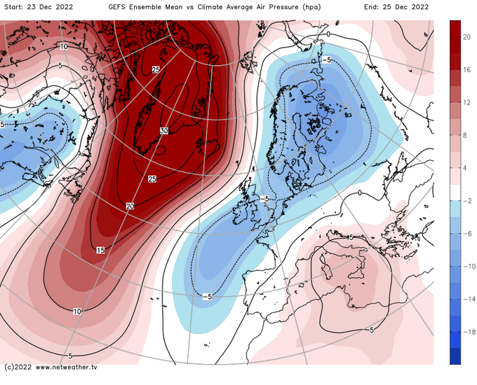
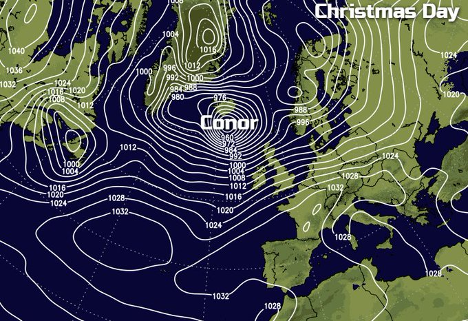
On behalf of the whole team at Netweather, I wish you a merry Christmas. For the majority, it's a mild Christmas day, so it's definitely green for most, but north of the border, there is some snow. After a lot of dry, bright weather on Boxing Day, the weat

2
0
23
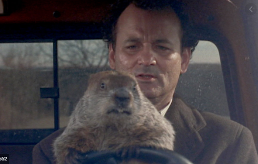
The groundhog has spoken
#Punxsutawney
Phil sees his shadow, declaring six more weeks of winter.
#groundhogday2021
Discuss
5
1
22
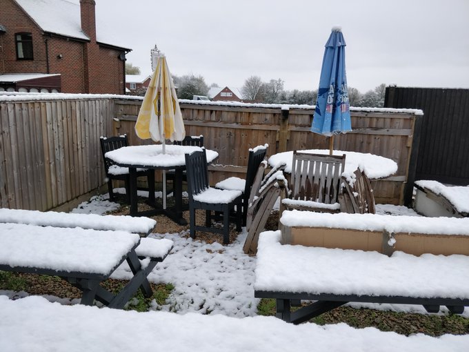
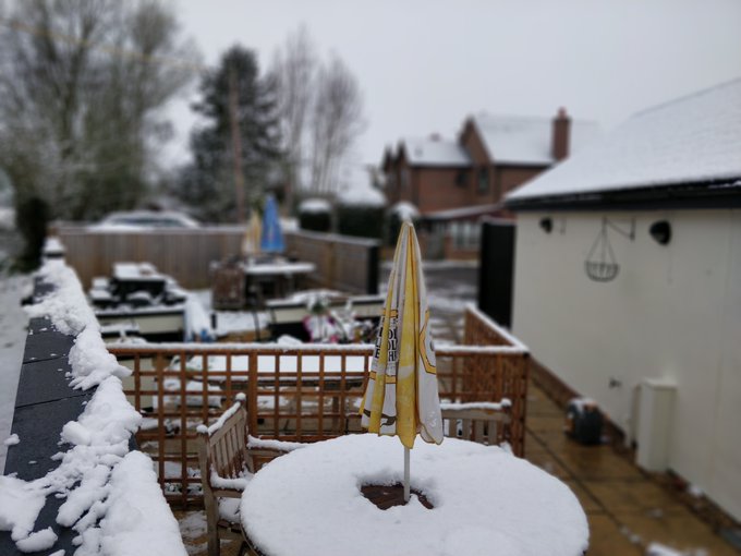
A nice day for a pint in the pub garden! Thanks to Griff in South Oxfordshire for sharing
#NetweatherCommunity
#UKsnow
0
7
23
Risk of severe weather, including damaging wind gusts and tornadoes, across Ireland and SW UK today/tonight.
#Thunderstorms
#StormEllen

6
8
22
1
35
20
Funnel cloud in Peterborough earlier Thanks to East_England_Stormchaser91

0
14
20
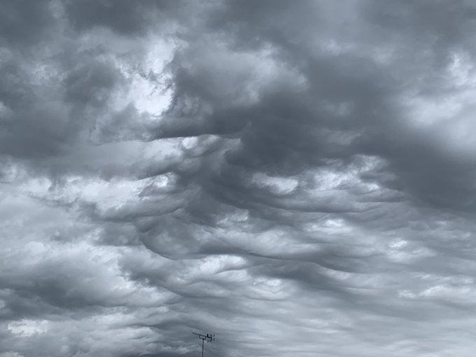
Asperitas clouds (formerly known as Undulatus Asperitas) uploaded by Hampshire Dan to the Netweather community this morning.
2
3
21
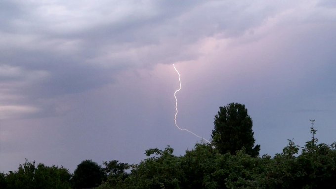
Some early morning
#lightning
to get what could potentially be a very stormy Saturday underway. Uploaded by Zak M to the Netweather community
1
4
22
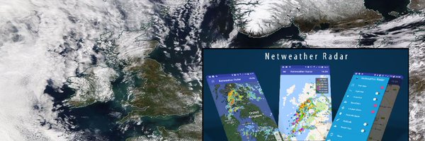
Our upgraded weather type radar looking good as the wintry weather starts to arrive in the Highlands. The update includes upgraded 500m prec type resolution, new height mapping and improved algorithms.
0
3
21
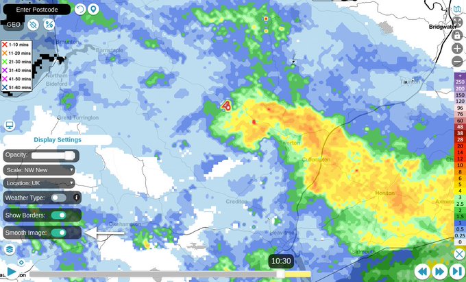
Some concerning rainfall totals on the UKV 15z with 150mm+ of rain forecast to fall quite widely in eastern Scotland during the second half of the week and into the weekend.
2
5
21
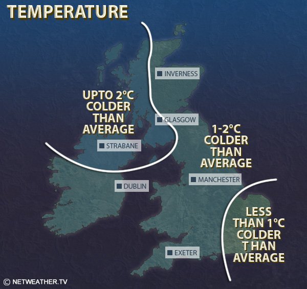
Memories of the 2018 Beast From the East - only coming up on 4 years ago but seems longer than that!
9
5
20

Morning everyone, what a week of weather to come. Intense cold and plenty of
#snow
. Enjoy or endure, let's do this
#MondayMotivation
6
3
19
5
19
19

What a difference a day is going to make! Over 15c drop in temperatures for some by tomorrow.
0
6
20
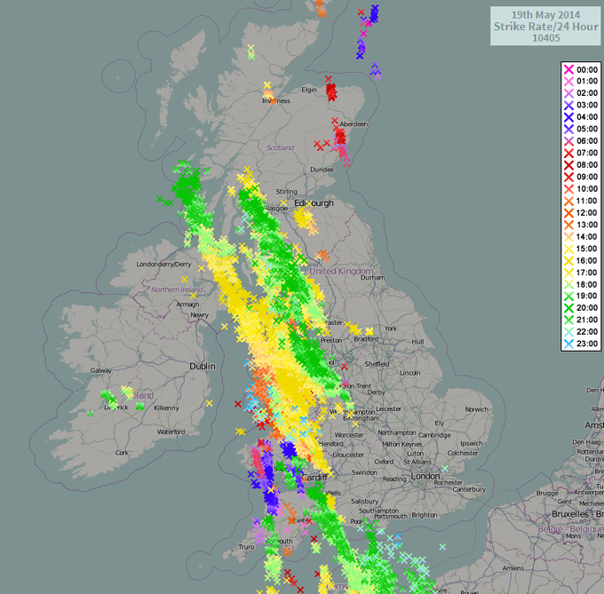
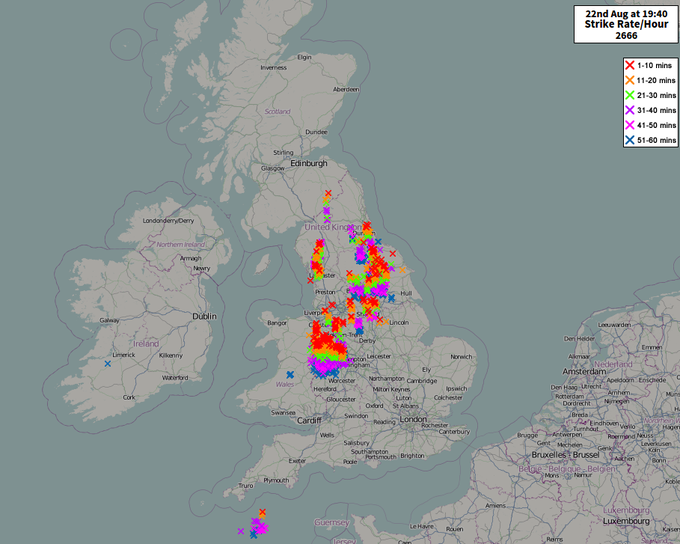
Just the 9000 lightning strikes so far today - and they keep coming too!
2
20
20
Probably the most requested feature we get asked about is the option to smooth the radar. It's live as of 2 minutes ago on the V8 Radar for Netweather Extra subscribers 😀
6
6
19

#StormForecast
issued for today. Risk of hail, strong wind gusts, flash-flooding & frequent lightning:
2
17
19
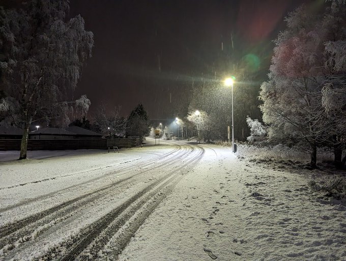
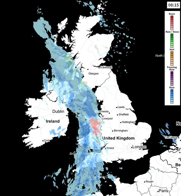
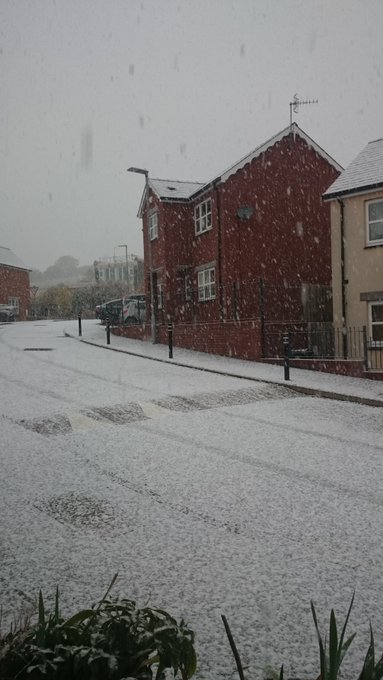
Snow across the UK this morning! Cold flow around a lingering high pressure, north Atlantic has produced surprise snowfall overnight for many parts of the UK even down to low levels. As you look out of the window this morning, a winter wonderland
#UKsnow
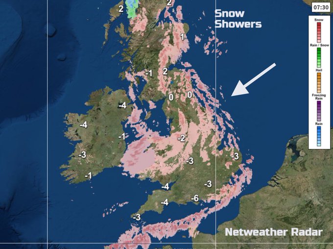
8
4
20
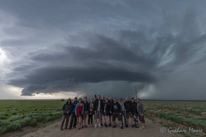
RT
@gavmonster
:
@Netweather
lightning & wedding cake stack from yesterday
#supercell
#kansas
#stormchasing
http://t.co/eQ7VqLjQS8
1
8
19

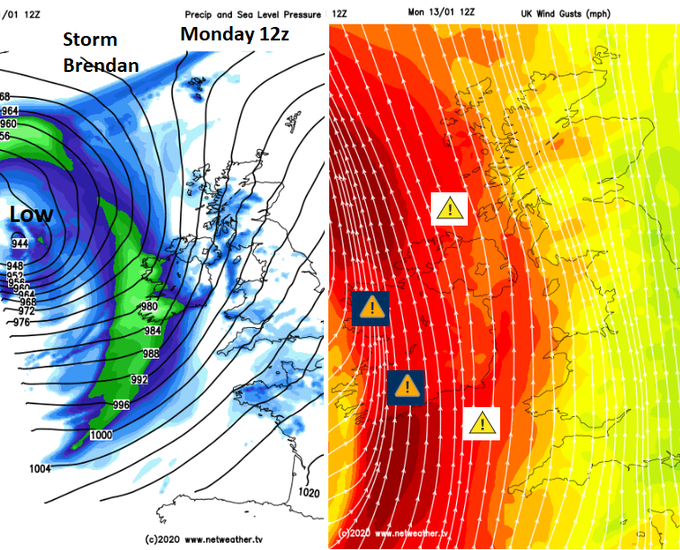
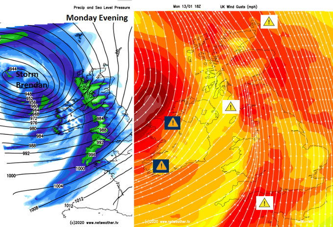
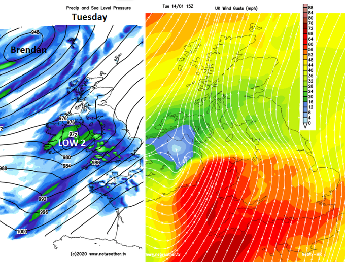
#StormBrendan
"A widely very windy period expected Monday afternoon/evening with disruption to travel likely." "Further warnings for strong winds and rainfall are likely to be issued ... A combination of spring tide/gales may lead to coastal flooding" Another low Tuesday
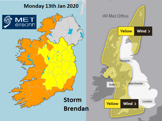
1
16
19