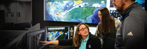

NWS Central Region
@NWSCentral
Followers
23K
Following
3K
Media
522
Statuses
5K
Official Twitter account for NWS Central Region to extend the reach of NWS information. Details: http://t.co/iGsuslzVWY
Kansas City, MO
Joined April 2012

It snowed again last night... Just enough to etch us into the record books here at the office! #MIwx
1
10
73
Also, here's an updated forecast for the wind chills tonight. If you must go outside, remember to dress warmly in layers, and to cover as much skin as possible. At these temperatures, frostbite can occur in as little as five minutes. #NDwx
0
2
0


💧After a widespread 3-7 inches of rain fell, many roads still remain closed and rivers are still rising. ⚠️🚗Be very cautious when traveling and never drive over a flooded road.
14
9
22
Lots going on this weekend but there is something to be keeping an eye on.

Chances for snow are increasing across the region as several disturbances pass through Mon. evening with an additional round of snow possible Tues. night-Wed. Exact snow amounts are unknown at this point, however chances for accumulating snow are increasing areawide. #kswx
0
0
1

Happy National Weatherperson’s Day! Weather can change in an instant & that’s why we work closely with the team at @NWSLouisville to keep you safe and aware. Thank you to all our local meteorologists for all you do to keep us prepared and help plan our days! ☀️☔️⚡️❄️💨🌦️
1
7
27

Please see our latest Key Messages for the ongoing winter storm that will move into the Mid-Atlantic states tonight. Find your latest forecast at https://t.co/QoghhWv7M7 and the latest Winter Storm Severity Index at https://t.co/KLGc2zZKr2
2
75
179
As of 3:15 PM, Louisville has observed 7.7 inches of snowfall. This crushes the previous daily snowfall record for January 5 in Louisville, which was 3 inches in 1910.
4
102
398
We have 12 inches of snow here at the office in Topeka. This is the 4th highest one day snow total on record and it is still coming down strong. #kswx
0
53
331
Conditions such as these will be moving north during the late morning and afternoon today. Even with dry roads now, expect road conditions to deteriorate through the day. Please stay off the roads unless necessary! #kswx

9:25 AM: Here is an example of what we are dealing with folks! An 18-wheeler sliding sidewards! STAY HOME! #kswx
0
8
45
A winter storm is expected to begin impacting the Central Plains by Saturday night, with heavy snow and significant icing potential spreading eastward to the Mid-Atlantic by early next week. See our latest Key Messages below. ❄️
9
221
916
Much of the area currently has a 40-60% chance to see at least minor travel impacts this weekend into Monday due to a winter system moving through the region. These impacts may be from ice, snow, or both. More details on timing and amounts will be determined in the coming days.
0
7
12

The ingredients for a strong winter storm are set to come together Saturday into Sunday, where 4+ inches of snow are likely (50-70% chance). Be wary of travelling southeast, with the greatest travel disruptions expected to be in Kansas and Missouri!
2
15
150

Increasing likelihood of an impactful winter storm event across central and southeast Illinois late this weekend. Continue to monitor the forecast for updates. #ILwx
0
14
60

Mild temperatures will continue across the U.S. for the rest of 2024. However, as we turn the calendar to 2025, there is a strong signal for below normal temperatures for the first couple weeks of January across most of the country. The Southwest and Alaska hold on to better
8
165
566

Winter is officially here — & so is the potential for hazardous driving conditions. Snow & ice are obvious conditions that can be extremely dangerous, but there are also 4 “sneaky” hazards to be aware of. Find out more in our video: https://t.co/rgp10CIvQ5
@NWS
4
26
82
Already looking forward to 2025? 😵💫 We are too! Join us for a webinar featuring presenters from @NWSCentral about improving convective warnings on January 22 at 2 PM Eastern. Register here: https://t.co/zZ4Y6ztSMC
1
4
3

The winter solstice marks a special moment as the shortest day and longest night of the year in the Northern Hemisphere. @NOAA's newest satellite, GOES-19, captured this celestial event from space while undergoing post-launch testing. #WinterSolstice 🌎🛰️

nesdis.noaa.gov
NOAA’s newest satellite, GOES-19, provided a beautiful view of Earth during the winter solstice.
3
52
172

Are you dreaming of a white Christmas this year? While the map shows the historical probability that at least 1 inch of snow will be observed on December 25, the actual conditions in any year may vary widely. (So you're saying there's a chance?!) More: https://t.co/ZQFewmahMp
11
77
237
Increased chance for periods of Atmospheric River Activity to Impact the West during the Busy Holiday Travel Season https://t.co/UxC7DZQPmE
2
55
170