

NHC_TAFB
@NHC_TAFB
Followers
43K
Following
3K
Media
5K
Statuses
13K
Official X account for the National Hurricane Center's Tropical Analysis and Forecast Branch. Details: https://t.co/Mm8fd5WFFu
Miami, FL
Joined March 2015
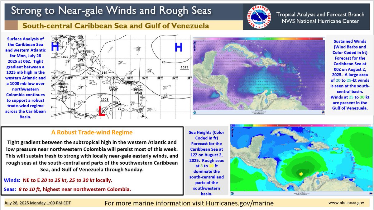
#Hazardous marine conditions caused by strong to near-gale winds and #rough seas will persist at the south-central, and parts of the southwestern Caribbean Sea most of this week, including the Gulf of Venezuela. Mariners need to take precautions and avoid sailing if necessary.
0
5
10
Animated #Winds Forecast (wind barbs and color coded in knots) for the Caribbean Sea through Sunday. Notice a large area of fresh to strong with locally near-gale winds at the south-central basin, including the Gulf of #Venezuela.
1
5
17
The latest Tropical Atlantic Marine Weather Briefing is available at the following link:. Thank you for watching!.
1
1
11
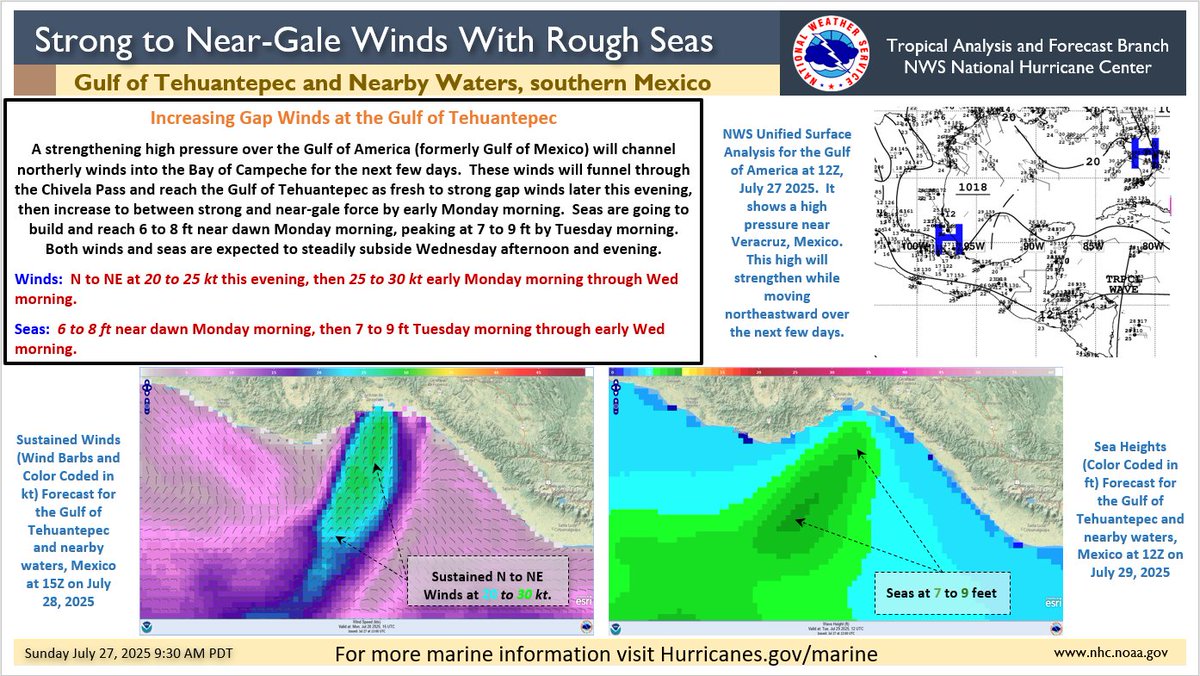
A #gap wind event will cause #hazardous marine conditions at the Gulf of Tehuantepec, and nearby waters from later this evening through Wednesday morning. Mariners, especially local fishermen need to monitor this situation and plan accordingly.
1
8
14
July 26, 2025: An area of showers and thunderstorms along the monsoon trough near 10N130W will move W at around 10 kt through early next week, bringing locally gusty winds and higher seas. In addition, it has a low chance (20%) of tropical formation over the next week.
0
4
18
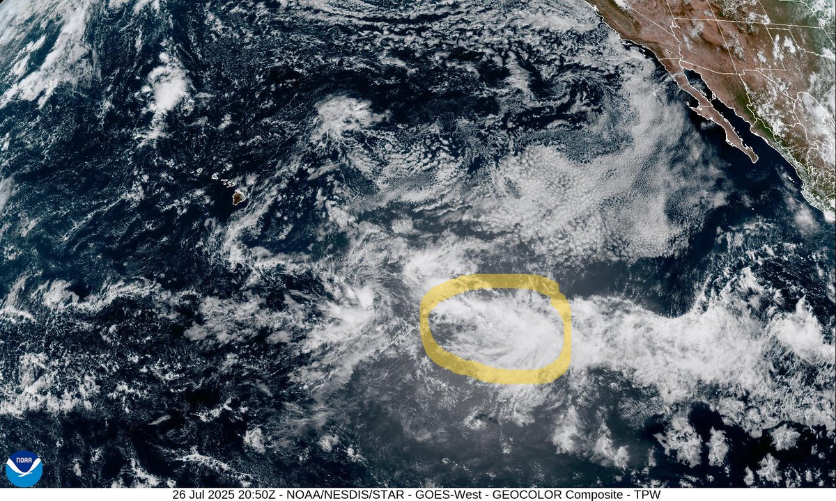
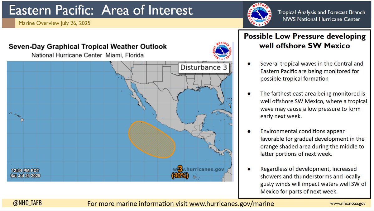
7/26/2025: Low pressure may form in the orange shaded area of the east Pacific early next week and has a 40% chance of tropical formation over the next 7 days. Regardless of formation, increased thunderstorms and locally higher winds are expected over nearby waters next week.
1
2
10
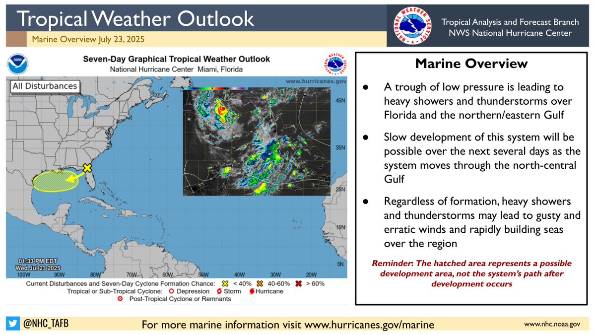
Low pressure is churning in the northern Gulf, and fresh to locally strong winds have been observed via satellite data near the low. Building seas and erratic winds can be expected in the area. There is a low (10%) chance of tropical formation before the low moves inland tonight.
0
6
15
A tropical wave located near 140W is producing showers and t-storms along the wave axis. Increasing winds and rough seas are expected near this wave as it moves westward into the Central Pacific. For more marine weather information on this system, visit:
0
3
8
RT @NOAASatellites: This #FullDiskFriday, we are looking at the Pacific Ocean with enhanced color imagery via.@NOAA's #GOESWest 🛰️. In….
0
25
0
RT @NHC_Pacific: 25 July: We are monitoring 2 areas for development in the Pacific. The disturbance well SE of Hawaii has a 50% chance of f….
0
48
0
RT @NHC_Atlantic: July 25 - Senior Hurricane Specialist John Cangialosi gives an update on an area of low pressure NHC is monitoring over t….
0
66
0
RT @NHC_Atlantic: 8 am EDT - A broad low pressure area located about 100 miles south of the coast of southwestern Louisiana continues to pr….
0
154
0
7/24/2025: Check out today's edition of the Tropical Atlantic Marine Weather Briefing. Over the next 5 days, the main marine weather focus will be the central Caribbean, where fresh to strong trade winds will continue to generate 8 to 10 ft seas.
0
3
7
Fresh to locally strong NW winds are expected offshore of the Baja California peninsula into this weekend, as a strong pressure gradient develops between high pressure to the west and troughing over the Gulf of California. The strongest winds are likely each afternoon/evening.
1
5
7
A trough of low pressure near northern Florida is being monitored for potential tropical development over the next day or two. There is a low (10%) of formation within the next 48 hours before the system moves inland. Mariners are urged to use caution in this region.
0
3
13
Two tropical waves have been analyzed in the EPac, and showers and storms are occurring near the northern end of the waves. Farther east, heavy showers and storms continue along the monsoon trough into Central America. Rough seas and gusty winds are possible near storms.
0
2
8
Building seas will accompany the strong winds, especially over the north-central Caribbean, as the wave moves westward.
0
0
1
A tropical wave located east of the Lesser Antilles will move westward through the Caribbean over the next few days. This wave will lead to increasing winds and seas over the basin, especially across the north-central Caribbean. Heavy showers and t-storms are also likely.
2
7
15