
Mykola Kozyr 🇺🇦🇩🇪🇪🇺
@MykolaKozyr
Followers
1K
Following
6K
Media
728
Statuses
3K
#StandWithUkraine Space-tech and geospatial. Product at @satellitevu. Earlier - @UP42_ @eos_da Views are strictly my own.
Berlin, Germany
Joined December 2015
Checking some protected data catalogs on @STACspec Index, but looks like people tend to forget mentioning how to actually access data 🤷♂️
0
0
0
You're telling me that after a ~year of Vibe Coding phenomenon, the best practices are: 1. Create an .md file describing a project, style and 5 points about being HONEST. 2. Run (different) agents (wearing different hats) (in different tabs). End...?
0
0
1
The most random geospatial find of the day:
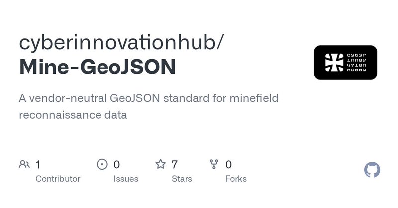
github.com
A vendor-neutral GeoJSON standard for minefield reconnaissance data - cyberinnovationhub/Mine-GeoJSON
0
0
1
Now better: > Awesome project that visualizes how satellites create f̶u̶l̶l̶ ̶i̶m̶a̶g̶e̶ ̶o̶f̶ ̶E̶a̶r̶t̶h̶'̶s̶ ̶l̶a̶n̶d̶m̶a̶s̶s̶ 400,000 images of clouds from 600,000 photos taken in a single day.
0
0
0
Hey team - I've been playing with something. Need to populate more data points and then publish. Data by crunchbase and media reports, debt generally included, data approximate, chart via Python by ChatGPT5, capital raised to date or before the respective exit.
8
2
16
Apparently, one person just fainted… Pushing people to stand 3 hours at 7pm (with the London pace of working) isn’t the best idea.
0
0
0
Google having an event with weirdest setup I‘ve seen for a while. And it’s a 3,5 hours event. Probably, will be shorter for most.
1
0
1
Ukrainian Antonov ✈️ brought Sentinel-1D 🛰️ to French Guiana for the upcoming launch: https://t.co/WLi9KeWkcn That‘s the European autonomy we’re talking about 🇺🇦🇪🇺
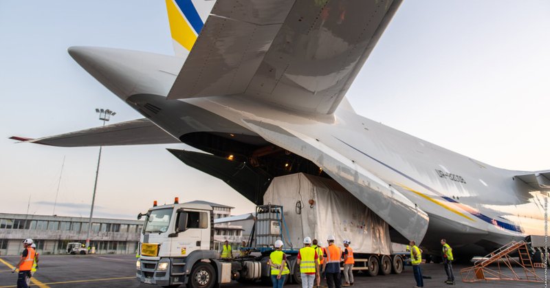
esa.int
The fourth satellite for the Copernicus Sentinel-1 mission, Sentinel-1D, has arrived at Félix Eboué airport, the main airport in French Guiana. From there the spacecraft, safely stored in its...
0
0
2
Its out live. Sorry for the delay, been doing things that don't scale.

In 14 hours I'll publish "Incorporating your space company in Europe 101" 9 pages, feels pretty decent
0
1
21

We’ve expanded our multi-peril change detection to include #Earthquake with Fire Following. This capability delivers near real-time insights into destruction caused by primary earthquakes and the #fires that can follow. Read the press release: https://t.co/KvhqwD9eFF
#Insurance
1
4
23
Hey @Atlassian, there is literally no one in the world will choose "1 Column layout" after typing "/1". Please return it back to Heading 1.
0
0
1

🎙️ New Podcast & YouTube: TorchGeo 1.0 with Adam Stewart In this episode, Adam Stewart shares updates on TorchGeo, the widely adopted geospatial ML library, and its upcoming 1.0 release with long-awaited time series support. We cover insights from a recent review of geospatial
1
5
34
Here you go: https://t.co/QN0Es4n4o6 Official EU design system 🧑🎨 I love it
0
0
0

🌸 If you're using Folium in your Streamlit app, you should probably thumbs-up this issue to support it https://t.co/sQlIcwVYdq 👀
0
1
9
Kinda agree, but then eventually it returns you a GeoJSON or whatever, and you need GIS tool/knowledge anyway to deal with it 🙂

The problem: OSM uses a complex query language (OverpassQL). Unless you know the tagging system, it’s nearly impossible to find specific features like “an Italian restaurant next to a Carrefour in Paris”.
1
0
3
Definitely need to try this one out 👇 "Generate a custom base style based on a natural language prompt like “Create a Halloween-themed map. Make it look spooky and fun for Halloween.”

Developers — supercharge your Mapbox development workflows with the new Mapbox MCP DevKit. 🚀 Now, it’s faster and easier to build with Mapbox by equipping AI coding tools with access to the Mapbox platform. From designing maps to managing data, generating API tokens, and
1
0
2
To the point of Health / Biodiversity, somewhat relevant work described by @PixxelSpace
pixxel.space
Analysing Water Quality in Utah Lake using Hyperspectral Imaging Satellites
0
0
1
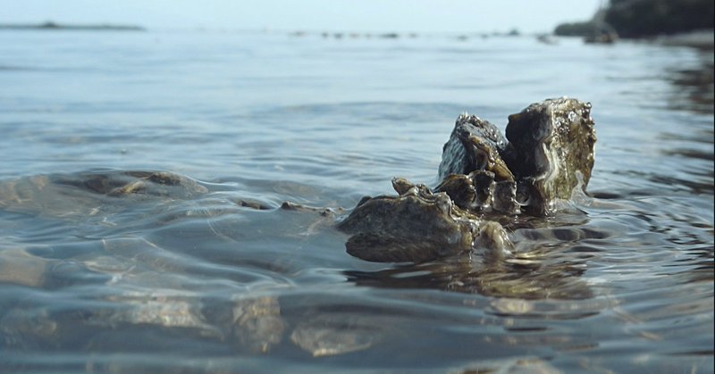
PlanBlue mentions the following products 👇 If combining Space EO data, it looks like quite a few could be achieved on a relatively good level.
1
0
0
I saw PlanBlue 3 years ago at the GWF event: https://t.co/L4NcSMv34B The use case they use is pretty much in a shore area. I've never really worked with hyperspectral, but isn't that good enough to achieve those goals?

planblue.com
Fully-automated seafloor intelligence to drive your nature-positive operations.
1
0
1