
Robin Cole
@robmarkcole
Followers
11K
Following
61K
Media
746
Statuses
8K
Tackling the worlds toughest challenges with AI & ML applied to satellite & aerial imagery https://t.co/QmbOWgdfAZ
London, England
Joined April 2009
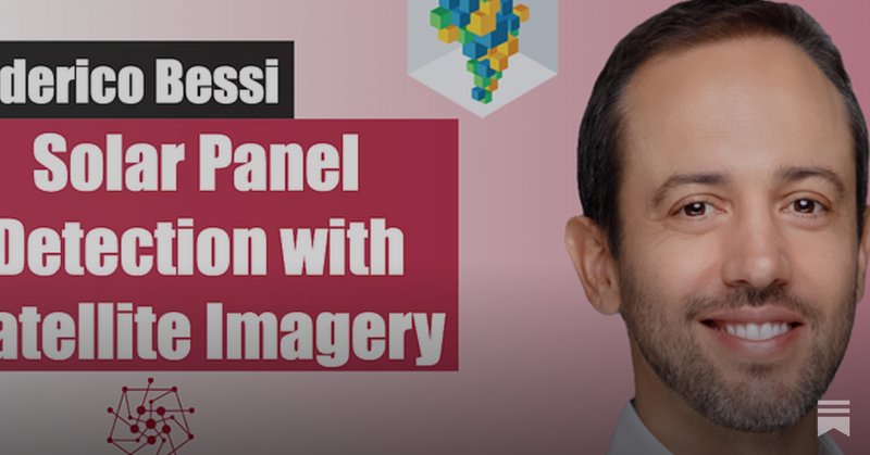
🎙️ New podcast and YouTube: Solar Panel Detection with Satellite Imagery. In this episode, I catch up with Federico Bessi to learn about the automatic detection of photovoltaic solar plants using satellite imagery and deep learning 🌞

2
10
65
Asterisk Labs is expanding its team of climate and Earth observation scientists.

Asterisk Labs is expanding its team of climate and Earth observation scientists. You could help us build an alternative to the usual routes for doing research, prioritising positive societal impact, and democratic worker control!. (1/4)

0
1
12
Galileo is a new open-source multimodal model designed to process many kinds of earth observations at once 🌍.

🛰️ 🔭 Say hello to Galileo, an open-source multimodal model designed to process many kinds of earth observations at once—driving applications such as mapping agricultural land, detecting floods, and monitoring marine pollution.
2
11
55
From Flask to vLLM: How Model Inference has evolved (2017-2025).

My first model was a model that had a human in the loop to help craft responses to real-time chats. I link to that lecture in this post (this was 2017 🤯).
1
0
7
MOSAIKS (Rolf et al. 2021) is a top performer.

One major insight that will be lost in the hype of AlphaEarth is MOSAIKS (Rolf et al. 2021) is a top performer in the paper's experiments while requiring ZERO pretraining - yes you read that right. No petabyte-scale pretraining dataset, no cluster of A100/H100s. Just


0
0
11
AlphaEarth Foundations 🌎


Our new AI model AlphaEarth Foundations is mapping the planet in astonishing detail. 🌏🔍. Scientists will now be able to track the impact of deforestation, monitoring crop health, and more – significantly faster, thanks to our new datasets. 🧵
0
7
113

EcoMapper: Generative Modeling for Climate-Aware Satellite Imagery.

Super happy our work, “EcoMapper: Generative Modeling for Climate-Aware Satellite Imagery” will be at #ICML2025! EcoMapper generates satellite views under different climate scenarios by utilising millions of Sentinel-2 images 🛰️🚀

0
1
20
Instance Segmentation with GeoAI! 🛰️🧠.

🚀 New Feature Alert: Instance Segmentation with GeoAI! 🛰️🧠. The GeoAI Python package now supports instance segmentation for remote sensing imagery — all with just a few lines of code!. You can quickly:.✅ Train instance segmentation models.✅ Run inference on multiple

0
2
11
Water Detection Using GeoAI with Sentinel-2 Satellite Imagery 🌍🛰️.
🚀 GeoAI Tutorial 24: Water Detection Using GeoAI with Sentinel-2 Satellite Imagery 🌍🛰️ . In this tutorial, I walk you through training a model to detect water bodies from Sentinel-2 satellite imagery with 6 spectral bands — then show you how to run batch inference across

0
11
51
🛰️ Finetuning Pixtral on a satellite imagery dataset 🛰️.

New @MistralAI Cookbook: 🛰️ Finetuning Pixtral on a satellite imagery dataset 🛰️. - How to call Mistral's batch inference API.- How to pass images (encoded in base64) in your API calls to Mistral's VLM (here Pixtral-12B).- How to fine-tune Pixtral-12B on an image classification

0
0
10
A cross-stage features fusion network for building extraction from remote sensing images.

🔥Achieved 91.74 IoU!. 🚀Existing methods struggle to fully tap into low-level features in #RemoteSensing images—limiting building extraction accuracy. Enter CFF-Net: a Cross-stage Features Fusion Network that changes the game. 📖Read more: #ComputerVision

1
2
27

🎙️ New podcast and YouTube: Chat2Geo and the Power of LLMs. Chat2Geo is a web-based app designed to simplify remote-sensing-based geospatial analysis through an intuitive, chatbot-style interface

1
7
31
RT @indragie: I haven't written a blog post in 11 years, but the recent experience of building a complete macOS app with AI has me so optim….
0
155
0
RT @MethaneSAT: On Friday, June 20 we lost contact with our methane-measuring satellite. Despite considerable efforts we were unable to ree….
0
25
0
A large scale training sample database system for intelligent interpretation of remote sensing imagery.
Attractive!!! Over 2156 views on a groundbreaking solution in #RemoteSensing! Current ML/DL training samples for imagery lack an integrated approach. Enter #LuoJiaSET, a large - scale database with over five million samples, solving key challenges. Link:

1
0
14
Overheard conversation from an artist - ‘the company don’t want to use AI so they had me paint the AI generated picture and they used that - it’s AI translation’ 🧐.
1
1
2
