
MapTiler France
@MapTiler_FR
Followers
197
Following
382
Media
74
Statuses
138
Créez et hébergez vos #cartes avec @MapTiler - Solutions cartographiques pour vos applications et sites internet. #géoservices #sig #opendata #openmaptiles
France
Joined March 2019
RT @JLZIMMERMANN: Autre surprise de taille grâce à @MapTiler un rendu personnalisé avec la langue de l'utilisateur rendant (enfin) les étiq….
0
1
0
RT @MapTiler: We're supporting the @openstreetmap community by providing a new map layer for their website. Thanks to #VectorTiles technolo….
0
31
0

Generate videos in just a few seconds. Try Grok Imagine, free for a limited time.
386
674
3K
RT @JLZIMMERMANN: Surprise d'été 2025 : 2 nouveaux rendus (shortbread & Maptiler) pour avec du vectoriel & plus de….
0
3
0
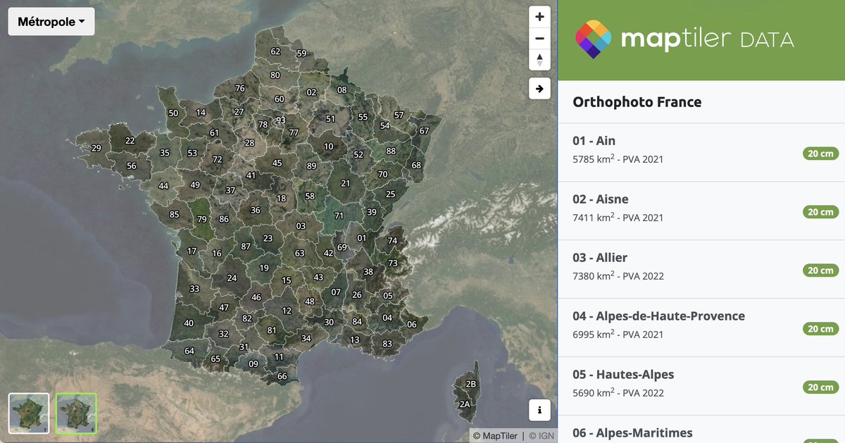
RT @MapTiler: Zoom in on France and switch to the satellite layer—you’ll see the most recent aerial imagery, now updated across 95 départem….
0
3
0
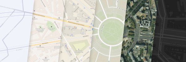
Mise à jour complète de MapTiler Satellite pour la France! La couverture haute-resolution inclue maintenant les prises de vues aériennes les plus récentes @IGNFrance @sorianotech.
0
0
3
RT @MapTiler: Inspired by the artistic beauty of watercolor paintings, please welcome our new map, Aquarelle!. 🎨 Aquarelle .🌚 Aquarelle Dar….
0
3
0
Retrouvez-nous au #SotMfr24 ce vendredi 28/06 à #Lyon! Présentation @openmaptiles 3.15 à 16:30 - Salle 325 @MapTiler #cartographie @openstreetmap @sotmfr

0
7
16
RT @mirbole01: TimeMap, un moteur de recherche visuel pour trouver des cartes historiques par zones géographiques (notamment à partir de la….
0
43
0
🇫🇷 Mise à jour complète de MapTiler Satellite pour la France! La couverture haute-resolution inclue à présent les prises de vues aériennes les plus récentes @IGNFrance


0
1
3
RT @MapTiler: Use vector tiles in #LeafletJS with our plugin! Access our vector basemaps or any other vector layers in your MapTiler Cloud.….
0
4
0
RT @MapTiler: MapTiler Engine makes processing large batches of files into map tiles easy! Filter files by attribute, removing the ones you….
0
2
0

0
1
4
RT @MapTiler: Happy #PostGISDay! Celebrate with vector tiles served from PostGIS on your laptop or server: https://….
0
3
0
RT @MapTiler: Are you heading to @foss4g_asia2023 in Seoul at the end of the month? Look out for @cartogenic, who will be talking about #Ca….
0
3
0
RT @MapTiler: We’re always on the lookout for more high-resolution aerial imagery, giving us up to 8cm/px maps. To fill in the gaps, we’ve….

maptiler.com
A high-resolution satellite map of the entire world is now available to all free and paying users of MapTiler Cloud.
0
7
0
RT @MapTiler: Happy Halloween! Check out our spooktacular map of creepy placenames in the USA and UK! . #Halloween….
0
10
0
RT @MapTiler: Introducing our new map style editor! Create beautiful cartography using this powerful tool with an easy-to-use interface. Fi….
0
12
0
RT @MapTiler: Do you need night 🌚 and day ☀️maps for your dashboard? Or do you want monochromatic background maps to make your colors po….
0
3
0