Jacob Burgardt
@JacobBurgardtWX
Followers
1,073
Following
459
Media
2,123
Statuses
20,666
20 | Grad Class of 23’ | Plains | Skywarn Storm Spotter | 24’🌪️1 | #YouHaveToSeeIt | Victim of Denver Football | Go State!💜 | #GoAvsGo Major: Graphic Design
Kansas, USA
Joined January 2021
Don't wanna be here?
Send us removal request.
Explore trending content on Musk Viewer
JUNGKOOK
• 1074946 Tweets
Celtics
• 274895 Tweets
ENGLOT LoveBully EP1
• 197688 Tweets
VIRGINIA AL 9009
• 149941 Tweets
sabrina
• 137110 Tweets
Mavs
• 133088 Tweets
Dallas
• 125935 Tweets
Luka
• 123298 Tweets
BRAT
• 96572 Tweets
Kyrie
• 92231 Tweets
Tatum
• 81545 Tweets
Porzingis
• 80377 Tweets
#NBAFinals
• 79512 Tweets
Mavericks
• 68389 Tweets
barry
• 62951 Tweets
Dr. Phil
• 50587 Tweets
Miranda
• 43912 Tweets
Charli
• 41952 Tweets
Corinthians
• 39913 Tweets
Doncic
• 36910 Tweets
Jaylen Brown
• 30707 Tweets
ナイトワンダラー
• 27022 Tweets
#MyLoveMixUpTHLive
• 26043 Tweets
#スターレイル予告番組
• 25018 Tweets
Soto
• 22397 Tweets
Miss Alabama
• 17730 Tweets
#PowerGhost
• 14629 Tweets
ロックマンワールド
• 13950 Tweets
Lively
• 13850 Tweets
Kaytranada
• 13304 Tweets
#يوم_Iلجمعه
• 12113 Tweets
Hayırlı Cumalar
• 10317 Tweets
Carlos Miguel
• 10231 Tweets


@8forMVP
@jasrifootball
@JamesPalmerTV
@Ravens
3 firsts and an O Lineman will be the cost of your request
16
1
172
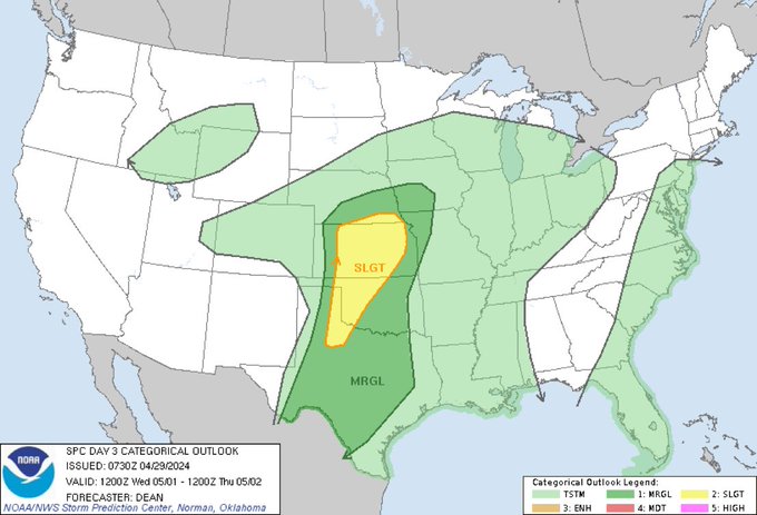
I got bored and Spring is here. My 2024 tornado season forecast let me know what you all think about this.
#wxtwitter
33
21
145
@gmenjake1
@BleacherNation
You’re in rebuild and we have a top 3 farm system so there’s definitely people the Mets would want from us
22
0
112
Thoughts on the new style of graphics for next years season. Wanting to know if it's to much or to little and if the text fits the outlook. Just general feedback would be nice as well.
#wxtwitter
23
5
90
Haven’t said this in a while might be time for the 5/5
8
7
84

I will gladly take this as long as it’s not finals week
5
9
71
1
0
67
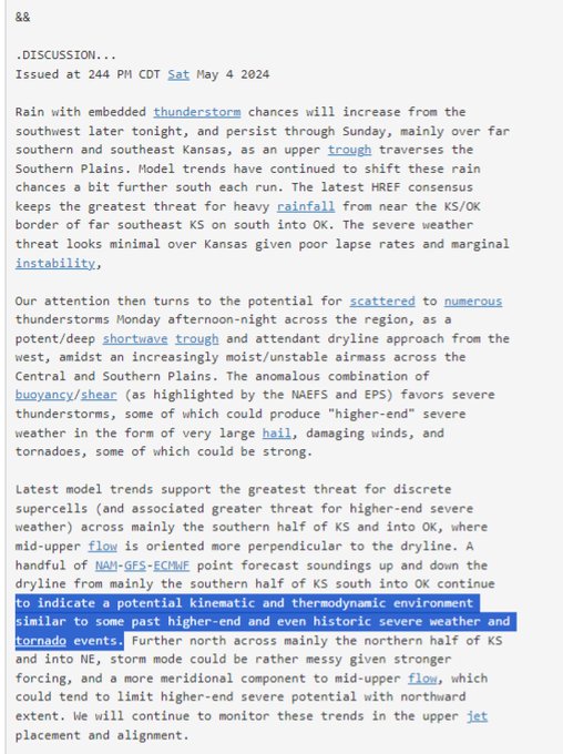
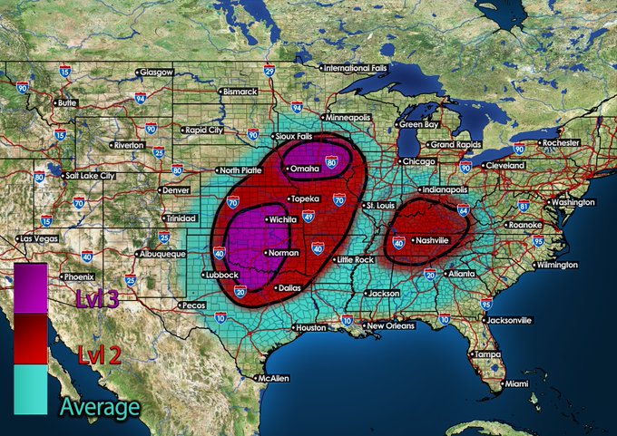
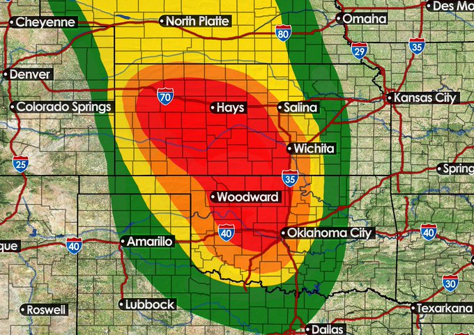
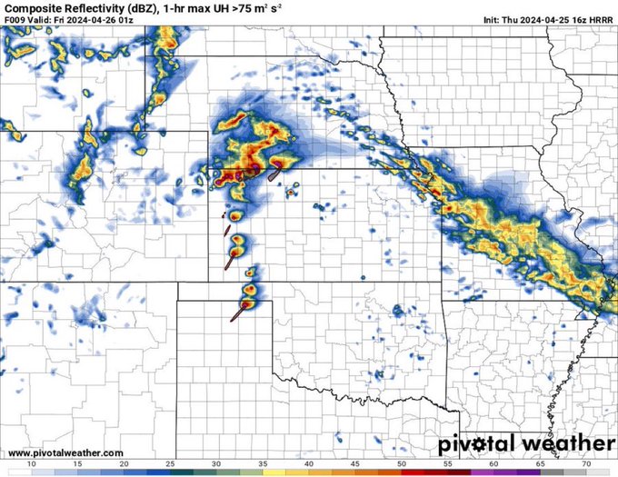
*Not An Official Forecast*
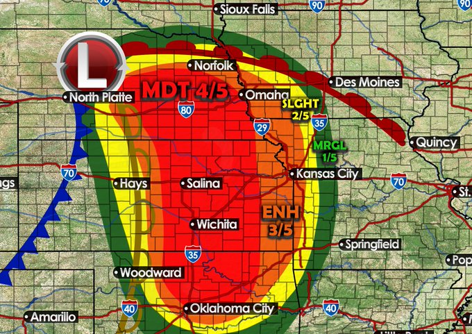
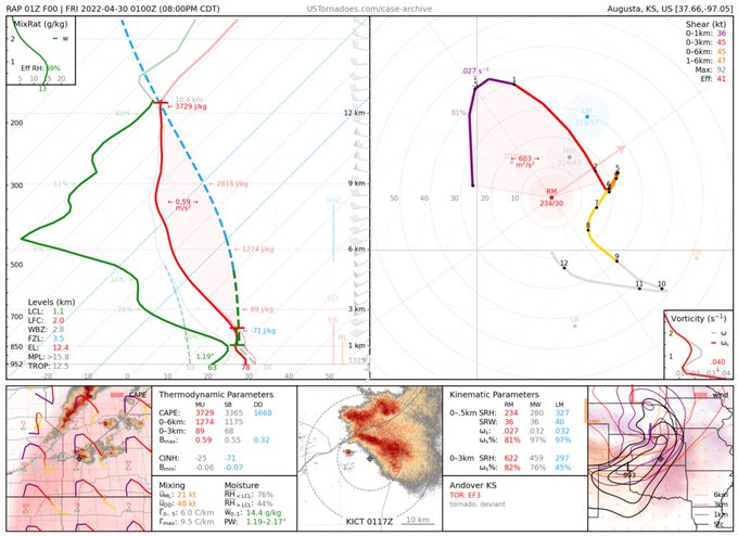
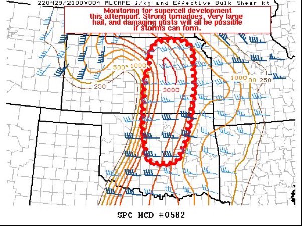
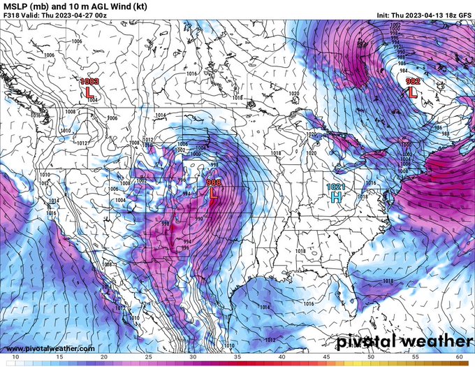
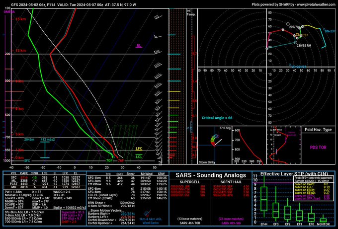
I think that given the latest HRRR & RAP runs and the talk of a possible MDT from Mets that the SPC will issue an expansive MDT risk stretching from Central OK to NW Kansas. Hodographs and instability supports Tornadoes some strong , very large hail, as…
11
16
65
@RussToJeudy10
He’s a chiefs fan so he’s gonna be biased against the broncos. That’s why I dk t watch the show for broncos stuff
0
0
57
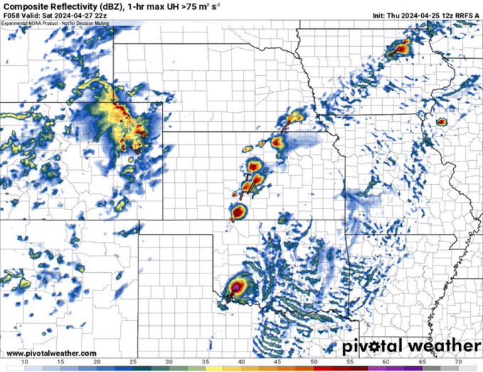

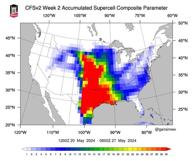
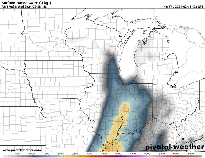
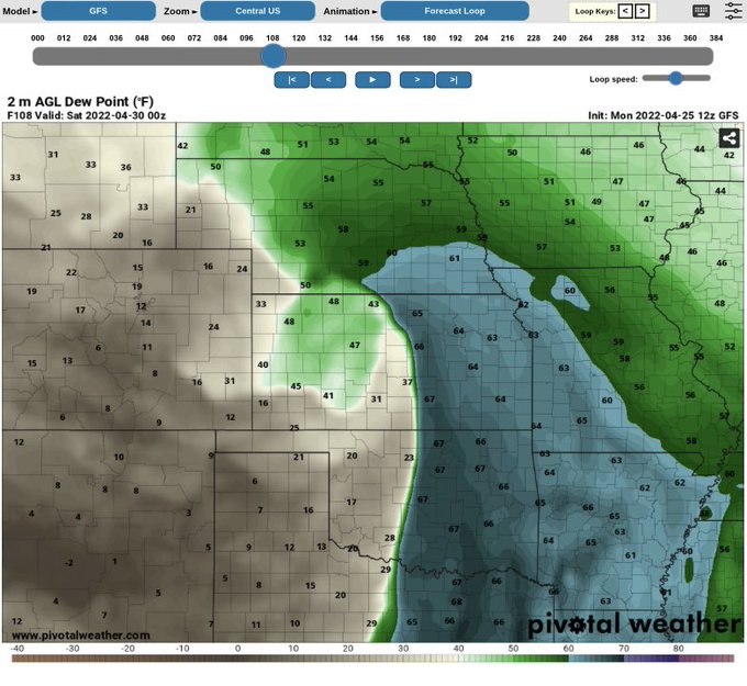
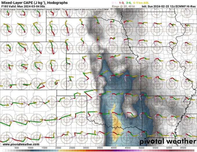
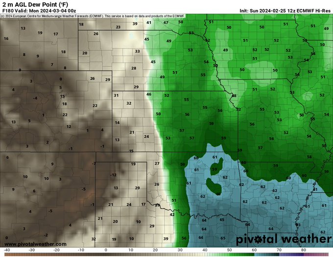
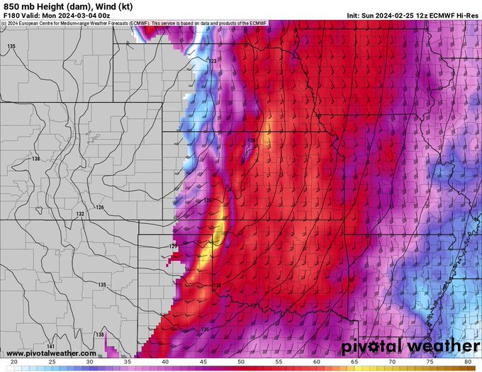
As we head into June models are depicting at a pattern flip that could alter our recent lack of severe weather in the areas highlighted. These area could wake back up as we enter the pattern flip.
#wxtwitter
@Kc_Chasers
7
15
61
@MileHighMims
The Vikings barely beat the Niners and then they sweep teams under 500. But yet they still have them winning after we beat to of the top AFC teams 😭
3
0
59
1
0
59

@devshah000
@SayreBedinger
We’re going to lose him after his contract he ain’t signing back. So might as well get something out of him
1
0
53
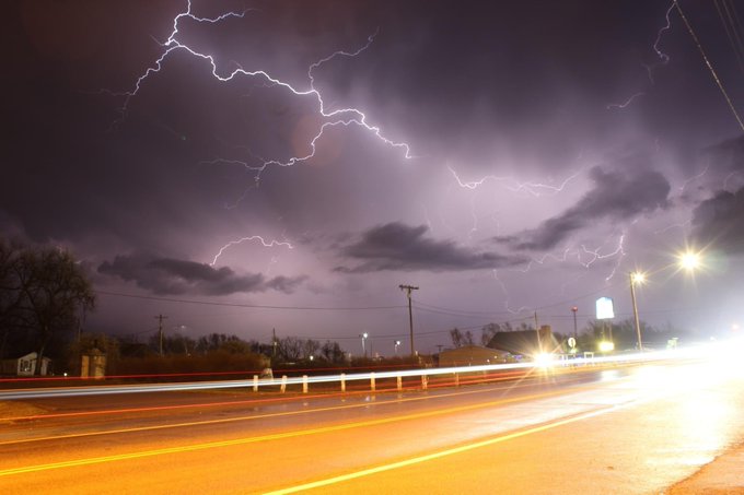
I've been seeing a lot of people in wxtwitter pre-rating the Rolling Fork tornado an EF-5. One word STOP!
#wxtwitter
3
6
53
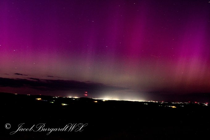
What an absolute day for auroras. Definitely a career day for me. Might have more on the way as well as there seems to be a stronger one in store this weekend. We shall see!!
#wxtwitter
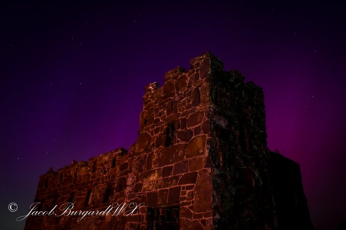
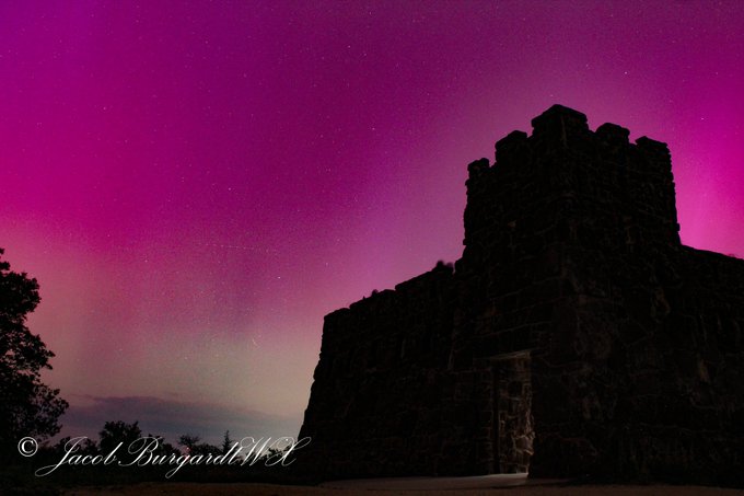

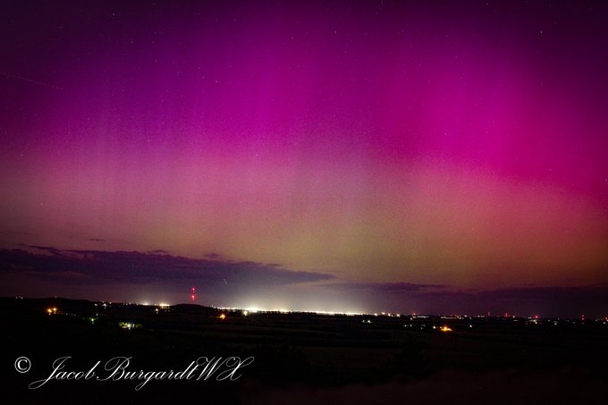
5
15
54
@Broncos
It’s a picture of mid field which is the 50 and then there’s 8 paws. Von Miller number retirement 🤔
2
0
51
1
0
52


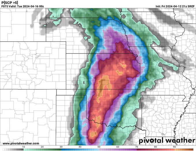
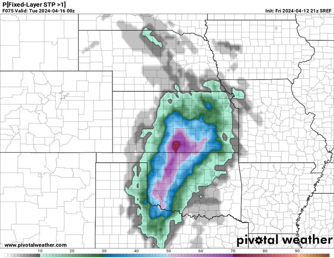
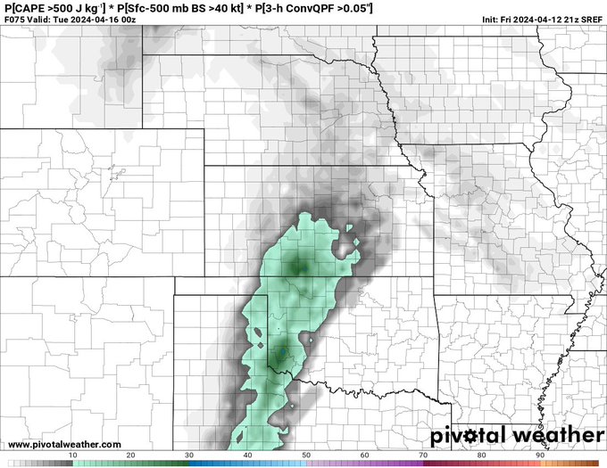
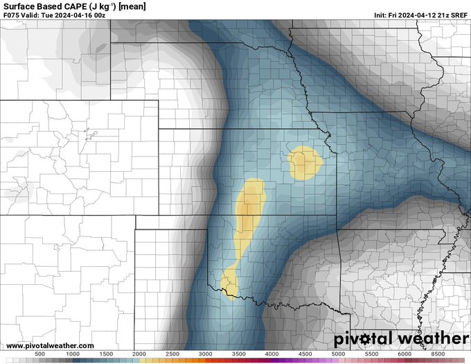
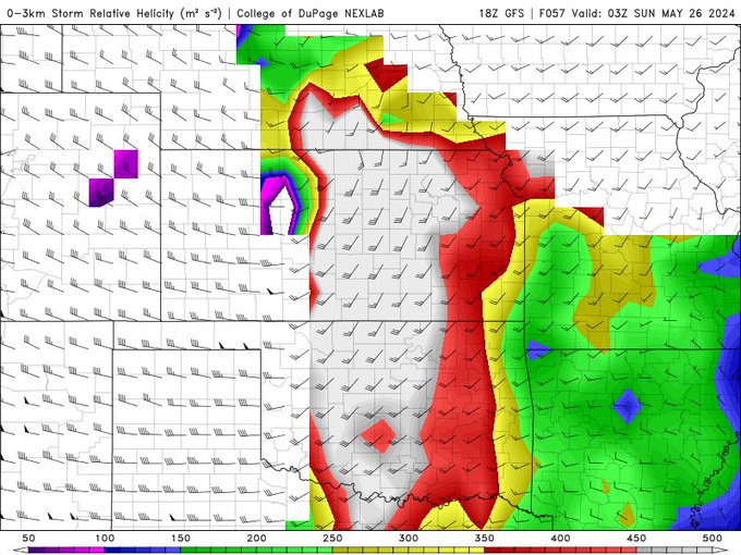
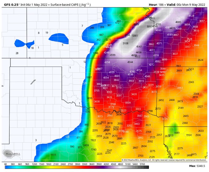
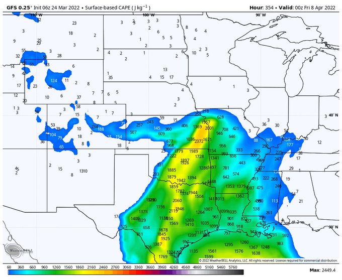
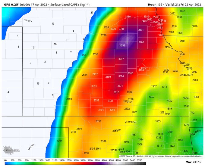
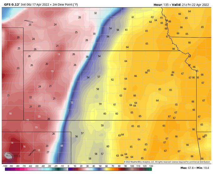
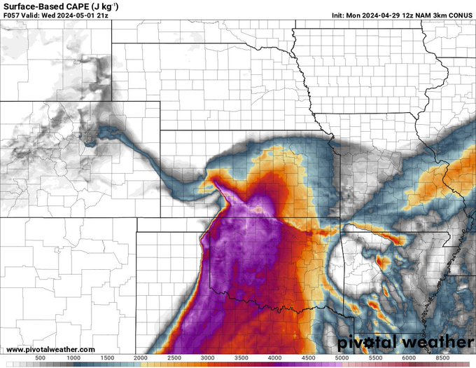
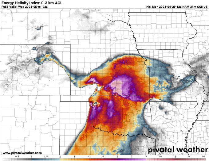
My thoughts on the tornado risk for tomorrow. Even though you don't have the 3 cape like you do down south I think 45-50 will be plenty for storms to become tornado with the amount of shear. Although, I do thin the south has the potential to have some possibly strong tornadoes. I…
3
6
50
@BroncosHispano
@KelbermanNFL
Russ holding on to the ain’t his fault. Receivers can’t get open
5
0
48

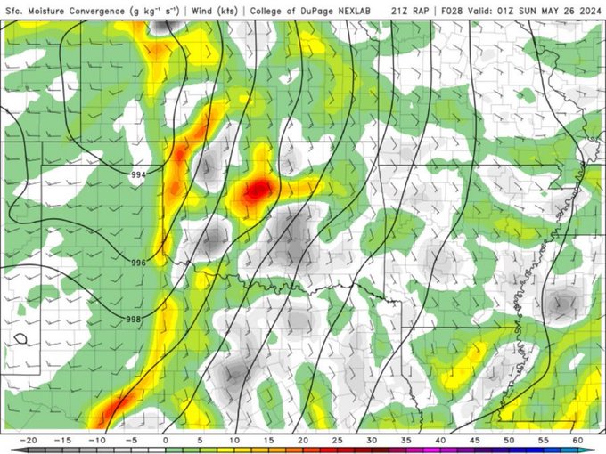
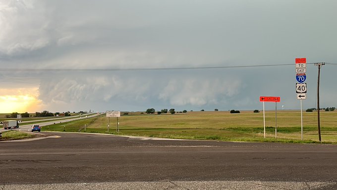
Hey storms motions I would greatly appreciate it if you slow down please and thank you 😵💫
4
0
47
2
5
47
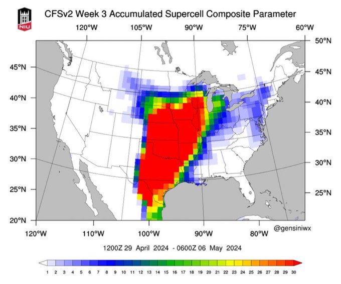
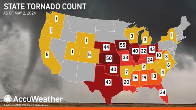
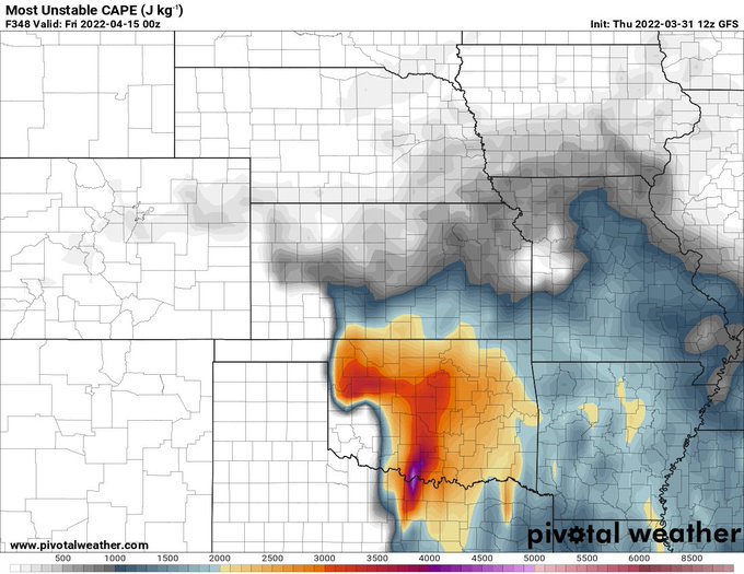
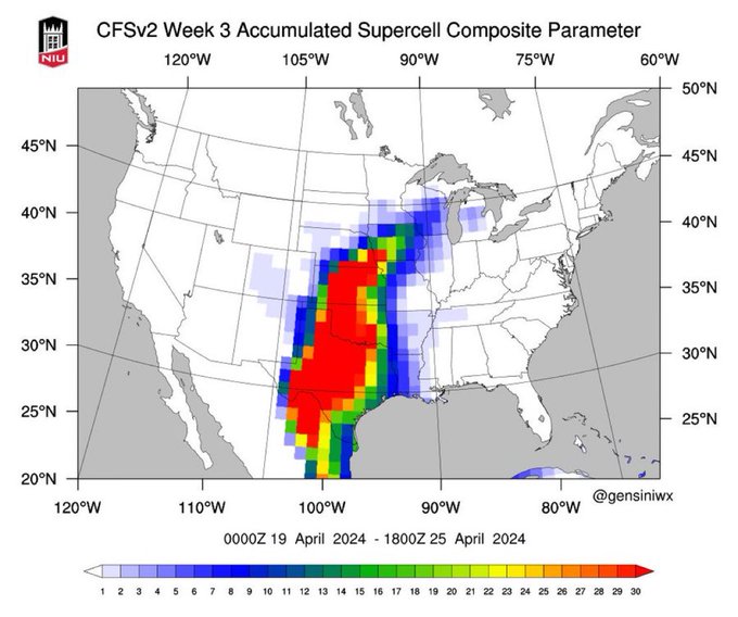
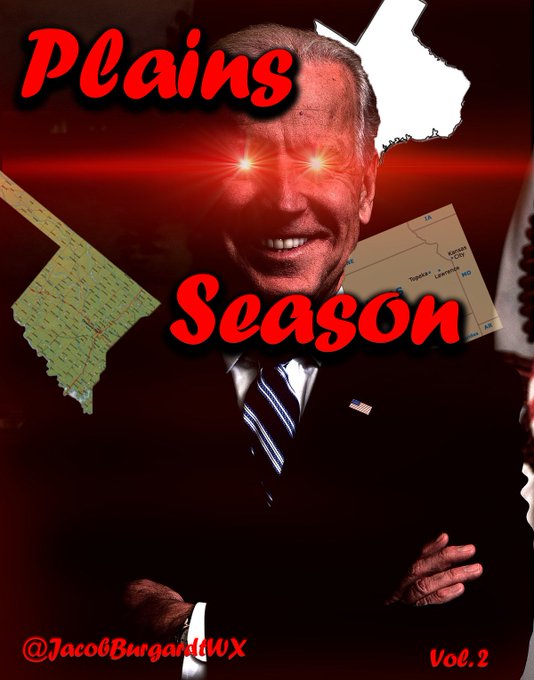
Why is nobody talking about this the Plains are back baby!!!
10
1
44
1
0
43
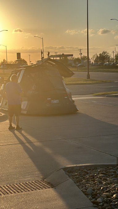
@ChasingWConnor
@FreddyMcKinneyR
Hoping he recovers from this traumatic experience. Yall did absolutely amazing out there!!
0
0
46
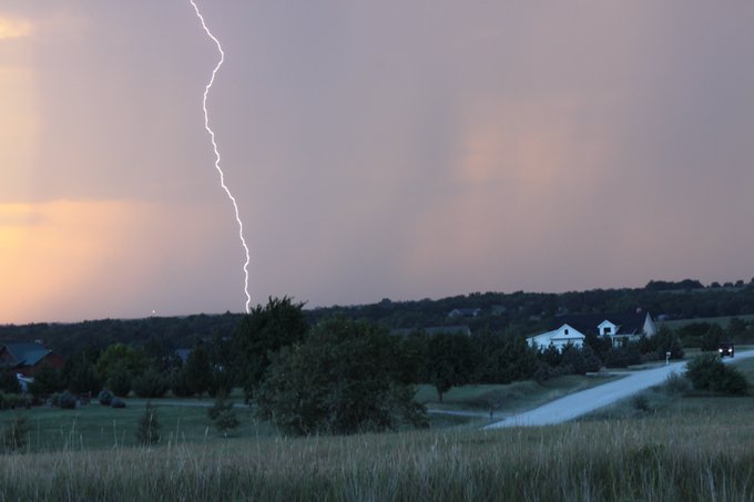
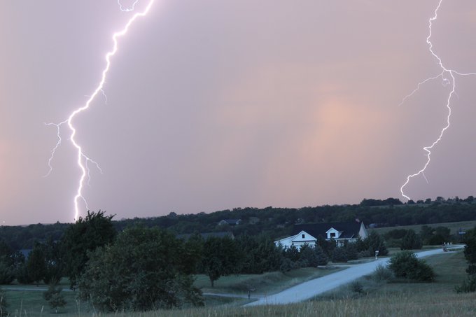
The only way to see a Dixie tornado 💀

Dixie Madness:
This
#tornado
was captured by Team Dominator 3 back in June down in Georgia! Whoever says Dixie doesn’t do it like the plains is WRONG!
Cheers to spring everyone!!
#wxtwitter
#gawx
@ReedTimmerUSA
@Sierra_Lindsey3
9
57
374
3
4
43
Hmmm what shall my target area be on Saturday. SPC: House
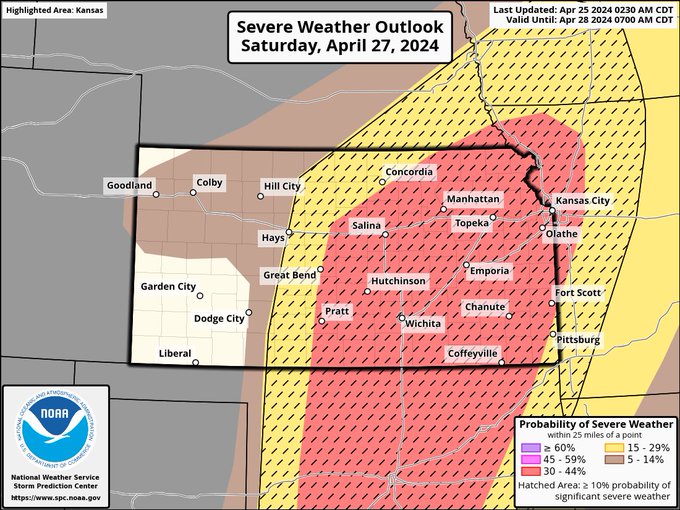
0
3
43
@Lateralus982
@SNFonNBC
@BadgerFootball
@DangeRussWilson
Bro he’s been doing this his entire career hop off the meat
1
0
41
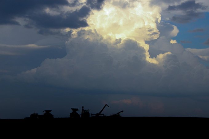
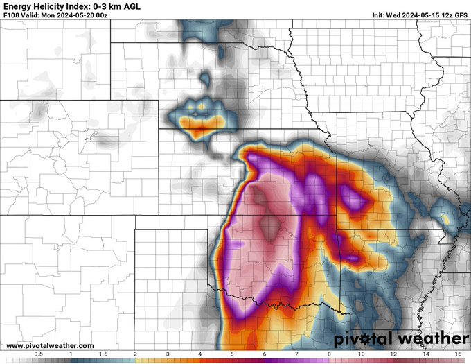
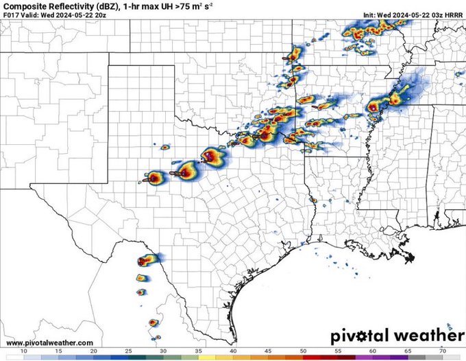
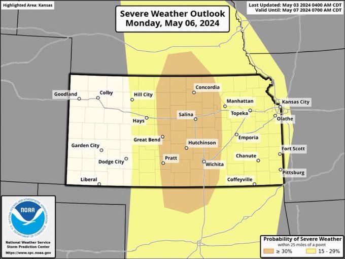
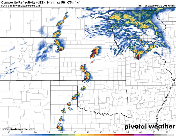
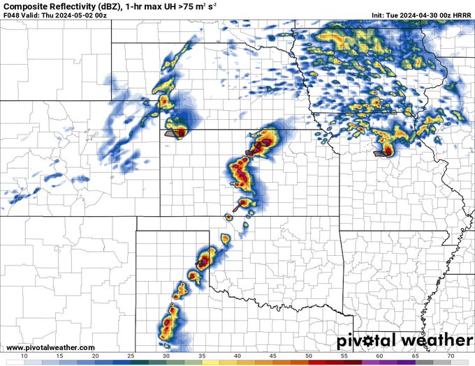
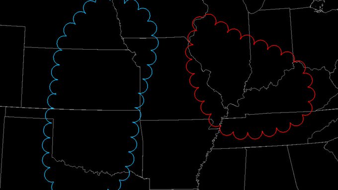
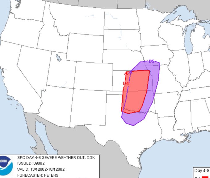
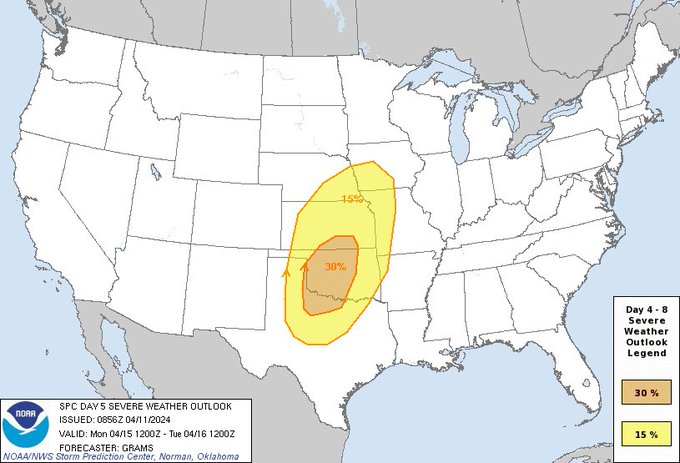
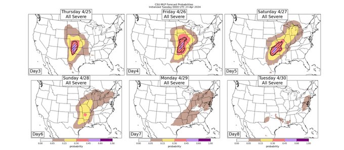
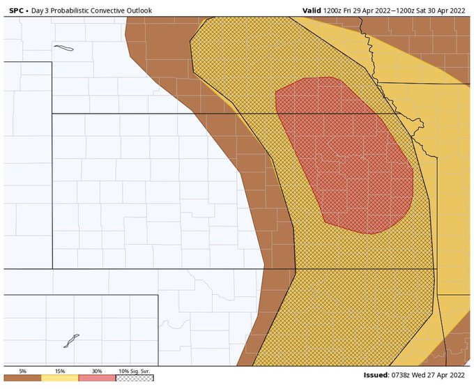
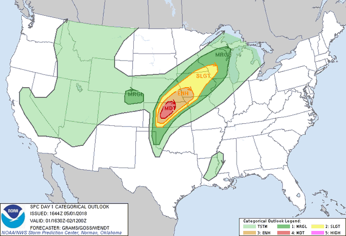
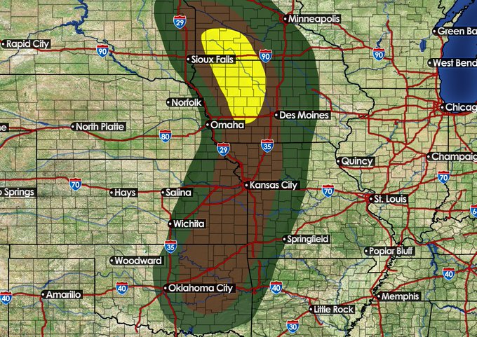
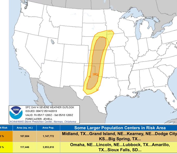
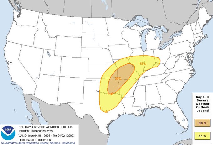
A rare day 4 30% has been issued for parts of the plains and much of the Mississippi Valley. Significant severe weather now seems to be possible
#wxtwitter
1
4
43