James G. LaDue
@JLaDue
Followers
1K
Following
4K
Media
805
Statuses
5K
Master Instructor: NWS Warning Decision Training Division, past Acting Director: NIST NWIRP, Chair: ASCE WindstormEstimation Standards Committee
Oklahoma
Joined December 2008
I think this is the most intense tornado sound I’ve heard. Nicely done footage!.
Here is the video clip where I thought I was going to witness multiple chasers die in the Henry, SD #tornado #sdwx after getting too close as the farm disintegrated and flew over them. @MichaelGordonWX.@SimonStormRider.@JustonStrmRider.@scottmcpartland.@mikebettes.@parkertwc
1
0
5

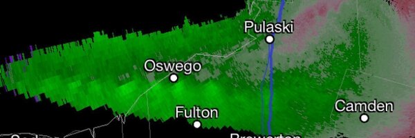
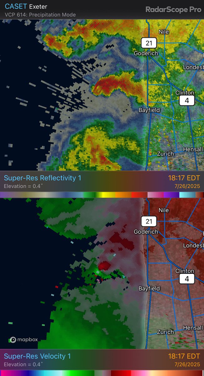
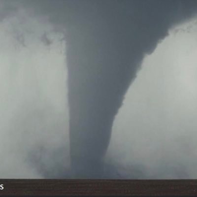
Well look at that! It’s another apparently wide multivortex tornado over southern Lake Huron with a relatively small supercell. Parameters don’t stand out except one in the SPC Meso products.
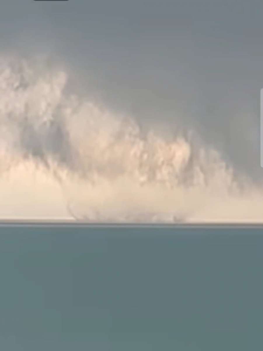
User on FB from the Bayfield local group, shot near Cut Line. Clearly tornadic over water. The tor warning came out on the video ~20sec later. #onstorm @NTP_Reports
1
4
14
theweathernetwork.com
Researchers spent months combing through evidence to classify Canada’s first fire-generated tornado back in August
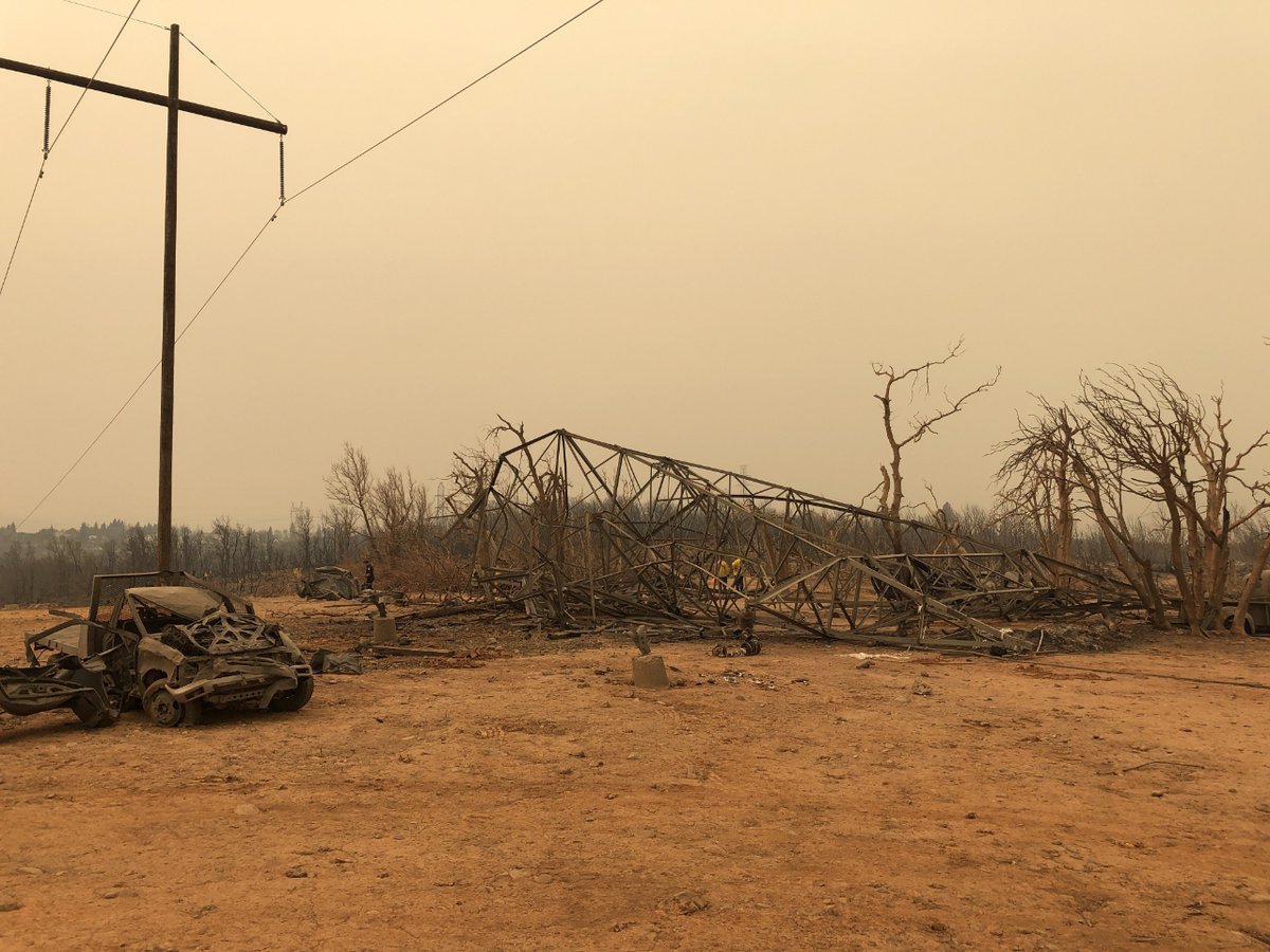
This one in late July 2018 took down transmission towers, debarked trees and threw vehicles long distances. It went out of the burn zone to strike a neighborhood. This article, following, highlights other fire tornadoes that occurred in British Columbia and elsewhere. 2/
0
0
1
This one in late July 2018 took down transmission towers, debarked trees and threw vehicles long distances. It went out of the burn zone to strike a neighborhood. This article, following, highlights other fire tornadoes that occurred in British Columbia and elsewhere. 2/
0
1
9
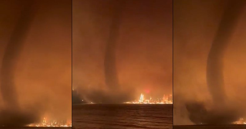
Fire tornadoes can be as strong as any tornado. This one looked like any strong or violent tornado I've seen. I've got some pics below of damage taken of a fire tornado in 2018 NW of Reading, CA. 1/.
This footage shows the size, scale, and severity of the Fire weather event that took place on the Deer Creek Fire in La Sal, Utah. One individual said they believed a skid plate off a Toyota Tacoma was hurled and hit their fire apparatus. The shear size and velocity of this
3
7
43
RT @HotshotWake: This footage shows the size, scale, and severity of the Fire weather event that took place on the Deer Creek Fire in La Sa….
0
297
0
The NWS also uses an amazing flash flood warning guidance tool made by NSSL and CIWRO. See how it predicted the stream flow rates at Mystic Campground as well as what was observed in Hunt, TX.

facebook.com
Here is one more important input available to NWS forecasters and created by NSSL and CIWRO. This is the observed river flow at the Hunt, TX gauge vs the FLASH output standing for Flooded Locations...
0
5
12


If this doesn’t impress you…. Why was that bridge open for traffic for so long?.

This video of the Guadalupe was shot in Kerrville, Tx from the Center Bridge. Watch how fast these flood waters were traveling & washing everything in front of it out. It goes from low & barley flowing to over the top of the bridge in around 35 minutes. I sped the video up to
0
0
3
RT @averytomascowx: New info out of Ingram, TX is hard to stomach. This is video from the back of Howdy's Bar and Chill restaurant. There….
0
2K
0
The whackos have taken over and all I can say is life expectancy will decline.
Physician here. The #1 cause of bankruptcy in the US is medical debt. And we don't even have a good healthcare system either. we spend more and get less and have the highest excess mortality rate in the 1st world. But wait. it's worse. /1.
0
0
7
Contact your reps and senators.

There isn’t a word strong enough to describe how bad this is.
0
0
1
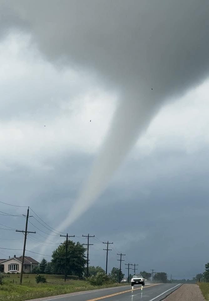
After getting nice whole storm and tornado shots this year, I’m still just as enamored with these combo shots. I bet there were fewer crowds there too.
Beautiful tornado and structure near Gary, South Dakota yesterday.

1
0
4
RT @MetzStormMedia: One of the most epic tornado photos I have captured in my lifetime! June 28th, 2025 near Gary, South Dakota. This is th….
0
996
0
RT @MatthewCappucci: NEXRAD WEATHER MODIFICATION GEOENGINEERING NON-GMO HAARP CHEMTRAIL BOOGEYMAN ALERT! . Just kidding. Everything is a c….
0
145
0
RT @SouthTahoeNow: 6 dead, 2 missing after storm hits #LakeTahoe. Multiple boats capsized in the 8-10 foot troughs. @ElDoradoSheriff dive t….
0
66
0
RT @project_otus: Inside the EF3+ Spiritwood, ND wedge tornado near peak intensity from our research drone!
0
995
0
Extremely favorable supercell and tornado environment and you get this. Wow!.
OMG.
0
0
1