fede.fierli
@FedericoFierli
Followers
126
Following
55
Media
21
Statuses
99
Joined May 2012
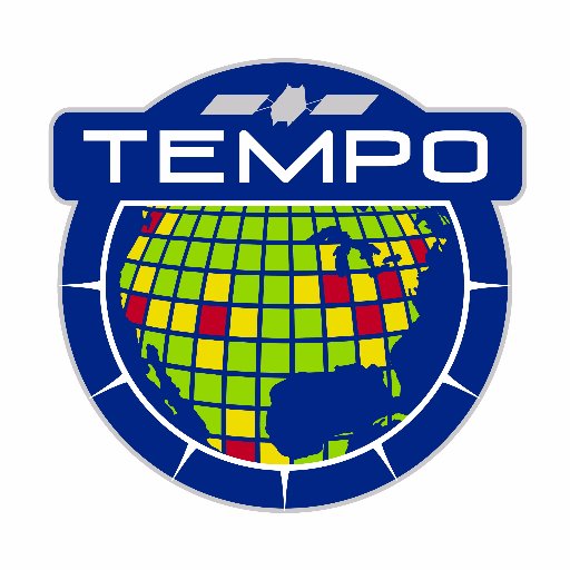
Near real-time data of #AirPollution over our neighborhoods is here! Our hourly daytime scans of North America’s atmosphere from coast to coast will help us better understand what’s in the air we breathe. TEMPO data is publicly available. Learn more: https://t.co/vFacMxpPAv
3
27
61

Register now for the 6th @ECMWF CAMS, @esa, @eumetsat joint training in Atmospheric Composition. Taking place in Kjeller 🇳🇴 Hosted by @NILU_now 🗓️16-20 September ❗️Registrations open until May 24 https://t.co/SgUoSiTKwa
0
24
55

#SaharanDust plume crossing Iberian Peninsula & the rest of Europe predicted over the coming days in #CopernicusAtmosphere aerosol optical depth forecast initialized 14 February at 00 UTC https://t.co/W84Bwszpqr - maybe hazy sunsets between the clouds @CopernicusECMWF @ECMWF
2
39
82
0
0
3
Whatever we are doing or we would like to this is changing our lives irreversibly https://t.co/Zh8yjUpqoH
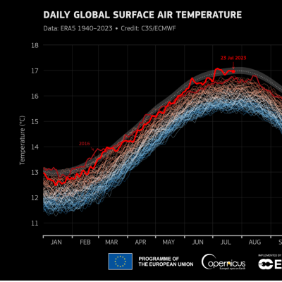
climate.copernicus.eu
According to ERA5 data from the EU-funded C3S, the first three weeks of July have been the warmest three-week period on record and the month is on track to be the hottest July and the hottest month...
0
0
0

⚠️🏜️As predicted by @CopernicusECMWF #CAMS, a #saharandust transport is involving #Canarias, iberian peninsula, moving northwards and even reaching #France in the next few days. Here a #MSG 📸of Feb.19 #Spain #Portugal #canarias #Calima #airquality #eumetview @Giulio_Firenze
2
15
35

🟠 Fire🔥 with big smoke plume NE of Chillán in #Chile🇨🇱 3 February 2023 #Landsat-8🛰️ Full-size ➡️ https://t.co/nIV2sQHqZx
#OpenData #SciComm #RemoteSensing #fire #wildfire Image is about 106 kilometers wide
2
14
42
Wildfires in Chile seen by #sentinel satellite #Copernicus
0
0
1
⚠️🔴❄ The cyclonic vortex keeps affecting #Italy, especially in central southern regions where the #snow is increasing, being more and more visible among clouds. Here a six hours animation until 15UTC by Meteosat11 #weather #Vortex @Giulio_Firenze @LotharSchueller
2
16
58
Mauna Loa persisting plume …

Last month the Mauna Loa volcano on Hawaii's Big Island erupted for the first time in 34 years, its plume could be tracked by satellite data https://t.co/IDWrRsDhV7 Case by @am_sundstrom @JuliaWagemann @sabrinaszos @FedericoFierli
0
0
3

#MaunaLoa emits SO2 in the atmosphere as apparent in the operational @eumetsat product from @Atmospheric_SAF. Data and info at https://t.co/lSOsoXODbV.
0
7
12